
Surveyor
CurrentSurveyor and spatial data management in project M12 in New Sydney International Airport.
Mar 2023 - Present
Please complete the CAPTCHA to continue
A concise factual answer block for searchers comparing this professional profile.
Andres Felipe Plazas Velasquez is listed as Spatial Data Analyst at ESO Surveyors, a with 56 employees, based in Waterloo, New South Wales, Australia. AeroLeads shows a matched LinkedIn profile for Andres Felipe Plazas Velasquez.
Andres Felipe Plazas Velasquez previously worked as Surveyor at Eso Surveyors and Capitan valet at First Class Valet Australia Pty Ltd.
This section adds company-level context without repeating Andres Felipe Plazas Velasquez's masked contact details.
Review company-level records connected to Andres Felipe Plazas Velasquez before choosing the right outreach path.
I am an engineer specialized in spatial analysis with wide knowledge and 10 years experience in geographic information systems (GIS), quality control and data management, capable of generating, analyzing and managing spatial data information which allow decision making for planning, exploitation of natural resources, and human activities for their sustainable development; using modern Geoinformation and Geomatics technologies such as ArcGIS, QGIS, AutoCAD and SQL.
Company context helps verify the profile and gives searchers a useful next step.
A career timeline built from the work history available for this profile.
Australia
Surveyor and spatial data management in project M12 in New Sydney International Airport.

Sydney, New South Wales, Australia
Capitan Manager valet at Porsche City South Sydney

Bogotá, Distrito Capital, Colombia
Professional activities to support IDECA's Operations Sub-Management.Structuring and implementation of geographic information for the project using ArcGis package (extensions: ArcEditor, ArcMap) and QGis.Definition and development of spatial data infrastructure of Regional scope.
Bogotá, Distrito Capital, Colombia
Professional activities to support IDECA's Operations Sub-Management.Structuring and implementation of geographic information for the project. using ArcGis package (extensions: ArcEditor, ArcMap) and QGis.Definition and development of spatial data infrastructure of Regional scope.
Bogotá, Distrito Capital, Colombia
Give final approval to the digital cartography evaluating the elements related to the capture and digital quality control through the use of GIS tools.• Evaluate the quality of the digital cartographic information produced by updating the cartographic sheets at the different scales of production using ArcGis package (extensions: ArcEditor, ArcMap) and QGis.• Verify quality elements according to ISO standards: Totality, logical consistency, thematic consistency.

Development and preparation of environmental impact studies, environmental management plans and diagnoses of alternatives, through the use of GIS tolos.• Administration of geographic databases in different data models (ANLA, IGAC)• Quality control of basic and thematic geographic databases according to official technical standards and the parameters established by the ANLA• Generation of basic and thematic cartography• Interpretation and processing of satellite images• Data geoprocessing using ArcGis package (extensions: ArcEditor, ArcMap) and QGis.• Preparation of geographic metadata
Give final approval to the digital cartography evaluating the elements related to the capture and digital quality control through the use of GIS tools.• Evaluate the quality of the digital cartographic information produced by updating the cartographic sheets at the different scales of production using ArcGis package (extensions: ArcEditor, ArcMap) and QGis.• Verify quality elements according to ISO standards: Totality, logical consistency, thematic consistency.

Carry out activities aimed at the development and preparation of environmental impact studies, environmental management plans and diagnosis of alternatives, through the use of GIS (ArcGis, Qgis, ERDAS) tools.
Bogota, D.C., Capital District, Colombia
Carry out professional activities to support IDECA's Operations Division in the development of geographic and alphanumeric information editing processes to obtain the first, second and final version of the Integral Urban Road Network for Bogotá Colombia.Generation, updating and maintenance of basic and thematic cartography of Urban Road Network for Bogotá Colombia.Street visits, adjustment of spatial information through coordinates taken with GPS and alphanumeric information collected.Presentation of the final integrated road network for Bogota.
Bogotá, Capital District, Colombia
Carry out professional activities to support IDECA's Operations Division in the development of geographic and alphanumeric information editing processes to obtain the first, second and final version of the Integral Urban Road Network for Bogotá Colombia.Generation, updating and maintenance of basic and thematic cartography of Urban Road Network for Bogotá Colombia.Street visits, adjustment of spatial information through coordinates taken with GPS and alphanumeric information collected.Presentation of the final integrated road network for Bogota.
Bogota, D.C., Capital District, Colombia
Evaluate the quality of the digital cartographic information produced at the different scales of production.Verify quality elements according to ISO standards: Totality, logical consistency, thematic consistency.Make corrections and adjustments to the information resulting from review processes and digital quality control.Give final approval to digital cartography.
Bogotá, Capital District, Colombia
Evaluate the quality of the digital cartographic information produced at the different scales of production.Verify quality elements according to ISO standards: Totality, logical consistency, thematic consistency.Make corrections and adjustments to the information resulting from review processes and digital quality control.Give final approval to digital cartography. Technologies: ArcGIS, QGIS, AutoCAD and Office package.
Bogotá, Capital District, Colombia
Evaluate the quality of the digital cartographic information produced at the different scales of production.Verify quality elements according to ISO standards: Totality, logical consistency, thematic consistency.Make corrections and adjustments to the information resulting from review processes and digital quality control.Give final approval to digital cartography. Technologies: ArcGIS, QGIS, AutoCAD and Office package.
Other employees you can reach at esosurveyors.com.au. View company contacts for 56 employees →
 Martin Sorby
Colleague at Eso SurveyorsAustralia
View →
SS
Martin Sorby
Colleague at Eso SurveyorsAustralia
View →
SS
 Sarwan Singh Gill
Colleague at Eso SurveyorsKings Langley, New South Wales, Australia
View →
VM
Sarwan Singh Gill
Colleague at Eso SurveyorsKings Langley, New South Wales, Australia
View →
VM
 Vanessa Monaco
Colleague at Eso SurveyorsSydney, New South Wales, Australia
View →
JL
Vanessa Monaco
Colleague at Eso SurveyorsSydney, New South Wales, Australia
View →
JL
 Jack Lalor
Colleague at Eso SurveyorsBacchus Marsh, Victoria, Australia
View →
AL
Jack Lalor
Colleague at Eso SurveyorsBacchus Marsh, Victoria, Australia
View →
AL
 Aled Loy
Colleague at Eso SurveyorsAdelaide, South Australia, Australia
View →
TK
Aled Loy
Colleague at Eso SurveyorsAdelaide, South Australia, Australia
View →
TK
 Trent Kennedy
Colleague at Eso SurveyorsAustralia
View →
NM
Trent Kennedy
Colleague at Eso SurveyorsAustralia
View →
NM
 Ned Medrano
Colleague at Eso SurveyorsRozelle, New South Wales, Australia
View →
RK
Ned Medrano
Colleague at Eso SurveyorsRozelle, New South Wales, Australia
View →
RK
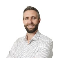 Ryan Kent
Colleague at Eso SurveyorsMelbourne, Victoria, Australia
View →
MJ
Ryan Kent
Colleague at Eso SurveyorsMelbourne, Victoria, Australia
View →
MJ
 Marcus Jennings-Sykes
Colleague at Eso SurveyorsGreater Melbourne Area, Australia
View →
SA
Marcus Jennings-Sykes
Colleague at Eso SurveyorsGreater Melbourne Area, Australia
View →
SA
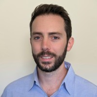 Simon Altman
Colleague at Eso SurveyorsAdelaide, South Australia, Australia
View →
Simon Altman
Colleague at Eso SurveyorsAdelaide, South Australia, Australia
View →
Quick answers generated from the profile data available on this page.
Andres Felipe Plazas Velasquez works for ESO Surveyors.
Andres Felipe Plazas Velasquez is listed as Spatial Data Analyst at ESO Surveyors.
Andres Felipe Plazas Velasquez is based in Waterloo, New South Wales, Australia while working with ESO Surveyors.
Andres Felipe Plazas Velasquez has worked for Eso Surveyors, First Class Valet Australia Pty Ltd, Instituto Geográfico Agustín Codazzi (Igac), Unidad Administrativa Especial De Catastro Distrital, and Wsp En Colombia.
Andres Felipe Plazas Velasquez's colleagues at ESO Surveyors include Martin Sorby, Sarwan Singh Gill, Vanessa Monaco, Jack Lalor, and Aled Loy.
You can use AeroLeads to view verified contact signals for Andres Felipe Plazas Velasquez at ESO Surveyors, including work email, phone, and LinkedIn data when available.
Search by job title, company, industry, location, and seniority. Export verified B2B contact data when you need it.
Start free trial Search contacts