AeroLeads people directory · profile
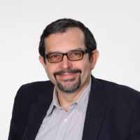
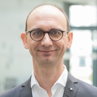
Alexander Reiterer Email & Phone Number
Professor and Chair Monitoring of Large Scale Structures
at
Albert-Ludwigs-Universität Freiburg im Breisgau
1 work email found
@ipm.fraunhofer.de
LinkedIn matched
✓ Verified August 2026
4 data sources
Profile completeness 100%
Current company
Role
Professor and Chair Monitoring of Large Scale Structures
Location
Greater Freiburg Area, Germany
Who is Alexander Reiterer? Overview
A concise factual answer block for searchers comparing this professional profile.
Quick answer
Alexander Reiterer is listed as Professor and Chair Monitoring of Large Scale Structures at Albert-Ludwigs-Universität Freiburg im Breisgau, based in Greater Freiburg Area, Germany. AeroLeads shows a work email signal at ipm.fraunhofer.de and a matched LinkedIn profile for Alexander Reiterer.
Alexander Reiterer previously worked as Professor / Chair Monitoring of Large Scale Structures at Albert-Ludwigs-Universität Freiburg Im Breisgau and Head of Department Object and Shape Detection at Fraunhofer Ipm. Alexander Reiterer holds Habilitation, Angewandte Geodäsie from Technische Universität München / Tu Munich.
Company email context
Email format at Albert-Ludwigs-Universität Freiburg im Breisgau
This section adds company-level context without repeating Alexander Reiterer's masked contact details.
{first}.{last}@ipm.fraunhofer.de
86% confidence
AeroLeads found 1 current-domain work email signal for Alexander Reiterer. Compare company email patterns before reaching out.
Profile bio
About Alexander Reiterer
Alexander Reiterer is a Professor and Chair Monitoring of Large Scale Structures at Albert-Ludwigs-Universität Freiburg im Breisgau. He possess expertise in matlab, wissenschaft, laser scanning, forschung, image processing and 6 more skills. He is proficient in Englisch, Italienisch and Deutsch.
Listed skills include Matlab, Wissenschaft, Laser Scanning, Forschung, and 7 others.
Current workplace
Alexander Reiterer's current company
Company context helps verify the profile and gives searchers a useful next step.
Albert-Ludwigs-Universität Freiburg Im Breisgau
AeroLeads page
10 roles
Alexander Reiterer work experience
A career timeline built from the work history available for this profile.
Professor / Chair Monitoring Of Large Scale Structures
Already a comprehensive university at its founding in 1457, the University of Freiburg still offers undergraduate and graduate studies as well as professorial qualification in all important disciplines today.More than 24.000 students from over 100 nations are matriculated in 180 degree programs at 11 faculties. More than 7.000 professors and lecturers and many other employees put in their effort every day.The Institute of Sustainable Systems Engineering (INATECH) has the aim to… Show more Already a comprehensive university at its founding in 1457, the University of Freiburg still offers undergraduate and graduate studies as well as professorial qualification in all important disciplines today.More than 24.000 students from over 100 nations are matriculated in 180 degree programs at 11 faculties. More than 7.000 professors and lecturers and many other employees put in their effort every day.The Institute of Sustainable Systems Engineering (INATECH) has the aim to connect teaching and research in the field of sustainable systems and to complete it with an engineering research facility for sustainability research. In cooperation with the Fraunhofer-Institutes in Freiburg, following research emphasis have been conceptualized: (1) Sustainable Materials, which can be produced and applied in an energy and resource friendly way. (2) Energy Systems, which can provide a reliable and efficient supply and storage of renewable energies. (3) Resilience, which can secure the resistance and adaptability of systems towards environmental disasters and climate change.The growing world population, the ongoing urbanization, the ever-increasing size, height and complexity of large scale built infrastructure leads to higher risks with respect to natural and manmade threats. Therefor smart designs and monitoring of large infrastructures are required.The chair “Monitoring of Large Structures” is focusing on the research and design of measurement systems for inspecting those large infrastructures. Main goals: (1) key concepts and ideas to design and monitor a large structure safe, secure and resilient, (2) design concepts for sensor application and structural health monitoring, (3) data analysis methods for interoperating and visualizing measurements, and (4) software aided assessment of infrastructures. Show less

Head Of Department Object And Shape Detection
In the Department of Object and Shape Detection, activities center on the development of laser scanners, fast image processing and camera systems. The systems measure the geometry and position of objects three-dimensionally at high speed and with high precision, particularly from moving platforms. Particular attention is attached to the robustness and long service life of the systems as well as to efficient data evaluation. Objects and shapes are detected over a broad size range: extending from… Show more In the Department of Object and Shape Detection, activities center on the development of laser scanners, fast image processing and camera systems. The systems measure the geometry and position of objects three-dimensionally at high speed and with high precision, particularly from moving platforms. Particular attention is attached to the robustness and long service life of the systems as well as to efficient data evaluation. Objects and shapes are detected over a broad size range: extending from tenth of a millimeter to dimensions of 10 meters. The measurement systems are in use around the world – in rail traffic and in the surveying of road surfaces. Supplementing them are special applications in the fields of safety as well as transport and logistics. Show less
Head Of The Laser Scanning Group
The Laser Scanning Group at Fraunhofer Institute for Physical Measurement Techniques develops optical measurement systems based on time-delay measurements, which enable the distance and geometry of surfaces to be measured at high speed and with great precision. The scientists and technicians utilize their expertise from the disciplines of radar, sonar, control engineering, optics, communications and digital electronics as well as information technology for successful systems solutions indoors… Show more The Laser Scanning Group at Fraunhofer Institute for Physical Measurement Techniques develops optical measurement systems based on time-delay measurements, which enable the distance and geometry of surfaces to be measured at high speed and with great precision. The scientists and technicians utilize their expertise from the disciplines of radar, sonar, control engineering, optics, communications and digital electronics as well as information technology for successful systems solutions indoors and outdoors. The systems are employed worldwide in various fields of application. At present, research focuses on mobile applications such as mobile mapping. The Laser Scanning Group is your competent development and consulting partner for all questions related to 3D measurement technology – from feasibility studies to turnkey measurement systems. Show less
Jun 2012 - Dec 2020

University Lecturer (Privatdozent)
Technische Universität München (TUM) is one of Europe’s top universities. It is committed to excellence in research and teaching, interdisciplinary education and the active promotion of promising young scientists. The university also forges strong links with companies and scientific institutions across the world. TUM was one of the first universities in Germany to be named a University of Excellence. The Chair of Geodesy is a key player in developing imageassisted measurement systems, alerting… Show more Technische Universität München (TUM) is one of Europe’s top universities. It is committed to excellence in research and teaching, interdisciplinary education and the active promotion of promising young scientists. The university also forges strong links with companies and scientific institutions across the world. TUM was one of the first universities in Germany to be named a University of Excellence. The Chair of Geodesy is a key player in developing imageassisted measurement systems, alerting components and the use of Artificial Intelligence for data interpretation. The lnstitute is mainly involved in research activities concerning the application of geodesy to engineering and other natural sciences. Typical fields of research are: intelligent multi-sensor systems for positioning and navigation, intelligent data analysis on large construction sites, intelligent alert systems for disaster prevention (e.g. landslides), navigation of construction processes, pedestrian navigation and location-based services, knowledge-based systems for engineering applications. The research group cooperates on an international level with research institutes, governmental offices and industry. Show less
Mar 2013 - Mar 2018
Postdoctoral Researcher (Humboldt Research Fellowship)
A large part of geodetic sensor systems use electromagnetic radiation to determine the measurement values (distances, directions, etc.). The geometry of the path of propagation and the velocity of the electromagnetic wave is strongly influenced by the physical state of the atmosphere. As most geodetic measurements are performed in the lower atmosphere, the study of refraction and of corresponding impact constitutes a key research field. In geodesy, the refractive index represents a common way… Show more A large part of geodetic sensor systems use electromagnetic radiation to determine the measurement values (distances, directions, etc.). The geometry of the path of propagation and the velocity of the electromagnetic wave is strongly influenced by the physical state of the atmosphere. As most geodetic measurements are performed in the lower atmosphere, the study of refraction and of corresponding impact constitutes a key research field. In geodesy, the refractive index represents a common way to describe the terrestrial refraction. The Humboldt Research Fellowships has been usedfor researching/developing a method for the determination of the influence of refraction on the basis of 'turbulence parameters'. Show less
Feb 2011 - Jun 2012

Postdoctoral Researcher
The Engineering Geodesy Group at Vienna University of Technology is one of the three Research Groups within the Institute of Geodesy and Geophysics at the Vienna University of Technology. The Group represents Applied Geodesy and Engineering Geodesy both in terms of research and of teaching.
Sep 2004 - Jan 2011
Researcher
Researcher at Department of Geomatics Engineering, the University of Calgary (Prof. El-Sheimy). Topic: Sensing for Mobile Mapping.
Jun 2008 - Nov 2008

Researcher
Reseracher at the Department of Civil, Environmental and Geomatic Engineering, Institute of Geodesy and Photogrammetry (Prof. Grün). Topic: Autometd Target Idetification by Artificial Neuronal Networks.
Sep 2005 - Mar 2006
Phd Candidate
Research work to provide an efficient, highly automated, high-resolution, terrestrial, long range sensing measurement and analysis system which is able to monitor geo-risk (and related) objects by means of non-signalized natural target points
Aug 2001 - Jul 2004
3 education records
Alexander Reiterer education
Habilitation, Angewandte Geodäsie
Dr. Techn., Doktor Der Technischen Wissenschaften
Diplom, Geodäsie
FAQ
Frequently asked questions about Alexander Reiterer
Quick answers generated from the profile data available on this page.
What company does Alexander Reiterer work for?
Alexander Reiterer works for Albert-Ludwigs-Universität Freiburg im Breisgau.
What is Alexander Reiterer's role at Albert-Ludwigs-Universität Freiburg im Breisgau?
Alexander Reiterer is listed as Professor and Chair Monitoring of Large Scale Structures at Albert-Ludwigs-Universität Freiburg im Breisgau.
What is Alexander Reiterer's email address?
AeroLeads has found 1 work email signal at @ipm.fraunhofer.de for Alexander Reiterer at Albert-Ludwigs-Universität Freiburg im Breisgau.
Where is Alexander Reiterer based?
Alexander Reiterer is based in Greater Freiburg Area, Germany while working with Albert-Ludwigs-Universität Freiburg im Breisgau.
What companies has Alexander Reiterer worked for?
Alexander Reiterer has worked for Albert-Ludwigs-Universität Freiburg Im Breisgau, Fraunhofer Ipm, Technische Universität München, Vienna University Of Technology, and University Of Calgary.
How can I contact Alexander Reiterer?
You can use AeroLeads to view verified contact signals for Alexander Reiterer at Albert-Ludwigs-Universität Freiburg im Breisgau, including work email, phone, and LinkedIn data when available.
What schools did Alexander Reiterer attend?
Alexander Reiterer holds Habilitation, Angewandte Geodäsie from Technische Universität München / Tu Munich.
What skills is Alexander Reiterer known for?
Alexander Reiterer is listed with skills including Matlab, Wissenschaft, Laser Scanning, Forschung, Image Processing, Latex, 3D Reconstruction, and Mobile Mapping.
Find 750M verified contacts
Search by job title, company, industry, location, and seniority. Export verified B2B contact data when you need it.
Start free trialPeople with similar names
Check these profiles if this is not the Alexander Reiterer you were looking for.
View similar profiles