AeroLeads people directory · profile
Alvaro Campomanes Email & Phone Number
UAV Mapping and Photo and Video Media Specialist
at
GeoARI
LinkedIn matched
✓ Verified Jun 2026
3 data sources
Profile completeness 86%
Current company
Role
UAV Mapping and Photo and Video Media Specialist
Location
Portland, Oregon, United States
Company size
Who is Alvaro Campomanes? Overview
A concise factual answer block for searchers comparing this professional profile.
Quick answer
Alvaro Campomanes is listed as UAV Mapping and Photo and Video Media Specialist at GeoARI, a company with 1 employees, based in Portland, Oregon, United States. AeroLeads shows a matched LinkedIn profile for Alvaro Campomanes.
Alvaro Campomanes previously worked as UAV Mapping and Photo/Video Media Specialist at Geoari and GIS Technician I at Noaa Marine Fisheries. Alvaro Campomanes holds Bachelor Of Science In Geographic Science, Applied Geographic Information Science And Environmental Conservation, Sustainability & Development from James Madison University.
Company email context
Email format at GeoARI
This section adds company-level context without repeating Alvaro Campomanes's masked contact details.
GeoARI
Review company-level records connected to Alvaro Campomanes before choosing the right outreach path.
Profile bio
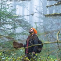
About Alvaro Campomanes
Innovative and resourceful leader at GeARI providing support in all aspects. Broad range an experience in managing a mapping & media company specializing in UAV technology. I have successfully carried the company for four years to date, and have helped the company grow exponentially. With my extensive experience in conservation and sustainability work, my mission is to create a vision were landowners and developers are in complete awareness of the resources in their land with the help of our technologies. Specializing in GIS systems for use in conscious stewardship of our land and natural resources.Specialties: Environmental & Conservation solutions, experience in project/program management, data acquisition and mapping specialist, remote sensing and optics technology, GIS systems, UAV systems, project monitoring and assessment, redundant systems and protocols, process improvement, resourceful and innovative, excellence in communication skills, coordinating and volunteering.Solution driven in helping developers in the acquisition of mapping data, spatial analysis, cartography, Photogrammetry, quality assurance and quality control in land development projects. Coordinate with teams of operation and provide critical data for all systems and processes at different stages of development. Agency solutions for food/agriculture, conservation, land development, power, residential/commercial real estate, sports events, corporate events, artists, and small businesses in the West Coast Region.Volunteer rescue pilot with Search and Rescue in Portland, Oregon and FEMA registered for national disaster relief. SAM registered for government contract capability. Multi-language, minority, and small business owner and partner. BS degree in Geography / Geographic Information Science (GIS) and Environmental Conservation, Sustainability, and Development concentrations. Double Concentration in AGIS and Environmental Conservation, Sustainability and DevelopmentMinor in Integrated Science and Technology (ISAT) with a focus on Environment
Current workplace
Alvaro Campomanes's current company
Company context helps verify the profile and gives searchers a useful next step.
Geoari
7 roles
Alvaro Campomanes work experience
A career timeline built from the work history available for this profile.
Uav Mapping And Photo/Video Media Specialist
CurrentAt GeoARI (Geospatial Aerial Robotic Imaging) we use drone technology to bring in a new era of conservation and environmental protection solutions. From natural feature modeling, biomass estimation, and erosion control to species identification, field monitoring, and project assessment. With our FAA compliant pilots and redundant hardware systems we can.
Aug 2018 - Present
Gis Technician I
Noaa Marine Fisheries
1. Perform quality assurance and quality control review of recovery plan actions2. Enter recovery action data into Recovery Action Mapping Tool3. Assign spatial locations for each recovery action4. Compile and enter information necessary to fill missing recoveryaction data5. Coordinate with recovery partners to update and refine recovery actiondata in the.
Oct 2014 - Aug 2018

Seasonal Environmental Engineering Intern
- Responsible for identifying and delineating all public drainage areas in Hanover County in compliance with the new 2010 urbanized area additions.
- Mapping of Outfall and stormwater infrastructure and drainage areas using construction plans, ArcGIS, Google maps, and DPW GIS mapping software.
- Exportation and management of outfall and drainage data through Access, Excel, and ArcGIS software.
- Stormwater outfall inspections in agreement with the county’s MS4 permit requirements. Inspections included physical observations, geographical localization, and water quality testing using pH, Specific Conductivity.
- Gathering of DEQ information on impaired waters included in the 303d list and mapping the areas on ArcGIS
- Public education and outreach on high priority pollutants, and TMDL action plans for the Chickahominy tributary.
May 2014 - Aug 2018

Seasonal Mosquito Surveillance Intern
- Responsible for trapping and analyzing both native and invasive mosquito species from several locations to asses and mitigate the presence of West Nile virus
- Capture and identify mosquitoes to the species level; test in lab setting for virus presence
- Performed inspections of stormwater conveyance structures to examine illicit discharges, structural failures, and mosquito larvae populations in fulfillment of the county's MS4 permit requirements.
- Data entry; use ArcGIS 10.1 to analyze mosquito population and viral patterns across Henrico County
- Maintain laboratory and field equipment
Aug 2013 - Aug 2018
Program Intern
- Perform storm water audits and Spanish translations of essential information for home owners
- Initiation of a GIS project to manage and display the program’s data
- Facilitate connections between Richmond citizens and environmental issues related to storm water runoff
- Other duties include: Stream restoration, biological monitoring and water quality monitoring in the Reedy Creek watershed, and festival/event workshops to inform the public of the Alliance’s missions and goals
Jun 2013 - Aug 2018
Interviewer
Responsive Management
- Natural Resources management and environmental research firm
- Contracted by government environmental agencies such as the EPA, multiple state natural resources departments, state park agencies, etc. to collect public interest data and opinions regarding facilities and public.
Aug 2011 - Dec 2011
1 education record
Alvaro Campomanes education

FAQ
Frequently asked questions about Alvaro Campomanes
Quick answers generated from the profile data available on this page.
What company does Alvaro Campomanes work for?
Alvaro Campomanes works for GeoARI.
What is Alvaro Campomanes's role at GeoARI?
Alvaro Campomanes is listed as UAV Mapping and Photo and Video Media Specialist at GeoARI.
Where is Alvaro Campomanes based?
Alvaro Campomanes is based in Portland, Oregon, United States while working with GeoARI.
What companies has Alvaro Campomanes worked for?
Alvaro Campomanes has worked for Geoari, Noaa Marine Fisheries, Hanover County, County Of Henrico, and Alliance For The Chesapeake Bay.
How can I contact Alvaro Campomanes?
You can use AeroLeads to view verified contact signals for Alvaro Campomanes at GeoARI, including work email, phone, and LinkedIn data when available.
What schools did Alvaro Campomanes attend?
Alvaro Campomanes holds Bachelor Of Science In Geographic Science, Applied Geographic Information Science And Environmental Conservation, Sustainability & Development from James Madison University.
Find 750M verified contacts
Search by job title, company, industry, location, and seniority. Export verified B2B contact data when you need it.
Start free trialPeople with similar names
Check these profiles if this is not the Alvaro Campomanes you were looking for.
Alvaro Díez Campomanes
1 email domain