Geospatial Consultant - Hydrology And Ecology
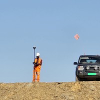
CurrentProjects include the capturing of precise geospatial and topographical points in difficult to access areas, which are typically in, on or around watercourses throughout Ireland. The main focus of the role is to deliver geospatial data using standard industry equipment such as GNSS units and Total Stations. This also includes surveying infrastructure such as railway bridges, private businesses and homes for hydromorphology studies and national flood risk assessments and prevention projects. Providing reports back to clients based on surveys, on bridges for example, requires excellent attention to detail and in field record keeping skills. These reports serve as foundation for further action to be taken, by the client, if required.
Sep 2022 - Present