
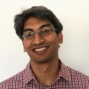
AeroLeads people directory · profile
Benoit Parmentier Email & Phone Number
Senior Data Scientist at RetailStat
at
AccuWeather
2 work emails found
@premise.com
1 phone found area 508
LinkedIn matched
✓ Verified August 2026
4 data sources
Profile completeness 100%
Current company
Role
Senior Data Scientist at RetailStat
Location
Poughkeepsie, New York, United States
Company size
Who is Benoit Parmentier? Overview
A concise factual answer block for searchers comparing this professional profile.
Quick answer
Benoit Parmentier is listed as Senior Data Scientist at RetailStat at AccuWeather, a with 529 employees, based in Poughkeepsie, New York, United States. AeroLeads shows a work email signal at premise.com, phone signal with area code 508, and a matched LinkedIn profile for Benoit Parmentier.
Benoit Parmentier previously worked as Senior Data Scientist at Retailstat and Senior Data Scientist - Team Lead at Premise Data. Benoit Parmentier holds Phd, Geography from Clark University.
Company email context
Email format at AccuWeather
This section adds company-level context without repeating Benoit Parmentier's masked contact details.
{first}@premise.com
89% confidence
AeroLeads found 2 current-domain work email signals for Benoit Parmentier. Compare company email patterns before reaching out.
Profile bio
About Benoit Parmentier
Hello! I am a Senior Data Scientist and manager at Premise Data. My daily work includes dealing with data problems to help customers at Premise, standardizing and automating processes, as well as coming up with new ideas for products or improvements for processes.I like to keep myself up to date and learn new things. While being an applied data scientist in the private sector, I am a scientist and still actively involved in research. I have worked in a variety of projects processing Earth Observation and examining global environmental change (air pollution, malaria etc.) and working with Deep Learning (NLP and Computer Vision).CORE EXPERTISEData Science & Machine Learning:Data wrangling, modeling and visualization. Statistics, Computer Vision and NLP.Tech: Python, Scikit learn, Pandas, Pypark, SQL, TensorFlow, pytorch, Mlflow, jupyter, R.Engineering, Big Data & Distributed Computing:High Performance Computing, Cloud computingTech: Kubernetes, docker, GCP, AWS, Bigquery, Cloud run, EMR, Spark, SLURM, PBS, airflow.Geospatial Science and Analysis:Large satellite imagery processing and geospatial modelingTech: GDAL/OGR, geopandas, rasterio, xarray, Shapely, QGIS, GRASS, Postgis, Google Earth Engine, ArcGIS
Listed skills include Gis, Geography, Arcgis, Spatial Analysis, and 36 others.
Current workplace
Benoit Parmentier's current company
Company context helps verify the profile and gives searchers a useful next step.
Accuweather
12 roles
Benoit Parmentier work experience
A career timeline built from the work history available for this profile.

Senior Data Scientist
Current
Apr 2024 - Present

Senior Data Scientist - Team Lead
• Managed team focusing on data production/pipelines, processing and analysis for customers success. • Mentored and trained team members on python, GCP, SQL BigQuery, git. • Automated pipelines, built REST api, standardized processes, created and managed python package for the team. • App deployment using serverless cloud computing with Flask and Streamlit• Contributed and helped build polling and random sampling practices, cluster sampling and spatial random sampling design for surveys.• Served as expert in Geospatial data analyses and processing across projects and the company.
Jul 2021 - Dec 2023

Data Scientist
• Developed models (e.g. lightboost) for users categorization• Worked on NLP processing and models for email classification• Worked on Email volume estimation for customer facing products.• Managed Big Data pipelines production, spark jobs, time series analysis, code debugging, versioning (git)
Oct 2019 - Jun 2021

Lead Geospatial And Remote Sensing Data Scientist - Consultant
• Modeled and analyzed Earth observation time series for urbanization and malaria in African cities.• Managed and provided leadership in projects, analyses and reports.• Set up image processing pipeline, contributed to code base and academic conference presentations.
Jun 2020 - May 2021
Data Scientist, Geospatial & Remote Sensing
The National Socio-Environmental Synthesis Center (Sesync) U. Of Maryland
• Provided research support and training on ML and modeling: random forest, Bayesian methods, Fourier Series, ARIMA, ROC, SVM, machine learning, clustering, statistics, geospatial image processing, PCA/EOF. • Consult on large datasets, data science tools software stack and technology, automated processing workflow, code debugging and technical issues related to code execution.• Mentored on efficient reproducible coding and use of High Performance Computing resources (git, parallel processing, bash scripting, SLURM job submission). • Designed specific code solutions for many projects including time series analyses (seasonal trends) • Generated web content including data science blogs using Jekyll and Hugo. • Initiated, organized and led Geospatial Data Analysis Short Course at the Center. • Supported interdisciplinary research teams on Social and Environmental topics. • Conducted multiple research projects and published scientific manuscripts.
May 2017 - Oct 2019
Research Associate, Climate & Remote Sensing
University Of Maine
Lead in statistical modeling of water pollution in relation to climate covariates in R.Developed Shiny web application to visualize and explore spatio-temporal patterns of water quality and climate variables. Developed climate and environmental layers for online Maine Decision Support System. Co-authored report for the New England Sustainability Consortium.
Jan 2016 - Feb 2017
Postdoctoral Researcher, Climate And Remote Sensing
University Of Maine
Produced automated workflow for global climate and environmental spatial layers using interpolation methods and satellite imagery on NASA Pleiades HPC using R, Python, GDAL. Developed datasets for Land cover in Maine, New England Sustainability Consortium (NEST) and Maine Healthy Beaches using automated python workflow. Modeled environmental change with Spatio-temporal modelling (ARIMA, SAR) and developed the framework for assessing abrupt changes.
Jan 2014 - Jan 2016
Geospatial Scientist/Postdoctoral Researcher
National Center For Ecological Analysis And Synthesis, University Of California Santa Barbara
Developed interpolation methods ((Kriging, GAMs,GWR) and workflow for the production of spatial layers using satellite imagery on NASA Pleiades HPC with R, Python, GDAL. Developed model accuracy assessment for land cover change with ROC (Delphi and Python).
Jan 2012 - Jan 2014

Adjunct Professor/Instructor
Designed and taught Introductory GIS course for two sections at the EEOS department
Sep 2011 - Dec 2011
Research Assistant, Geospatial And Remote Sensing
Clark Labs, Clark University
Developed models with neural network and machine learning methods for land cover change in Panama using Landsat imagery. Developed methods for large area mapping of agricultural fields using Object Based Image Analysis with Landsat imagery and classification methods (CTA, unsupervised clustering). Reviewed and Developed GIS methodology for Reduction of Emission of Deforestation and Degradation (REDD) projects: Land cover change mapping and carbon accounting. Developed methodology for a Climate Teleconnection-based Early Warning System for Food, Health and Ecosystem Security: Time Series Analysis and GIS with TerrSet and Python. Key contributor to Earth Trend Modeler in TerrSet: Fourier Analysis for Seasonal Trend Analysis, EOF/PCA and Multichannel Empirical Orthogonal Teleconnection analysis. Modeled Emerald Ash Borer Infestation using Hyperspectral imagery and LIDAR with Classification Tree Algorithm, KNN and Maximum Likelihood Classifier.
Aug 2005 - Aug 2011
Adjunct Professor/Instructor
Salem State University
Taught two sections of Weather and Climate in the department of Geography
Aug 2010 - Dec 2010
Team & coworkers
Colleagues at AccuWeather
Other employees you can reach at accuweather.com. View company contacts for 529 employees →
SW
 Sharon Ward
Colleague at AccuweatherState College, Pennsylvania, United States
View →
HD
Sharon Ward
Colleague at AccuweatherState College, Pennsylvania, United States
View →
HD
 Hava Delisi
Colleague at AccuweatherTürkiye, Turkey
View →
CM
Hava Delisi
Colleague at AccuweatherTürkiye, Turkey
View →
CM
 Chris Milchak
Colleague at AccuweatherAltoona, Pennsylvania, United States
View →
TR
Chris Milchak
Colleague at AccuweatherAltoona, Pennsylvania, United States
View →
TR
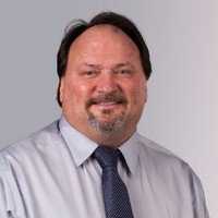 Thomas Rerko
Colleague at AccuweatherState College, Pennsylvania, United States
View →
IB
Thomas Rerko
Colleague at AccuweatherState College, Pennsylvania, United States
View →
IB
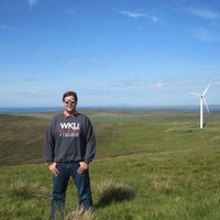 Isaac Bowers
Colleague at AccuweatherWichita, Kansas, United States
View →
JS
Isaac Bowers
Colleague at AccuweatherWichita, Kansas, United States
View →
JS
 Joe Sobel
Colleague at AccuweatherState College, Pennsylvania, United States
View →
HH
Joe Sobel
Colleague at AccuweatherState College, Pennsylvania, United States
View →
HH
 Henry Haitz
Colleague at AccuweatherMount Pleasant, South Carolina, United States
View →
JS
Henry Haitz
Colleague at AccuweatherMount Pleasant, South Carolina, United States
View →
JS
 Joshua Solt
Colleague at AccuweatherLewistown, Pennsylvania, United States
View →
JW
Joshua Solt
Colleague at AccuweatherLewistown, Pennsylvania, United States
View →
JW
 Joshua Wensel
Colleague at AccuweatherState College-Dubois Area, United States
View →
CG
Joshua Wensel
Colleague at AccuweatherState College-Dubois Area, United States
View →
CG
 Carolyn Grove
Colleague at AccuweatherState College, Pennsylvania, United States
View →
Carolyn Grove
Colleague at AccuweatherState College, Pennsylvania, United States
View →
Sharon Ward
Colleague at AccuweatherState College, Pennsylvania, United States
View →
HD
Hava Delisi
Colleague at AccuweatherTürkiye, Turkey
View →
CM
Chris Milchak
Colleague at AccuweatherAltoona, Pennsylvania, United States
View →
TR
Thomas Rerko
Colleague at AccuweatherState College, Pennsylvania, United States
View →
IB
Isaac Bowers
Colleague at AccuweatherWichita, Kansas, United States
View →
JS
Joe Sobel
Colleague at AccuweatherState College, Pennsylvania, United States
View →
HH
Henry Haitz
Colleague at AccuweatherMount Pleasant, South Carolina, United States
View →
JS
Joshua Solt
Colleague at AccuweatherLewistown, Pennsylvania, United States
View →
JW
Joshua Wensel
Colleague at AccuweatherState College-Dubois Area, United States
View →
CG
Carolyn Grove
Colleague at AccuweatherState College, Pennsylvania, United States
View →
4 education records
Benoit Parmentier education
Phd, Geography
Clark University
Des/Master, Cartography And Remote Sensing
Universite Libre De Bruxelles
Licentiate Degree, Geography
Universite Libre De Bruxelles
Education record
Lycée De Berlaymont
FAQ
Frequently asked questions about Benoit Parmentier
Quick answers generated from the profile data available on this page.
What company does Benoit Parmentier work for?
Benoit Parmentier works for AccuWeather.
What is Benoit Parmentier's role at AccuWeather?
Benoit Parmentier is listed as Senior Data Scientist at RetailStat at AccuWeather.
What is Benoit Parmentier's email address?
AeroLeads has found 2 work email signals at @premise.com for Benoit Parmentier at AccuWeather.
What is Benoit Parmentier's phone number?
AeroLeads has found 1 phone signal(s) with area code 508 for Benoit Parmentier at AccuWeather.
Where is Benoit Parmentier based?
Benoit Parmentier is based in Poughkeepsie, New York, United States while working with AccuWeather.
What companies has Benoit Parmentier worked for?
Benoit Parmentier has worked for Accuweather, Retailstat, Premise Data, Sparkpost, and University Of Maine.
Who are Benoit Parmentier's colleagues at AccuWeather?
Benoit Parmentier's colleagues at AccuWeather include Sharon Ward, Hava Delisi, Chris Milchak, Thomas Rerko, and Isaac Bowers.
How can I contact Benoit Parmentier?
You can use AeroLeads to view verified contact signals for Benoit Parmentier at AccuWeather, including work email, phone, and LinkedIn data when available.
What schools did Benoit Parmentier attend?
Benoit Parmentier holds Phd, Geography from Clark University.
What skills is Benoit Parmentier known for?
Benoit Parmentier is listed with skills including Gis, Geography, Arcgis, Spatial Analysis, R, Envi, Cartography, and Matlab.
Find 750M verified contacts
Search by job title, company, industry, location, and seniority. Export verified B2B contact data when you need it.
Start free trial