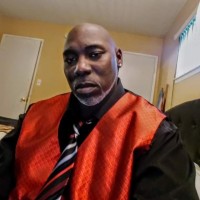
Hello my name is Brian Carnes. I am an experienced Land Surveyor - Party Chief and CAD Drafter. I have experience in Topographic Surveys, Boundary Surveys, Marking Property Corners, Flood Elevation Certificates, Grading Violations, GPS Surveys, GIS Surveys, Cartography, Lot Line Adjustments, Encroachments, Site Plans, Easements, Construction Staking, ALTA Surveys, and Condominium Plans, Marking for Fencing, Tract Maps, Topographic Maps, Record of Surveys, Parcel Maps, Site Plans, Plan & Profile Maps, Legal Descriptions, Addition Plans, and Landscaping Plans. I primarily do Residential Land Surveys and secondarily do Commercial Land Surveys. I am in charge of the field crew. I have over 20+ years of experience working with AutoCAD, GPS, and Cartography. I have a few years’ experience with GIS. I am skilled in operating all field equipment and vehicles. I am responsible for the care and maintenance of all tools and equipment. I interact with clients, answer their questions.One of the proudest and most rewarding moments of my career took place a few years ago. We were hired to do an Elevation Certificate for Kehillah Jewish High School in Palo Alto California. The high school was overpaying for flood insurance, over $50,000 a year. The school wasn't near a river, creek, lake or any nearby body of water, so this made no sense and seemed unfair. Their hope was to reduce or even eliminate the outrageous costs for the flood insurance. I thoroughly located very detailed topography and benchmarks in order to give a accurate and detailed map to FEMA. A few weeks later the director of the high school called very excited with the results of our work. She said based on our excellent work FEMA allowed them to eliminate their flood insurance. Kehillah Jewish High School spend $1500 on our map and it saved them over $50,000 per year. I felt so excited, rewarded and proud that I made this happen.