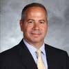
AeroLeads people directory · profile
Brian Hurry Email & Phone Number
CAD Designer at WSP Global
at
WSP
1 work email found
@anchorqea.com
7 phones found area 917, 201, 518, and 315
LinkedIn matched
✓ Verified July 2026
4 data sources
Profile completeness 100%
Current company
Role
CAD Designer at WSP Global
Location
Greater Syracuse-Auburn Area, United States
Company size
Who is Brian Hurry? Overview
A concise factual answer block for searchers comparing this professional profile.
Quick answer
Brian Hurry is listed as CAD Designer at WSP Global at WSP, a with 13 employees, based in Greater Syracuse-Auburn Area, United States. AeroLeads shows a work email signal at anchorqea.com, phone signal with area code 917, 201, 518, 315, and a matched LinkedIn profile for Brian Hurry.
Brian Hurry previously worked as CAD Designer at Wood and Civil Designer at Geosyntec Consultants. Brian Hurry holds Ba, Geography from University At Albany.
Company email context
Email format at WSP
This section adds company-level context without repeating Brian Hurry's masked contact details.
{first_initial}{last}@anchorqea.com
86% confidence
AeroLeads found 1 current-domain work email signal for Brian Hurry. Compare company email patterns before reaching out.
Profile bio
About Brian Hurry
I am a Senior CAD Designer specializing in Civil 3D grading to support environmental remediation projects. I have 20 years of experience in both Metropolitan and Upstate New York working with dredge design,Water and Wastewater projects, GIS analysis, utility and municipal mapping, data analysis, land surveying and other mapping and analysis platforms.
Listed skills include Arcgis, Cad, Microsoft Office, Autocad Civil 3D, and 4 others.
Current workplace
Brian Hurry's current company
Company context helps verify the profile and gives searchers a useful next step.
Wsp
9 roles
Brian Hurry work experience
A career timeline built from the work history available for this profile.

Cad Designer At Wsp Global

Cad Designer
Jul 2022 - Sep 2022

Civil Designer
Apr 2022 - Jul 2022

Senior Designer
ProjectsBuffalo River AOC - Honeywell, Buffalo, New York Mr. Hurry provided three-dimensional (3D) grading and design using core chemistry, depth design models, and bathymetric surveys to provide 3D models and volume takeoffs for dredging teams for several miles of river. The designs were used to create figures for a full Fox River work plan.Yellowstone River Remediation - Montana-Dakota Utilities, Sydney, MontanaMr. Hurry provided three-dimensional (3D) grading and design using core chemistry, depth design models, and bathymetric surveys to provide 3D models for dredging teams for several miles of river. The designs were used to create figures for a full Fox River work plan.Fox River Design - Tetra Tech, Green Bay, Wisconsin Mr. Hurry provided three-dimensional (3D) grading and design using core chemistry, depth design models, and bathymetric surveys to provide 3D models for dredging teams for several miles of river. The designs were used to create figures for a full Fox River work plan.Lower Rouge River Old Channel Design - Honeywell Detroit, Michigan Mr. Hurry provided 3D grading, full contract plan sets, permit drawings, and general figures for this project. The project involved many different grading designs mended together to provide a seamless design surface with consistent design rules.
Jan 2015 - Apr 2022

Gis Analylst, Cad Designer
Town of Verona Sewer District Design-Town of Verona Verona, New York Mr. Hurry provided layout and design for the alignment of a force main and gravity sewer in the Town of Verona. GPS was used to locate existing septic tanks and electric meters. Post-processed data were then used along with aerial photography for the design phase.Town of Sullivan Sewer District Design-Town of Sullivan Sullivan, New York Mr. Hurry was responsible for the layout and design of the alignment for a force main and gravity sewer in the Town of Sullivan/Hamlet of Bridgeport. Post-construction as-built drawings were provided to the client using GPS locations attained during the construction phase.
Aug 2011 - Dec 2014
Gis Analyst
Mcgoey, Hauser And Edsall, Pc
Responsibilities• Preparation site plans & drawing sets• Utilization of aerial surveys to create large utility networks• Sewer design - creating inverts, calculating slopes.• Converted various datasets into specific coordinate systems & datums; data procurement• GIS mapping & analysis• Software utilized: AutoCAD 2011 3D, AutoDesk LT, ArcGIS, Trimble handheld GeoXH 2008 GPS, Trimble Pathfinder, all Microsoft Office ProductsProjects• Cartegraph/ArcView 10 Software Integration - Completed software integration for the City of Port Jervis with ArcView and Cartegraph. Created seamless end-user interface.• Multiple Municipal Services in Hudson Valley GIS – served as service specialist providing municipal services across Orange, Sullivan and Ulster County in New York State. Services included digital conversion of utilities, mapping services, data analysis for costing, field operations, software installation, training and ongoing technical support. 4/2008 – Present.• New Windsor Landfill Management Management of landfill including metals analysis, VOC levels, basic observation including dumping mitigation. Coordinator with NYS DEC for delivery of Quarterly reports and assisted with the development of the Site Management Plan.
Apr 2008 - Aug 2011

Gis Analyst
Responsibilities• Gather, organize and analyze GIS data to create digital and hard copy mapping for clients as well as internal departments• Supervise field operation of data collected by subconsultants.• Manage workflow between other corporate offices, subconsultants and clients.• Utilized topographic survey CAD data for elevations, cross sections and other tasks to create FEMA flood maps (DFIRMS) for Region 2• Worked to create and edit details and layout for MetroNorth Railroad (MTA).• Software utilized: AutoCAD 2000, AutoCAD 2004, ArcGIS, all Microsoft Office ProductsProjects• NYC Sewer Mapping Project. NYC Department of Environmental Protection. Field supervisor, responsible for day to day management and organization of field surveys. Supervises group of in-house technicians responsible for document research as well as production and geodatabase deliveries. Provides on-site training/orientation of data maintenance, software installation, application updates for client. Conducts GIS related activities including map interpretation, aerial photo interpretation, quality control, database design, spatial analysis, GPS and cartography in the development of a citywide sewer GIS and map. 2002-2008• Map Modernization Program Federal Emergency Management Agency. Served as GIS Analyst assisted with mapping needs assessment for conversion of flood insurance rate maps into digital format for Region II Regional Management Center in New York and New Jersey. Developed database for tracking FY05 and FY06 adoption and compliance for FEMA Region II. Used AutoCAD to create Digital Flood Insurance Rate Maps. 2004-present• New Haven Line Station Improvements MTA. Field supervisor, responsible for day to day management and organization of field data. Designed tracking database for 10 engineers to more easily coordinate tasks from different office locations. Assisted with AutoCAD drawing development and deliveries. 11/2007-4/2008
Nov 2002 - Apr 2008

Survey Technician
RBA Group, Morrisville, NJ 11/2001 to 11/2002: Survey Instrument Operator/CAD Technician Responsibilities• Surveyed all subsurface utilities at JFK Airport (Port Authority NYNJ)• Converted, transferred and drafted Utilities lines • Packaged data deliveries to PANYNJ• Software utilized: AutoCAD 2000, Trimble Pathfinder, all Microsoft Office ProductsProjects• JFK Utilities Management System. Port Authority of New York New JerseyManaged both markout and survey crews developing a GIS to manage utilities at JFK International Airport. Converted survey data of all underground utilities including water, sewer, gas, electric, and communication into detailed maps using AutoCAD. GPS was used to establish control points at the airport. This project allowed for better construction management while JFK is under a 15 year redevelopment plan as well as future emergency management plans. 2001
Nov 2001 - Nov 2002
1 education record
Brian Hurry education

FAQ
Frequently asked questions about Brian Hurry
Quick answers generated from the profile data available on this page.
What company does Brian Hurry work for?
Brian Hurry works for WSP.
What is Brian Hurry's role at WSP?
Brian Hurry is listed as CAD Designer at WSP Global at WSP.
What is Brian Hurry's email address?
AeroLeads has found 1 work email signal at @anchorqea.com for Brian Hurry at WSP.
What is Brian Hurry's phone number?
AeroLeads has found 7 phone signal(s) with area code 917, 201, 518, 315 for Brian Hurry at WSP.
Where is Brian Hurry based?
Brian Hurry is based in Greater Syracuse-Auburn Area, United States while working with WSP.
What companies has Brian Hurry worked for?
Brian Hurry has worked for Wsp, Wood, Geosyntec Consultants, Anchor Qea, and Barton And Loguidice.
How can I contact Brian Hurry?
You can use AeroLeads to view verified contact signals for Brian Hurry at WSP, including work email, phone, and LinkedIn data when available.
What schools did Brian Hurry attend?
Brian Hurry holds Ba, Geography from University At Albany.
What skills is Brian Hurry known for?
Brian Hurry is listed with skills including Arcgis, Cad, Microsoft Office, Autocad Civil 3D, Ms4 Mapping And Inventory For Municipal Compliance, Arcgis And Cartographic Integration, Municipal Mapping, and Bentley Microstation.
Find 750M verified contacts
Search by job title, company, industry, location, and seniority. Export verified B2B contact data when you need it.
Start free trialPeople with similar names
Check these profiles if this is not the Brian Hurry you were looking for.
View similar profiles