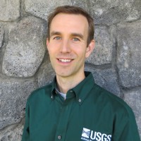
Brian Shiro, Ph.D.
AeroLeads people directory · profile

Brian Shiro, Ph.D. Email & Phone Number

Deputy Director at USGS Geologic Hazards Science Center at U.S. Geological Survey (USGS)
Location: Golden, Colorado, United States 9 work roles 11 schools
2 work emails found @usgs.gov 4 phones found area 808 and 850 LinkedIn matched
✓ Verified Jul 2026 4 data sources Profile completeness 100%

Contact Signals · 2 work emails · 4 phones

Work email b****@usgs.gov
Direct phone (808) ***-****
LinkedIn Profile matched
3 free lookups remaining · No credit card
Role
Deputy Director at USGS Geologic Hazards Science Center
Location
Golden, Colorado, United States
Company size

Who is Brian Shiro, Ph.D.? Overview

A concise factual answer block for searchers comparing this professional profile.

Quick answer

Brian Shiro, Ph.D. is listed as Deputy Director at USGS Geologic Hazards Science Center at U.S. Geological Survey (USGS), a with 6325 employees, based in Golden, Colorado, United States. AeroLeads shows a work email signal at usgs.gov, phone signal with area code 808, 850, and a matched LinkedIn profile for Brian Shiro, Ph.D..

Brian Shiro, Ph.D. previously worked as Deputy Director (Supervisory Physical Scientist) at U.S. Geological Survey (Usgs) and Seismic Network Manager (Supervisory Geophysicist) at U.S. Geological Survey (Usgs). Brian Shiro, Ph.D. holds Ph.D., Geology And Geophysics from University Of Hawaii At Manoa.

Company email context

Email format at U.S. Geological Survey (USGS)

This section adds company-level context without repeating Brian Shiro, Ph.D.'s masked contact details.

*@usgs.gov
74% confidence

AeroLeads found 2 current-domain work email signals for Brian Shiro, Ph.D.. Compare company email patterns before reaching out.

Profile bio

About Brian Shiro, Ph.D.

Geophysicist specializing in earthquake, volcano, and tsunami hazard monitoring and mitigation

Listed skills include Physics, Science, Remote Sensing, Proposal Writing, and 46 others.

Current workplace

Brian Shiro, Ph.D.'s current company

Company context helps verify the profile and gives searchers a useful next step.

U.S. Geological Survey (USGS)
U.S. Geological Survey (Usgs)
Deputy Director at USGS Geologic Hazards Science Center
reston, virginia, united states
Website
Employees
6325
AeroLeads page
9 roles

Brian Shiro, Ph.D. work experience

A career timeline built from the work history available for this profile.

Deputy Director (Supervisory Physical Scientist)

Current

Golden, Colorado, United States

Geologic Hazards Science Center- I manage science center operations, staff, and programs in Earthquake, Geomagnetism, and Landslide hazard monitoring areas. This includes utilizing expertise in geology, geophysics, and network operations to support the goals and objectives of the USGS Natural Hazards Mission Area.

Jul 2020 - Present

Seismic Network Manager (Supervisory Geophysicist)

Volcano, Hi

Hawaiian Volcano Observatory- I was responsible for HVO's seismic instrumentation and data processing from its network of 80+ stations on Hawaii and Maui. Set priorities and worked with support staff to ensure high-quality equipment installation, repairs, upgrades, and operation to maintain robust seismic and infrasound monitoring networks, including timely distribution of HVO data to partners. Assisted HVO field technicians with station installations, maintenance, and upgrades.- Supervised seismic data analysts, computer specialists, and volunteers to process real-time and archived seismic data and produce the HVO earthquake catalog. Wrote position descriptions and works with HR to classify, advertise, and select new staff members.- Responded to significant earthquakes as HVO's on-call duty seismologist and managed HVO's formal response by providing sound scientific evaluation of seismic activity and characterization of public hazard. Wrote press releases and interacted with emergency management agencies, the news media, and the public to ensure clear communication of hazards during times of increased volcanic activity.- Served as Advanced National Seismic System (ANSS) regional coordinator for Hawaii and takes leadership role at a national level to advance earthquake monitoring capabilities. Served on the ANSS governing board, the ANSS National Implementation Committee, the SIS Technical Implementation Committee, and the ANSS NetOps Workshop organizing committee.- Served as the Instrumentation Task lead for the Volcano Science Center's planning and spending of $4.9M portion of the Disaster Supplemental. This includes a dramatic upgrade and expansion of HVO's monitoring capabilities in response to the 2018 Kilauea eruption and in preparation for future National Volcano Early Warning (NVEWS) needs.- Periodically served as Acting Scientist-in-Charge for HVO during temporary 1- and 2-week periods during 2019.

Mar 2016 - Jul 2020

Geophysicist

Honolulu, Hi

Pacific Tsunami Warning Center- Monitored global earthquakes on a 24x7 basis, rapidly locating earthquakes, forecasting tsunami potential, issuing alerts, troubleshooting technical problems, performing operational research, developing software and procedures, and interacting with multiple partners including local, state, and national emergency management agencies.- Established the Hawaii Integrated Seismic Network (HISN) in close cooperation with the USGS Hawaiian Volcano Observatory and National Strong Motion Project. Planned and executed the expansion of NOAA's 26-station contribution to the HISN by scouting for new field sites, negotiating permits with and writing cooperative agreements with landowners, establishing science and hardware requirements, developing budgets, procuring equipment, collecting station metadata, and maintaining station data feeds. Assisted technicians with most field installations of broadband and strong motion seismic stations.- Measured the Earth's geomagnetic field inclination and declination on a weekly basis for the USGS Honolulu Magnetic Observatory using a theodolite-mounted magnetometer from 2005-2014. Data is used by NOAA, NASA, USGS, DOD, NSF, and foreign national geomagnetism programs to understand and monitor how the Earth's geomagnetic field relates to space weather.- Created PTWC's website for public access to tsunami information. Initiated effort to bring social media into NOAA's tsunami warning capabilities. Served on a national multi- agency team to create a new web portal at Tsunami.gov.- Developed and delivered earthquake and tsunami modules of the Hawaii Hazards Awareness & Resilience Program to communities around Oahu throughout 2015. Communicated other earthquake and tsunami science educational information to diverse audiences through frequent news media interviews, public lectures, school visits, and tours ranging from community groups to foreign government officials.

Sep 2005 - Mar 2016

Graduate Associate

St Louis, Missouri, United States

Research Assistant- Determined earthquake locations, depths, and focal mechanisms using land and ocean bottom seismic data to constrain lithosphere stress models at the Tonga subduction zone.- Developed a technique to study reflections off the Earth's D'' layer above the core-mantle boundary.- Modeled seismic energy focusing antipodal to large planetary impacts with emphasis on investigating the origin of the Tharsis Rise on Mars and hilly/lineated terrain on Mercury.Teaching Assistant- Developed/taught labs, created course websites, graded assignments/exams, and delivered occasional lectures.1) Hydrology (2005)2) Exploration & Environmental Geophysics (2003) Taught field exercises in gravity, magnetic, electrical, and seismic refraction methods.3) Epic of Evolution: Life, the Earth, and the Cosmos (2001) Interdisciplinary course in Biology, Physics, and Earth Science departments. Won the Carl Tolman Teaching Assistant Award.4) The Solar System (2000)Field Assistant- Team member for 4 NSF-funded IRIS-PASSCAL expeditions to install and maintain broadband seismic stations for targeted study of the Earth's interior. Worked in small teams to coordinate logistics for ground, ice, sea, and air scientific field operations at over 80 stations across the globe under strict time frames constrained by hostile weather conditions.1) MARIANA: Mariana Subduction Zone Seismic Imaging (2003)Installed 16 stations on 8 Northern Mariana islands. Member of team to first witness and report the eruption of Anatahan volcano.2) TAMSEIS: Trans-Antarctic Mountains Seismic Experiment (2002)Serviced 31 stations on the Antarctic plateau, dry valleys, and coast regions.3) SAFT: Seismic Arrays in Fiji & Tonga (2001, 2002)Installed 14 stations on 4 Fiji Islands. Returned solo in 2002 to service 27 stations on 4 Fiji and 6 Tonga islands.4) FLED: Florida to Edmonton Broadband Seismic Array (2001)Installed 26 stations in FL, GA, AL, MO, IA, SD, ND, MT, SK, and AB.

Jul 2000 - May 2005

Operations Supervisor

Norrisoutdoors

Evanston, Illinois, United States

- Managed staff, operations, budget, promotions, and sales for an on-campus outdoor recreation gear rental business catering to camping, skiing, biking, backpacking, and other outdoor sports. Performed equipment maintenance, and taught clinics on backpacking, cross- country skiing, and kayaking. Organized community events related to outdoor recreation and fitness.

Sep 1997 - Jun 2000

Nsf/Nasa Fellow

Juneau, Alaska, United States

- Led a research team to measure glacier thickness using seismic refraction and gravity methods during the Juneau Icefield Research Program expedition. Participated in other projects including differential GPS glacier movement, glacier mass balance, and katabatic wind meteorology.- Obtained interdisciplinary training in arctic earth system science in the longest continuous glacier research study in the world. Over the course of 8 weeks, the 50-member team traversed 80 miles on ski/foot from Juneau, AK to Atlin, BC Canada. Earned wilderness first aid certification. Gained expertise in cross-country skiing, mountaineering, glacier travel, survival, radio communications, and expedition operations.

Jul 1999 - Aug 1999

Undergraduate Research Assistant (Geodesy And Geochemistry)

Evanston, Illinois, United States

Geodesy Research Assistant (1/2000 - 6/2000)- Constrained geodynamic dislocation models of creep on a buried fault in the New Madrid Seismic Zone using precision continuous GPS data in order to characterize the region's stress state and hazard.Geochemistry Lab Assistant (9/1998 - 2/1999)- Measured the carbon content of Cretaceous-Tertiary Boundary rocks using coulometry in order to characterize the paleoenvironment surrounding the mass extinction event.

Sep 1998 - Feb 1999

Nsf-Reu Intern (Insar Geodesy)

Fairbanks, Alaska, United States

- Processed interferometric synthetic aperture radar (InSAR) satellite data to make highly accurate digital elevation model (DEM) maps for regions of Alaska and Antarctica.- Participated in geological field trips to remote Alaskan locations and learned skills in geological field research, backpacking, mountaineering, glacier travel, and wilderness survival.

Jun 1998 - Aug 1998

Nsf-Reu Intern (Applied Physics)

Houston, Texas, United States

- Designed, built, and tested an electronic detector to measure real time atomic oxygen flux in upper atmosphere scattering experiments at the Atomic and Molecular Collisions Laboratory of the Physics and Astronomy Department.- Aligned optics and other equipment for carbon nanotube production at the NASA Johnson Space Center's Applied Nanotechnology Program's Pulsed Laser Vaporization Facility.

Jun 1997 - Aug 1997
Team & coworkers

Colleagues at U.S. Geological Survey (USGS)

Other employees you can reach at usgs.gov. View company contacts for 6325 employees →

11 education records

Brian Shiro, Ph.D. education

Ph.D., Geology And Geophysics

Dissertation: “Geological and Geophysical Investigations on Kilauea and Mauna Loa Volcanoes, Hawaii”. This includes projects related.

M.S., Space Studies

Interdisciplinary program offering an in-depth study of space from scientific, technical, political, legal, historical, and social.

Certificate, Space Studies

Activities and Societies: Policy and Law Department 10-week program trains future leaders of the global space community.

Ph.D. (Incomplete), Earth And Planetary Sciences

Activities and Societies: Graduate Student Senate, Graduate Council, National Association of Graduate and Professional Students See.

Mission Lifecycle Process

Nasa Summer School For Planetary Sciences

Principal Investigator in an 18-person team effort to create and design a Mars Geophysical Lander mission concept study responsive.

Parallel Supercomputing

Nasa Summer School For High Performance Computing In Earth & Space Sciences

Learned computational theory and hands-on techniques for parallel supercomputing. Program held at the NASA Goddard Space Flight Center's.

M.A., Earth And Planetary Sciences

Activities and Societies: Peer Mentor, webmaster for EPSc Student Central thesis: "Outer Rise Seismicity and Dynamics: Implications.

B.A., Integrated Science Program, Geological Sciences, Physics

Activities and Societies: Integrated Science Program, Lindgren Residential College of Science and Engineering, Running Club, Senior Class.

Education record

Activities and Societies: Boy Scouts, Order of the Arrow, Odyssey of the Mind, Band, GCT-TV, Quiz Bowl, Model United Nations, Student.

FAQ

Frequently asked questions about Brian Shiro, Ph.D.

Quick answers generated from the profile data available on this page.

What company does Brian Shiro, Ph.D. work for?

Brian Shiro, Ph.D. works for U.S. Geological Survey (USGS).

What is Brian Shiro, Ph.D.'s role at U.S. Geological Survey (USGS)?

Brian Shiro, Ph.D. is listed as Deputy Director at USGS Geologic Hazards Science Center at U.S. Geological Survey (USGS).

What is Brian Shiro, Ph.D.'s email address?

AeroLeads has found 2 work email signals at @usgs.gov for Brian Shiro, Ph.D. at U.S. Geological Survey (USGS).

What is Brian Shiro, Ph.D.'s phone number?

AeroLeads has found 4 phone signal(s) with area code 808, 850 for Brian Shiro, Ph.D. at U.S. Geological Survey (USGS).

Where is Brian Shiro, Ph.D. based?

Brian Shiro, Ph.D. is based in Golden, Colorado, United States while working with U.S. Geological Survey (USGS).

What companies has Brian Shiro, Ph.D. worked for?

Brian Shiro, Ph.D. has worked for U.S. Geological Survey (Usgs), Noaa: National Oceanic & Atmospheric Administration, Washington University In St. Louis, Norrisoutdoors, and Foundation For Glacier & Environmental Research.

Who are Brian Shiro, Ph.D.'s colleagues at U.S. Geological Survey (USGS)?

Brian Shiro, Ph.D.'s colleagues at U.S. Geological Survey (USGS) include Grace Stojeba, Morgan Schneider, Lara So, Mary Mandt, and Brandon Root.

How can I contact Brian Shiro, Ph.D.?

You can use AeroLeads to view verified contact signals for Brian Shiro, Ph.D. at U.S. Geological Survey (USGS), including work email, phone, and LinkedIn data when available.

What schools did Brian Shiro, Ph.D. attend?

Brian Shiro, Ph.D. holds Ph.D., Geology And Geophysics from University Of Hawaii At Manoa.

What skills is Brian Shiro, Ph.D. known for?

Brian Shiro, Ph.D. is listed with skills including Physics, Science, Remote Sensing, Proposal Writing, Research, Data Analysis, Project Management, and Earth Science.

Find 750M verified contacts

Search by job title, company, industry, location, and seniority. Export verified B2B contact data when you need it.