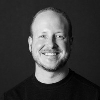
AeroLeads people directory · profile
Brad Weigle Email & Phone Number
Lecturer in GIS
at
Kauai Community College
2 phones found
area 727
LinkedIn matched
✓ Verified August 2026
4 data sources
Profile completeness 100%
Who is Brad Weigle? Overview
A concise factual answer block for searchers comparing this professional profile.
Quick answer
Brad Weigle is listed as Lecturer in GIS at Kauai Community College, based in Hawaii, United States. AeroLeads shows phone signal with area code 727 and a matched LinkedIn profile for Brad Weigle.
Brad Weigle previously worked as Senior Geospatial Consultant at Allpoints Gis and Adjunct Faculty Instructor at Southwestern College. Brad Weigle holds Ms+, Marine Science, Remote Sensing from University Of South Florida.
Company email context
Email format at Kauai Community College
This section adds company-level context without repeating Brad Weigle's masked contact details.
Kauai Community College
Review company-level records connected to Brad Weigle before choosing the right outreach path.
Profile bio
About Brad Weigle
Chasing Rainbows - catching my share.Sharing the Vision - creating a sustainable future.Living in the 4th Dimension and Beyond - dialing back to 2- & 3-D when required
Listed skills include Gis, Arcgis, Remote Sensing, Arcinfo, and 18 others.
Current workplace
Brad Weigle's current company
Company context helps verify the profile and gives searchers a useful next step.
8 roles
Brad Weigle work experience
A career timeline built from the work history available for this profile.
Lecturer In Gis
2024 Update! I'm returning to the classroom @ KCC to teach GIS starting in January 2025. Working out all the details and preparing a series of 4 courses to introduce students to the power of GIS to map their community, planet, and the great Beyond. The Esri User Conference in San Diego was most enlightening and a grand opportunity to reconnect with long-term colleagues & meet new ones.In August of 2020, I was hired by KCC as a Lecturer to teach an introductory Geographic Informations Systems (GIS) class. This asynchronous class had not been offered in a couple of years so during the Fall Semester, I'm getting to interact with 12 highly motivated students having a diverse set of learning objectives. The course is intended to provide a set of geospatial experiences and tools to assist their professional development with enhanced capabilities to view our planet with an additional perspective that GIS can provide to the learning and real-world environments. We'll be using Esri's ArcGIS Online this semester and progress to other GIS software packages in more advanced courses for subsequent offerings in the KCC curriculum of 6 classes, should my contract be renewed after this initial offering.I talked with Jack Dangermond, the co-founder and President of Esri, about my retirement plans in early 2016, and he encouraged me to never retire since I would just get old and fade away. I'm back into the "industry", Jack, although I never really left in spirit. I just wasn't getting a paycheck for my efforts! One of my current goals is to educate as many students as possible about the power of GIS in virtually every aspect of their lives and to teach the teachers here on Kaua'i and elsewhere how to incorporate GIS into classrooms from K-12. To me, an education that doesn't incorporate GIS leaves the learner with a reduced set of tools to use for global understanding, monitoring, and restoration. Onward and upward we grow!
Senior Geospatial Consultant
Allpoints Gis
I continue to disrupt barriers with PEACE and Tenacity of Purpose:Persistence of VisionEducation of the Under-InformedAltruistic IntentCreative Cooperative CommunicationEthical Enlightened ExpertiseMy valued colleagues Deb & Mike Grieco reached out to collaborate on geospatial projects where they need remote sensing & future visioning expertise. In addition to my projects, I'll consider consulting roles for GIS, RS, & 3D-Wizardry projects that fit in with my personal goals. You can reach me via LinkedIn, Facebook, or my cell # which remains the same. Leave a message to get a return call as I might be in the jungle or away on another adventure.I'm on Kauai full time --- enjoying island life and pursuing personal goals, both geospatial and adventure related . I actually ended up somewhat near the site of the Taj Mahal song above - New Hula Blues - that I posted almost 2 years before retiring from QSI in 4/2016. I take it as just another example of the power of words and positive thoughts ... "I'm goin' to Hanalei, sit down on the beach, you can call me on my cell phone but I'll be out of reach" - Taj Mahal.
May 2016 - Aug 2020

Adjunct Faculty Instructor
Evaluating online science courses for Southwestern College Professional Studies. I taught Science in Our World covering Physics, Chemistry, Biology, Geology, and Space Science in summer 2018. Lots of new knowledge since I was in college. The best part was Unit 5 on the cosmos. Beam me up, Scotty!
Jan 2018 - Jul 2020
Sr. Program Manager
I transitioned out of my PSI/QSI Forest Service Sr. Program Manager role on what used to be Tax Day - April 15, 2016. There are many personal projects on my to-do list that are screaming for attention & this is the perfect time to complete the excellent adventure at PSI & QSI. Over the last 17 years of THIS career, I've been blessed with: the opportunity to work with world-class GIS & Remote Sensing professionals; travelling to the most beautiful places in America (our National Forests & National Parks) while providing technical solutions that contribute to the protection & enhancement of the most well managed federal lands one could ever hope to impact; achieving personal growth on a daily basis through planned & random interactions with a plethora of amazing people I've encountered along the path. To all of you, I am saying THANK YOU for sharing, listening, brainstorming, laughing loud, working & playing hard, & doing everything you possibly can to ensure that the lands that we all jointly own as US & World citizens are the shining example of how great things can be accomplished with personal dedication to the greater good. I am proud to have worked with you in this quest. All the Best to each of you & stay in touch!Aloha 'Oe!
Jun 2013 - Apr 2016

Sr. Program Manager
I was the Program Manager for the Photo Science GIS Services contract with the USDA Forest Service. We provided geospatial and technical expertise along with staffing capacity to supplement the GIS and RS staffs in all 9 FS regions, the Washington Office, and Research Labs across the country. Projects involved vegetation mapping, spatial analyses, cartography, remote sensing, data warehousing, GIS application development, aerial imagery collection, and onsite staffing. It was always a pleasure to work the FS staff as they're dedicated professionals who integrate mapping technology with field data collection to manage the public's natural resources for multiple uses. I also collaborated with other company managers who handled our NOAA, BLM, USGS, COE, and state contracts to see how each agency could benefit from the work that we did for the others.The Photo Science entity disapparated on December 31, 2015, as a result of the acquisition by Quantum Spatial. Thanks go out to GMR (Mike Ritchie) for all the energy he generated and the company he nurtured and grew. I personally and professionally expanded my horizons during my 15+ years at PSI and G&O. May PSI RIP!!!!!!
Jun 1999 - Dec 2015
Research Scientist
Florida Marine Research Institute
I was the first biologist staff member hired into the new Marine Mammals program at the FL Marine Research Institute in 1985. We initiated regular aerial surveys for manatee distribution on both coasts of FL and, in the process, quickly learned that we needed a GIS system to map sightings, deaths, and conduct spatial analyses. Since the lab didn't have a vector GIS, I found PC ArcInfo and off we went, digitizing coastlines and converting paper maps and historic data into the Marine Mammal GIS. We expanded to include surveys for Right Whales and Leatherbacks, took over the statewide manatee rescue and necropsy program, and initiated a telemetry program using satellite and radio tags to monitor and map the movements of manatees on Florida's west coast. We started a statewide manatee GIS group to share data with and train other biologists. We also worked with our colleagues in Tallahassee to establish slow speed zones in areas where manatees congregate or are vulnerable to boat strikes in their migratory corridors. Those were magical days, that involved long hours, often going to work in a bathing suit and flip flops, working in - on - & over the coastal waters of FL.
Jun 1985 - Jun 1998
Research Scientist
Human Dolphin Foundation
Building the dream of communicating with an extra-terrestrial species using brain power and IT. These years inspired me to go back to graduate school for a degree that conveys credibility. The list of participants and visitors from that period is lengthy so names will be added or subtracted as they are re-cogitated:starring Dr. John Lilly - the mentor, Toni Lilly - my cosmic mom, Burgess Meredith - in the role of a kind and generous godfather, Helen the Yogi - who called me Shazam from the 1st day we met, Cynthia and Nina Lilly, Georgia Tanner, Paul Benson, Alexandra Hubbard, Linda Dias, Dennis Kastner & Paule Jean, Larry Marchperson, Dr. Dan Graboi, Lois and Saul Lessler, Sherry, Ed from UCLA, & John Kert --- with guest appearances by Paul Winter, Robin Williams, Milos Forman, Carroll O'Connor, Larry Hagman, Jeff Bridges, Olivia Newton John, Sylvester Stallone, Paul Williams, John Denver, Shirley MacLaine, Cleveland Amory, Jack Perkins, Penny Marshall, Cindy Williams, Dr. Bill Evans, Dr. Ken Norris, Bob Coburn, Helen Pasakarnis, the Beverly Hills Hotel, the Esalen Institute, Black Mountain, and an amazing cast of extras. There was a nearly constant parade through Decker Canyon to meet the muse and mentor. While floating at the Feathered Pipe Ranch, I had envisioned leading tours of the lab and materialized those beliefs into reality.
Jul 1977 - Jun 1979
3 education records
Brad Weigle education
Ms+, Marine Science, Remote Sensing
Bachelor’S Degree, Biology, Chemistry Minor, Fun, Summa Cum Laude
High School, Biology, Chemistry, Math, Aeronautics
Wichita North High School
FAQ
Frequently asked questions about Brad Weigle
Quick answers generated from the profile data available on this page.
What company does Brad Weigle work for?
Brad Weigle works for Kauai Community College.
What is Brad Weigle's role at Kauai Community College?
Brad Weigle is listed as Lecturer in GIS at Kauai Community College.
What is Brad Weigle's phone number?
AeroLeads has found 2 phone signal(s) with area code 727 for Brad Weigle at Kauai Community College.
Where is Brad Weigle based?
Brad Weigle is based in Hawaii, United States while working with Kauai Community College.
What companies has Brad Weigle worked for?
Brad Weigle has worked for Kauai Community College, Allpoints Gis, Southwestern College, Quantum Spatial, and Photo Science.
How can I contact Brad Weigle?
You can use AeroLeads to view verified contact signals for Brad Weigle at Kauai Community College, including work email, phone, and LinkedIn data when available.
What schools did Brad Weigle attend?
Brad Weigle holds Ms+, Marine Science, Remote Sensing from University Of South Florida.
What skills is Brad Weigle known for?
Brad Weigle is listed with skills including Gis, Arcgis, Remote Sensing, Arcinfo, Spatial Databases, Erdas Imagine, Environmental Science, and Spatial Analysis.
Find 750M verified contacts
Search by job title, company, industry, location, and seniority. Export verified B2B contact data when you need it.
Start free trialPeople with similar names
Check these profiles if this is not the Brad Weigle you were looking for.
View similar profiles