Data Center Operations
• Break-fix of servers and network devices• Troubleshooting of network connections• Responding to high-severity events in compliance with SLAs• Rack installation and configuration
May 2019 - Apr 2021
Please complete the CAPTCHA to continue
@ibge.gov.br
✓
LinkedIn matched
A concise factual answer block for searchers comparing this professional profile.
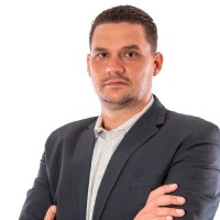
Rodrigo Quirino is listed as Geomatics Engineer | Network specialist based in Curitiba, Paraná, Brazil. AeroLeads shows a work email signal at ibge.gov.br and a matched LinkedIn profile for Rodrigo Quirino.
Rodrigo Quirino previously worked as Data Center Operations at Amazon Web Services (Aws) and Geomatics Engineer at Furnas. Rodrigo Quirino holds Associate'S Degree, System, Networking, And Lan/Wan Management/Manager from Collège De Maisonneuve.
This section adds company-level context without repeating Rodrigo Quirino's masked contact details.
AeroLeads found 1 current-domain work email signal for Rodrigo Quirino. Compare company email patterns before reaching out.
Rodrigo Quirino is a Geomatics Engineer | Network specialist. He is proficient in English, Spanish and French. Colleagues describe him as "Rodrigo trabalhou comigo em Furnas Centrais Eletricas, um professional de excelente qualidade tecnica, maravilhoso relacionamento pessoal."
Listed skills include Arcgis, Esri, Surveying, Geospatial Intelligence, and 20 others.
A career timeline built from the work history available for this profile.
Montreal, Canada Area
• Break-fix of servers and network devices• Troubleshooting of network connections• Responding to high-severity events in compliance with SLAs• Rack installation and configuration

Rio De Janeiro E Região, Brasil
Tasks / responsabilities (Environment Department):• Provided support to a multidisciplinary team of the Environment Department with geospatial analysis;• Responsible for the Geographic Informstion System (GIS) of the Environmental Department, with data from 14 hydroeletric power plants and 24,000km of power lines;• Made supervised classification of high resolution images (WorldView, GeoEye, Ikonos and Kompsat sensors) in order to detect change signals in the properties of the company, such as land invasions, wildfires and illegal water pumping;• Collected field data to make a real-world testing of the satellite imagery, analyzing data results of the classification and checking if they match with reality;• Researched conservation and indigenous areas that could be affected by the power lines and water reservoirs;• Executed research and data collection from different data sources in order to preview potential land properties to be bought;• Implemented ArcGIS scripts, dynamic labels and texts and data driven pages to accelerate and save time to generate maps;• Applied continuous remote sensing in the estimation of macrophytes presence floating in water; • Produced several types of maps and datasets according to the demands of the team;• Calculated and analyzed geospatial data to produce environmental impacts reports.

Rio De Janeiro
Tasks / responsabilities (Geodesy department):• Responsible for the network configuration of high precision GNSS receivers of the Brazilian Active GNSS Network (RBMC) formed by 120 equipments connected to the Internet 24/7;• Configured routers, switches, FTP servers, Satellite modems and network servers;• Solved TCP/IP and FTP issues detected on the RBMC network;• Assembled cable connectors and adapters (BNC, TNC, Lemo, RS-232, RJ-45);• Managed, verified and organized thousands of RINEX files (GPS standard file) in a Linux server (Debian);• Researched and negotiated with new partners in order to increase the numbers of stations, as a result the number of stations was increased from 67 to 120 during the period;• Verified the proper functioning of the GNSS receivers by analyzing data broadcasted by the stations such as the size of the files, DOP parameters and satellite health;• Verified quality analytics of RINEX data using Shell Scripting;• Automatized download, compression and upload of RINEX files to the FTP server and to IGS Network;• Contributed in research projects to investigate the effects of ionospheric scintillation in Brazil (CIGALA/CALIBRA Network Project and Embrace-INPE Project);• Created and updated DOMES numbers of the active geodetic stations to the IGN-France;• Installed and configured VAISALA weather stations to send meteorological data to the GNSS receivers;• Vice-coordinator of the Brazilian geospatial comission for metadata policies and procedures (INDE).
Rio De Janeiro
Tasks / responsabilities:• Supervised a 26-people team responsible for the prodution of all IFR (Instrument Flight Rules) aeronautical charts of the Brazilian Airspace;• Participated in the flight controller training of the Brazilian Air Force, teaching geospatial concepts and how to interpretate maps and understand map projections;• Corrected aeronautical procedures content after flight inspections and give support to flight procedure designers;• Coordinated several land surveyings to locate, build and verify navigation auxiliary equipments (PAPI, D-VOR, VOR, DME and, NDB) and to represent runways, taxiways and aircraft parking;• Responsible for feeding an Aeronautical GIS database;• Surveying, verification and calculation of geospatial data of airways, aerodromes and procedures.

Curitiba
• Responsible for updating a GIS database of planted pine stands, calculating coordinates and areas of production.• Analysed and processed data from land surveyings and satellite images;• Worked in several land surveyings using GPS receivers and Total Stations.

Quick answers generated from the profile data available on this page.
Rodrigo Quirino is listed as Geomatics Engineer | Network specialist.
AeroLeads has found 1 work email signal at @ibge.gov.br for Rodrigo Quirino.
Rodrigo Quirino is based in Curitiba, Paraná, Brazil.
Rodrigo Quirino has worked for Amazon Web Services (Aws), Furnas, Ibge, Brazilian Air Force, and Geoplus Geotecnologia E Informática.
You can use AeroLeads to view verified contact signals for Rodrigo Quirino, including work email, phone, and LinkedIn data when available.
Rodrigo Quirino holds Associate'S Degree, System, Networking, And Lan/Wan Management/Manager from Collège De Maisonneuve.
Rodrigo Quirino is listed with skills including Arcgis, Esri, Surveying, Geospatial Intelligence, Data Analysis, Linux, Shell Scripting, and Global Positioning System.
Search by job title, company, industry, location, and seniority. Export verified B2B contact data when you need it.
Start free trial Search contactsCheck these profiles if this is not the Rodrigo Quirino you were looking for.