
Jan 2024 - Present
Please complete the CAPTCHA to continue
A concise factual answer block for searchers comparing this professional profile.
Chris W. is listed as Counter-UAS Industry Professional | Spatial Intelligence Analytics | at Government of Canada, a with 114110 employees, based in Ottawa, Ontario, Canada. AeroLeads shows a matched LinkedIn profile for Chris W..
Chris W. previously worked as Technical Inspector - Drone Security at Government Of Canada and Geomatics Consultant at Truenorth Drones. Chris W. holds Geographical Information Systems (Gis), Geospatial Management from Nbcc Moncton Campus.
This section adds company-level context without repeating Chris W.'s masked contact details.
Review company-level records connected to Chris W. before choosing the right outreach path.
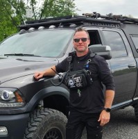
Dedicated to safeguarding airspace and protecting critical infrastructure from unauthorized drone activity. I specialize in comprehensive detection, tracking, and mitigation strategies. Expertise in developing vulnerability assessments and implementing counter-drone solutions to mitigate safety and security risks to people and assets. Skilled at producing comprehensive intelligence-gathering strategies to identify and mitigate vulnerabilities. Experienced in analyzing drone activity patterns, trends, and behaviors to inform proactive defense measures. My commitment to safeguarding our airspace incorporates staying at the forefront of industry advancements for enhanced situational awareness of emerging threats and vulnerabilities.Civil Engineering Technologist specializing in Geomatics. Adept at land surveying, GIS mapping, and designing airborne operating systems for collecting and processing spatial data and aerial imagery. Specialized in planning, collecting and analysis of Unmanned Aerial Systems (UAS) data.•
Company context helps verify the profile and gives searchers a useful next step.
A career timeline built from the work history available for this profile.
Ottawa, Ontario, Canada
RPAS Task Force - Security
Ottawa, Ontario, Canada
Consulting services in Ottawa, ON Canada for UAS remote sensing/data collection projects, GIS mapping, and data analytics.

Ottawa, Ontario, Canada
Conducting proof-of-concept and relevant field trials. Enabling business development while supporting the sales team drive sales opportunities. Providing demonstrations, systems training, and technical product support to commercial and defence sectors.
Calgary, Alberta, Canada
Consulting services in Calgary, Alberta, Canada for UAS remote sensing/data collection projects, GIS mapping, and data analytics.

Kearl Mine, Calgary/Fort Mcmurray
Responsible for the oversight and management of the Kearl oil sands mine geomatics and remote sensing contractors. Surveying Technologist field supervisor. Development, training and implementation of Imperials RPAS operations. Summary:-Provided geomatics support to all Imperial Oil assets and promoted new technologies to expand Geomatics applications by developing Imperials RPAS Operations manual, training program and procedures for photogrammetry data collection-Training and mentoring staff to optimize effectiveness of data collection tools and workflows -Designed and conducted validation tests for comparative photogrammetry data collection and solved technical issues for internal/external stakeholders-Eliminating and or mitigating job hazards to provide a safe working environment for geomatics contractors; one recordable hurt over 7.5 years-Oversight over the timely and accurate collection and QC/QA of spatial data for integration into spatial databases to ensure measurable regulatory commitments were consistently attained-Acquisition and interpretation of aerial photographs and LiDAR -Innovation and design standards considerations for the Imperial GIS to integrate third party external data into Imperials spatial database

Fort Mcmurray, Alberta
Supported Mine Operations and the Planning teams by delivering current topographic surfaces of the mine progression, tailings dyke construction, and all layouts of mining panel limits, road, and tailings dyke construction. Maintained and merged pit and dyke DTM surfaces with current as-built surveys. Performed 3D laser surveys of the mine on a weekly basis for material quantity tracking and progression.-Volumetric surveys and spatial analysis and calculation for material quantities-3D terrestrial laser scanning-Performing quality control of spatial data for importing/exporting to and from customers

Fort Mcmurray, Alberta
Fly in/Fly out position at CNRL Horizon Oil Sands Mine. Was responsible for survey layouts of tailings dyke construction boundaries, road designs, and overburden mining panel limits as well topographic as-built surveys to capture mining and construction progression.-Robotic Total Station, Static PPK, and RTK GPS topographic surveys-Volumetric surveys and spatial analysis and calculation for material quantities-3D terrestrial laser scanning

Other employees you can reach at canada.ca. View company contacts for 114110 employees →
 Pamela Workman
Colleague at Government Of CanadaKemptville, Ontario, Canada
View →
MR
Pamela Workman
Colleague at Government Of CanadaKemptville, Ontario, Canada
View →
MR
 Marlene Robinson
Colleague at Government Of CanadaGatineau, Quebec, Canada
View →
TT
Marlene Robinson
Colleague at Government Of CanadaGatineau, Quebec, Canada
View →
TT
 Tina Tondreau
Colleague at Government Of CanadaGatineau, Quebec, Canada
View →
SC
Tina Tondreau
Colleague at Government Of CanadaGatineau, Quebec, Canada
View →
SC
 Sandra Connors
Colleague at Government Of CanadaSt John’S, Newfoundland And Labrador, Canada
View →
NT
Sandra Connors
Colleague at Government Of CanadaSt John’S, Newfoundland And Labrador, Canada
View →
NT
 Nick Thompson
Colleague at Government Of CanadaOttawa, Ontario, Canada
View →
CD
Nick Thompson
Colleague at Government Of CanadaOttawa, Ontario, Canada
View →
CD
 Chantale Dubois
Colleague at Government Of CanadaOttawa, Ontario, Canada
View →
VG
Chantale Dubois
Colleague at Government Of CanadaOttawa, Ontario, Canada
View →
VG
 Valerie Gauthier
Colleague at Government Of CanadaGatineau, Quebec, Canada
View →
BF
Valerie Gauthier
Colleague at Government Of CanadaGatineau, Quebec, Canada
View →
BF
 Bryan Ferrer
Colleague at Government Of CanadaQuezon City, National Capital Region, Philippines
View →
KM
Bryan Ferrer
Colleague at Government Of CanadaQuezon City, National Capital Region, Philippines
View →
KM
 Ken Mahoney
Colleague at Government Of CanadaEdwardsburgh/Cardinal, Ontario, Canada
View →
JM
Ken Mahoney
Colleague at Government Of CanadaEdwardsburgh/Cardinal, Ontario, Canada
View →
JM
 John Mouroukas
Colleague at Government Of CanadaCanada
View →
John Mouroukas
Colleague at Government Of CanadaCanada
View →
Gained a a comprehensive understanding of spatial analysis, data visualization, and mapping techniques. Leveraging geospatial expertise.
The Civil Engineering Technology Geomatics provided me with the ability to plan, execute and supervise the collection of field surveying.
Quick answers generated from the profile data available on this page.
Chris W. works for Government of Canada.
Chris W. is listed as Counter-UAS Industry Professional | Spatial Intelligence Analytics | at Government of Canada.
Chris W. is based in Ottawa, Ontario, Canada while working with Government of Canada.
Chris W. has worked for Government Of Canada, Truenorth Drones, D-Fend Solutions, Terra-Sky Gis/Remote Sensing Consulting, and Exxonmobil.
Chris W.'s colleagues at Government of Canada include Pamela Workman, Marlene Robinson, Tina Tondreau, Sandra Connors, and Nick Thompson.
You can use AeroLeads to view verified contact signals for Chris W. at Government of Canada, including work email, phone, and LinkedIn data when available.
Chris W. holds Geographical Information Systems (Gis), Geospatial Management from Nbcc Moncton Campus.
Search by job title, company, industry, location, and seniority. Export verified B2B contact data when you need it.
Start free trial Search contactsCheck these profiles if this is not the Chris W. you were looking for.