Senior Spatial Application Developer
Nsw Department Of Planning, Housing And Infrastructure
Please complete the CAPTCHA to continue
area 145
✓
LinkedIn matched
A concise factual answer block for searchers comparing this professional profile.
George Chandeep Corea is listed as Senior Spatial Application Developer at NSW Department of Planning, Housing and Infrastructure, based in Greater Sydney Area, Australia. AeroLeads shows phone signal with area code 145 and a matched LinkedIn profile for George Chandeep Corea.
George Chandeep Corea previously worked as Remote Sensing Scientist at Department of Planning & Environment at Nsw Government and Data Manager at Mangoesmapping. George Chandeep Corea holds Msc, Forestry And Environmental Management from University Of Sri Jayewardenepura.
This section adds company-level context without repeating George Chandeep Corea's masked contact details.
Review company-level records connected to George Chandeep Corea before choosing the right outreach path.
As a Research Scientist and GIS Specialist with over 20 years of experience, I specialize in integrating AI with geospatial analysis to drive innovative solutions for environmental conservation, disaster management, and sustainable development. My expertise spans the use of Esri technologies, QGIS, Python scripting, and other advanced tools, enabling me to deliver data-driven insights that influence policy and improve operational efficiency.I have a proven track record of leading multidisciplinary teams and developing custom solutions that streamline processes, enhance data accuracy, and provide strategic outcomes. For example, I pioneered a nationally recognized disaster response mapping initiative that improved real-time decision-making for government agencies and was instrumental in winning the GITA Spatial Excellence Award for innovation in geospatial technology.My work extends beyond technical implementation to include training and capacity building in technologies, empowering communities and organizations to utilize data and research findinga effectively. From developing automated workflows for local councils to supporting wildlife habitat mapping projects with AI-driven models, my approach combines technical precision with a passion for sustainable outcomes.Driven by a commitment to conservation and resilience, I continue to explore cutting-edge applications of AI in GIS, aiming to solve complex environmental challenges and foster long-term sustainability. I am always open to connecting with professionals who share a vision for using geospatial technology as a catalyst for positive change.
Listed skills include Program Management, Gis, Strategic Planning, Research, and 46 others.
Company context helps verify the profile and gives searchers a useful next step.

A career timeline built from the work history available for this profile.
Sydney, Nsw, Au
Newcastle, New South Wales, Australia
In my new role as a Remote Sensing Scientist, I am excited to leverage my extensive experience in GIS and spatial data analysis to contribute to innovative environmental projects. This position involves:+Utilizing advanced remote sensing techniques and GIS platforms for environmental data analysis and conservation efforts.+Collaborating with a multidisciplinary team to develop strategies for biodiversity conservation and science.+Engaging in data-driven research to inform policy and management decisions within the Department of Planning & Environment.+Contributing to science economics and insights, enhancing the department's ability to manage natural resources effectively.This role allows me to combine my technical expertise in GIS with my passion for environmental stewardship, making a meaningful impact in the field of conservation and resource management.
Atherton, Queensland, Australia
--- Transitioning to part-time ---As the Data Manager at Mangoesmapping, I spearheaded key GIS initiatives, blending technical expertise with strategic leadership. My tenure was marked by:+Leading the development of innovative GIS solutions, significantly enhancing project accuracy and operational efficiency.+Driving several award-winning projects, recognized for outstanding contributions in GIS technology and spatial data analysis, exemplified by the GITA Spatial Excellence Award.+Presenting our groundbreaking work at prestigious industry events, sharing insights and methodologies that set new standards in the field.+Successfully managing large-scale spatial data projects, from inception to delivery, ensuring adherence to the highest quality and accuracy.+Collaborating with diverse teams and stakeholders, fostering strong relationships that enhanced project outcomes and expanded the company's influence in the GIS sector.+Mentoring and developing a team of GIS professionals, cultivating a culture of excellence and continuous professional growth.This role continues to be a testament to my commitment to advancing GIS technology and delivering solutions that drive meaningful impact.
Atherton, Queensland
FORMERLY Bk2BasiksConsultancy in Enabling Technology (IT), Spatial problem solving and Tourism. We help you find and make your mark.NOTE: Spatial work is now exclusively through Mangoesmapping.oHelped organise Startup Weekend TablelandsoSelected for second round of QLD OpenInnovation project with ParkArk - Explore|Map|Visualize|Analyse a comprehensive single platform solution for National Parks.oWon 2014 Cairns Startup Weekend #2– ShareMatey.com; borrow to save, lend to earnoWon 2014 Cairns Startup Weekend #1– Incorporated PakYak.com.au that has developed an app for safer team sports with Venture Capital funds.oTraining at Google Australia HQ in there mapping technology.oDeveloped training for Aboriginal children and other niche groups in GIS.oIntiated SMaRTourism.org -connecting travelers to communities.oConsulting for Mulungu Aboriginal Corporation and Destiny Inc for developing IT strategies.oDeveloping a school holidays program for the Tablelands with Apex campsoPlanning a Startup Weekend Tablelands with Tablelands residents, organisations and businesses.oDeveloping a drone based property visualization product.
Atheton, Queensland, Australia
Destiny Futures is a new company that manages the business arm of Destiny Church in Atherton, FNQ. It currently oversees the operations of our Work For Dole program, Destiny Exchange, Scarlet Threads and Destiny Cafe/Auditorium.Destiny Cafe - A quiet place to relax and have a cuppa plus some yummy meals and deserts on Wed and Thursday plus special bookings for large or small groups.Destiny Auditorium - Large 300+ seat air-conditioned facility with professional lighting and sound. An ideal space for displaying art, having a seminar or screening a film.Scarlet Threads - Quality women's clothing at prices that can't be beat. Proceeds go into local womens causesDestiny Exchange - An op-shop which also gives things away to people in real need.Work for Dole - helping the community with a hand up rather than a hand out. We work with BreakThru and Neato in the Tablelands. The projects include a children's playground and community garden.

Far North Queensland, Australia
Chair July 2014-2016Previously on executive responsible for new website, newsletter and on conference/workshop committees.Conducted almost annual workshops and delivered talks on GIS software and processes.


Worldwide
As the GIS Coordinator as part of the executive for the Standby Task Force, I was instrumental in deploying GIS capabilities in global disaster response efforts. My role encompassed:+Leading the GIS response for international emergencies, facilitating critical mapping and spatial data analysis.+Representing the only NGO on FEMA’s daily coordination calls, providing crucial GIS insights for disaster management.+Orchestrating global volunteer efforts, ensuring accurate and timely data collection and analysis for emergency response.+Spearheading the presentation at the International Conference of Crisis Mappers (ICCM), showcasing our innovative approaches in GIS for humanitarian aid.+Developing training programs for volunteers, enhancing their skills in GIS for more efficient disaster response mapping.+Fostering collaborations with international agencies, amplifying the impact and reach of our GIS initiatives in emergency situations.This role highlighted my ability to lead in high-stakes, fast-paced environments, making a significant difference in humanitarian disaster response through GIS expertise.
Cairns, Queensland
Developing a system to rent idle assets from others, so that you can ‘try before you buy’ or have fun or get things done without blowing the budget. On the flip side if you're paying to upkeep depreciating stuff that you hardly use, our idea could be a way to earn some cash on the side.Formerly called ShareMateySee http://www.sharematey.com/animation.html
Cairns, Australia
Pak Yak app is a wifi, real time voice communication app. It utilises the wifi hotspots of several linked iPhones (android on the way) to allow real time walkie talkie like communications with only your phone and optional bluetooth ear piece.Safety and communication are the key features of the app. Cyclist can now ride single file and still continue to talk in real time, which makes the activity inherently safer for cyclists and causes less friction with motorists.Pak Yak works off the grid - no mobile reception will be required.Pak Yak will have applications far beyond cycling - anywhere that active group communication is required pak yak could be the solution for example, event management, venue security, sports administration, off grid mine sites.
Far North Queensland, Australia
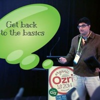
o Technical lead for Disaster Resilient Communication Project - Corporate Winner of the 2013 Australia New Zealand Geographic and Information Technology Association Spatial Excellence Award and Highly Commended at SSSI, Queensland Spatial Excellence Award. Related article published in 2014 Position Magazine. o Responsible for most projects with large data sets that require high level analysis and automation such as Bushfire, radio propagation and hazard analysis utilizing, generating and presenting terabytes of data. These projects have been presented at multiple industry symposia. o Town planning for regional councils according to State standards. Developed templates and scripts, utilizing python and ArcGIS models to semi-automate and manage the multiple iterations of data and symbology changes required by the clients. The GIS team then used these to create 21 different series just for TRC containing over 750 individual maps of varying scales and created efficient raster versions for online search and display. o Disaster planning, preparation and operations. EIMS certified. Planning officer at Local Disaster Management Center for Cyclone Yasi and Cyclone Ita, along with multiple wildfires. Developed many field mapping products to help manage and plan for disasters o Hard and soft copy, data capture and restructuring to standards for NDRRA web mapping interface and for customised asset management systems. Created a semi-automated system to capture, index and implement searchability within councils Mapinfo environment of historical sewerage data. o GIS installation support and implementing/learning new software prior to further deployment o Support for council staff and residents o Liaison with ESRI, Pitney Bowes, ERDAS (and other software/data providers) o Policy and procedure documentation updates o Contractor/Team supervision on internal and external project implementations o Client coordination as required for project implementation
Adelaide, Australia
o Developing a Google Earth interface for their website.o Developed internal maps for negotiating the South Australian marine parks with DEH/Minister of Environment.o Resourced a volunteer to continue and develop the interface.
Berri, South Australia
Responsible for office and fieldwork in the Murray-Darling basin focused on GIS Mapping/Analysis of existing data and arranging background data sets for upcoming surveys.

Sri Lanka
o Organisational winner of the UNDP Equator Initiative 2008.o Managed, planned and administered the community development, marine & terrestrial conservation, and socio-economic research programs. o Grew program from: annual budgets of US$30,000 to over $600,000, over 20 full time staff and several consultants, programs in 4 of the 5 administrative provinces of Sri Lanka, permanent bases in 4 sites and international consultancies in Asia and Africa. o Coordinated an international paying volunteer program with volunteer companies based mainly in Europe, USA and Australia.o Grew from initiation to an organisational entity that supported over 30% of the annual operating costs of the entire organisation and hosted over 100 experiential visitors per year -despite an ongoing civil war (till mid 2009). o Organized several international and local forums/exhibitions (and presented at them). These had a diverse range of audience (from local communities, to government ministers to international specialists) and ranged in size from 50 people to 500 people. o Acted/Featured in multiple international documentaries (for Animal Planet/Discovery Channel/National Geographic etc). Filmed and edited numerous short advertorials for SLWCS. o Organised study tour of 6 terrestrial and marine conservation programs in South Africa to further strengthen programs and to develop MaRINE; a multi-marine community based conservation program. o Managed two information technology programs to develop applications and hardware to prevent and manage Human Wildlife Conflict. The EleAlert project, won the 2009 National Science Foundation award.o Negotiated partnership with a University (for expertise) and Google, a Telecom, an International Development Agency and USFWS for funding. o Coordinated relationships with several international organizations and individuals to provide funding and specialist support. o Presented at over 35 international and local forums/expert panels.

Activities and Societies: SCGIS

Activities and Societies: Christain Leadership and Conservation Marine Biology and Computer Science

Quick answers generated from the profile data available on this page.
George Chandeep Corea works for NSW Department of Planning, Housing and Infrastructure.
George Chandeep Corea is listed as Senior Spatial Application Developer at NSW Department of Planning, Housing and Infrastructure.
AeroLeads has found 2 phone signal(s) with area code 145 for George Chandeep Corea at NSW Department of Planning, Housing and Infrastructure.
George Chandeep Corea is based in Greater Sydney Area, Australia while working with NSW Department of Planning, Housing and Infrastructure.
George Chandeep Corea has worked for Nsw Department Of Planning, Housing And Infrastructure, Nsw Government, Mangoesmapping, Get Back 2 Basics, and Destiny Futures Pty Ltd.
You can use AeroLeads to view verified contact signals for George Chandeep Corea at NSW Department of Planning, Housing and Infrastructure, including work email, phone, and LinkedIn data when available.
George Chandeep Corea holds Msc, Forestry And Environmental Management from University Of Sri Jayewardenepura.
George Chandeep Corea is listed with skills including Program Management, Gis, Strategic Planning, Research, Proposal Writing, Sustainability, Ecology, and Policy.
Search by job title, company, industry, location, and seniority. Export verified B2B contact data when you need it.
Start free trial Search contacts