
Senior Spatial Scientist
CurrentRegional Ecosystem and Landscape Mapping (REALM) Project.
Nov 2023 - Present
Please complete the CAPTCHA to continue
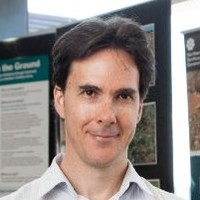
A concise factual answer block for searchers comparing this professional profile.
Daniel Mcintyre is listed as Senior Spatial Scientist at Northern Territory Government, a with 2603 employees, based in Darwin, Northern Territory, Australia. AeroLeads shows a matched LinkedIn profile for Daniel Mcintyre.
Daniel Mcintyre previously worked as Senior Assessment Officer at Northern Territory Government and Senior Rangeland Scientist - Remote Sensing at Northern Territory Government. Daniel Mcintyre holds Doctor Of Philosophy - Spatial Sciences (Phd), Environmental Remote Sensing from Curtin University.
This section adds company-level context without repeating Daniel Mcintyre's masked contact details.
Review company-level records connected to Daniel Mcintyre before choosing the right outreach path.
I am a senior environmental and spatial professional with 20 years of experience working in the diverse environments of the Northern Territory of Australia. My working experience covers roles across academia, the private sector and government. I have proven experience and expertise in a number of fields, including remote sensing, geographic information systems, land management and environmental impact assessment.
Listed skills include Remote Sensing, Spatial Analysis, Spectroscopy, Envi, and 38 others.
Company context helps verify the profile and gives searchers a useful next step.
A career timeline built from the work history available for this profile.
Palmerston, Northern Territory, Australia
Regional Ecosystem and Landscape Mapping (REALM) Project.
Darwin, Northern Territory, Australia
Petroleum Operations Team
Palmerston, Northern Territory, Australia
Rangeland Monitoring
Darwin, Australia
* Procurement and contract management for remediation and land management projects, including:- Weed survey and control on mining tenements at Tennant Creek- Baseline weed survey at Goodall legacy mine* Remote area fieldwork, including inspection and inventory of features (e.g. mine shafts) at legacy mines.* Specialist spatial support for Mine Rehabilitation and Mining Compliance teams* Creating and maintaining spatial databases of legacy mines and features* Spatial analysis and modelling e.g. landscape suitability modelling for waste rock storage

Darwin, Australia
* Contribution to major project approvals process, including referrals, EIS, risk assessment, and managing supporting studies (e.g. flora and fauna surveys)* Specialist spatial science support, including visual amenity analysis and sourcing and processing of remotely sensed data* Specialist contributions to statutory reports (e.g. annual environment reports)
Darwin, Australia
* Program leader: ERA Traditional Burning (2010-12). Employing local indigenous people for traditional fire management on ERA mining leases. * On-ground fire management to protect ERA assets, in particular revegetation sites.* Strategic level fire management on ERA leases, producing 5-year and 1-year fire management plans, and annual fire reports.* Using remote sensing technology and techniques to produce fire scar histories for ERA leases from Landsat and MODIS data sets.* On-ground assessment and survey of fire events and fire scars using GIS and mobile mapping technology.* Aquatic weed management, including airboat surveys of Jabiluka and Kakadu National Park wetlands for Salvinia and Para grass, and using fire as a control method for Para grass* Weed management: including on-ground and helicopter surveys, spatial analysis of data, and input into strategic weed management at ERA

Darwin, Australia
Lecturer in two second year undergraduate units: Introductory Remote Sensing & Geographic Information Systems 1
Darwin, Australia
Using Quickbird and IKONOS satellite imagery to map coral reef and marine habitats
Darwin, Australia
Key Centre for Tropical Wildlife Management* Documenting long-term landscape change from historical aerial photography* Bayesian predictive modelling of Magpie Goose nesting habitat using ecological datasets* Spatial predictive modelling of Mimosa pigra distribution using remote sensing and spatial datasets* Acquisition, processing, classification, and validation of remotely sensed data products* Spatial analysis and cartographic output for peer reviewed scientific publications
Other employees you can reach at nt.gov.au. View company contacts for 2603 employees →
 Rahul Vokerla
Colleague at Northern Territory GovernmentStuart Park, Northern Territory, Australia
View →
SG
Rahul Vokerla
Colleague at Northern Territory GovernmentStuart Park, Northern Territory, Australia
View →
SG
 Sandra Gardner (Debney)
Colleague at Northern Territory GovernmentGreater Darwin Area, Australia
View →
JL
Sandra Gardner (Debney)
Colleague at Northern Territory GovernmentGreater Darwin Area, Australia
View →
JL
 Jonathan L.
Colleague at Northern Territory GovernmentDarwin, Northern Territory, Australia
View →
AS
Jonathan L.
Colleague at Northern Territory GovernmentDarwin, Northern Territory, Australia
View →
AS
 Abu Saleh
Colleague at Northern Territory GovernmentMelbourne, Victoria, Australia
View →
MG
Abu Saleh
Colleague at Northern Territory GovernmentMelbourne, Victoria, Australia
View →
MG
 Michael Garrard
Colleague at Northern Territory GovernmentDarwin, Northern Territory, Australia
View →
FW
Michael Garrard
Colleague at Northern Territory GovernmentDarwin, Northern Territory, Australia
View →
FW
 Francis Wait
Colleague at Northern Territory GovernmentWoolner, Northern Territory, Australia
View →
JT
Francis Wait
Colleague at Northern Territory GovernmentWoolner, Northern Territory, Australia
View →
JT
 Jennifer Tucio
Colleague at Northern Territory GovernmentDarwin, Northern Territory, Australia
View →
SH
Jennifer Tucio
Colleague at Northern Territory GovernmentDarwin, Northern Territory, Australia
View →
SH
 Sarah Hore
Colleague at Northern Territory GovernmentMinyerri, Northern Territory, Australia
View →
MJ
Sarah Hore
Colleague at Northern Territory GovernmentMinyerri, Northern Territory, Australia
View →
MJ
 Mary Joseph
Colleague at Northern Territory GovernmentAustralia
View →
AM
Mary Joseph
Colleague at Northern Territory GovernmentAustralia
View →
AM
 Amanda Moore
Colleague at Northern Territory GovernmentNhulunbuy, Northern Territory, Australia
View →
Amanda Moore
Colleague at Northern Territory GovernmentNhulunbuy, Northern Territory, Australia
View →

Thesis title: Application of high resolution remote sensing to detect and map the pasture weed Paterson’s curse (Echium plantagineum).
Activities and Societies: Focus areas: Environmental biology, remote sensing, & Geographic Information Systems. Honours thesis title.
Quick answers generated from the profile data available on this page.
Daniel Mcintyre works for Northern Territory Government.
Daniel Mcintyre is listed as Senior Spatial Scientist at Northern Territory Government.
Daniel Mcintyre is based in Darwin, Northern Territory, Australia while working with Northern Territory Government.
Daniel Mcintyre has worked for Northern Territory Government, Rio Tinto, and Charles Darwin University.
Daniel Mcintyre's colleagues at Northern Territory Government include Rahul Vokerla, Sandra Gardner (Debney), Jonathan L., Abu Saleh, and Michael Garrard.
You can use AeroLeads to view verified contact signals for Daniel Mcintyre at Northern Territory Government, including work email, phone, and LinkedIn data when available.
Daniel Mcintyre holds Doctor Of Philosophy - Spatial Sciences (Phd), Environmental Remote Sensing from Curtin University.
Daniel Mcintyre is listed with skills including Remote Sensing, Spatial Analysis, Spectroscopy, Envi, Arcinfo, Idrisi, Erdas Imagine, and Spss.
Search by job title, company, industry, location, and seniority. Export verified B2B contact data when you need it.
Start free trial Search contactsCheck these profiles if this is not the Daniel Mcintyre you were looking for.
View similar profiles