AeroLeads people directory · profile
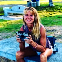
Dr. Kim Baldwin Email & Phone Number
Founder and Director
at
Marine Spatial Information Solutions, Inc.
LinkedIn matched
✓ Verified August 2026
3 data sources
Profile completeness 100%
Current company
Role
Founder and Director
Location
Saint James, Barbados
Company size
Who is Dr. Kim Baldwin? Overview
A concise factual answer block for searchers comparing this professional profile.
Quick answer
Dr. Kim Baldwin is listed as Founder and Director at Marine Spatial Information Solutions, Inc., a with 2 employees, based in Saint James, Barbados. AeroLeads shows a matched LinkedIn profile for Dr. Kim Baldwin.
Dr. Kim Baldwin previously worked as Founder & Director at Marine Spatial Information Solutions, Inc. and Research Associate at University Of The West Indies: Cavehill. Dr. Kim Baldwin holds Post Graduate Teaching And Learning Certificate from The University Of The West Indies Cave Hill Campus.
Company email context
Email format at Marine Spatial Information Solutions, Inc.
This section adds company-level context without repeating Dr. Kim Baldwin's masked contact details.
Marine Spatial Information Solutions, Inc.
Review company-level records connected to Dr. Kim Baldwin before choosing the right outreach path.
Profile bio
About Dr. Kim Baldwin
I’m a marine ecologist using a range of geospatial and information technology tools to create comprehensive data and geospatial information to strengthen ecosystem-based environmental management in the Caribbean, California & beyond. My work strives to enable people with the practical skills and tools to effectively and accurately create ecosystem-based information to collaboratively develop practical solutions to better manage and care for our environment.As Director of Marine Spatial Information Solutions, I provide a range of environmental research, mapping and and geospatial analysis services tailored to your applications and resources. I also offer various training courses in: commerical drone operations, environmental mapping and monitoring strategies, data management and creation, participatory mapping, GIS, spatial analysis, information sharing, web-mapping and collaboration tools. Let me help you quickly, efficiently and effectively leverage information technologies to support your environment management workflows! Please contact me to talk or learn more about my services ⤵️Email - marsis.solutions@gmail.comWebsite - www.marsis.usTraining Academy - www.drkimbaldwin.com Instagram - @dronesorbust
Listed skills include Gis, Environmental Impact Assessment, Spatial Databases, Fisheries, and 32 others.
Current workplace
Dr. Kim Baldwin's current company
Company context helps verify the profile and gives searchers a useful next step.
Marine Spatial Information Solutions, Inc.
9 roles · 27 years
Dr. Kim Baldwin work experience
A career timeline built from the work history available for this profile.
Founder & Director
CurrentBased on my experience as a marine field practitioner, I am passionate about identifying innovative solutions to better connect people with the environment through the use of information technologies. My company, Marine Spatial Information Solutions (MarSIS) offers a wide range of participatory research, geospatial analysis and drone mapping services, as well as offers practical training courses in their use. I have extensive experience conducting field research, consulting and teaching (drone mapping & monitoring, habitat, resource & space-use mapping; Participatory GIS, data creation, conversion, geodatabase construction, spatial modelling, remote sensing and advanced analysis). I am passionate about using collaborative approaches to strengthen partnerships, promote two-way learning and ultimately foster wider participation in regenerative development, holistic planning and sustainable management systems.
2012 - Present
~14 yrs 7 mos
Research Associate
University Of The West Indies: Cavehill
Geospatial, Drone and Information Technology Specialist In 2015 produced a benthic classification scheme & associated marine habitat mapping products around the island of Barbados using Lidar reflectance data, underwater video surveys and high resolution imagery for the Coastal Zone Management Unit of Barbados.In 2016 collaboratively developed a protocol and methodology for the Government of Antigua and Barbuda's Department of Environment’s use of UAS technology; temporal comparison of the extent and health of the mangrove wetland at Johnson’s Point in the Cades Bay Marine Reserve; comparative analysis of satellite imagery and drone mapping techniques; and a protocol for the workflow and technical standards for the efficient storage and management of GIS data collected for the national environmental data repository.In 2017, a UAS Policy and Operating Procedures developed to promote the safe, efficient and lawful operation of UAS by CERMES & the University of the West Indies. Staff were also trained in the use of UAS for research, mapping and monitoring applications. Lastly a workflow for UAS and GIS data was developed via a geospatial data management protocol (including metadata standards).Since 2018 I have conducted research testing the application of using drones to obtain high resolution aerial data & UAS photogrammetry software to map and quantify the abundance of stranded sargassum on beaches across Barbados. Under the SargAdapt 2019-2022 project, we will now develop a standard protocol that can be applied across the Caribbean with minimal training to obtain, process and share sargassum information regionally in near real-time using online mapping dashboards and analytic tools.
2015 - 2023
~8 yrs
Geospatial Analyst
University Of The West Indies: Cavehill
Specialising in environmental management applications, including: Participatory GIS approach, remote sensing, marine spatial planning (MSP), habitat, resource and space-use mapping, spatial modeling, geodatabase construction and advanced spatial analyses on a variety of projects throughout the Caribbean and globally.
2006 - 2023
~17 yrs
Part-Time Lecturer - Geoinformatics For Environmental Management
University Of The West Indies: Cavehill
ENVT 6101 - ‘Geoinformatics for Environmental Management’ is a post-graduate course designed to provide the student with general knowledge and a practical application of GIS skills related to the science and technology of the capture, classification, storage, processing, analysis, portrayal and dissemination of spatially-based environmental information. This includes the infrastructure necessary to optimally utilise these types of information for environmental management applications within a Small Island Developing State (SIDS) context. The main themes of this course include: components of GIS; data management, conversion and collection; spatial analysis; and implementing GIS within a SIDS context. Thus this course is broken up into four modules: Module One provides an introduction to GIS; Module Two reviews aspects of GIS data management, quality and creation; Module Three familiarises students with basic geoprocessing tools and spatial analysis; and Module Four explores ecosystem-based management, the participatory GIS approach and relates these to the implementation of a GIS within a SIDS-based organisation. Additionally students will obtain a functional understanding and applied use of ESRI’s GIS software ArcGIS 10.1 as well as other relevant mapping and Web technologies.
2008 - 2018
~10 yrs
Research Assistant - Office Of Research
University Of The West Indies: Cavehill
Conduction of marine monitoring surveys for Environmental Impact Assessments for development projects including: marine mapping and surveys of habitats and resources, socio-economic information including the mapping of space-use patterns, water quality testing, statistical analysis, GIS and the production of EIA reports.
2001 - 2012
~11 yrs

Mentor
Supervision of a research fellow to expand the Grenadines MarSIS geodatabase with the heritage sites of the Grenadine Islands to support the designation of the areas as an UNESCO transboundary mixed marine World Heritage Site.
2011 - 2012
~1 yr
Marine Biologist / Fisheries Scientist
Private Consultant
A fisheries scientist and marine biologist with specialized skills in collaborative resource management and the production of ecosystem-based information, geoinformatics, particularly participatory research, stakeholder engagement and information communication technologies. Trained ‘Technology of Participation’ group facilitator. Considerable research and consulting experience for environmental management, including marine monitoring and impact assessments on a number of projects across the Caribbean.
2001 - 2012
~11 yrs
Waterfront Intern Research Assistant
Responsibilities include teaching all marine field identifications (via snorkel and SCUBA), the management of a conch fisheries research project and the management of a dive shop, boats and research equipment for the field station.
2000 - 2001
~1 yr
4 education records
Dr. Kim Baldwin education

Post Graduate Teaching And Learning Certificate
Doctor Of Philosophy (Phd), Environmental Management
Master Of Science (Msc), Coastal And Marine Resource Management

Bachelor Of Science (Bsc), Marine Biology
FAQ
Frequently asked questions about Dr. Kim Baldwin
Quick answers generated from the profile data available on this page.
What company does Dr. Kim Baldwin work for?
Dr. Kim Baldwin works for Marine Spatial Information Solutions, Inc..
What is Dr. Kim Baldwin's role at Marine Spatial Information Solutions, Inc.?
Dr. Kim Baldwin is listed as Founder and Director at Marine Spatial Information Solutions, Inc..
Where is Dr. Kim Baldwin based?
Dr. Kim Baldwin is based in Saint James, Barbados while working with Marine Spatial Information Solutions, Inc..
What companies has Dr. Kim Baldwin worked for?
Dr. Kim Baldwin has worked for Marine Spatial Information Solutions, Inc., University Of The West Indies: Cavehill, Foundation For The Compton Community College District, Private Consultant, and The School For Field Studies.
How can I contact Dr. Kim Baldwin?
You can use AeroLeads to view verified contact signals for Dr. Kim Baldwin at Marine Spatial Information Solutions, Inc., including work email, phone, and LinkedIn data when available.
What schools did Dr. Kim Baldwin attend?
Dr. Kim Baldwin holds Post Graduate Teaching And Learning Certificate from The University Of The West Indies Cave Hill Campus.
What skills is Dr. Kim Baldwin known for?
Dr. Kim Baldwin is listed with skills including Gis, Environmental Impact Assessment, Spatial Databases, Fisheries, Environmental Awareness, Gis Application, Arcgis, and Scuba Diving.
Find 750M verified contacts
Search by job title, company, industry, location, and seniority. Export verified B2B contact data when you need it.
Start free trial