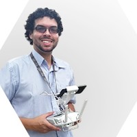
Chief Executive Officer
Current
May 2015 - Present
Please complete the CAPTCHA to continue

A concise factual answer block for searchers comparing this professional profile.
Drone Pixel is listed as Chief Executive Officer at Drone Pixel Vzla, a with 4 employees, based in Miranda State, Venezuela, Bolivarian Republic of. AeroLeads shows a matched LinkedIn profile for Drone Pixel.
Drone Pixel previously worked as Rail Road Inspection at Unmanned Experts. Drone Pixel holds Master'S Degree, Finance, General from Universidad Central De Venezuela.
This section adds company-level context without repeating Drone Pixel's masked contact details.
Review company-level records connected to Drone Pixel before choosing the right outreach path.
Drone Pixel merge drone sensors integration Lidar, Thermal IR, 360 cameras and GIS applications for gathering, managing, and analyzing visual data. That aims to streamline and optimize inspection, monitoring and surveillance processes in different industries Telecommunication, Insurance, Power, Oil & Gas, Mining, Construction. All the information is stored as an ArcGIS platform supported by ESRI global market leader GIS. Our vast experience and technical knowledge are one of our unique values. We have developed an alliance with ESRI. Over the past 5 years, we have inspected Telecommunication Towers, Transmission Power Line, Constructions and Factory inspections. This has contributed as strong regulatory knowledge and legal approval when using Lidar thermal IR or UAVs.Our services have expanded to assist clients through every step of the process of UAV integration. We offer Training and Consulting, Product Sales, Customization, and inspection Services. ● Generate data from Lidar sensor survey and Thermal IR to process it into GIS platform in a cloud.● Introduce businesses into the digital age, efficiently and effectively transforming data captured by the GIS system into productivity, connectivity across business sectors, and security. ● Characterize Telecom Towers in terms of inventory, infrastructure state, maintenance, network optimization, lowering Human risk with safety inspections and quick response to emergency situations.● Deliver enrichment data to network implementation and design for the new 5G Network.● Signal Measurement, Antenna Pattern Radiation, Line of sight study for Microwave.Industries SupportedMapping/SurveyingLIDARThermal IR360 CamerasAerial InspectionTelecommunicationPower LinesInsuranceOil & GasMiningUtility Companies
Listed skills include Data Analysis, Uav, Uv Mapping, Data Management, and 7 others.
Company context helps verify the profile and gives searchers a useful next step.
A career timeline built from the work history available for this profile.

Other employees you can reach at dronepixel.com.ve. View company contacts for 4 employees →


Quick answers generated from the profile data available on this page.
Drone Pixel works for Drone Pixel Vzla.
Drone Pixel is listed as Chief Executive Officer at Drone Pixel Vzla.
Drone Pixel is based in Miranda State, Venezuela, Bolivarian Republic of while working with Drone Pixel Vzla.
Drone Pixel has worked for Drone Pixel Vzla and Unmanned Experts.
Drone Pixel's colleagues at Drone Pixel Vzla include Luis Fernando Ascanio, Maria Alejandra Rodriguez Le Maitre, and Sergio Moreno.
You can use AeroLeads to view verified contact signals for Drone Pixel at Drone Pixel Vzla, including work email, phone, and LinkedIn data when available.
Drone Pixel holds Master'S Degree, Finance, General from Universidad Central De Venezuela.
Drone Pixel is listed with skills including Data Analysis, Uav, Uv Mapping, Data Management, Telecommunications, Web Development, Technology Integration, and Aerial Photography.
Search by job title, company, industry, location, and seniority. Export verified B2B contact data when you need it.
Start free trial Search contactsCheck these profiles if this is not the Drone Pixel you were looking for.