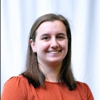
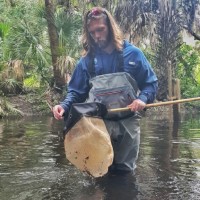
Emilly Baechle
AeroLeads people directory · profile

Emilly Baechle Email & Phone Number

Technical Project Coordinator at Pinellas County Government
Location: St Petersburg, Florida, United States 6 work roles 2 schools
1 work email found @pinellascounty.org 1 phone found area 813 LinkedIn matched
✓ Verified July 2026 4 data sources Profile completeness 100%

Contact Signals · 1 work email · 1 phone

Work email e****@pinellascounty.org
Direct phone (813) ***-****
LinkedIn Profile matched
3 free lookups remaining · No credit card
Current company
Role
Technical Project Coordinator
Location
St Petersburg, Florida, United States
Company size

Who is Emilly Baechle? Overview

A concise factual answer block for searchers comparing this professional profile.

Quick answer

Emilly Baechle is listed as Technical Project Coordinator at Pinellas County Government, a with 1326 employees, based in St Petersburg, Florida, United States. AeroLeads shows a work email signal at pinellascounty.org, phone signal with area code 813, and a matched LinkedIn profile for Emilly Baechle.

Emilly Baechle previously worked as Senior Geospatial Analyst at Quantum Spatial and Graduate Research Assistant at University Of Florida. Emilly Baechle holds Master’S Degree, Geomatics, Urban Forestry from University Of Florida.

Company email context

Email format at Pinellas County Government

This section adds company-level context without repeating Emilly Baechle's masked contact details.

{first_initial}{last}@pinellascounty.org
89% confidence

AeroLeads found 1 current-domain work email signal for Emilly Baechle. Compare company email patterns before reaching out.

Profile bio

About Emilly Baechle

Emilly is a professional with 18 years of experience utilizing geographic information systems and remote sensing techniques to facilitate ecological studies and urban and regional development projects in both the public and private sectors. Emilly is an ASPRS Certified Mapping Scientist and has a Master's Degree from the University of Florida Geomatics Program with emphasis on urban forestry. Currently, she is a Technical Project Coordinator focusing on GIS and asset management for the Pinellas County Parks and Conservation Resources Department in Largo, Florida.Specialties: ArcPro, Asset Management, Urban Forestry, Hurricane Damage, Cartography, Photo Interpretation, C-CAP

Listed skills include Arcgis, Gis, Remote Sensing, Cartography, and 15 others.

Current workplace

Emilly Baechle's current company

Company context helps verify the profile and gives searchers a useful next step.

Pinellas County Government
Technical Project Coordinator
clearwater, florida, united states
Employees
1326
AeroLeads page
6 roles

Emilly Baechle work experience

A career timeline built from the work history available for this profile.

Technical Project Coordinator

Current

Largo, Florida, United States

Technical Project Coordinator supporting the Pinellas County Parks and Conservation Resources Department. Special focus is on the County’s implementation of a comprehensive GIS-based enterprise asset management system designed to provide improved and sustainable services to citizens by increasing consistency, organization, accountability, transparency, and the ability to analyze data/costs. Trimble Cityworks Asset Management System software is currently being implemented in conjunction with the design of a new enterprise geodatabase schema. The new GDB schema design is driven by a major, county-wide data inventory and gap analysis and has resulted in carefully constructed best practices for data migration, data creation, data maintenance, and data sharing. The life-cycle management of ALL physical assets owned and operated by Pinellas County via Cityworks is planned to go live in 2021.

Jun 2020 - Present

Senior Geospatial Analyst

St. Petersburg, Fl

DoD GEOINTNOAA ESI West FL; Technical lead in shoreline creationBOEM MMPGIS; versatile GIS team member that assisted with all project tasks from researching/gathering/reformatting numerous spatial and tabular data products, building a data model as a base for an enterprise SDE GDB, daily engagement with client, and creating FGDC-compliant metadata.Core GIS team member for compiling studies for BOEM’s Envl Studies Program Information System (ESPIS) update. Also completed Task 2 gathering finished GIS data products for select studies in each BOEM region, reformatting the data as needed to import into a file GDB, and loading into an online web service for the public to easily view the spatial data.Core team member for the Florida Forest Service project entitled Comprehensive Statewide Forest Inventory Analysis and Study (CSFIAS), a state-wide inventory of non-urban timber biomass, stand age, and stand origin in Florida using existing moderate and high res data and imagery with processes performed in Erdas and ArcGIS. Specific duties include collecting/formatting vector and raster data (ex. C-CCAP, FLUCCS, FRACIP, FNAI, LANDSAT) and developing various models for (1) integrating multiple data layers into a single, usable raster layer classified into 19 classes and (2) analyzing time series data from a vector change analysis to assign age ranges to tree stands. Other duties include manual photo interpretation, stand age, and stand origin (i.e. plantations); quantifying vector and raster data; and technical writing assistance and map generation. Production team member for 2011 NOAA C-CAP update (MI, WI, WA, NC, SC, GA, FL, AL, MS, OR, CA) and for 1985 historic layer; assist with data prep for MIICA change detection using multi-date Landsat; manual change detection using various Landsat scenes; utilize statistical software See5 (CART) for automated classification; write ERDAS models for automated clean-up; manual classification; responsible for in-house training

Mar 2011 - Jun 2020

Graduate Research Assistant

Gainesville, Florida Area

1. Evaluate usefulness of SolVES ArcGIS extension for use in mapping ecosystem social values 2. Determine if tomato plant volume and health can be quantified from high resolution photographs captured by handheld multispectral camera; perform atmospheric scattering correction and normalize reflectance; perform NDVI in ENVI; calculate surface volume in ArcGIS3. Download multi-spectral Hyperion satellite imagery; perform atmospheric correction using ENVI FLAASH; perform analysis to determine percent canopy cover and compare to field data3. Independently conduct research use GIS and statistical techniques to determine if local tree cover is related to the occurrence of home damage during a hurricane event (Hurricane Ike specifically); collect, create, and edit spatial and tabular data for the following variables: storm meteorology; urban forest cover; building characteristics within subdivisions of homogeneous canopy cover; building damage (yes/no); Conduct aerial photo interpretation of roof damage and percent canopy cover within subdivisions; Perform statistics: multiple regression, spearman correlations

Jan 2009 - Mar 2011

Ufore Field Assistant

Orlando, Florida Area

Helped collect tree data during the 2009-2010 inventory of numerous UFORE sampling plots in NE Orlando. UFORE, or Urban Forest Effects (UFORE) model, is now called i-Tree Eco. The tree data is used to construct a model of a community's urban forest. The structure and functions of the urban forest can be analyzed and the results used to develop urban forest management programs and hopefully improve environmental quality.

Feb 2010 - Mar 2010

Gis Address Technician

Port St. Lucie, Fl

Responsible for the assignment of addresses, including commercial and residential, within the city limits; Responsible for maintenance of the City’s MS Access address database and enforce proper addressing guidelines; Verify existing City addresses using various databases and including field excursions using a City vehicle; Work closely with other governmental agencies such as St. Lucie County, 911 and the U.S. Postal Service, in addition to citizens, private contractors, and engineering firms; Produce and maintain a “Street Map Book” made available to other governmental agencies and the public using ArcGIS; Develop spatial layers of commercial buildings with addresses and other descriptive data; Assist with preparations for the 2010 Census Local Update of Census Addresses (LUCA)

Apr 2006 - Dec 2007

Gis Analyst

Tallahassee, Florida Area

Develop, maintain, and manage geographic databases and datasets; Generate maps and reports to support projects within all WilsonMiller business units such as planning and ecological services; Interpret spatial data and perform analyses; Research data sources and generate new data for project maps; Enforce strict standards for digital set-up of data and project folders within office; GIS liaison between Tallahassee office and other offices within the company; Provide training and technical support for WM business units and clientsProject examples: 1. Digital Parcel Conversion Projects for Franklin and Suwannee Counties, Florida – Digitize property lines from aerial photography, legal descriptions, subdivision plats, CCRs, and additional sources of data. Also included is client training and technical support.2. Utility Map Conversion Projects in Manatee and Charlotte County, Florida – Tasks include geodatabase development, geometric network creation, and AutoCAD-to-GIS data conversion of water, wastewater, irrigation, and drainage utilities.3. Duval County, Florida – Researched and retrieved historic aerial photographs used to compare wetland extents from 1940’s to today. Successfully converted and rectified historic aerials for GIS use.4. Rural Lands Stewardship Agreement Projects, Private Property, St. Lucie County, Florida – GIS team member assisting ecologists with the preparation of all maps used in field surveys. Other duties include data generation, such as digitizing animal habitats, flow-ways, and wetland retention areas using aerial photographs as a backdrop, to assess the potential for listed species occurrences. Researched and rectified historic aerial photographs usable for GIS analyses.

May 2004 - Mar 2006
Team & coworkers

Colleagues at Pinellas County Government

Other employees you can reach at pinellascounty.org. View company contacts for 1326 employees →

2 education records

Emilly Baechle education

Master’S Degree, Geomatics, Urban Forestry

Activities and Societies: Xi Sigma Pi Forestry Honor Society1. Teaching Assistant, FOR3434C Forest Res. Info. Sys., Summer 2009 & 2008.

B.S., Environmental Studies

Activities and Societies: Minors: Geography, Math, Chemistry, and Criminology; Habitat for Humanity volunteer 2002-20041. Permitting.

FAQ

Frequently asked questions about Emilly Baechle

Quick answers generated from the profile data available on this page.

What company does Emilly Baechle work for?

Emilly Baechle works for Pinellas County Government.

What is Emilly Baechle's role at Pinellas County Government?

Emilly Baechle is listed as Technical Project Coordinator at Pinellas County Government.

What is Emilly Baechle's email address?

AeroLeads has found 1 work email signal at @pinellascounty.org for Emilly Baechle at Pinellas County Government.

What is Emilly Baechle's phone number?

AeroLeads has found 1 phone signal(s) with area code 813 for Emilly Baechle at Pinellas County Government.

Where is Emilly Baechle based?

Emilly Baechle is based in St Petersburg, Florida, United States while working with Pinellas County Government.

What companies has Emilly Baechle worked for?

Emilly Baechle has worked for Pinellas County Government, Quantum Spatial, University Of Florida, City Of Port St. Lucie, and Wilsonmiller, Inc..

Who are Emilly Baechle's colleagues at Pinellas County Government?

Emilly Baechle's colleagues at Pinellas County Government include Lauren Isenman, Katie Bower, Dieldra Gardner, Rochelle Carlson, and John Holt.

How can I contact Emilly Baechle?

You can use AeroLeads to view verified contact signals for Emilly Baechle at Pinellas County Government, including work email, phone, and LinkedIn data when available.

What schools did Emilly Baechle attend?

Emilly Baechle holds Master’S Degree, Geomatics, Urban Forestry from University Of Florida.

What skills is Emilly Baechle known for?

Emilly Baechle is listed with skills including Arcgis, Gis, Remote Sensing, Cartography, Geomatics, Erdas Imagine, Gps, and Spatial Analysis.

Find 750M verified contacts

Search by job title, company, industry, location, and seniority. Export verified B2B contact data when you need it.