Ingegnere Civile Ambientale E Topografo (Design And Construction Manager)
Freelance
Please complete the CAPTCHA to continue
A concise factual answer block for searchers comparing this professional profile.
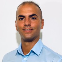
Marco Ercoli is listed as Ingegnere Civile Ambientale e Topografo (Design and Construction Manager) at Freelance, based in San Cesareo, Latium, Italy. AeroLeads shows a matched LinkedIn profile for Marco Ercoli.
Marco Ercoli previously worked as Environmental Civil Engineer and Topographer (Design & Construction Manager) at Freelance and Environmental & Civil Engineer and Topographer at Art Studio - Progettazioni Generali. Marco Ercoli holds Bachelor Of Science Civil Engineering, Design, Construction, Maintenance Of The Physical And Naturally Built Environment, Bachelor Of Science Engineering from Università Telematica Pegaso.
I am a civil, environmental and topographer engineer (with enrollment in the register of engineers of the province of Rome).I have ten years of experience in the management of civil and environmental engineering projects at 360 *.I am an expert in environmental and architectural surveys through the use of the latest generation tools such as Laser Scanner and APR.I have experience in the design of interior furnishings and outdoor spaces, and public works projects with BIM methodology.For a year I have been working as a freelancer with a portfolio of private clients, public bodies and companies.Software & Hardware knowledge• PriMus-A - Analysis of building site prices and requirements• Fotus Photo - Straightening and photographic surveys• ArchlineXP vers. From 2010 to 2018 BIM architectural design - Planimetric survey. Rendering - Environmental impact• Photo survey automatic vectorization and straightening - 3D models• GeoMurus- Design and calculation of retaining walls• EdiLus - Structural Calculation• Autocad Architectural design - Planimetric survey• Cyclone - Data processing for 3D Laser scan jobs• Edil-COMPACT - Building regulations database• progeCAD 2018 PRO - Architectural and topographic design• MeshLab - Three-dimensional graphics• Edificius - BIM architectural design• Photoscan Realization of 3D models from a set of photographs• Leica 1200 GPS Topographic surveys performed using the survey Satellite (dual frequency receiver L1 / L2. GPS / GLONASS-L2C-MMT, real Time RTK)• Leica TCRA1202 R300, 2 ”(0.6mgon) Topographic surveys performed using an electronic station• Leica ScanStation C10 (Laser Scanner) 3D Laser Scanner Survey• DJI Phantom 4 Pro Drone for Air Surveys and Aerial SurveyGPS
Listed skills include Cad, Architecture, Rendering, Construction, and 12 others.
Company context helps verify the profile and gives searchers a useful next step.
A career timeline built from the work history available for this profile.
San Cesareo, It
Roma, Lazio, Italia
I deal with the following activities for private clients, public bodies, industries and companies.Relevant activities- 2D and 3D GIS, GPS, topographic, architectural and photogrammetric surveys with latest generation tools such as Laser Scanner and APR;- Archaeological surveys, areas in hydrogeological instability (rock walls, landslide slopes, avalanche areas, riverbeds and streams, mountain basins, coasts and shorelines);- Surveys in quarries, landfills and mines;- Road surveys;- Surveys of existing structures, buildings, tunnels and undergrounds;- Video inspections- Surveys for feasibility studies Superbonus 110%.Post-Production Activities- Post-production of surveys, analysis and management of the data obtained, processing and subsequent graphic and digital rendering, 2D and 3D, with Structure from motion (SfM) and BIM Software- 3D modeling- 2D and 3D graphic processing and rendering of point cloudsPlanning and design activities- Design of architectural and structural civil works - public and private buildings - infrastructures;- Restorations and renovations;- 360 * design and management of 110% Superbonus renovations;- Geotechnical design;- Environmental design;- Interior design;- Rendering;- Photo EntriesEvaluation activity- Land and building appraisalsCadastral activities- Stacking;- Subdivisions;- Restoration of borders- D.O.C.F.A.Management activities- Preparation of reports, specifications, technical analyzes, definition of design requirements, equipment and services required;- Negotiation of contracts with suppliers and presentation of formal approval documentation;- Manage contracts to verify that they are fit for purpose, that they are cost effective and that they include appropriate service level agreements;- Overall project management, coordination, planning and accounting.- Analysis of commercial proposals;
Rome Area, Italy
As a Civil, Environmental Engineer and Topographer I have dealt with the following activities for the ART technical office:Relevant activities- 2D and 3D GIS, GPS, topographic, architectural and photogrammetric surveys with latest generation tools such as Laser Scanner and APR;- Archaeological surveys, areas in hydrogeological instability (rocky walls, landslide slopes, avalanche areas, riverbeds and streams, mountain basins, coasts and shorelines);- Surveys in quarries, landfills and mines;- Road surveys;- Surveys of existing structures, buildings, tunnels and undergrounds;- Video inspections- Surveys for feasibility studies Superbonus 110%.Post-Production Activities- Post-production of surveys, analysis and management of the data obtained, processing and subsequent graphic and digital rendering, 2D and 3D, with Structure from motion (SfM) and BIM Software- 3D modeling- 2D and 3D graphic processing and rendering of point cloudsPlanning and design activities- Design of architectural and structural civil works - public and private buildings - infrastructures;- Restorations and renovations;- 360 * design and management of 110% Superbonus renovations;- Geotechnical design;- Environmental design;- Interior design;- Rendering;- Photo EntriesEvaluation activity- Land and building appraisalsCadastral activities- Stacking;- Subdivisions;- Restoration of borders- D.O.C.F.A.Management activities- Preparation of reports, specifications, technical analyzes, definition of design requirements, equipment and services required;- Negotiation of contracts with suppliers and presentation of formal approval documentation;- Manage contracts to verify that they are fit for purpose, that they are cost effective and that they include appropriate service level agreements;- Overall project management, coordination, planning and accounting.- Analysis of commercial proposals;
Genazzano, Lazio, Italia
Relevant activities- 2D and 3D GIS, GPS, topographic, architectural and photogrammetric surveys with latest generation tools such as Laser Scanner and APR;- Archaeological surveys, areas in hydrogeological instability (rock walls, landslide slopes, avalanche areas, riverbeds and streams, mountain basins, coasts and shorelines);- Surveys in quarries, landfills and mines;- Road surveys;- Surveys of existing structures, buildings, tunnels and undergrounds;- Video inspectionsPost-Production Activities- Post-production of surveys, analysis and management of the data obtained, processing and subsequent graphic and digital rendering, 2D and 3D, with Structure from motion (SfM) Software- 3D modeling- 2D and 3D graphic processing and rendering of point cloudsPlanning and design activities- Architectural design of public and private building works;- Restorations and renovations;- Design of structural and infrastructural civil works;- Geotechnical design;- Environmental design;- Interior design;- Rendering;- Photo EntriesEvaluation activity- Land and building appraisalsCadastral activities- Stacking;- Subdivisions;- Restoration of borders- D.O.C.F.A.

Rome Area, Italy
- design and planning of structures with AutoCAD software- construction of the structures in the workshop (electrode and continuous wire welding / MIG and TIG welding / metal and alloy processing)- assembly of the sets at theaters and television studios- workforce management and site organization


Surveying or land surveying Bulding Surveyor project management geography; science; mathematics; urban and land studies; languages.
Quick answers generated from the profile data available on this page.
Marco Ercoli works for Freelance.
Marco Ercoli is listed as Ingegnere Civile Ambientale e Topografo (Design and Construction Manager) at Freelance.
Marco Ercoli is based in San Cesareo, Latium, Italy while working with Freelance.
Marco Ercoli has worked for Freelance, Art Studio - Progettazioni Generali, Studio Tecnico Art, and Nuova Unisider S.R.L..
You can use AeroLeads to view verified contact signals for Marco Ercoli at Freelance, including work email, phone, and LinkedIn data when available.
Marco Ercoli holds Bachelor Of Science Civil Engineering, Design, Construction, Maintenance Of The Physical And Naturally Built Environment, Bachelor Of Science Engineering from Università Telematica Pegaso.
Marco Ercoli is listed with skills including Cad, Architecture, Rendering, Construction, Microsoft Office, Project Management, Microsoft Excel, and Management.
Search by job title, company, industry, location, and seniority. Export verified B2B contact data when you need it.
Start free trial Search contactsCheck these profiles if this is not the Marco Ercoli you were looking for.
View similar profiles