
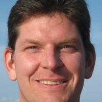
AeroLeads people directory · profile
Erle Dzus Email & Phone Number
Senior Developer and Architect
at
MicroSurvey Software Inc.
1 work email found
@microsurvey.com
LinkedIn matched
✓ Verified July 2026
4 data sources
Profile completeness 100%
Current company
Role
Senior Developer and Architect
Location
Canada
Company size
Who is Erle Dzus? Overview
A concise factual answer block for searchers comparing this professional profile.
Quick answer
Erle Dzus is listed as Senior Developer and Architect at MicroSurvey Software Inc., a with 39 employees, based in Canada. AeroLeads shows a work email signal at microsurvey.com and a matched LinkedIn profile for Erle Dzus.
Erle Dzus previously worked as Senior Developer / Architect at Microsurvey Software Inc. and Software Developer at Microsurvey Software Inc.. Erle Dzus holds Bachelor Of Technology (B.Tech.), Computer Systems from British Columbia Institute Of Technology / Bcit.
Company email context
Email format at MicroSurvey Software Inc.
This section adds company-level context without repeating Erle Dzus's masked contact details.
{first}.{last}@microsurvey.com
89% confidence
AeroLeads found 1 current-domain work email signal for Erle Dzus. Compare company email patterns before reaching out.
Profile bio
About Erle Dzus
Multiple decades of experience developing software applications for the Geomatics industries.Prior to that, nearly 10 years hands-on experience in field surveying and geomatics data processing.Senior Developer / Architect => managing development of MicroSurvey's FieldGenius for Android mobile application.Automating build/test/deploy cycles using DevOps Continuous Integration, Continuous Delivery (CI/CD) best practices.We consistently ship a new version of FieldGenius for Android every 6 weeks. This tight release schedule allows quick response time to customer feedback and feature requests.Specialities: Azure DevOps ● CI/CD Pipelines ● System Architecture ● Analysis & Design ● C# ● Xamarin Forms ● Cross Platform ● Android ● Code Quality Assurance ● Azure Cloud Computing Technology Proficiencies:● Command protocols to interface with various survey equipment (including Total Stations and GNSS receivers).● Bluetooth and serial communications.● Coordinate Geometry calculations, volumetric calculations for earthwork reporting, cadastral computations● Geomatics file formats (knowledgable in a wide variety of vector and raster data formats).● Geodetic coordinate conversions.● GIS data processing.● Xamarin Certified since 2016.● Geomatics field experience including Construction Surveys, Mineral Claim Boundary postings, Legal Surveys for large subdivisions, Topographic Surveys, Right-of-way postings.Now applying my extensive knowledge in software development and my wide variety of survey experiences to build the best Field Survey application on the market!I'm always happy to help if I can. Let's connect. ✉ erle.dzus@microsurvey.com
Listed skills include Strong Debugging Skills, Defensive Code Writing Habits, C++, Mfc, and 37 others.
Current workplace
Erle Dzus's current company
Company context helps verify the profile and gives searchers a useful next step.
Microsurvey Software Inc.
8 roles
Erle Dzus work experience
A career timeline built from the work history available for this profile.
Senior Developer / Architect
Current
Oct 2017 - Present
Software Developer
Practical geomatics field experience and specialized data processing knowledge, along with software development expertise has brought me to MicroSurvey where I can apply all aspects of my career history to mobile application development for the surveying and mapping industries.Regularly write C++/MFC code in Visual Studio to support various geomatics file formats, such as ESRI Shape, TDS Raw, and AutoCAD DXF/DWG, and geodetic coordinate conversions. Apply Unit Testing to any new computational functions as they are added to the codebase, and to existing functions during refactoring. Establish an automated build process to generate nightly builds for all platforms.Maintain and enhance existing command interfaces to connect with various survey equipment, such as robotic Total Stations and GNSS receivers, using specific protocols for each manufacturer. This requires some multi-threading to synchronize send and receive commands with the external devices, either through Bluetooth, Long-Range Bluetooth, or RS-232 serial communications.Special Projects:3D Disto MEP Module – Developed a system for iteratively taking measurements to determine the location of a point projected onto a surface (floor, ceiling or wall). The practical application of this functionality is to layout design points in a construction environment where the surface location doesn’t necessarily match the design (for example, project design points onto an undulating concrete floor.)Video Streaming – Displayed real-time video stream with scan boundary overlay defining a point cloud capture area. Linework is overlaid onto real-time video stream (RTSP) received from the telescope camera of a Total Station, to allow the user to visualize the bounding area of scan before the scan is started. Implemented Tap-and-Turn to rotate the telescope directly toward the location where the user tapped on the real-time video display. Visual Studio, MFC, Win32, C++, some C++/CLI
Apr 2010 - Mar 2017

Software Developer
Softree develops road design and terrain modelling applications which was a perfect fit for me to apply my previous work experience in survey engineering offices to a new career in software engineering. My duties involved maintaining the existing Softree codebase, fixing defects and adding new features.Highlights: Architected an Import/Export process as a pluggable structure to allow coordinate transformations (both Cartesian and Geodetic) to be applied during the import/export for a wide variety of both vector and raster data formats including ASCII coordinate files, KML markup, AutoCAD DWG/DXF, ESRI Shapefile, and LandXML formats.Designed and built a road maintenance program (RoadLogger - runs on laptop computers in field crew trucks). Collaborated with client to produce a Functional Specification, then wrote Detailed-Design documents before implementing. Leveraged Softree code-base to provide mapping functionality, and added GPS device interface to display/capture real-time positions. Adapted Terrain Tools CE field data application to the Windows Mobile platform for use with rugged handhelds. Added an interface to laser guns (LTI and LCI) and to mapping-grade GPS devices (NMEA-0183 and Garmin proprietary protocols).Integrated the Open Design Alliance (ODA) Teigha third party library for adding capability for multiple AutoCAD versions. Added a symbol/linetype storage dictionary for standardizing interchange with drawing file formats.Visual Studio, MFC, Win32, C++Job Transitions:As this was my first full-time programming job, I focused on developing good coding habits, and learning a variety of debugging techniques. Evenings and weekends were spent taking courses for the Computer Systems degree program at BCIT through part-time studies. After several years I successfully completed the program with a specialization in Distributed Systems.
Nov 2000 - Mar 2010

Senior Cad Operator
Responsibilities included supervision of the drafting department, the training of staff in computer drafting techniques, and communication with clients to ensure that project deliverables met the clients’ expectations.Technical duties included Coordinate Geometry calculations, volumetric calculations for earthwork reporting, cadastral computations for legal boundary locations.Focused on making improvements to drafting workflow by creating AutoLisp custom commands, and by applying various scripting techniques to automate repetitive tasks and speed up drafting output.Applications used on a regular basis:AutoCAD LDD (Land Desktop, a previous version of Civil 3D)AutoCAD R13, R14, AutoCAD 2000, some MicroStation v7.McElhanney in-house applications for Terrain Modelling and Road Alignment geometry.Blue Marble Geographic CalculatorMicroSurvey v12 coordinate geometry applicationMajor projects include: Vancouver Skytrain (Millennium Line) corridor mapping.Design and drafting of hundreds of kilometers of resource roads.GIS asset location and data structuring for various municipalities.Many legal boundary plan and site survey drafting projects.Job TransitionsMy interest in programming techniques increased, so I enrolled in part-time studies of Computer Systems at BCIT. Achieved diploma level, and changed employers to begin working full time as a C++ programmer.
Jun 1995 - Oct 2000
Survey Computer Technician
Topographic Survey data processing to create Digital Terrain Models and generate contour lines. Site Plan drafting to show lot boundaries and features located in the field.Resource Road alignment geometry design and earthwork computations based on centerline / cross section field data for hundreds of kilometers of forestry and mining haul roads throughout B.C.Cadastral compilation for legal boundary definitions along the Island Highway corridor.Job TransitionsDuring this part of my career, I continued taking evening courses on geomatics topics at BCIT such as GPS, and Advanced CAD techniques. My previous Survey Fieldwork knowledge combined with a focus on CAD skill development allowed me to be promoted to Senior CAD Operator.
Jun 1993 - Jun 1995
Gis Mapping Technician
Validated and edited topology of GIS datasets. Modified topological primitives (nodes, lines, areas) to ensure spatial correctness of GIS coverages using ESRI ArcCAD (ArcCAD was an add-on to AutoCAD 11/12). Digitized and converted hardcopy plans, and then linked the graphical data with database files to form complete GIS datasets.Job TransitionsLeveraged new AutoCAD skills along with previous Geomatics knowledge/experience to successfully transfer to the Land Surveying department at McElhanney.
Sep 1992 - Jun 1993
Land Surveys Technician
Various Survey Companies
Enrolled in the Geomatics (surveying and mapping) program at BCIT, and began applying the training during summer breaks. I learned a lot and got to travel extensively throughout British Columbia, which was great!Highlights:Construction Surveys for Vancouver International Airport Taxi-wayMineral Claim Boundary postings at various locations in B.C.Legal Surveys for large subdivisions throughout Metro VancouverTopographic Surveys for dam and spill-way - City of Victoria water reservoirRight-of-way postings for fibre-optic line extending across B.C.Job Transitions:I was able to extend my survey knowledge toward geographic information systems by taking several advanced GIS courses at BCIT. My instructor worked in the same industry and recruited me to work full-time as a GIS Technician at McElhanney.
Nov 1987 - May 1992
Team & coworkers
Colleagues at MicroSurvey Software Inc.
Other employees you can reach at microsurvey.com. View company contacts for 39 employees →
JP
 Jhuan Pompei Usó
Colleague at Microsurvey Software Inc.Santos, São Paulo, Brazil
View →
AM
Jhuan Pompei Usó
Colleague at Microsurvey Software Inc.Santos, São Paulo, Brazil
View →
AM
 Amaan Makhani
Colleague at Microsurvey Software Inc.Edmonton, Alberta, Canada
View →
MM
Amaan Makhani
Colleague at Microsurvey Software Inc.Edmonton, Alberta, Canada
View →
MM
 Matt Mclean
Colleague at Microsurvey Software Inc.Calgary, Alberta, Canada
View →
MT
Matt Mclean
Colleague at Microsurvey Software Inc.Calgary, Alberta, Canada
View →
MT
 Matthew Taylor
Colleague at Microsurvey Software Inc.Westbank, British Columbia, Canada
View →
KF
Matthew Taylor
Colleague at Microsurvey Software Inc.Westbank, British Columbia, Canada
View →
KF
 Kiera Fulton
Colleague at Microsurvey Software Inc.Calgary, Alberta, Canada
View →
BR
Kiera Fulton
Colleague at Microsurvey Software Inc.Calgary, Alberta, Canada
View →
BR
 Bob Romano
Colleague at Microsurvey Software Inc.Braintree, Massachusetts, United States
View →
BS
Bob Romano
Colleague at Microsurvey Software Inc.Braintree, Massachusetts, United States
View →
BS
 Brian Sloman
Colleague at Microsurvey Software Inc.Kelowna, British Columbia, Canada
View →
EO
Brian Sloman
Colleague at Microsurvey Software Inc.Kelowna, British Columbia, Canada
View →
EO
 Emerson Operador
Colleague at Microsurvey Software Inc.Belém, Pará, Brazil
View →
OC
Emerson Operador
Colleague at Microsurvey Software Inc.Belém, Pará, Brazil
View →
OC
 Ofélia Cavalcante
Colleague at Microsurvey Software Inc.Rio De Janeiro, Brazil
View →
LS
Ofélia Cavalcante
Colleague at Microsurvey Software Inc.Rio De Janeiro, Brazil
View →
LS
 Lori Snowbird
Colleague at Microsurvey Software Inc.Kelowna, British Columbia, Canada
View →
Lori Snowbird
Colleague at Microsurvey Software Inc.Kelowna, British Columbia, Canada
View →
Jhuan Pompei Usó
Colleague at Microsurvey Software Inc.Santos, São Paulo, Brazil
View →
AM
Amaan Makhani
Colleague at Microsurvey Software Inc.Edmonton, Alberta, Canada
View →
MM
Matt Mclean
Colleague at Microsurvey Software Inc.Calgary, Alberta, Canada
View →
MT
Matthew Taylor
Colleague at Microsurvey Software Inc.Westbank, British Columbia, Canada
View →
KF
Kiera Fulton
Colleague at Microsurvey Software Inc.Calgary, Alberta, Canada
View →
BR
Bob Romano
Colleague at Microsurvey Software Inc.Braintree, Massachusetts, United States
View →
BS
Brian Sloman
Colleague at Microsurvey Software Inc.Kelowna, British Columbia, Canada
View →
EO
Emerson Operador
Colleague at Microsurvey Software Inc.Belém, Pará, Brazil
View →
OC
Ofélia Cavalcante
Colleague at Microsurvey Software Inc.Rio De Janeiro, Brazil
View →
LS
Lori Snowbird
Colleague at Microsurvey Software Inc.Kelowna, British Columbia, Canada
View →
2 education records
Erle Dzus education

Bachelor Of Technology (B.Tech.), Computer Systems
Survey Technology, Diploma
FAQ
Frequently asked questions about Erle Dzus
Quick answers generated from the profile data available on this page.
What company does Erle Dzus work for?
Erle Dzus works for MicroSurvey Software Inc..
What is Erle Dzus's role at MicroSurvey Software Inc.?
Erle Dzus is listed as Senior Developer and Architect at MicroSurvey Software Inc..
What is Erle Dzus's email address?
AeroLeads has found 1 work email signal at @microsurvey.com for Erle Dzus at MicroSurvey Software Inc..
Where is Erle Dzus based?
Erle Dzus is based in Canada while working with MicroSurvey Software Inc..
What companies has Erle Dzus worked for?
Erle Dzus has worked for Microsurvey Software Inc., Softree Technical Systems Inc., Mcelhanney Consulting Services, and Various Survey Companies.
Who are Erle Dzus's colleagues at MicroSurvey Software Inc.?
Erle Dzus's colleagues at MicroSurvey Software Inc. include Jhuan Pompei Usó, Amaan Makhani, Matt Mclean, Matthew Taylor, and Kiera Fulton.
How can I contact Erle Dzus?
You can use AeroLeads to view verified contact signals for Erle Dzus at MicroSurvey Software Inc., including work email, phone, and LinkedIn data when available.
What schools did Erle Dzus attend?
Erle Dzus holds Bachelor Of Technology (B.Tech.), Computer Systems from British Columbia Institute Of Technology / Bcit.
What skills is Erle Dzus known for?
Erle Dzus is listed with skills including Strong Debugging Skills, Defensive Code Writing Habits, C++, Mfc, Stl, C++/Cli, C#, and .Net Framework.
Find 750M verified contacts
Search by job title, company, industry, location, and seniority. Export verified B2B contact data when you need it.
Start free trial