
Learning Operation
Current
Oct 2024 - Present
Please complete the CAPTCHA to continue
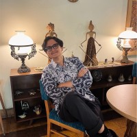
A concise factual answer block for searchers comparing this professional profile.
Fariz Rizaldy Wibowo is listed as LearnOps @MAPID | Igniting Curiosity with the Power of #GIS at MAPID, a with 12 employees, based in Bandung, West Java, Indonesia. AeroLeads shows a matched LinkedIn profile for Fariz Rizaldy Wibowo.
Fariz Rizaldy Wibowo previously worked as Learning Operation at Mapid and GIS Platform Mentor at Mapid. Fariz Rizaldy Wibowo holds Bachelor'S Degree, Geological Engineering from Diponegoro University.
This section adds company-level context without repeating Fariz Rizaldy Wibowo's masked contact details.
Review company-level records connected to Fariz Rizaldy Wibowo before choosing the right outreach path.
Committed Spatial Analyst, curiosity-fueled with proven experience as a GIS Trainer and Fully Dedicated to Disaster Risk Management. Let’s connect! #GIS
Company context helps verify the profile and gives searchers a useful next step.
A career timeline built from the work history available for this profile.
Bandung, West Java, Indonesia
• Assisted clients in using the GIS location intelligence platform (GEO-MAPID) to select suitable sites for new Mixue ice cream stores• Conducted in-depth location analysis by integrating GIS location intellegence platform (GEO-MAPID), QGIS, and analytical tools to provide comprehensive spatial and business insights.• Supervised surveyors to ensure they gathered the required information at four locations inIndonesia (Lahat, Pasaman Barat, Solok, and Solok Selatan) to find shop locations that meetspecific criteria• Guided clients, particularly

Bandung, West Java, Indonesia
• Developed and fine-tuned Google Earth Engine and Python scripts for raster clipping and pixel analysis, playing a key role in generating updated wind direction maps for DKI Jakarta, enhancing the accuracy of spatial assessments.• Designed and perfected map layouts using QGIS, ensuring high precision and visual clarity, supporting data-driven decision-making through clear geospatial presentations.•Produced a detailed flood risk map for North Jakarta using Google Earth Engine, leveraging advanced spatial analysis and hydrological modeling to identify high-risk flood zones and inform mitigation strategies.• Conducted an in-depth literature review on damage and loss assessments across Southeast Asia, with a specific focus on climate change-related disasters, providing valuable insights into their socio-economic impacts and resilience-building efforts.
Bandung, West Java, Indonesia
Landslide hazard research in Lebak Regency (supervised by : Dr. Ir. Vera Sadarviana, M.T.), conducted by Bandung Institute of Technology.My detailed role on this work: • Conducting GPS operations to monitor and track the dynamic conditions of landslides in the Kabupaten Lebak region.• Employing expertise in GIS to map and analyze areas prone to landslides, facilitating informed land-use planning and disaster preparedness measures.• Conducting thorough spatial analyses and field studies to comprehensively map the geological characteristics of the Kabupaten Lebak region.• Integrating field observations with spatial data to enhance understanding of geological factors contributing to landslide susceptibility.• Deliver concise research findings reports to stakeholders, including government agencies and community groups, employing academic writing standards.
Yogyakarta, Indonesia
• Elevate geospatial-based techniques by instructing and empowering over 70 students to master advanced concepts.• Strategize and organize dynamic training sessions, hosting a minimum of 2 engaging classes.• Craft immersive training programs, blending interactive teaching sessions and stimulating quizzes to foster deep learning and skill acquisition.• Foster a collaborative learning environment, encouraging active participation and knowledge sharing among students.• Provide personalized guidance and support to students, catering to individual learning styles and needs.
Semarang, Central Java, Indonesia
• Arranged, provided, responsible to taught more than 100+ students about satellite image correction curriculum subject with use of ArcGIS 10.3 and ENVI software• Helping the students to learn in a more practical way about land use analysis using 3 different geospatial land use spectral indices (NDVI, NDWI and LST) analysis method• Create quizzes and worksheets for students to work on during practicum which consist of 2 practicum curriculum subjects• Provided 3 different geospatial software (ArcGIS 10.3, ENVI, Surfer) basic tutorial to more than 100+ students

Bandung, West Java, Indonesia
• Successfully conducted observations with geological field method and stream sediment regional geochemical exploration with the exploration area of 30x90km• Analyzed numerical data with statistics and geostatistics method which consist variable of 8 chemical elements property• Executed spatial interpolation method with the 'Kriging' (geostatistical method) using ArcGIS 10.3 to produced 8 geochemical distribution element map
Other employees you can reach at mapid.io. View company contacts for 12 employees →
 Abila Krisna Wardana
Colleague at MapidIndonesia
View →
JG
Abila Krisna Wardana
Colleague at MapidIndonesia
View →
JG
 Julystia Ginanjar Putri
Colleague at MapidBandung, West Java, Indonesia
View →
MR
Julystia Ginanjar Putri
Colleague at MapidBandung, West Java, Indonesia
View →
MR
 M Rinaldi Hasanudin
Colleague at MapidLembang, West Java, Indonesia
View →
AW
M Rinaldi Hasanudin
Colleague at MapidLembang, West Java, Indonesia
View →
AW
 Azizah Wardaningtyas P A T.
Colleague at MapidKota Salatiga, Central Java, Indonesia
View →
JK
Azizah Wardaningtyas P A T.
Colleague at MapidKota Salatiga, Central Java, Indonesia
View →
JK
 Javohir Khudoynazarov
Colleague at MapidTashkent, Uzbekistan
View →
VM
Javohir Khudoynazarov
Colleague at MapidTashkent, Uzbekistan
View →
VM
 Vivek Mohan
Colleague at MapidKozhikode, Kerala, India
View →
NS
Vivek Mohan
Colleague at MapidKozhikode, Kerala, India
View →
NS
 Nabila Shafira Putri
Colleague at MapidBandung, West Java, Indonesia
View →
KA
Nabila Shafira Putri
Colleague at MapidBandung, West Java, Indonesia
View →
KA
 Krisna Adhitia
Colleague at MapidBandung, West Java, Indonesia
View →
SS
Krisna Adhitia
Colleague at MapidBandung, West Java, Indonesia
View →
SS
 Sreejesh S
Colleague at MapidPathanamthitta, Kerala, India
View →
AS
Sreejesh S
Colleague at MapidPathanamthitta, Kerala, India
View →
AS
 Alif Septian Bagaskoro
Colleague at MapidBandung, West Java, Indonesia
View →
Alif Septian Bagaskoro
Colleague at MapidBandung, West Java, Indonesia
View →
Quick answers generated from the profile data available on this page.
Fariz Rizaldy Wibowo works for MAPID.
Fariz Rizaldy Wibowo is listed as LearnOps @MAPID | Igniting Curiosity with the Power of #GIS at MAPID.
Fariz Rizaldy Wibowo is based in Bandung, West Java, Indonesia while working with MAPID.
Fariz Rizaldy Wibowo has worked for Mapid, Resilience Development Initiative (Rdi), Institut Teknologi Bandung, Langen Teknik Satria, and Diponegoro University.
Fariz Rizaldy Wibowo's colleagues at MAPID include Abila Krisna Wardana, Julystia Ginanjar Putri, M Rinaldi Hasanudin, Azizah Wardaningtyas P A T., and Javohir Khudoynazarov.
You can use AeroLeads to view verified contact signals for Fariz Rizaldy Wibowo at MAPID, including work email, phone, and LinkedIn data when available.
Fariz Rizaldy Wibowo holds Bachelor'S Degree, Geological Engineering from Diponegoro University.
Search by job title, company, industry, location, and seniority. Export verified B2B contact data when you need it.
Start free trial Search contacts