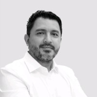
Gabriel Dicelis Phd
AeroLeads people directory · profile

Gabriel Dicelis Phd Email & Phone Number

iMMAP Country Representative for Yemen at iMMAP
Location: Amman, Jordan 12 work roles 5 schools
1 work email found @immap.org LinkedIn matched
✓ Verified August 2026 4 data sources Profile completeness 100%

Contact Signals · 1 work email

Work email g****@immap.org
LinkedIn Profile matched
3 free lookups remaining · No credit card
Current company
Role
iMMAP Country Representative for Yemen
Location
Amman, Jordan
Company size

Who is Gabriel Dicelis Phd? Overview

A concise factual answer block for searchers comparing this professional profile.

Quick answer

Gabriel Dicelis Phd is listed as iMMAP Country Representative for Yemen at iMMAP, a with 329 employees, based in Amman, Jordan. AeroLeads shows a work email signal at immap.org and a matched LinkedIn profile for Gabriel Dicelis Phd.

Gabriel Dicelis Phd previously worked as Yemen Country Representative at Immap and Head of IM Unit at United Nations Ocha. Gabriel Dicelis Phd holds Master Of Business Administration - Mba, Business Administration And Management, Sustainability, Mba from Universidad De Los Andes - Colombia.

Company email context

Email format at iMMAP

This section adds company-level context without repeating Gabriel Dicelis Phd's masked contact details.

*@immap.org
71% confidence

AeroLeads found 1 current-domain work email signal for Gabriel Dicelis Phd. Compare company email patterns before reaching out.

Profile bio

About Gabriel Dicelis Phd

Interest: Humanitarian Response, Geophysics (seismology and geodesy), GIS, M&E, Dev and Disasters.

Listed skills include Cartography, Gis, Arcgis, Gps, and 15 others.

Current workplace

Gabriel Dicelis Phd's current company

Company context helps verify the profile and gives searchers a useful next step.

iMMAP
Immap
iMMAP Country Representative for Yemen
washington, district of columbia, united states
Website
Employees
329
AeroLeads page
12 roles

Gabriel Dicelis Phd work experience

A career timeline built from the work history available for this profile.

Yemen Country Representative

Current

Ammán, Jordania

• Oversaw four major projects secured a combined budget exceeding $7.5 million, with multiple donors BHA-USAID, UNICEF and World Bank: Provision of information management support to Yemen response clusters and OCHA (2022-2025), Strengthen Health & Nutrition Data Analysis UNICEF Yemen Country Office (2022-2025), Review and restructuring on UNICEF YCO Information Management system (2024), and Statistical capacity building of Yemen Central Statistical Office - CSO (2024-2025).• Led a cross-functional team of 50+ IM, GIS, Coordination and Analysis professionals across Yemen and Jordan, supporting clusters and Humanitarian architecture, emphasizing Coordination, data quality, IM system design, and capacity building.

Aug 2022 - Present

Head Of Im Unit

Caracas Area, Venezuela

• Established and led the Information Management Unit for OCHA, enhancing data coordination and sharing across all clusters to support effective humanitarian response in complex emergencies.• Implementation of Humanitarian Planning Cycle: Coordination and design of Humanitarian Needs Overview (HNO) and the Humanitarian Response Plan (HRP).• Fostered collaboration among humanitarian actors, national authorities, and UN agencies, streamlining information flows and decision-making processes to improve the efficiency of humanitarian operations in Venezuela.

Sep 2019 - Aug 2022

Team Lead / Project Manager At Unmas

Iraq

• Led the development of advanced Information Management (IM) systems for Mine Action, integrating remote sensing and GIS technologies to enhance landmine detection and clearance efforts in high-risk areas.• Applied advanced techniques to assess and map land contamination, using geospatial analysis to identify affected zones and prioritize mine clearance operations, which increased efficiency and reduced risk for the field.• Actively participated in technical coordination, planning, and field support activities, ensuring that geospatial analysis insights were effectively integrated into operational strategies, enhancing decision-making and response capabilities.

Jun 2018 - Sep 2019

Imo Information Management

Erbil, Iraq

• Led the GIS, Mapping, and Remote Sensing team to support health and humanitarian response initiatives, producing high-resolution maps and spatial analyses that enhanced situational awareness and informed emergency response strategies. • Implemented ArcGIS Server, Portal, and Survey123 to centralize and streamline data collection and analysis processes, significantly improving data accessibility and integration across WHO’s emergency response operations. • Developed and launched Power BI dashboards and Kobo data collection tools, enabling real-time monitoring of health indicators and data-driven decision-making for early warning systems and outbreak preparedness.

Jun 2017 - Jan 2018

Assessment And Statistics Specialist At Immap-Fao

Fao

Amman Governorate, Jordan

• Designed and implemented surveys and sampling frameworks for Syria, Iraq, and Jordan, providing critical data that informed FAO’s assessments and interventions in food security and agricultural needs across the region. • Led a team in conducting price analysis and econometric modeling, delivering insights into market trends and price volatility, which supported strategic planning and resource allocation for FAO’s humanitarian operations.• Applied GIS, remote sensing, and geostatistical analysis to produce detailed spatial reports, enabling targeted response efforts and improving the accuracy of agricultural and economic assessments across conflict-affected areas.

Oct 2016 - Jul 2017

Phd In Geophysics And Research Assistant

São Paulo Y Alrededores, Brasil

PhD Thesis "Modeling deformation-stress of the continental crust in the northern Andes through joint inversion of data from seismology and geodesy"

Nov 2012 - Oct 2016

Web And Gis Officer

• Led Web development and GIS for natural disaster response, including floods and environmental crises, producing high-impact maps and assessments that guided response teams and improved resource allocation during emergencies.• Supported the Humanitarian Planning Cycle designing the Humanitarian reports for needs overview and strategic plan, providing essential data and analysis that shaped response priorities and informed strategic planning for Colombia’s humanitarian efforts. • Conducted advanced geospatial analysis to monitor and assess humanitarian needs, tracking displacement patterns, infrastructure damage, and environmental changes in crisis-affected areas, integrating satellite imagery and field surveys for comprehensive situation awareness.

Dec 2011 - Oct 2016

Program Officer And Country Representative For Colombia

Bogotá D.C., Colombia

∙ Establish Information Management Unit at the service of OCHA-UNDP-RCO for Colombia∙ Represent iMMAP and liaise with donors. ∙ Create proposals for donor funding.∙ Create TORs for new prospective staff.

Jun 2015 - Jun 2016

Victimization Risk Index - Researcher In Geostatistics And Gis

University Of Santo Tomas - Uariv, Colombia

Bogotá

- Create spatial database (geodatabase)- Spatial econometric analysis- Geostatistical mapping (R and Arcgis)- Thematic mapping http://rni.unidadvictimas.gov.co/IRV

Oct 2011 - Oct 2012

Gis And Program Officer For Colombia

Bogotá, Colombia

• Compiled and integrated cross-sectoral data into the iMMAP Landmine monitor system, enhancing data accessibility and enabling comprehensive analysis for multiple stakeholders involved in humanitarian Mine Action.• Conducted satellite image processing (SAR and optical) for natural disaster monitoring, producing critical assessments and visualizations that supported timely and data-driven decision-making during emergencies. • Developed GIS-based cartographic products for disaster risk reduction and monitor impacts, including flood zones and landslides, which improved situational awareness and resource allocation for response teams.

Jun 2008 - Feb 2012

Field Work, Gis And Dip (Digital Image Processing)

Colombia

• Supervised the eradication of illicit crops by providing technical support for crop detection and topographic measurement using GPS and digital image processing software. • Digital image processing of active sensor imagery (Landsat, SPOT) and GNSS post-processing, as well as experience in collecting diverse datasets for conflict and drug-related analysis in Colombia.• Conducted GNSS post-processing and developed methods for collecting and analyzing diverse datasets related to conflict dynamics and illicit crop patterns in Colombia.

Jun 2007 - Jun 2008

Geographic Information Systems Consultant

Colombia

• Conducted GNSS surveys, post-processed data, and performed GIS-based analyses to ensure accurate geospatial data, optimize resource allocation, and enhance the safety and efficiency of Ecopetrol’s pipeline infrastructure. • Applied remote sensing techniques and satellite imagery to monitor environmental impacts and land use changes around pipeline routes, supporting Ecopetrol’s compliance with environmental regulations. • Utilized remote sensing techniques and satellite imagery to assess environmental impacts and monitor land use changes, contributing to Ecopetrol’s adherence to environmental compliance standards.

Mar 2005 - Jul 2007
Team & coworkers

Colleagues at iMMAP

Other employees you can reach at immap.org. View company contacts for 329 employees →

5 education records

Gabriel Dicelis Phd education

Phd In Geophysics, Geodesy And Seismology

Activities and Societies: Seismological Center IAG/USPPhD Thesis "Modeling deformation-stress of the continental crust of the northern.

Master In Geophysics, Geodesy, Seismology

Activities and Societies: IAG/USP - Seismology groupMaster's dissertation: “Integrated Study of the basalt layer in Bebedouro – SP, Paraná.

Geodetic Engineering

District University Of Bogotá Colombia.

Undergraduate Project: Geophysical prospecting with GPR. Characterization of plastic and metal tubes within a shallow Geophysical.

Specialist In Science Divulgation, Science Journalism

Abradic And School Of Communication And Arts (Eca), University Of São Paulo

Activities and Societies: Abradic - http://www.abradic.com/

FAQ

Frequently asked questions about Gabriel Dicelis Phd

Quick answers generated from the profile data available on this page.

What company does Gabriel Dicelis Phd work for?

Gabriel Dicelis Phd works for iMMAP.

What is Gabriel Dicelis Phd's role at iMMAP?

Gabriel Dicelis Phd is listed as iMMAP Country Representative for Yemen at iMMAP.

What is Gabriel Dicelis Phd's email address?

AeroLeads has found 1 work email signal at @immap.org for Gabriel Dicelis Phd at iMMAP.

Where is Gabriel Dicelis Phd based?

Gabriel Dicelis Phd is based in Amman, Jordan while working with iMMAP.

What companies has Gabriel Dicelis Phd worked for?

Gabriel Dicelis Phd has worked for Immap, United Nations Ocha, United Nations Mine Action Service, World Health Organization, and Fao.

Who are Gabriel Dicelis Phd's colleagues at iMMAP?

Gabriel Dicelis Phd's colleagues at iMMAP include Abdullah Alashwal, Daniel Potts, Emilia Lopez Diaz, Fanar Nabaty, and Alejandro Daniel Navarro.

How can I contact Gabriel Dicelis Phd?

You can use AeroLeads to view verified contact signals for Gabriel Dicelis Phd at iMMAP, including work email, phone, and LinkedIn data when available.

What schools did Gabriel Dicelis Phd attend?

Gabriel Dicelis Phd holds Master Of Business Administration - Mba, Business Administration And Management, Sustainability, Mba from Universidad De Los Andes - Colombia.

What skills is Gabriel Dicelis Phd known for?

Gabriel Dicelis Phd is listed with skills including Cartography, Gis, Arcgis, Gps, Remote Sensing, Spatial Databases, Spatial Analysis, and Research.

Find 750M verified contacts

Search by job title, company, industry, location, and seniority. Export verified B2B contact data when you need it.