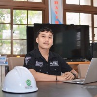
Geographic Information System Specialist
Current
Oct 2024 - Present
Please complete the CAPTCHA to continue
A concise factual answer block for searchers comparing this professional profile.
Gilang Pradana is listed as GIS and Remote Sensing | Monitoring & Evaluation | Disaster & Climate Change Risk Reduction at Otorita Ibu Kota Nusantara (Nusantara Capital Authority), based in Jakarta Metropolitan Area, Indonesia. AeroLeads shows a matched LinkedIn profile for Gilang Pradana.
Gilang Pradana previously worked as Geographic Information System Specialist at Otorita Ibu Kota Nusantara (Nusantara Capital Authority) and Geographic Information System Specialist - Emergency Assistant for Rehabilitation and Reconstruction at Asian Development Bank (Adb). Gilang Pradana holds Bachelor’S Degree, Geodetic And Geomatics Engineering from Institut Teknologi Bandung.
This section adds company-level context without repeating Gilang Pradana's masked contact details.
Review company-level records connected to Gilang Pradana before choosing the right outreach path.
A Geographic Information System (GIS) Specialist with experiences in harnessing data for effective monitoring, verification, and evaluation in environmental management, natural ecosystems, disaster management, and climate change. Skilled in developing integrated geospatial solutions to enhance mitigation and adaptation strategies, and promoting sustainability and resilience.
Company context helps verify the profile and gives searchers a useful next step.
A career timeline built from the work history available for this profile.
Balikpapan, East Kalimantan, Indonesia

Jakarta, Indonesia
Being responsible as a GIS Specialist and Programme Officer within Environment, Natural Resources, and Agriculture Division. My core responsibilities centered on developing methodologies and frameworks, harnessing geospatial data and technologies to support post-disaster rehabilitation and reconstruction efforts, and enhancing stakeholders' capabilities in monitoring, reporting, and evaluation.• Geo-Spatial Analysis & Monitoring Platform Development: Conducted comprehensive monitoring and analysis using diverse geospatial data sources (optical, radar, lidar, UAV) and technologies · Supported the environment and social expert by assessing environmental impact, land cover change, natural ecosystems, indigenous peoples' areas, land movement, building stability, and potential natural hazards · Organized and maintained database · Presented analytical findings through maps, presentations, and detailed reports · Developed a geospatial platform to assist ministries and relevant stakeholders in monitoring and evaluating reconstruction and rehabilitation efforts.• Project Work Plans and Management: Organized project work plans · Mapped stakeholder roles and responsibilities · Identified and addressed institutional gaps · Developed strategies to mitigate potential challenges and to achieve project objectives · Facilitated technical activities, including organizing meetings, and preparing briefs and periodic reports.• Stakeholders Collaboration and Capacity Building: Facilitated cooperation and coordination among ministries, ADB’s team and partners, and other relevant institutions involved in the project · Conducted capacity-building workshops and developed training materials and manuals in collaboration with ADB’s partners and relevant institutions to strengthen stakeholders' abilities in monitoring ecosystems, disasters, and reconstruction efforts · Maintained clear communication, regular contact, and ensured a consistent flow of information.
Jakarta, Indonesia
Being responsible as a GIS Analyst within the Monitoring and Evaluation Division of the Planning Department, my primary responsibilities included harnessing geospatial data and technologies to facilitate the efficient monitoring, reporting, and verification of peatland and mangrove restoration efforts, as well as monitoring natural ecosystem degradation and climate disaster occurrences.• Geo-Spatial Analysis & Monitoring Platform Development: Conducted monitoring and analysis using various geospatial data sources (optical, radar, lidar, UAV) and technologies comprising assessment of land cover change, peatland, mangrove, and other natural ecosystems including mapping potential carbon and analyzed climate disaster occurrences such as wildfires, floods, and droughts · Presented analytical findings through maps, presentations, and reports, offering clear insights into key areas · Organized and maintained database · Collaborated with BRGM’s partners to develop geospatial platforms comprised a website, a smartphone app, and a dashboard to supports stakeholders and decision-makers in monitoring and evaluating restoration and rehabilitation efforts across all phases from planning through to implementation and maintenance.• Stakeholders Support and Coordination: Facilitated coordination with various BRGM’s departments, other ministries, and relevant partners such as NGOs and press · Maintained clear communication, regular contact, and ensured a consistent flow of information across various stakeholders.• Capacity Building and Workshops: Conducted capacity building and workshops, and developed materials in collaboration with BRGM’s partners and related agencies to enhance stakeholders' capabilities in monitoring restoration efforts, natural ecosystems, and climate-related disasters.

Bandung Area, West Java, Indonesia
Being responsible for geospatial data collection, processing, and analysis for regional spatial planning. My core responsibility centered on supporting the team leader on revising planning policies, emphasizing conservation, agriculture, and disaster risk assessment.• Geospatial Data: Provided comprehensive support through geospatial data collection, processing, and analysis, established ensuring accuracy and relevance for regional planning purposes. • Data and Map Visualization: Created detailed data and maps that visually represented regional spatial planning, enhancing communication and understanding among stakeholders.• Policy and Decision Support: Provided the stakeholders with data-driven insights to make well informed-decision for regional spatial planning .

Quick answers generated from the profile data available on this page.
Gilang Pradana works for Otorita Ibu Kota Nusantara (Nusantara Capital Authority).
Gilang Pradana is listed as GIS and Remote Sensing | Monitoring & Evaluation | Disaster & Climate Change Risk Reduction at Otorita Ibu Kota Nusantara (Nusantara Capital Authority).
Gilang Pradana is based in Jakarta Metropolitan Area, Indonesia while working with Otorita Ibu Kota Nusantara (Nusantara Capital Authority).
Gilang Pradana has worked for Otorita Ibu Kota Nusantara (Nusantara Capital Authority), Asian Development Bank (Adb), Badan Restorasi Gambut Dan Mangrove, and Pt. Matrasarakan Sinergita.
You can use AeroLeads to view verified contact signals for Gilang Pradana at Otorita Ibu Kota Nusantara (Nusantara Capital Authority), including work email, phone, and LinkedIn data when available.
Gilang Pradana holds Bachelor’S Degree, Geodetic And Geomatics Engineering from Institut Teknologi Bandung.
Search by job title, company, industry, location, and seniority. Export verified B2B contact data when you need it.
Start free trial Search contactsCheck these profiles if this is not the Gilang Pradana you were looking for.