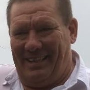
Senior Data Scientist
Current
Jul 2021 - Present
Please complete the CAPTCHA to continue

@uleth.ca
✓
1 phone found area 403
✓
LinkedIn matched
A concise factual answer block for searchers comparing this professional profile.
Gordon Logie is listed as Senior Data Scientist at Sparkgeo, a with 25 employees, based in Lethbridge, Alberta, Canada. AeroLeads shows a work email signal at uleth.ca, phone signal with area code 403, and a matched LinkedIn profile for Gordon Logie.
Gordon Logie previously worked as Remote Sensing Manager at Farmers Edge and Senior Remote Sensing Scientist at Farmers Edge. Gordon Logie holds Master Of Science (M.Sc.), Geography, 4.0 from The University Of Lethbridge.
This section adds company-level context without repeating Gordon Logie's masked contact details.
AeroLeads found 1 current-domain work email signal for Gordon Logie. Compare company email patterns before reaching out.
Data and Remote Sensing Scientist. I am passionate about how geospatial data coupled with the right analysis techniques can help mitigate and solve many problems the world is facing right now.I have more than a decade of experience in the remote sensing and geospatial sectors, working in academia, government, and private industry. Currently I work as a Senior Data Scientist at Sparkgeo, a leading geospatial consulting company.Born, raised, and still living in Southern Alberta, Canada, I live on a small acreage with my wife, our two dogs, two cats, a chinchilla, and a flock of chickens.
Listed skills include Remote Sensing, Geographic Information Systems, Arcgis, Research, and 19 others.
Company context helps verify the profile and gives searchers a useful next step.
A career timeline built from the work history available for this profile.

Lethbridge, Alberta
• Responsible for planning, oversight, and development of cutting-edge imagery analytics.• Lead team of remote sensing professionals, coordinating project scheduling, budgets, materials acquisition.• Work with product, development, and other R&D teams in agile software development environment.• Development and delivery of presentations and documentation to key stakeholders both within and outside of the company.• Assessment and provision of training opportunities to develop team skillset.• Performance assessment and provision of feedback for team members.• Responsible for recruitment of new team members and interns.
Lethbridge, Alberta, Canada
• Subject matter expert for remote sensing science and imagery analytics.• Led development of remote sensing applications and analytics.• Production and documentation of prototype code in Python.• Led multiple field research campaigns including planning, equipment and supplies acquisition, organization, training, management of field staff, data collection, and data processing. • Provided leadership and mentorship for other team members and interns.

Lethbridge, Alberta
• Taught Precision Agriculture course.• Development and delivery of lecture, lab, and assessment material.• GIS-based labs using tools for precision agriculture data analysis, as well as some field labs.• Classroom management for 38 students during lectures and labs.


Calgary, Alberta
This internship was done during my M.Sc. program. Working as part of a team in the GIS department of Integrated Sustainability Consultants Ltd., I primarily worked on tasks relating to Unmanned Aerial Vehicles (UAVs), which was a recent addition to their service offerings. My work with UAVs included researching UAV platforms, producing instruction and regulation documents for UAV operators, designing training and safety policies for UAV operators, and producing promotional documents for the UAV program for clients. I also processed UAV imagery into orthophotos and digital elevation models using the Pix4D software, and consulted with UAV operators about best practices to ensure high quality imagery was obtained.Aside from my UAV work, I also helped the GIS team through GIS data processing and mapping, creating scripts for UAV data processing, creating a web scraping program for downloading survey marker data from online sources, and by performing competitor analyses for new GIS service offerings from the company.
Lethbridge, Alberta
During my 3rd AMETHYST internship I worked as part of a team to collect data for an extensive project on food security. Over several months I assisted by collecting ground-based measurements of spectral reflectance, leaf area, chlorophyll content, and biomass for a variety of agricultural crops. I also helped to collect and process image data using an unmanned aerial vehicle system (UAS).
Ottawa, Ontario
For my 2nd AMETHYST internship I contributed to remote sensing research projects by performing pre-processing tasks on hyperspectral image data, by collecting and processing lab-based spectrometer data, as well as by creating GIS map layers.
Lethbridge, Alberta
In my first AMETHYST internship I worked on a large remote sensing project for wetland monitoring in northern Alberta. I performed land cover classifications on satellite imagery, produced GIS maps using high resolution image data, and participated in a field work campaign during which spectral data and GPS measurements were obtained.
Other employees you can reach at sparkgeo.com. View company contacts for 25 employees →
 Rajtantra Lilhare
Colleague at SparkgeoPrince George, British Columbia, Canada
View →
DD
Rajtantra Lilhare
Colleague at SparkgeoPrince George, British Columbia, Canada
View →
DD
 David Dowding
Colleague at SparkgeoTywyn, Wales, United Kingdom
View →
JM
David Dowding
Colleague at SparkgeoTywyn, Wales, United Kingdom
View →
JM
 Jesse Mauch
Colleague at SparkgeoCalgary, Alberta, Canada
View →
GP
Jesse Mauch
Colleague at SparkgeoCalgary, Alberta, Canada
View →
GP
 George Pyne
Colleague at SparkgeoCanada
View →
RD
George Pyne
Colleague at SparkgeoCanada
View →
RD
 Rebecca Doherty
Colleague at SparkgeoWildwood, Alberta, Canada
View →
SH
Rebecca Doherty
Colleague at SparkgeoWildwood, Alberta, Canada
View →
SH
 Scott Howes
Colleague at SparkgeoPrince George, British Columbia, Canada
View →
AM
Scott Howes
Colleague at SparkgeoPrince George, British Columbia, Canada
View →
AM
 Anthony Mayne
Colleague at SparkgeoGreater Ottawa Metropolitan Area, Canada
View →
CM
Anthony Mayne
Colleague at SparkgeoGreater Ottawa Metropolitan Area, Canada
View →
CM
 Cara Moore
Colleague at SparkgeoPrince George, British Columbia, Canada
View →
JD
Cara Moore
Colleague at SparkgeoPrince George, British Columbia, Canada
View →
JD
 John Donovan
Colleague at SparkgeoUnited Kingdom
View →
JR
John Donovan
Colleague at SparkgeoUnited Kingdom
View →
JR
 Justin Robinson
Colleague at SparkgeoDuncan, British Columbia, Canada
View →
Justin Robinson
Colleague at SparkgeoDuncan, British Columbia, Canada
View →
Activities and Societies: The University of Lethbridge Geography ClubMaster of Science program in Geography as part of NSERC CREATE.
Activities and Societies: Geography Club, Archaeology Club
Quick answers generated from the profile data available on this page.
Gordon Logie works for Sparkgeo.
Gordon Logie is listed as Senior Data Scientist at Sparkgeo.
AeroLeads has found 1 work email signal at @uleth.ca for Gordon Logie at Sparkgeo.
AeroLeads has found 1 phone signal(s) with area code 403 for Gordon Logie at Sparkgeo.
Gordon Logie is based in Lethbridge, Alberta, Canada while working with Sparkgeo.
Gordon Logie has worked for Sparkgeo, Farmers Edge, Lethbridge College, University Of Lethbridge, and Integrated Sustainability Consultants Ltd..
Gordon Logie's colleagues at Sparkgeo include Rajtantra Lilhare, David Dowding, Jesse Mauch, George Pyne, and Rebecca Doherty.
You can use AeroLeads to view verified contact signals for Gordon Logie at Sparkgeo, including work email, phone, and LinkedIn data when available.
Gordon Logie holds Master Of Science (M.Sc.), Geography, 4.0 from The University Of Lethbridge.
Gordon Logie is listed with skills including Remote Sensing, Geographic Information Systems, Arcgis, Research, Field Work, Gis, Geographic Information Science, and Scientific Writing.
Search by job title, company, industry, location, and seniority. Export verified B2B contact data when you need it.
Start free trial Search contactsCheck these profiles if this is not the Gordon Logie you were looking for.