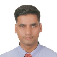

Hari Prasad Pokharel
AeroLeads people directory · profile

Hari Prasad Pokharel Email & Phone Number

GIS and Data Specialist at City of Markham
Location: Greater Toronto Area, Canada 6 work roles 2 schools
1 work email found @markham.ca LinkedIn matched
✓ Verified August 2026 4 data sources Profile completeness 100%

Contact Signals · 1 work email

Work email h****@markham.ca
LinkedIn Profile matched
3 free lookups remaining · No credit card
Current company
Role
GIS and Data Specialist
Location
Greater Toronto Area, Canada
Company size

Who is Hari Prasad Pokharel? Overview

A concise factual answer block for searchers comparing this professional profile.

Quick answer

Hari Prasad Pokharel is listed as GIS and Data Specialist at City of Markham, a with 1148 employees, based in Greater Toronto Area, Canada. AeroLeads shows a work email signal at markham.ca and a matched LinkedIn profile for Hari Prasad Pokharel.

Hari Prasad Pokharel previously worked as Infrastructure Data Specialist at City Of Markham and Director at York Condominium Corporation #388. Hari Prasad Pokharel holds Msc, Geoinformation from Msc-Geoinformation From University Of Twente, Department Of Geo-Information (Itc), The Netherlands.

Company email context

Email format at City of Markham

This section adds company-level context without repeating Hari Prasad Pokharel's masked contact details.

{first_initial}{last}@markham.ca
89% confidence

AeroLeads found 1 current-domain work email signal for Hari Prasad Pokharel. Compare company email patterns before reaching out.

Profile bio

About Hari Prasad Pokharel

10+ years of experience in GIS mapping, remote sensing, database management and data analysis with extensive knowledge of GIS project management, GIS training design, field data collection, image processing, database management, spatial analysis and map cartography. Specialties: GIS mapping, remote sensing, GPS, LiDAR data processing, map cartography, Geo-statistics, data analysis, image processing, information system development, asset management, structures and utilities life-cycle analysis.

Listed skills include Remote Sensing, Gis, Arcgis, Cartography, and 46 others.

Current workplace

Hari Prasad Pokharel's current company

Company context helps verify the profile and gives searchers a useful next step.

City of Markham
City Of Markham
GIS and Data Specialist
markham, ontario, canada
Website
Employees
1148
AeroLeads page
6 roles

Hari Prasad Pokharel work experience

A career timeline built from the work history available for this profile.

Infrastructure Data Specialist

Current

Ontario, Canada

- Assist in development and maintenance of infrastructure asset inventories and databases to support asset management planning for Environmental, Water and Wastewater assets. - Develop and maintain procedures for managing/ updating assets in tabular and geographic database.- Collect and analyse data for developing, managing and maintaining condition assessment inspection programs for ROW, Environmental, Water and Wastewater assets.- Develop tools and spreadsheet models for the simulation and analysis of various condition scenarios.- Assist in developing and managing infrastructure asset replacement programs using the results from condition assessments and determine budget requirements.- Interpret CCTV inspection data to storm sewer GIS layer, assign structural and operational maintenance ratings to pipes and prioritize the rehabilitation/ replacement program for storm sewer pipes. - Prepare GIS shape files, custom maps and databases for capital projects.- Prepare Request for Proposal, Request for Tender documents to retain qualified consultants and contractors for streetlight pole and streetlight underground cable condition inspection/ rehabilitation replacement. Manage the data sharing agreements with consultants. - Liaise with the utility companies, contractors, internal departments during streetlight rehabilitation works.- Provide support to the departmental capital budgeting process- Support Senior Manager of Infrastructure and other business unit Managers in all matters involving the section.- Other duties as assigned.


Dec 2013 - Present

Director

York Condominium Corporation #388

Toronto, Canada Area

- Attend board meetings- Appoint committees and retain maintenance contractor - Communicate with residents and respond to owner concerns- Investigate inquiries regarding violations, maintenance and other pertinent issues- Maintain corporate records- Enforce the bylaws and other governance documents

May 2017 - Nov 2020

Gis, Mapping And Information Technology Expert/ System Specialist

Swiss Agency For Development And Cooperation (Sdc)

ITECO Engineering Ltd. is a Switzerland-based engineering company that executed Local Roads Bridge Program (LRBP) in Nepal. The program was implemented under the bilateral agreement of the Governments of Switzerland and Nepal for local road and bridge infrastructure development in Nepal. Responsibilities:- Captured and managed spatial data, digitized maps and conducted GPS surveying of 2000+ local road bridge sites in Nepal- Processed satellite images using ArcGIS, PCI Geomatica, and ERDAS IMAGINE- Analyzed spatial data using Spatial Analyst, Geo-statistical Analyst, 3D Analyst and Multi- criteria evaluations in ArcGIS environment.- Studied demographic and other statistical data using MS-Excel, SPSS program.- Disseminated information through statistical tools and thematic / topographical mapsTechnical Environment: ArcGIS, Quantum GIS, ERDAS, Google Earth, PCI Geomatica, ENVI, SPSS, Microsoft Office Suite.

May 2011 - Aug 2013

Gis And Lidar Technology Expert

Arbonaut Oy Ltd Finland/ Forest Resource Assessment Project, Nepal

Arbonaut Oy Ltd. is a Finland-based company that executed Forest Resource Assessment (FRA) project in Nepal. The program was implemented under the bilateral agreement of the Governments of Finland and Nepal for Forest Resource Assessment in Nepal. Responsibilities:- Managed GIS and remote sensing data for forest resource analysis and mapping. - Conducted analysis of geographic database using Spatial Analyst and 3D Analyst programs. - Conducted field data collection, evaluated quality of spatial and attribute data. - Facilitated sessions for the end users to implement the developed GIS system. - Provided post-production support for GIS system including follow-up and research.- Developed forest resource GIS based maps. - Organized software applications training for end-users.Technical Environment: ArcMap9.3, ENVI, LPS SUITE, SPSS, Google Earth, ESRI-Model Builder and Microsoft Office Suite.

Nov 2009 - May 2010

Principal/ Board Of Director /Founder

School Of Geomatics

School of Geomatics (SOG) founded in 1999 , is a pioneer institute in Geomatics Education in Nepal providing academic and vocational training on the latest GIS technologies;surveying, mapping, Geo-information and space-tech applications. Responsibilities: - Planned academic and training modules on the regular basis along with the tailor made packages to meet the industry needs- Designed exclusive curriculum and customized software packages relevant with Remote Sensing, GIS, GPS and Database management- Executed Remote Sensing, GIS , GPS and Database Management training.- Provided consulting and expert services to the clients- Supervised student research projects and facilitated student for job placement

Aug 2000 - Apr 2010

Gis Analyst - Consultant

Genesis Consultancy Pvt. Ltd

Prepared Geo-databases, managed spatial information, Satellite imagery processing, spatial data analysis, topographic/thematic mapping, prepared urban base map, Land use analysis and change detection, and Geo-visualization and cartography. Specific area in which I worked for: - Spatial Data Analysis- Cartography and map production- DAG/Poverty Mapping- Geo-statistical analysis, Spatial Multi-Criteria Analysis and modeling - Design geo-database and application design- Satellite imagery processing, ortho-rectification, interpretation and analysis- Data modeling and system design- Development of training packages in the field of GIS applications- Coordination and Conduct Trainings- Field survey Design,- Presentations, reporting and documentations

Mar 2008 - May 2009
Team & coworkers

Colleagues at City of Markham

Other employees you can reach at markham.ca. View company contacts for 1148 employees →

2 education records

Hari Prasad Pokharel education

Msc, Geoinformation

Msc-Geoinformation From University Of Twente, Department Of Geo-Information (Itc), The Netherlands

Activities and Societies: Database Management, Remote Sensing, GIS, Photometry, Advanced Remote Sensing application, LIDAR, Python.

Msc, Mathematics

Msc Mathematics From Tribhuvan University
FAQ

Frequently asked questions about Hari Prasad Pokharel

Quick answers generated from the profile data available on this page.

What company does Hari Prasad Pokharel work for?

Hari Prasad Pokharel works for City of Markham.

What is Hari Prasad Pokharel's role at City of Markham?

Hari Prasad Pokharel is listed as GIS and Data Specialist at City of Markham.

What is Hari Prasad Pokharel's email address?

AeroLeads has found 1 work email signal at @markham.ca for Hari Prasad Pokharel at City of Markham.

Where is Hari Prasad Pokharel based?

Hari Prasad Pokharel is based in Greater Toronto Area, Canada while working with City of Markham.

What companies has Hari Prasad Pokharel worked for?

Hari Prasad Pokharel has worked for City Of Markham, York Condominium Corporation #388, Swiss Agency For Development And Cooperation (Sdc), Arbonaut Oy Ltd Finland/ Forest Resource Assessment Project, Nepal, and School Of Geomatics.

Who are Hari Prasad Pokharel's colleagues at City of Markham?

Hari Prasad Pokharel's colleagues at City of Markham include Raj Billvamangal, Veronica Siu, Jonn Faustino, Harold Wideman, and Marsha Mariani.

How can I contact Hari Prasad Pokharel?

You can use AeroLeads to view verified contact signals for Hari Prasad Pokharel at City of Markham, including work email, phone, and LinkedIn data when available.

What schools did Hari Prasad Pokharel attend?

Hari Prasad Pokharel holds Msc, Geoinformation from Msc-Geoinformation From University Of Twente, Department Of Geo-Information (Itc), The Netherlands.

What skills is Hari Prasad Pokharel known for?

Hari Prasad Pokharel is listed with skills including Remote Sensing, Gis, Arcgis, Cartography, Spatial Databases, Spatial Analysis, Gps, and Erdas Imagine.

Find 750M verified contacts

Search by job title, company, industry, location, and seniority. Export verified B2B contact data when you need it.

People with similar names

Check these profiles if this is not the Hari Prasad Pokharel you were looking for.

View similar profiles