
Gis Analyst
Current
May 2024 - Present
Please complete the CAPTCHA to continue

A concise factual answer block for searchers comparing this professional profile.
Isaiah Angelo Teh is listed as GIS Specialist | Data Enthusiast at Sydney Metro, a with 621 employees, based in Lidcombe, New South Wales, Australia. AeroLeads shows a matched LinkedIn profile for Isaiah Angelo Teh.
Isaiah Angelo Teh previously worked as GIS Analyst at Sydney Metro and GIS Specialist at Everickhf. Isaiah Angelo Teh holds Bachelor Of Science (Bs) from University Of The Philippines Diliman Quezon City.
This section adds company-level context without repeating Isaiah Angelo Teh's masked contact details.
Review company-level records connected to Isaiah Angelo Teh before choosing the right outreach path.
With over five years of extensive experience in multiple GIS and Drone applications, I bring technical expertise and strategic insight to organizations in the geomatics sector. Whether working on complex projects or being part of cross-functional teams, I am committed in providing value and delivering exceptional results that exceed expectations.
Company context helps verify the profile and gives searchers a useful next step.
A career timeline built from the work history available for this profile.

Sydney, New South Wales, Australia
Responsible for creating and preparing mapping suites using ArcGIS Pro for our archaeologists and clients.Utilizes ArcGIS Online to produce web maps for project management, data analysis, and data storytelling within the organization.Configure and troubleshoot ArcGIS Field Maps to assist archaeologists during field data collection.In charge of storing, maintaining geospatial data, and implementing efficient data management workflows for Everick Heritage's NSW office.Develop workflows and automate processes using Python, Arcade, Model Builder, ArcGIS Online web mapping application, and web app builder to increase internal efficiencies of day-to-day work.
Yokohama, Kanagawa, Japan
As a member of the crew aboard the cable vessel Subaru, I was responsiblefor analyzing and providing accurate geospatial data during submarine cablelaying, burial, and repair operations.Created cable laying simulations using onboard software (MakaiLay) that wereused to ensure the accuracy and efficiency of cable laying processes,contributing to the timely completion of projects.Produced maps using CAD software and graphs to monitor and track projectprogress.Ensured several onboard geospatial equipment were providing accurate dataand effectively communicate with project managers and team members ifthere were adjustments to be made during operations.Maintained meticulous records of all project activities and milestones,enabling the team to quickly identify and address any issues that arose.

Metro Manila
Processed drone images into usable spatial outputs through the use of AgisoftMetashape to aid clients in accurately managing and measuring their worksiteby delivering fast and accurate data.Conducted quality checks and assessments of clients' spatial data throughchange analysis to ensure accuracy and completeness.Investigated and addressed concerns raised by clients regarding the accuracyof their spatial data. Provided solutions and recommendations to inquiries fromPropeller's customers.

Pasig, National Capital Region, Philippines
Analyzed and processed high-resolution aerial photographs to createorthophotos and point clouds.Prepared and designed ortho mosaic, digital elevation, and topographic mapsusing several GIS software based on the client's requirements and purpose.Established a network of ground control points using Trimble and Topconreceivers.Operated Light Detection and Ranging Sensors (LiDAR) using Phoenix spatialsoftware to integrate with the company's UAV systems in acquiring LiDARpoints throughout the client's area of interest.Produced digital elevation models from LiDAR point clouds through the use ofTerraScan to create highly accurate topographic data.
National Engineering Center, University Of The Philippines, Diliman, Quezon City
Designed and established a control network of ground control points inproject study areas through the use of Trimble and Spectra precisionreceivers.Conducted tree inventory surveys that determine the tree species' accuratepositions, used for LiDAR data calibration and validationsDeveloped algorithms and processes to utilize LIDAR data for forestapplications using LASTools, ArcGIS, and ENVI software.Prepared and designed canopy height, canopy cover, forest cover classification, above-ground biomass, and carbon stock maps using ArcMap.Created and presented comprehensive reports on all processes,methodologies, and accuracy assessment of spatial data for foresters andengineering professionals.
National Engineering Center, University Of The Philippines, Diliman, Quezon City
Assisted the Research Assistant and Senior Research Specialist in organizing, processing, and analyzing the data collected for the designated unit of the component project.Recorded salient information of turned-over data portion, and date of turnover of output for that data portion.

National Engineering Center, University Of The Philippines, Diliman, Quezon City
Satellite-based Monitoring and Assessment of Rehabilitation in Typhoon-affected RegionsAssessed damaged houses from Typhoon Yolanda affected areas using satellite images.Created hazard maps using data from LiDAR and IfSAR.
Other employees you can reach at sydneymetro.info. View company contacts for 621 employees →
 Bethany Harper
Colleague at Sydney MetroGreater Sydney Area, Australia
View →
BA
Bethany Harper
Colleague at Sydney MetroGreater Sydney Area, Australia
View →
BA
 Ben Armstrong
Colleague at Sydney MetroGreater Sydney Area, Australia
View →
DV
Ben Armstrong
Colleague at Sydney MetroGreater Sydney Area, Australia
View →
DV
 David Virtue
Colleague at Sydney MetroGreater Sydney Area, Australia
View →
TG
David Virtue
Colleague at Sydney MetroGreater Sydney Area, Australia
View →
TG
 Tim Garrard
Colleague at Sydney MetroGreater Sydney Area, Australia
View →
NC
Tim Garrard
Colleague at Sydney MetroGreater Sydney Area, Australia
View →
NC
 Nick Croft
Colleague at Sydney MetroAustralia
View →
AM
Nick Croft
Colleague at Sydney MetroAustralia
View →
AM
 Andy Malakul
Colleague at Sydney MetroSydney, New South Wales, Australia
View →
IS
Andy Malakul
Colleague at Sydney MetroSydney, New South Wales, Australia
View →
IS
 Irene Suhyeon Hwang
Colleague at Sydney MetroGreater Sydney Area, Australia
View →
SW
Irene Suhyeon Hwang
Colleague at Sydney MetroGreater Sydney Area, Australia
View →
SW
 Savanna Wray
Colleague at Sydney MetroAustralia
View →
JL
Savanna Wray
Colleague at Sydney MetroAustralia
View →
JL
 John Langron
Colleague at Sydney MetroGreater Sydney Area, Australia
View →
GP
John Langron
Colleague at Sydney MetroGreater Sydney Area, Australia
View →
GP
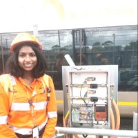 Gaya Prem Kumar
Colleague at Sydney MetroThe Rocks, New South Wales, Australia
View →
Gaya Prem Kumar
Colleague at Sydney MetroThe Rocks, New South Wales, Australia
View →

Quick answers generated from the profile data available on this page.
Isaiah Angelo Teh works for Sydney Metro.
Isaiah Angelo Teh is listed as GIS Specialist | Data Enthusiast at Sydney Metro.
Isaiah Angelo Teh is based in Lidcombe, New South Wales, Australia while working with Sydney Metro.
Isaiah Angelo Teh has worked for Sydney Metro, Everickhf, Ntt World Engineering Marine Corp., Propeller Aero, and Aero 360 Solutions, Inc..
Isaiah Angelo Teh's colleagues at Sydney Metro include Bethany Harper, Ben Armstrong, David Virtue, Tim Garrard, and Nick Croft.
You can use AeroLeads to view verified contact signals for Isaiah Angelo Teh at Sydney Metro, including work email, phone, and LinkedIn data when available.
Isaiah Angelo Teh holds Bachelor Of Science (Bs) from University Of The Philippines Diliman Quezon City.
Search by job title, company, industry, location, and seniority. Export verified B2B contact data when you need it.
Start free trial Search contacts