AeroLeads people directory · profile
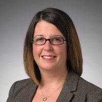
Jennifer Horsman Email & Phone Number
Volunteer
at
La Plata County Search and Rescue
2 work emails found
@researchplanning.com
3 phones found area 803 and 970
LinkedIn matched
✓ Verified August 2026
4 data sources
Profile completeness 100%
Current company
Role
Volunteer
Location
Durango, Colorado, United States
Who is Jennifer Horsman? Overview
A concise factual answer block for searchers comparing this professional profile.
Quick answer
Jennifer Horsman is listed as Volunteer at La Plata County Search and Rescue, based in Durango, Colorado, United States. AeroLeads shows a work email signal at researchplanning.com, phone signal with area code 803, 970, and a matched LinkedIn profile for Jennifer Horsman.
Jennifer Horsman previously worked as GIS & UAS Specialist/Geologist at Research Planning, Inc. and Computer Systems Engineer at Lawrence Berkeley National Laboratory. Jennifer Horsman holds A. B., Geophysics from University Of California, Berkeley.
Company email context
Email format at La Plata County Search and Rescue
This section adds company-level context without repeating Jennifer Horsman's masked contact details.
{first}@researchplanning.com
89% confidence
AeroLeads found 2 current-domain work email signals for Jennifer Horsman. Compare company email patterns before reaching out.
Profile bio
About Jennifer Horsman
I am a geospatial specialist with experience in spatial analysis, 3D visualization, GIS desktop and mobile application development, web mapping, field data collection, data management, and more. I have gained experience by working in various fields including environmental science, natural resource management, climate change, conservation, forestry, and meteorology.
Listed skills include Arcgis, Spatial Analysis, Gps, Cartography, and 36 others.
Current workplace
Jennifer Horsman's current company
Company context helps verify the profile and gives searchers a useful next step.
La Plata County Search And Rescue
Website
AeroLeads page
14 roles · 31 years
Jennifer Horsman work experience
A career timeline built from the work history available for this profile.

Gis & Uas Specialist/Geologist
Current
Dec 2012 - Present

Computer Systems Engineer
Visualization of scientific data and model outputs for DOE ASCEM project.https://eesa.lbl.gov/projects/advanced-simulation-capability-for-environmental-management-ascem/
Jul 2010 - Nov 2012

Research Associate Iii
Precipitation Research GroupProgramming an analysis support for "A Fundamental Climate Data Record of SSM/I, SSMIS and Future Microwave Imagers"http://rain.atmos.colostate.edu/research/NOAA-SDS.html
Nov 2010 - Jul 2011
Owner
Jencarta, Llc
Cartography for the Colorado Geological Survey Marmot Peak Quadrangle.
Sep 2008 - Jul 2011

Gis Specialist
GIS Manager with the USDA Animal and Plant Health Inspection Service (APHIS), Plant Protection and Quarantine (PPQ) in Cheyenne, Wyoming, preceded by a Cartographic Technician position with USDA APHIS PPQ in Fort Collins, Colorado.
Mar 2009 - Sep 2010
Research Associate Ii, Gis Specialist/Developer
https://warnercnr.colostate.edu/frs/westfire-center/starfire/starfire-components/As part of a team, developed a Windows software application for National Park Service forest fire Appropriate Management Response (AMR) with Visual Basic 2008 and ESRI MapObjects. Using ESRI ArcGIS Desktop software, managed and processed vector and raster datasets and performed spatial analyses on datasets. Created maps of inputs and outputs for meetings and documents. Created custom tools for raster analysis in ArcMap using VBA and ArcObjects
Nov 2007 - Sep 2008

Graduate Research Assistant
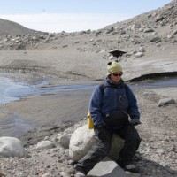
Used ground-penetrating radar (GPR) on glacial sediments and frozen lakes in the McMurdo Dry Valleys of Antarctica and on lakes in New Hampshire. Interpreted glacial lacustrine and fluvial sediments in GPR profiles for work towards a Master of Science degree. Used GIS and GPS for mapping and spatial analysis of glacial geomorphological features.
Oct 2006 - Oct 2007

Gis Analyst
Acted as GIS manager for a multi-disciplinary, collaborative conservation planning project. Performed integrated vector and raster spatial analyses in ArcGIS including landscape and habitat suitability/integrity, ecological drainage unit (EDU) delineation, habitat modeling (regression and ecological niche factor analysis), and cumulative threats modeling, and computed metrics for conservation site planning and terrestrial and aquatic site planning. Created and maintained data and FGDC compliant metadata. Processed data for and ran spatial optimization model to determine priority conservation sites. Created and edited geodatabases and performed queries and calculations in Microsoft Access. Created static and interactive maps for use in meetings, workshops, and presentation to the public.
Oct 2004 - Oct 2006
Gis/Remote Sensing Specialist
Used ENVI for hyperspectral data analysis and classification of forest structure. Managed results from remote sensing analysis and created maps in ArcGIS and ArcView for use in fire behavior models and forest treatment planning. Performed validation of forest structure classification using field observations in ArcMap. Georeferenced and orthorectified aerial photography in ERDAS Imagine. Classified amount of tree canopy cover from aerial photographs into discrete percentage categories. Designed field sampling studies and collected data on species composition, fire history from scars, basic under story vegetation structure, and age and size structure of stands in mixed conifer forests.
Jun 2003 - Oct 2004

Graduate Research Assistant
Analyzed stratification of the planetary boundary layer within a GIS using radiosonde, remote sensing (multi-spectral AVHRR and LIDAR), and observational data. Made comparisons between output from the NCEP Eta forecast model and observational data. Used ArcGIS for spatial statistical analyses of 3-D gridded Eta model output, synoptic maps, and meteorological observations. Wrote AML, Avenue and Matlab scripts for data manipulation and statistical analyses. Maintained ArcSDE and Oracle and Microsoft Access databases (requires use of SQL). Installed the ArcIMS server and Internet applications.
Oct 2002 - May 2003
Professional Research Assistant
Mcmurdo Lter
Nov 2000 - Jul 2001
Graduate Research Assistant
Conducted paleoclimate research of ice cores with field work in the Yukon and Antarctica while attending graduate school in the Climate Change Research Center.
Aug 1998 - Jun 2000
Geophysicist/Surveyor
Usgs
1996 - 1998
~2 yrs
3 education records
Jennifer Horsman education

A. B., Geophysics
M. S., Environmental Science
Climate Change, Atmospheric Chemistry, Meteorology, Paleoclimate, Ice Cores
FAQ
Frequently asked questions about Jennifer Horsman
Quick answers generated from the profile data available on this page.
What company does Jennifer Horsman work for?
Jennifer Horsman works for La Plata County Search and Rescue.
What is Jennifer Horsman's role at La Plata County Search and Rescue?
Jennifer Horsman is listed as Volunteer at La Plata County Search and Rescue.
What is Jennifer Horsman's email address?
AeroLeads has found 2 work email signals at @researchplanning.com for Jennifer Horsman at La Plata County Search and Rescue.
What is Jennifer Horsman's phone number?
AeroLeads has found 3 phone signal(s) with area code 803, 970 for Jennifer Horsman at La Plata County Search and Rescue.
Where is Jennifer Horsman based?
Jennifer Horsman is based in Durango, Colorado, United States while working with La Plata County Search and Rescue.
What companies has Jennifer Horsman worked for?
Jennifer Horsman has worked for La Plata County Search And Rescue, Research Planning, Inc., Lawrence Berkeley National Laboratory, Colorado State University, and Jencarta, Llc.
How can I contact Jennifer Horsman?
You can use AeroLeads to view verified contact signals for Jennifer Horsman at La Plata County Search and Rescue, including work email, phone, and LinkedIn data when available.
What schools did Jennifer Horsman attend?
Jennifer Horsman holds A. B., Geophysics from University Of California, Berkeley.
What skills is Jennifer Horsman known for?
Jennifer Horsman is listed with skills including Arcgis, Spatial Analysis, Gps, Cartography, Arcsde, Erdas Imagine, Arcobjects, and Visual Basic.
Find 750M verified contacts
Search by job title, company, industry, location, and seniority. Export verified B2B contact data when you need it.
Start free trialPeople with similar names
Check these profiles if this is not the Jennifer Horsman you were looking for.
View similar profiles