
AeroLeads people directory · profile
John Hammon Email & Phone Number
South Australian State Manager
at
BCE Surveying
1 work email found
@jacobs.com
LinkedIn matched
✓ Verified July 2026
4 data sources
Profile completeness 100%
Current company
Role
South Australian State Manager
Location
Australia
Company size
Who is John Hammon? Overview
A concise factual answer block for searchers comparing this professional profile.
Quick answer
John Hammon is listed as South Australian State Manager at BCE Surveying, a with 27 employees, based in Australia. AeroLeads shows a work email signal at jacobs.com and a matched LinkedIn profile for John Hammon.
John Hammon previously worked as WA Regional Manager at Bce Surveying and Perth Regional Manager at Bce Surveying. John Hammon holds Bachelor Of Geomatic/Engineering from University Of Melbourne.
Company email context
Email format at BCE Surveying
This section adds company-level context without repeating John Hammon's masked contact details.
{first}.{last}@jacobs.com
86% confidence
AeroLeads found 1 current-domain work email signal for John Hammon. Compare company email patterns before reaching out.
Profile bio
About John Hammon
John Hammon is a South Australian State Manager at BCE Surveying. He possess expertise in surveying, rail, gps, microstation, gis and 15 more skills.
Listed skills include Surveying, Rail, Gps, Microstation, and 16 others.
Current workplace
John Hammon's current company
Company context helps verify the profile and gives searchers a useful next step.
Bce Surveying
8 roles
John Hammon work experience
A career timeline built from the work history available for this profile.
Wa Regional Manager
Perth Regional Manager
Jun 2021 - Jan 2023

Senior Surveyor - Wa Uav Lead
Senior member of the spatial division responsible for planning and delivering surveys for a range of mining and infrastructure clients across Australia. Working in both the field and office, John is involved in all aspects of projects including initial scope and project costing, client liaison, coordinating field based teams and processing final deliverables. Additionally, in his role as UAV lead John has focused on developing UAV business opportunities, promoting drone capabilities both internally and externally, mentoring junior pilots, compiling safety documents and flight procedures for the Matrice210 and Phantom 4 and ensuring team access to the latest equipment, software and training. KEY CLIENTS- RIO Tinto (West Angelas, Silvergrass, Nammuldi, Brockman 2 mine sites): Laser scanning existing structures to generate a comprehensive point cloud model to support new infrastructure works on site.- Oz Minerals (Carrapateena mine): Audit survey role responsible for establishing a control network, set out and utilising UAV to monitor earthworks and construction, calculate weekly stockpile volumes, capture blast sites and land disturbances.- BHP (Nelson Point, Nickle West, Area C mine sites): Laser scanning and UAV capture of various site structures for design upgrade works and shareholder visualisation.Main Roads (Great Northern Highway): Topographical surveys, mobile laser scanning and UAV mapping provided as part of audit services on the $385 million upgrade between Muchea and Wubin.- Water Corporation (various sites across WA): Topographical surveys, laser scanning and UAV capture of existing plant across a number of sites supporting new infrastructure works. - Perth Transport Authority (Claremont Railway Station): Static laser scanning to generate a complete a 3D model for platform extension study.-Woodside (Karatha Gas Plant): Site survey for new plant design incorporating laser scanning, UAV and topographical surveys.
Mar 2016 - Jun 2021
Senior Surveyor
John was employed as a surveyor and laser scanning specialist predominantly working on infrastructure projects around NSW (road, rail and water). John led the laser scanning teams in the field and was responsible for both processing and data extraction to deliver 3D models and pointclouds for a variety of clients. KEY CLIENTS- Sydney Water (Orchard Hills Processing Plant, Bondi Junction Heritage Sewerage Station): Laser scanning and modeling of plant infrastructure for upgrade works. - Sydney Trains: Mobile and static point cloud capture of a variety of NSW railway lines and stations including the rail transom deck of the Sydney Harbour Bridge. - Roads and Maritime Services (RMS): Performed a variety of surveys across NSW roads including establishing control networks, earthwork surveys and mobile and static laser scanning of road corridors for deliverables in MX.
May 2014 - Mar 2016

Survey Data Manager, Laser Scanning Coordinator
John coordinated a team of surveyors working nights and during pressured shut down periods to map the underground rail network using track trolley mounted mobile laser scanners and static laser scanners. The role involved extracting critical data, creating 3D models and tunnel profiles and liaising with track designers and construction teams to enable rail works. KEY PROJECTS- Created a 3D model of the Bakerloo, Northern and Jubilee tunnel profiles using trolley mounted mobile laser scanner.- Monitoring of tunnels and stations during track replacement, earthworks and civil construction.- Created and maintained a deep tube tunnel geodetic control network.
Sep 2007 - Feb 2014

Rail Surveyor
John was employed as a rail surveyor responsible for delivery of topographical surveys on Network Rail and London Underground. The role included creating multi-layered digital maps of stations, fault line monitoring, coordinated networks of control in the deep tube tunnels, generation of cross sections and tunnel outline diagrams and office management duties. He managed a survey team to ensure accurate data reduction in SCC, Starnet and Microstation and acted as client liaison.
Sep 2005 - Sep 2007

Gis Analyst
John was part of a team that developed an asset mapping system that was utilised on a train and tram to capture Melbourne's train (800km) and tram (450km) network assets for the State Government. The vehicles incorporated digital cameras, inertial positioning sensors, gyros, rail lasers, GPS and Visual Basic programs.
Jan 2002 - May 2005
Team & coworkers
Colleagues at BCE Surveying
Other employees you can reach at bcesurveying.com.au. View company contacts for 27 employees →
CA
 Chandana Abeynayaka
Colleague at Bce SurveyingEast Bunbury, Western Australia, Australia
View →
BG
Chandana Abeynayaka
Colleague at Bce SurveyingEast Bunbury, Western Australia, Australia
View →
BG
 Blake Gilmore
Colleague at Bce SurveyingSouth Bunbury, Western Australia, Australia
View →
VS
Blake Gilmore
Colleague at Bce SurveyingSouth Bunbury, Western Australia, Australia
View →
VS
 Vladimir Stakic
Colleague at Bce SurveyingForest Lodge, New South Wales, Australia
View →
CM
Vladimir Stakic
Colleague at Bce SurveyingForest Lodge, New South Wales, Australia
View →
CM
 Christopher Mcintosh
Colleague at Bce SurveyingDianella, Western Australia, Australia
View →
KB
Christopher Mcintosh
Colleague at Bce SurveyingDianella, Western Australia, Australia
View →
KB
 Kudzanai Bishi
Colleague at Bce SurveyingBunbury, Western Australia, Australia
View →
JG
Kudzanai Bishi
Colleague at Bce SurveyingBunbury, Western Australia, Australia
View →
JG
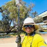 Judges Gwainda
Colleague at Bce SurveyingEast Bunbury, Western Australia, Australia
View →
PN
Judges Gwainda
Colleague at Bce SurveyingEast Bunbury, Western Australia, Australia
View →
PN
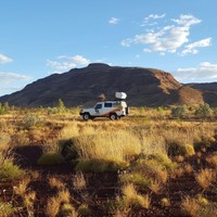 Predrag Neric
Colleague at Bce SurveyingEast Bunbury, Western Australia, Australia
View →
MK
Predrag Neric
Colleague at Bce SurveyingEast Bunbury, Western Australia, Australia
View →
MK
 Michael Knight
Colleague at Bce SurveyingBurekup, Western Australia, Australia
View →
KH
Michael Knight
Colleague at Bce SurveyingBurekup, Western Australia, Australia
View →
KH
 Kaylea Harrison
Colleague at Bce SurveyingEast Bunbury, Western Australia, Australia
View →
DM
Kaylea Harrison
Colleague at Bce SurveyingEast Bunbury, Western Australia, Australia
View →
DM
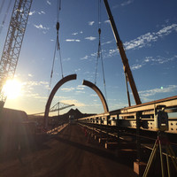 Damian Morris
Colleague at Bce SurveyingWestern Australia, Australia
View →
Damian Morris
Colleague at Bce SurveyingWestern Australia, Australia
View →
Chandana Abeynayaka
Colleague at Bce SurveyingEast Bunbury, Western Australia, Australia
View →
BG
Blake Gilmore
Colleague at Bce SurveyingSouth Bunbury, Western Australia, Australia
View →
VS
Vladimir Stakic
Colleague at Bce SurveyingForest Lodge, New South Wales, Australia
View →
CM
Christopher Mcintosh
Colleague at Bce SurveyingDianella, Western Australia, Australia
View →
KB
Kudzanai Bishi
Colleague at Bce SurveyingBunbury, Western Australia, Australia
View →
JG
Judges Gwainda
Colleague at Bce SurveyingEast Bunbury, Western Australia, Australia
View →
PN
Predrag Neric
Colleague at Bce SurveyingEast Bunbury, Western Australia, Australia
View →
MK
Michael Knight
Colleague at Bce SurveyingBurekup, Western Australia, Australia
View →
KH
Kaylea Harrison
Colleague at Bce SurveyingEast Bunbury, Western Australia, Australia
View →
DM
Damian Morris
Colleague at Bce SurveyingWestern Australia, Australia
View →
1 education record
John Hammon education
FAQ
Frequently asked questions about John Hammon
Quick answers generated from the profile data available on this page.
What company does John Hammon work for?
John Hammon works for BCE Surveying.
What is John Hammon's role at BCE Surveying?
John Hammon is listed as South Australian State Manager at BCE Surveying.
What is John Hammon's email address?
AeroLeads has found 1 work email signal at @jacobs.com for John Hammon at BCE Surveying.
Where is John Hammon based?
John Hammon is based in Australia while working with BCE Surveying.
What companies has John Hammon worked for?
John Hammon has worked for Bce Surveying, Jacobs, Transport For London, Atkins, and Geomatic Technologies.
Who are John Hammon's colleagues at BCE Surveying?
John Hammon's colleagues at BCE Surveying include Chandana Abeynayaka, Blake Gilmore, Vladimir Stakic, Christopher Mcintosh, and Kudzanai Bishi.
How can I contact John Hammon?
You can use AeroLeads to view verified contact signals for John Hammon at BCE Surveying, including work email, phone, and LinkedIn data when available.
What schools did John Hammon attend?
John Hammon holds Bachelor Of Geomatic/Engineering from University Of Melbourne.
What skills is John Hammon known for?
John Hammon is listed with skills including Surveying, Rail, Gps, Microstation, Gis, Laser Scanning, Topographic Surveys, and Road.
Find 750M verified contacts
Search by job title, company, industry, location, and seniority. Export verified B2B contact data when you need it.
Start free trialPeople with similar names
Check these profiles if this is not the John Hammon you were looking for.

John Hammon
4 email domains
John Hammon
2 email domains

John Hammon
3 email domains

John Hammon
5 email domains