
AeroLeads people directory · profile
John Manzer Email & Phone Number
Integration Engineer SETA Program Management at NoblisESI
at
Noblis
1 work email found
@noblis.org
3 phones found area 703
LinkedIn matched
✓ Verified August 2026
4 data sources
Profile completeness 100%
Current company
Role
Integration Engineer SETA Program Management at NoblisESI
Location
Ashburn, Virginia, United States
Company size
Who is John Manzer? Overview
A concise factual answer block for searchers comparing this professional profile.
Quick answer
John Manzer is listed as Integration Engineer SETA Program Management at NoblisESI at Noblis, a with 1335 employees, based in Ashburn, Virginia, United States. AeroLeads shows a work email signal at noblis.org, phone signal with area code 703, and a matched LinkedIn profile for John Manzer.
John Manzer previously worked as Integration Engineer at Noblis and Senior Software Test Engineer at Assurance Technology Corporation. John Manzer holds Certificate In Process, Geospatial Intelligence : Worldwide Campus from Penn State University.
Company email context
Email format at Noblis
This section adds company-level context without repeating John Manzer's masked contact details.
{first}.{last}@noblis.org
89% confidence
AeroLeads found 1 current-domain work email signal for John Manzer. Compare company email patterns before reaching out.
Profile bio
About John Manzer
Objective: CTO / VP Technology ; DoD TOP SECRET security clearance w/ SSBI Jan 2015. IT professional with 33 years of experience in many of the disciplines of SDLC, software development, Geospatial Information Systems and SIGINT; specializing in systems integration, data management integration and conversion, remote sensing satellite image processing, and 3D photogrammetry.
Listed skills include Geomatics, Systems Engineering, Remote Sensing, Integration, and 46 others.
Current workplace
John Manzer's current company
Company context helps verify the profile and gives searchers a useful next step.
Noblis
10 roles
John Manzer work experience
A career timeline built from the work history available for this profile.
Integration Engineer
CurrentMr. Manzer currently supports (and for the last 4 years) the National Reconnaissance Office JEMA - Joint Enterprise Modeling & Analytics program as lead SETA (Systems Engineering and Technical Assistance) in support of thousands of mission users. The tool is a powerful tradecraft automation visual programming web-app environment that is highly effective supporting any mission need for data automation. Current duties include contract task order statements of work, technical evaluations for contract proposals, and funds to align with project scope. Current technically duties include, service desk ticketing management to facilitate change to the systems under a set of standard operating procedures (SOPs). Mr. Manzer manages a development team creating hundreds of data connectors to IC data sources, to provide simple access to mission users in a power framework. He has also worked tirelessly to decommission the legacy JEMA-IC system that once supported thousands of IC mission users based on a highly successful proto-type pressed into production.Using program management techniques, Mr. Manzer provided direction for a new development initiative, Mission Presenter targeting a similar IC mission user base. Worked through the R&D phases of a startup, agile feature development, systems engineering inside the Information Assurance (IA) Risk Management Framework (RMF) supporting DevOps, and successfully built a user base of thousands of mission users. ATEAM - Analytic Technical Engagement Across Missions
Apr 2016 - Present

Senior Software Test Engineer
Quality Assurance testing of SEALINK Advanced Analysis (S2A) C4ISR system providing global, persistent, cooperative and non-cooperative maritime vessel tracking awareness and information that is valuable to intelligence analysts, joint warfighters, senior decision makers, and interagency offices within the SCI community. Providing system testing of the Navel Research Laboratory’s Open Mongoose System (OMS) that provides Maritime Domain Awareness (MDA) capabilities to the DoD, Intelligence Community (IC), Coast Guard, DHS, and Navy. The OMS system leverages multiple sources, and fusing positional information; Radarsat, Port Radar (HF), CTAR, AI, and provides vessel Tracks in a Firefox browser via a Web Portal built on services.Studied the web system architecture for the purpose of selecting the best test automation, continuous integration and test management tool for the programs’ needs. Components include: Ozone Widget Framework, Tomcat, Sencha EXT JS, Google Web Toolkit, Oracle, Hibernate, jdbc, Web Logic, Informatica RulePoint. JenkinsCI, Jira, .Performed a product search and detailed evaluation of test automation tools (IBM Rational Functional Tester (RFT), HP Quality Center ALM Unified Functional Tester (UFT), Selenium2 Web Driver, SmartBear TestComplete, AutomationAnywhere TestingAnywhere, T-Plan Robot, Ranorex, Telerik Test Studio. This effort included the development of a set of test scripts in each of the tool (IDE) environments. Detailed exposure to XPath, Cascading System Sheet (CSS), Optical Character Recognition (Google Tesseract), and image matching techniques in multiple scripting/language environment to test functionality.Test script development Java JDK 1.6, Eclipse JUNO with plugIns: (Polarion Subversion, Red Hat JBoss, Maven, Atlassian JIRA, Aptana Pydev, Spring, Oracle WebLogic Server 12c, Quest Toad, Mylyn, Sapphire , WebToolsPlatform, m2e ), Jenkins CI, Infomatica RulePoint - BigData Alerts
Feb 2013 - Apr 2016

Principal Software Test Engineer
Provided quality assurance of Pixa products HiPER-Stare, HiPER-Look, HiPER-Watch. Conducted aggressive agile software testing to ensure functionality of Windows Server 2008 services built in Java on top of Apache Tomcat that support the OGC WAMI (Wide-Area Motion Imagery) specification. System fielded in theater to support of National System for Geo-Intelligence Video Services (NVS) Expeditionary Architecture (NEA). Designed and executed quality and performance tests on Big Data from WAMI sensors, including BlueDevil, Constant Hawk, Gorgon Stare. Baselined system performance fps (frames per second) on both full bandwidth and latency challenged network segments. Multi-threaded and scalable enterprise services to encode into containers at near real-time rates hosted on EMC Isilon storage & VMware vSphere configuration with Security Technical Implementation Guides (STIGs) operating system; JIRA & Smartbear evaluations for test automation.
Apr 2012 - Sep 2012
Principal Software Test Engineer
Maxar (Digitalglobe/Geoeye)
Subject matter expert responsible for image quality of all aspects of imagery products available from a world class Web Dissemination and Hosting System that was developed as a set of services to scale at an enterprise level, and into the Cloud. Responsible for image quality of the commercially branded EyeQ and NGA’s enterprise system supporting GeoEye Enhanced View contract ($3.8B) for 1000 users. Products ingested from the GeoEye ground segment factory were preserved in terms of overall image quality and all deviations or adjustments to radiometric quality were documented. Image quality was ensured when optional output formats, compression, ground sample distance; epsg and metadata values changed and accompanied the products. Performed comprehensive testing of image formats such as {NITF, NITF w/JP2000, CIB-RPF, GeoTIFF, GeoPDF, JP2000, PNG, JPEG, MrSID}. The OCS services (KML, WMS, WMTS, WCS, WFS, GeoRSS) were tested to ensure image quality whether it was on instant mosaics from multiple sensors or tile services in combination supporting each other. Established and responsible for a geospatial test laboratory containing test clients under configuration control to include: ESRI ArcGIS 9.3 & 10.0, ERDAS Imagine 9.3 & 2011, ENVI 4.6 & 4.7, BAE Socet GXP 4.3, GlobalMapper 11 & 12, GaTech Falconview and detailed test procedures that used these tools to test. Ultimately the components used in the development architecture were understood by their version numbers, as defects were fixed and functionality was baselined (such as GDAL, OSSim, FME, and Kakadu) to maintain quality.
Dec 2008 - Apr 2012
Business Development : Project Manager
Geoeye
GeoEye Business Development Manager (Jan07-Dec08), responsible for the corporate business growth, including strategies to expand into vertical markets as a solution provider, such as the mobile handset market and location based services (LBS).GeoEye Program Office support (Apr05-Dec06), responsible for International Distributor account management, systems integration, and satellite operations coordination for high resolution commercial earth imaging.
Apr 2005 - Dec 2008

Sr. Technical Consultant
Managed an annual budget with targeted revenue planned and forecasted expenses. The fixed expenses included a technical staff of 8 and a revenue center generating $1.2 M. Monthly progress reporting of both revenue tasks and overhead activities presented in management meetings and written reports to confirm and cross reference SAP accounting records. Financial management in this environment included many of the dynamics of value added reseller data components when client opportunities and other departmental requirements arose.Managed the development of system components and application interfaces to Comsearch core corporate database resources, known as GeoPlanner. GeoPlanner includes point-to-point microwave infrastructure across many bands and is stored in an enterprise Sybase server. Leveraged ESRIs Arc/Info AML programming RDBI to Sybase for spatial enabling as coverages / shapefiles.
Jan 1996 - Apr 2005

Systems Analyst
Systems Analyst (SW Architecture,Oracle,TI-IEF,Software-Through Pictures)* Comprehensive Carnegie Mellon Systems Engineering Institute - CMMi training * Program development in an Integrated Development Environment (IEDs) including business process modeling, data modeling, and activity diagrams* Computer Assisted Systems Engineering (CASE) tool atego Software through Pictures including actors and roles, events, methods, and states. * Logical and Physical modelling using Texas Instruments IEF (now CA-Gen)* Spartanburg SC Assessors Office System9 GIS program integration* IBM Mainframe to client-server EPA data integration to Win-PC Token-Ring as Gateway/ENVIROFACTS (today’s EnviroMapper) DGUX kernel tuning with Oracle on RAID array storage under CMMi-2 maturity process; progress level-3* Department of Energy (DOE) facility siting study at Savannah River using stakeholder interviews and requirements definition to implement architectural building blocks
Aug 1991 - Dec 1995
Gis Specialist
Greenhorne & O'Mara
Managed several client programs involving spatial data conversion from existing sources and the development of related RDBMS/GIS databases and analyses. Designed and implemented a system interface to access 28 spatial data layers for planimetric and municipal information covering 450 square miles of urbanized area in Pulaski, County AR. Developed several customer applications, including incident mapping, geographic search and update of parcel property ownership, geographic query of the utilities infrastructure, and cartographic displays and reports. Managed the photogrammetric data capture program .Created a pilot spatial database to meet the needs of multiple county departments for Montgomery and Prince George's Counties, MD. Planimetric street centerline data were populated with address range information from the U.S. Census Bureau's TIGER and GBF DIME files. Twenty-five (25) other data layers were geometrically corrected to match positionally accurate planimetric data.
Jul 1990 - Aug 1991

Systems Analyst
Prepared the digital working sheets of 1:100,000 scale hydrography for the Commonwealth of Virginia. Technically performed the automated data conversion of the hydrography theme from the USGS Digital Line Graph (DLG) data product. Derived a set of maps for the Elizabeth River (VA) study area, which included geologic, contour, bathemetry and hydrographic data. Developed and designed a portion of the Prince William County (MD) Water Quality Database using relational keys to other existing county and federal water quality databases. Used ARC/INFO's TIN module for surface analysis to identify potential locations of aquifer contamination. Gained operating system experience with Prime computer systems running under Primos. Acquired skills in Command Programming Language (CPL), the development environment of Primos
Aug 1988 - Jul 1990
Team & coworkers
Colleagues at Noblis
Other employees you can reach at noblis.org. View company contacts for 1335 employees →
SU
 Surendra Upadhaya
Colleague at NoblisGainesville, Virginia, United States
View →
LE
Surendra Upadhaya
Colleague at NoblisGainesville, Virginia, United States
View →
LE
 Lynn Eckendorf
Colleague at NoblisCleveland, Ohio, United States
View →
NH
Lynn Eckendorf
Colleague at NoblisCleveland, Ohio, United States
View →
NH
 Nathaniel Hall
Colleague at NoblisFalls Church, Virginia, United States
View →
NS
Nathaniel Hall
Colleague at NoblisFalls Church, Virginia, United States
View →
NS
 Nathan Spivy
Colleague at NoblisIndianapolis, Indiana, United States
View →
CL
Nathan Spivy
Colleague at NoblisIndianapolis, Indiana, United States
View →
CL
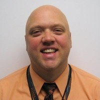 Chip Larue, Pmp
Colleague at NoblisVienna, Virginia, United States
View →
HG
Chip Larue, Pmp
Colleague at NoblisVienna, Virginia, United States
View →
HG
 H. Gilbert Miller
Colleague at NoblisFalls Church, Virginia, United States
View →
BR
H. Gilbert Miller
Colleague at NoblisFalls Church, Virginia, United States
View →
BR
 Brandon Rabackoff
Colleague at NoblisLeesburg, Virginia, United States
View →
CL
Brandon Rabackoff
Colleague at NoblisLeesburg, Virginia, United States
View →
CL
 Catherine Lam
Colleague at NoblisWashington Dc-Baltimore Area, United States
View →
LG
Catherine Lam
Colleague at NoblisWashington Dc-Baltimore Area, United States
View →
LG
 Leah Gangloff
Colleague at NoblisUnited States
View →
FM
Leah Gangloff
Colleague at NoblisUnited States
View →
FM
 Frances Murphy, Md, Mph
Colleague at NoblisSilver Spring, Maryland, United States
View →
Frances Murphy, Md, Mph
Colleague at NoblisSilver Spring, Maryland, United States
View →
Surendra Upadhaya
Colleague at NoblisGainesville, Virginia, United States
View →
LE
Lynn Eckendorf
Colleague at NoblisCleveland, Ohio, United States
View →
NH
Nathaniel Hall
Colleague at NoblisFalls Church, Virginia, United States
View →
NS
Nathan Spivy
Colleague at NoblisIndianapolis, Indiana, United States
View →
CL
Chip Larue, Pmp
Colleague at NoblisVienna, Virginia, United States
View →
HG
H. Gilbert Miller
Colleague at NoblisFalls Church, Virginia, United States
View →
BR
Brandon Rabackoff
Colleague at NoblisLeesburg, Virginia, United States
View →
CL
Catherine Lam
Colleague at NoblisWashington Dc-Baltimore Area, United States
View →
LG
Leah Gangloff
Colleague at NoblisUnited States
View →
FM
Frances Murphy, Md, Mph
Colleague at NoblisSilver Spring, Maryland, United States
View →
2 education records
John Manzer education
Certificate In Process, Geospatial Intelligence : Worldwide Campus
Penn State University
Bs, Mathematics : Computer Science
Virginia Commonwealth University
FAQ
Frequently asked questions about John Manzer
Quick answers generated from the profile data available on this page.
What company does John Manzer work for?
John Manzer works for Noblis.
What is John Manzer's role at Noblis?
John Manzer is listed as Integration Engineer SETA Program Management at NoblisESI at Noblis.
What is John Manzer's email address?
AeroLeads has found 1 work email signal at @noblis.org for John Manzer at Noblis.
What is John Manzer's phone number?
AeroLeads has found 3 phone signal(s) with area code 703 for John Manzer at Noblis.
Where is John Manzer based?
John Manzer is based in Ashburn, Virginia, United States while working with Noblis.
What companies has John Manzer worked for?
John Manzer has worked for Noblis, Assurance Technology Corporation, Pixia, Maxar (Digitalglobe/Geoeye), and Geoeye.
Who are John Manzer's colleagues at Noblis?
John Manzer's colleagues at Noblis include Surendra Upadhaya, Lynn Eckendorf, Nathaniel Hall, Nathan Spivy, and Chip Larue, Pmp.
How can I contact John Manzer?
You can use AeroLeads to view verified contact signals for John Manzer at Noblis, including work email, phone, and LinkedIn data when available.
What schools did John Manzer attend?
John Manzer holds Certificate In Process, Geospatial Intelligence : Worldwide Campus from Penn State University.
What skills is John Manzer known for?
John Manzer is listed with skills including Geomatics, Systems Engineering, Remote Sensing, Integration, Testing, System Architecture, Gis, and Arcgis.
Find 750M verified contacts
Search by job title, company, industry, location, and seniority. Export verified B2B contact data when you need it.
Start free trial