Jonathan Murphy

Jonathan Murphy Email and Phone Number

CEO, President and Founder of GoGeomatics Canada @ GoGeomatics
Jonathan Murphy's Location
Ottawa, Ontario, Canada, Canada
Jonathan Murphy's Contact Details

Jonathan Murphy work email

Jonathan Murphy personal email

n/a
About Jonathan Murphy

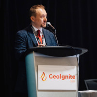
Connector and community builder and Canadian geospatial sector promoter and 5th generation entrepreneur. I’m the founder of several community-building and sector-promotion initiatives in Canada.I publish the GoGeomatics Online Magazine and the Canadian Spatial Times weekly Newsletter.www.goeomatics.caI founded the GoGeomatics Canada Network with over 4,000 members and 12 groups from coast to coast, meeting in cities like Vancouver, Victoria, Kelowna, Calgary, Edmonton, Regina, Niagara, Kitchener Waterloo, Toronto, Kingston, Ottawa, and Halifax.Much of my efforts involve either introducing companies to Canada's geospatial marketplace or helping Canadian companies raise their profiles and brand awareness internationally.It is an honour to have been inducted as a fellow of the Royal Canadian Geographical Society.I’m the chair and founder of GeoIgnite, Canada’s national leadership conference.www.geoignite.caGeoff Zeiss and I founded the SUMSF online event. In 2022, at Geoff's request, I took over publishing Between the Poles, the world's premier underground infrastructure mapping blog.https://sumsforum.com/As a geospatial career coach, I help mentor and guide the next generation of leaders in our community.https://geospatialcareercoach.com/ Through supply arrangements with the federal government of Canada, GoGeomatics can help government departments and geospatial experts meet and work together through contracting. I am the author of a career guide for international geospatial professionals seeking employment in Canada in GIS, remote sensing, surveying, geodesy, and geomatics engineering.https://canadiangeospatialcareers.com/ I'd love to work with you on your goals within the Canadian geomatics sector. Please connect with me on LinkedIn. Thanks! ~ Jonathan Murphy

Jonathan Murphy's Current Company Details
GoGeomatics

Gogeomatics

View
CEO, President and Founder of GoGeomatics Canada
Jonathan Murphy Work Experience Details
  • Gogeomatics
    Ceo, President And Founder
    Gogeomatics Jan 2024 - Present
    Ottawa, Ontario, Ca
    As Founder and CEO of GoGeomatics Canada, I am committed to nurturing the growth and evolution of Canada's geospatial community. Over the last 20 years, GoGeomatics has become the nation's leading geospatial network, hosting conferences, expos, online events, and local networking activities, all serving as a community platform for a diverse group including businesses, governments, NGOs, professionals, academics, and students. My responsibilities extend well beyond mere organizational management. I actively advocate for the geospatial sector, both domestically and internationally, while spearheading educational initiatives and fostering engagement within the community.
  • Gogeomatics
    Chair And Founder Of Canada'S Geomatics Expo
    Gogeomatics Oct 2022 - Present
    Ottawa, Ontario, Ca
    https://gogeomaticsexpo.com/Join us at the 2024 GoGeomatics Expo. Canada's national geomatics event.
  • Gogeomatics
    Managing Director
    Gogeomatics Jun 2010 - Present
    Ottawa, Ontario, Ca
    Responsible for:-Setting Strategic Direction-Writing business plans & marketing plans-Creating new Partnerships-Driving new Business-Creating Change and Innovation-Customer Focus
  • Gogeomatics
    Chair & Founder - Geoignite: Canada'S National Geospatial Conference
    Gogeomatics Jan 2019 - Present
    Ottawa, Ontario, Ca
    https://geoignite.ca/Contact me to get information about 2024
  • Gogeomatics
    Cofounder Subsurface Utility Mapping Strategy Forum (Sumsf)
    Gogeomatics Oct 2020 - Present
    Ottawa, Ontario, Ca
    Co-founder of SUMSF with Geoff Zeiss. The Subsurface Utility Mapping Strategy Forum (SUMSF), is a virtual conference that brings together individuals and organizations to share information about and contribute to improving the mapping of underground infrastructure. This is a highly specialized executive-level audience from organizations in both the private and public sector.
  • Gogeomatics
    Chair & Founder - Lidar Canex
    Gogeomatics Apr 2022 - Present
    Ottawa, Ontario, Ca
    The Lidar Canada Commercial Expo 2022 is a completely virtual B2B event matching reality capture lidar vendors with practicing 3D professionals. https://lidarcanex.com/
  • Gogeomatics
    Geospatial Career Coach
    Gogeomatics Jun 2011 - Present
    Ottawa, Ontario, Ca
    Geospatial career coach and mentor. My experience working across Canada and around the world as a GIS specialist, geomatics manager, and HR consultant is put to good use helping others reach career goals . I have been coaching graduates, professionals, and senior members of the geospatial industry for over ten years.
  • World Health Organization
    Gis Specialist
    World Health Organization Jun 2015 - Jul 2015
    Geneva 27, Ge, Ch
    - Working with ArcGisServer and ArcGIS online- Providing ad hoc GIS expertise - Being a general know it all when it comes to geomatics.
  • Gl Garrad Hassan Canada Inc.
    Gis Specialist
    Gl Garrad Hassan Canada Inc. Feb 2012 - May 2013
    • Create maps and graphs, using GIS software and data collection equipment.• Perform research to obtain and expand existing datasets• Gather and report on GIS data and determine how data sets are best utilized through GIS• Compile geographic and demographic data from many sources• Consult with external stakeholders to access censuses, fieldwork, satellite and aerial imagery, and maps• Compile data for statistics to incorporate into documents and reports• Build, manipulate, and update databases• Enter new map data using cartographic principles• Analyze and model relationships between geographic data sets• Operate and maintain GIS system hardware, software, and peripherals• Present information to clients and stakeholders in verbal or written format
  • Gmbh
    Geomatics Manager
    Gmbh Sep 2008 - May 2010
    Osnabrück, Niedersachsen, De
    As the Geomatics Manager for all operations, I was responsible for overseeing a wide range of geomatics activities, ensuring the efficient use of resources and maintaining strong client relationships. Key responsibilities included:Managed the geomatics budget, software, and data acquisition processes.Conducted GIS research, edited and created Digital Elevation Models (DEMs), and generated mosaics and site maps using datasets from various levels of government across the United States and Canada.Led fieldwork and site selection for wind farm projects.Acted as Project Manager for a variety of GIS projects, including cartography, DEM creation, GPS surveying, digital image processing, and data acquisition.Supervised external contractors and led internal teams to meet project goals.Maintained client relationships regarding geomatics services, presenting results in diverse formats such as PowerPoint presentations, maps, and posters.
  • Geocognition Consulting
    Geomatics Manager
    Geocognition Consulting Jun 2004 - Aug 2008
    - Sales Manager for all business sales since startup.- Responsible for writing proposals for government contracts and private sector contracts- Responsible for marketing and business planning.- Project Manager for GIS projects, Cartography, DEM creation, surveying, digital image processing, data acquisition and management.- Supervises other geomatics staff, programmer, remote sensing specialists, web developers, GIS developers. Management of outside contractors and team leading.- Oversees client relationships and stakeholders, presenting results in multiple formats including, power points, maps, and posters.
  • Applied Geomatics Research Group
    Research Associate
    Applied Geomatics Research Group May 2003 - May 2004
    Environmental research in Nova Scotia’s Annapolis Valley.- Management of weather stations on farms throughout the Annapolis Valley.- Data collection and analysis.- Site mapping and surveying: Lecia SR530 GPS RTK System, Lecia Total Station TCR1105, Trimble Pro XR, AG124, GPS gear - Project management of diverse deliverable for multiple private and public stakeholders.
  • Applied Geomatics Research Group
    Aerial Photographer
    Applied Geomatics Research Group May 2003 - May 2004
    High-resolution aerial photographer and mission planner.- Coordinated pilot, client, navigator and other team members to complete missions.- Experienced planning aerial photography missions from concept to polished final product handed to the client.- Digital image processing of image products to client’s specifications.- Provided professional remotely sensed images for both the private and public sector.
  • Hewlett-Packard
    Computer Support Engineer
    Hewlett-Packard Apr 2001 - Sep 2002
    Houston, Texas, Us
    - Provided Consumer level technical support for Compaq / Hewlett Packard Computers- Certified A+ support specialist- Supported both hardware & software of portable & personal computers.- Expertise in Windows XP, W2k, Win9X installation & troubleshooting.
  • The British Museum
    Web Manager
    The British Museum May 2000 - Oct 2000
    London, London, Gb
    Designed new web site developments maintaining the brand management standards within the British Museum marketing plans.- Researched wrote web site policy & standards. - Liaised with the public and other world class museums on web site development in Britain &; abroad.- Planned & implemented a web development education & training program for departments.- Supervised new projects & existing projects providing input & advice on many of the IT based applications implemented at the museum.
  • British School At Rome
    Research Assistant
    British School At Rome Apr 1999 - Oct 1999
    - Conducted research for the planning of the Mapping Rome Project & Pompeii project.- Planned, wrote & created the first web site of the British School at Rome. www.bsr.ac.uk- Field technician for data collection at Pompeii.- Conducted field research in Rome, photographed antiquities & prepared materials for presentation.- Using: ArcView, FrontPage, Dreamweaver.
  • Museums Association Of The Carribean
    Museums It Intern
    Museums Association Of The Carribean Sep 1998 - Feb 1999
    - Constructed and implemented a survey of collections of Caribbean museums for research & emergency -preparedness.- Constructed a database of collections for MAC & CAM.- Helped to coordinate & the technical aspects of the 10th annual MAC AGM.- Constructed & administered the MAC web site.- Conducted a presentation at the conference on the MAC web site & the potential to expand it & make it financially self-sufficient.- Excavated with University College London, prehistoric Amerindian site.

Jonathan Murphy Skills

Gis Cartography Gps Geomatics Software Aerial Photography Arcgis Geography Esri Spatial Analysis Spatial Databases Surveying Data Management Data Mapping Data Collection Project Planning Arcmap Mapinfo Water Remote Sensing Data Analysis Analysis Project Management Entrepreneurship Training Arcview Proposal Writing Policy Management Leadership Databases Field Work Database Admin Crm Start Ups Technical Writing Business Development Access Environmental Awareness Environmental Impact Assessment Report Writing Modeling Environmental Science Data Conversion Environmental Issues Climate Change Creative Strategy Collaborative Problem Solving Global Positioning System Geographic Information Systems

Jonathan Murphy Education Details

  • Nova Scotia Community College - Nscc
    Nova Scotia Community College - Nscc
    Geomatics Research
  • Nova Scotia Community College - Nscc
    Nova Scotia Community College - Nscc
    Gis
  • University Of Calgary
    University Of Calgary
    Archaeology
  • Bishop'S University
    Bishop'S University
    History
  • Champlain College
    Champlain College
    Liberal Arts

Frequently Asked Questions about Jonathan Murphy

What company does Jonathan Murphy work for?

Jonathan Murphy works for Gogeomatics

What is Jonathan Murphy's role at the current company?

Jonathan Murphy's current role is CEO, President and Founder of GoGeomatics Canada.

What is Jonathan Murphy's email address?

Jonathan Murphy's email address is jm****@****ics.net

What schools did Jonathan Murphy attend?

Jonathan Murphy attended Nova Scotia Community College - Nscc, Nova Scotia Community College - Nscc, University Of Calgary, Bishop's University, Champlain College.

What are some of Jonathan Murphy's interests?

Jonathan Murphy has interest in Conferences, Gis, Remote Sensing, Professional Associations, Educación, Infancia, Human Resources, Geomatics, Recruiting, Seminars.

What skills is Jonathan Murphy known for?

Jonathan Murphy has skills like Gis, Cartography, Gps, Geomatics, Software, Aerial Photography, Arcgis, Geography, Esri, Spatial Analysis, Spatial Databases, Surveying.

Free Chrome Extension

Find emails, phones & company data instantly

Find verified emails from LinkedIn profiles
Get direct phone numbers & mobile contacts
Access company data & employee information
Works directly on LinkedIn - no copy/paste needed
Get Chrome Extension - Free

Aero Online

Your AI prospecting assistant

Download 750 million emails and 100 million phone numbers

Access emails and phone numbers of over 750 million business users. Instantly download verified profiles using 20+ filters, including location, job title, company, function, and industry.