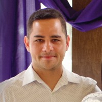
AeroLeads people directory · profile
Joshua Flickinger Email & Phone Number
Fire GIS Specialist
at
National Park Service
1 work email found
@nps.gov
1 phone found area 804
LinkedIn matched
✓ Verified August 2026
4 data sources
Profile completeness 100%
Current company
Role
Fire GIS Specialist
Location
Three Rivers, California, United States
Who is Joshua Flickinger? Overview
A concise factual answer block for searchers comparing this professional profile.
Quick answer
Joshua Flickinger is listed as Fire GIS Specialist at National Park Service, based in Three Rivers, California, United States. AeroLeads shows a work email signal at nps.gov, phone signal with area code 804, and a matched LinkedIn profile for Joshua Flickinger.
Joshua Flickinger previously worked as Cartographer at National Park Service and Graduate Student Instructor for GIS at University Of Michigan. Joshua Flickinger holds Master Of Science (Ms), Conservation Ecology, Environmental Informatics from University Of Michigan.
Company email context
Email format at National Park Service
This section adds company-level context without repeating Joshua Flickinger's masked contact details.
{first}_{last}@nps.gov
86% confidence
AeroLeads found 1 current-domain work email signal for Joshua Flickinger. Compare company email patterns before reaching out.
Profile bio
About Joshua Flickinger
I'm currently a GIS Specialist (read cartographer and data manager) with the National Park Service, working for the Fire Program at Sequoia and Kings Canyon NP. My projects typically involve wildfire and forest resilience - especially with regard to Giant Sequoias. I also dabble in programming, data analysis, web-mapping, and flying uncrewed aerial systems.
Listed skills include Geographic Information Systems, Arcgis, R, Spatial Analysis, and 24 others.
Current workplace
Joshua Flickinger's current company
Company context helps verify the profile and gives searchers a useful next step.
10 roles
Joshua Flickinger work experience
A career timeline built from the work history available for this profile.
Fire Gis Specialist
My primary responsibility is providing map and GIS support for the Sequoia and Kings Canyon Fire Program. This includes maintaining fire-related GIS data layers, providing maps and analyses to support fire planning, and mapping wildfires when they occur.
Cartographer
My primary projects were the creation of ESRI story maps, including story maps on soundscapes, forest vulnerability, and fire history. For these projects I managed geospatial data, wrote FGDC compliant metadata, managed and edited multimedia, performed quality control and quality assurance, published feature services to ArcGIS Online, created offline-ready html-based apps, wrote scripts to automate tasks, reviewed collaborator deliverables, created ESRI ArcGIS Online maps and apps, wrote articles for NPS newsletters, gave talks and presentations, and developed content for visitor centers.I built web maps using NPMap Builder (an internal NPS web mapping application) and authored paper maps for various park service divisions including resources management, interpretation, maintenance, and concessions. These maps informed resource management planning, were included in grant applications, used in project planning, and sometimes consumed by the public.I built digital data collection systems using Collector for ArcGIS and Survey123. I used these systems in the field to collect raw geospatial data (e.g. hazard tree data collection) and edited these data sets for inclusion in the parks' enterprise geodatabases.I provided GIS and data management support for other park divisions and programs including forestry, maintenance, and compliance offices. This included maintaining and updating spatial and tabular databases, as well as providing informal GIS training to other local GIS users.I crosstrained with the physical sciences branch, participating in field work for air quality monitoring, water quality monitoring, soundscape monitoring, and snow surveying. Fieldwork ranged from day trips in front-country sites to week-long backpacking trips
Apr 2018 - Oct 2022

Graduate Student Instructor For Gis
I facilitated lab learning for ~80 students (over two semesters) in a graduate level ‘Principles of GIS’ class in the University of Michigan's School of Natural Resources and Environment. For the lab, I reviewed lecture concepts, graded assignments, provided feedback on work, and performed GIS troubleshooting.This position required a moderate to high mastery of ArcGIS for Desktop in topics including geospatial data structures, data/metadata management and curation, projections, cartography, geoprocessing, spatial analyst, 3D analyst, and model builder. It also required good time management and interpersonal skills.
Sep 2016 - May 2017
Master'S Project
For a project designed to serve as a thesis, I planned, organized, and completed habitat mapping and an ecological inventory for a preserve in Homer, AK, as part of a 5-member team. I was primarily responsible for geospatial product delivery and map production, which included GPS data collection, geodatabase creation, aerial image interpretation, digitization of data, and spatial analysis. This position included a month of fieldwork conducting vegetation and wildlife surveys, workplan and budget management, and report writing.
Jan 2016 - Apr 2017
Graduate Student Property Caretaker
For a University of Michigan golf course, I was responsible for property maintenance and implementation of an environmental stewardship plan. As a main project, I created a story map (online web mapping application), gaining experience with ESRI’s online platforms for GIS data storage and presentation.
Aug 2015 - Apr 2017
Gis Research Assistant
As a research assistant in the Environmental Spatial Analysis Lab, I balanced several spatial analysis projects being conducted by researchers and managers at UM's School of Natural Resources and Environment.This position included learning and using ArcGIS Pro, ESRI's next-generation GIS software.
May 2016 - Aug 2016

Communications Research Assistant
For a work-study position in the MI Sea Grant communications department, I reviewed and updated factsheets and web pages about Great Lakes ecology and economics. In this role, I gained experience researching and synthesizing information relevant to the role of the organization and collaborating with coworkers to produce deliverables.
Sep 2015 - Apr 2016

Operations Associate
I worked for a non-profit organization dedicated to food security, working in nearly all roles related to logistics. In the course of weekly collection and distribution of food, I supervised volunteer groups ranging in size from 2 to 20 people and maintained positive relationships with donors and partners.
Jan 2015 - Aug 2015

Coastal Resource Management Volunteer
I managed coastal and environmental resources in partnership with a Philippine local government office. This included:• conducting biophysical assessments of 27 hectares of mangrove forests and 50+ hectares of coral reefs, mapping marine protected areas with GPS, installing demarcation buoys, conducting coastal clean-ups. • drafting environmental profiles, management plans, and local-level ordinances.• organizing a fisherfolk registration and licensing campaign in which over 1,100 fisherfolk were registered.• writing and managing a successful USAID sponsored grant for $3,500 to train Romblon provincial government offices in reef assessment techniques.• planning multiple secondary projects including an agriculture summer youth camp, a back-yard gardening and vermiculture project, and the documenting and mapping of trails in Mt. Guiting-Guiting Natural Park.
Jul 2012 - Sep 2014
2 education records
Joshua Flickinger education
Master Of Science (Ms), Conservation Ecology, Environmental Informatics

Bachelor Of Science (Bs), Biological/Biosystems Engineering
FAQ
Frequently asked questions about Joshua Flickinger
Quick answers generated from the profile data available on this page.
What company does Joshua Flickinger work for?
Joshua Flickinger works for National Park Service.
What is Joshua Flickinger's role at National Park Service?
Joshua Flickinger is listed as Fire GIS Specialist at National Park Service.
What is Joshua Flickinger's email address?
AeroLeads has found 1 work email signal at @nps.gov for Joshua Flickinger at National Park Service.
What is Joshua Flickinger's phone number?
AeroLeads has found 1 phone signal(s) with area code 804 for Joshua Flickinger at National Park Service.
Where is Joshua Flickinger based?
Joshua Flickinger is based in Three Rivers, California, United States while working with National Park Service.
What companies has Joshua Flickinger worked for?
Joshua Flickinger has worked for National Park Service, University Of Michigan, Michigan Sea Grant, Healthy Harvest Food Bank, and Us Peace Corps.
How can I contact Joshua Flickinger?
You can use AeroLeads to view verified contact signals for Joshua Flickinger at National Park Service, including work email, phone, and LinkedIn data when available.
What schools did Joshua Flickinger attend?
Joshua Flickinger holds Master Of Science (Ms), Conservation Ecology, Environmental Informatics from University Of Michigan.
What skills is Joshua Flickinger known for?
Joshua Flickinger is listed with skills including Geographic Information Systems, Arcgis, R, Spatial Analysis, Gis, Ecological Modeling, Remote Sensing, and Python.
Find 750M verified contacts
Search by job title, company, industry, location, and seniority. Export verified B2B contact data when you need it.
Start free trialPeople with similar names
Check these profiles if this is not the Joshua Flickinger you were looking for.
View similar profiles