Sr Gis And Remote Sensing Specialist
Acts
Please complete the CAPTCHA to continue
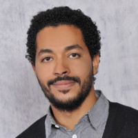
A concise factual answer block for searchers comparing this professional profile.
Mahmoud Abusalim is listed as Sr GIS and Remote Sensing Specialist at ACTS, based in Riyadh, Saudi Arabia. AeroLeads shows a matched LinkedIn profile for Mahmoud Abusalim.
Mahmoud Abusalim previously worked as Sr GIS & Remote Sensing Specialist at Geo & Innovation and Master Thesis Project at University Of Florida. Mahmoud Abusalim holds Master Of Science - Ms, Spatial Information Management from Fachhochschule Kärnten.
Skilled in Geographical Information Systems (GIS), Surveying, Landscaping Analysis & Image Processing (RS).
Company context helps verify the profile and gives searchers a useful next step.
A career timeline built from the work history available for this profile.
Cairo, Cairo Governorate, Eg

Khartoum, Khartoum State, Sudan
• Led and supervised GIS & data collection teams, ensuring project goals and deadlines were met.• Developed standardized database templates for seamless data integration from diverse sources• Transformed raw GIS and Remote Sensing data into insightful visualizations for informed decision-making• Supported the planning & development team by analyzing geospatial data to identify trends and inform decision-making.• Developed, tested, and maintained end-user map products.• Diagnosed and resolved complex GIS application and data issues.• Identified new GIS technologies and the benefits of integrating them.

Fort Lauderdale, Florida, United States
Conducting research on Marshallplan project titled “Accuracy and Effectiveness of GTFS Transit Feeds for Trip Planning in Public Transit Networks".

Medina, Saudi Arabia
• Guided and mentored undergraduate students in completing successful graduation projects, fostering critical thinking and research skills.• Provided theoretical & practical training in GIS & Remote Sensing techniques.• Equipped students with practical skills in operating land surveying equipment (GPS, Total Station & Digital Level).• Promoted student success in [GIS, Remote Sensing, Land Surveying & Photogrammetry] through dedicated teaching and active participation in the institute community.
Tabuk Governorate, Saudi Arabia
• Identified and addressed engineering problems through comprehensive data collection and analysis• Conducted high-precision detailed and topographic surveys to generate accurate maps• Utilized project management and engineering skills to plan, design, and execute installation projects.

Tabuk Governorate, Saudi Arabia
• Established and calculated high-precision geodetic networks.• Produced high-precision maps using traditional survey methods and advanced CAD software.• Empowered project teams through technical guidance and support.• Implemented and maintained robust quality control and quality assurance procedures to ensure data accuracy and project success.
Tabuk Governorate, Saudi Arabia
• Established and rigorously calculated high-precision geodetic networks for accurate positioning and mapping projects.• Conducted comprehensive property surveys, including topographic surveys and precise grid leveling, ensuring accurate data collection.• Planned, coordinated, and monitored workflows to meet deadlines and maintain quality standards.• Generated comprehensive progress and final reports detailing project implementation.

Thesis: Accuracy and Effectiveness of GTFS Transit Feeds for Trip Planning in Public Transit Networks

Thesis: Bridge Motion Monitoring Using (RTK GPS)
Quick answers generated from the profile data available on this page.
Mahmoud Abusalim works for ACTS.
Mahmoud Abusalim is listed as Sr GIS and Remote Sensing Specialist at ACTS.
Mahmoud Abusalim is based in Riyadh, Saudi Arabia while working with ACTS.
Mahmoud Abusalim has worked for Acts, Geo & Innovation, University Of Florida, Taiba Institute, and Al-Mandaryah Contracting Company.
You can use AeroLeads to view verified contact signals for Mahmoud Abusalim at ACTS, including work email, phone, and LinkedIn data when available.
Mahmoud Abusalim holds Master Of Science - Ms, Spatial Information Management from Fachhochschule Kärnten.
Search by job title, company, industry, location, and seniority. Export verified B2B contact data when you need it.
Start free trial Search contactsCheck these profiles if this is not the Mahmoud Abusalim you were looking for.
View similar profiles