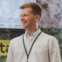
Senior Consultant
Current• Currently deployed within the Critical National Infrastructure sector in Professional Services, specialising in Utilities projects with a focus on the implementation of the ArcGIS Utility Network and UNE for ArcGIS.
Please complete the CAPTCHA to continue
A concise factual answer block for searchers comparing this professional profile.
Matt Mccready is listed as Senior Consultant at Esri UK, a with 293 employees, based in Folkestone, England, United Kingdom. AeroLeads shows a matched LinkedIn profile for Matt Mccready.
Matt Mccready previously worked as GIS Consultant at Esri Uk and GIS Data Analyst at Canterbury City Council. Matt Mccready holds Msc Geographical Information Systems, Distinction from University Of Portsmouth.
This section adds company-level context without repeating Matt Mccready's masked contact details.
Review company-level records connected to Matt Mccready before choosing the right outreach path.
Senior Geographical Information Systems (GIS) Consultant with eight years’ commercial experience in the GIS industry in both the public and private sectors, with an additional two years’ academic GIS experience through undergraduate and postgraduate study. Originally from Belfast, now based in Kent.Currently deployed within the Critical National Infrastructure sector in Professional Services at Esri UK, specialising in Utilities projects with a focus on the implementation of the ArcGIS Utility Network and UNE for ArcGIS.Extensive experience with Esri ArcGIS products; ArcMap, ArcGIS; Pro, Online, Server, Enterprise Portal, Web AppBuilder (Dev Ed.), Field Maps, Survey123, Utility Network and UNE.Nov 2020; passed ILM L3 Diploma in Leadership and Management with distinction.2019 and 2020 winner of GeoPlace Gold Performance Award and 2018 Gold Achievement Award for Data Quality and Improvement of Address Data.2016 winner of the Ordnance Survey MSc Dissertation Programme Award with sponsorship funding.Practical experience in topographic land surveying using Theodolites, Real-Time Kinematic GPS, Ground Penetrating Radar and Terrestrial Laser Scanning/LiDAR capture using Leica MultiStation technology.Additional experience in management; currently managing a team of consultants at Esri UK and was formerly a branch manager sales consultant in Australia during a two-year working holiday period of independent travel. Competent in conversational German.Passionate about travel, the outdoors, motorsport and scuba diving.
Listed skills include Gis, Geographic Information Science, Customer Service, Research, and 43 others.

Company context helps verify the profile and gives searchers a useful next step.
A career timeline built from the work history available for this profile.
• Currently deployed within the Critical National Infrastructure sector in Professional Services, specialising in Utilities projects with a focus on the implementation of the ArcGIS Utility Network and UNE for ArcGIS.
Canterbury, United Kingdom
• Product owner for the council’s corporate GIS system (Digital Transformation team)• GIS specialist and system admin for Esri software across the site; ArcGIS Server, Online and Enterprise Portal• Authority Address Custodian for the district; managed the Local Land and Property Gazetteer (LLPG)• Applied FME and Model Builder in the automation of complex data manipulation processes and scheduling corporate data update scripts; FME Server• Deployed GIS and FME workflows for emergency planning; streamlining the provision and delivery of critical services to those who needed it most during the COVID-19 crisis; network analysis, spatial analysis, developed interactive web apps/dashboards to support secure data sharing, querying and visualisation on the fly
East Kent
• Supported partnership-wide implementation of the ArcGIS platform, saving our partners time, money and resource in their day-to-day tasks• Utilised ArcGIS Online and the Enterprise Portal in publishing story maps, sharing data across the organisation and creating web applications in Web AppBuilder (Dev. Ed.), enabling internal departments to view and interact with spatial data securely in real-time as it is collected by visiting officers/contractors on site using Collector and Survey123 mobile apps• Built and published external web mapping applications, adding value to spatial data by enabling the public to search, visualise and interact with multiple layers of data simultaneously, e.g. Local Plan policies and 'Find my nearest...'• Provided professional GIS support and Local Land and Property Gazetteer maintenance services to Canterbury City Council, Dover District Council and Thanet District Council in compliance with the national addressing standard, BS7666• Led GIS workshops to advise on best working practices within the ArcGIS platform• SQL database management within the Esri suite; ArcCatalog for data loading, extraction, cleansing, versioning, user privileges and general geodatabase maintenance• Widespread use of Ordnance Survey products through the Public Sector Mapping/Geospatial Agreement• 2019 Winner of GeoPlace Gold Performance Award and 2018 Winner of GeoPlace Gold Achievement Award for Data Quality and Improvement of Address Data in my role as Custodian for Canterbury City Council's Local Land & Property Gazetteer
Wimborne Minster, Dorset, United Kingdom
6 month contract working within Savills' Strategic Projects Division's GIS team specialising in energy and infrastructure projects• Extensive use of Esri ArcMap 10.4-10.5, ArcGIS Pro, QGIS, iShareGIS, Global Mapper, PostgreSQL/PostGIS• Developed a bespoke methodology; strategic land searching for sites of potential development through data capture, data transformation (FME), geospatial analyses, map algebra, raster calculator and map production• Multi-criteria constraint mapping based on national and international environmental and cultural designations • End-to-end web mapping through ‘iShareGIS’ (ASTUN Technology), driven by data views created and stored in a PostgreSQL/PostGIS database schema – extensive use of SQL scripting for database management• Produced map output and site plans for Savills’ Planning, Development and Corporate Real Estate teams e.g. Land Registry Title asset management for the UK Water Industry• Extracted data from Ordnance Survey products; VectorMap Local, VectorMap District, Terrain 5, Code-Point• Interoperability; geo-coding of gazetteer data from Excel files (.CSV) for use within GIS software
Portsmouth, United Kingdom
• Part-time job alongside Master's Degree• Time management and planning; balanced work hours with full time studies• Responsible for company van, compiling client orders and carrying out weekly wine deliveries to greater Portsmouth/Gosport area working efficiently to self-planned routes/schedules• Additional experience gained in food hygiene, product sampling, health and safety and first aid in the workplace
Worldwide
Australia, Thailand, Indonesia, Singapore, Fiji, New Caledonia, VanuatuJune - September 2013 | Regional farm-work completed in Outback Australia (blueberry and cucumber picking)
Airlie Beach, Queensland, Australia
• Managed staff rotas, recruitment, new starter training, provision of promotional material• Liaised with suppliers and operators to negotiate net rates for new and existing products as well as independent advertisers to establish kickback contracts, fostering positive professional working relationships• Exceeded weekly and monthly sales targets through extensive networking and positive word of mouth sales• Utilised German language skills; greater volume of successful sales executed with high profit percentage rates to German customers under my management
Perth, Western Australia
• Developed and applied sales techniques selling tailored global travel solutions to local and international customers• Learned and adapted to new software packages (TDMS) and advanced international booking systems
Cairns, Queensland, Australia
• Gained extensive knowledge regarding the geography, geology, demographics and flora and fauna of Australia, New Zealand, Fiji, Thailand and Indonesia
Fitzwilliam College
• Part-time work to fund move to Australia• Provided silver service catering for academics and fellows of the University of Cambridge• Chosen as part of a select team to work at private functions at the Master's residence• Fast-paced environment under pressure• Team work
Coleraine, Northern Ireland
• Part-time job alongside Bachelor's Degree• Time management and planning; balanced work hours with full time studies• Managed stock rotation and keg storage facilities• Maintained bar hygiene, dealt with customer complaints and secured and locked the premises
Europe
Germany, Austria, Netherlands, Norway, Croatia
Other employees you can reach at esriuk.com. View company contacts for 293 employees →
Divanshu Malhotra, Ccsm, Csm®,Itil®
Colleague at Esri UkManchester, England, United Kingdom
View →
AD
Abhishek Dashpute
Colleague at Esri UkAylesbury, England, United Kingdom
View →
BS
Bhumika Suthar
Colleague at Esri UkLondon, England, United Kingdom
View →
IB
Ilyes Bougouffa
Colleague at Esri UkLeeds, England, United Kingdom
View →
LP
Lai-Sun Pang
Colleague at Esri UkLondon, England, United Kingdom
View →
LS
Laurie Stevens
Colleague at Esri UkGreater Oxford Area, United Kingdom
View →
JK
Joseph Kennelly
Colleague at Esri UkEdinburgh, Scotland, United Kingdom
View →
OM
Olivia Mitchell
Colleague at Esri UkCheltenham, England, United Kingdom
View →
RS
Ross Strachan
Colleague at Esri UkMotherwell, Scotland, United Kingdom
View →
DR
David Rix
Colleague at Esri UkFayence, Provence-Alpes-Côte D'Azur, France
View →
• Applied GIS and Remote Sensing | GIS and Database Management Systems | Modelling, Analysis and the Web | Principles of GI Science |.
Activities and Societies: UUC Shotokan KarateAdvanced GIS | Satellite Remote Sensing | Earth and Environmental Science | German Language.
ERASMUS Study Placement Year Abroad | Gießen, Germany Studied Geography Modules in German: • Bewertungs und Entscheidungsmethodik.
Activities and Societies: German Exchange Programme (1 week in Bavaria | 1 week in Northern Ireland), School Orchestra - Trumpet3 A-Levels
Activities and Societies: Football | School Orchestra - Trumpet10 GCSEs | A-B
Quick answers generated from the profile data available on this page.
Matt Mccready works for Esri UK.
Matt Mccready is listed as Senior Consultant at Esri UK.
Matt Mccready is based in Folkestone, England, United Kingdom while working with Esri UK.
Matt Mccready has worked for Esri Uk, Canterbury City Council, Ek Services, Savills, and Camber Wines | Abarbistro.
Matt Mccready's colleagues at Esri UK include Divanshu Malhotra, Ccsm, Csm®,Itil®, Abhishek Dashpute, Bhumika Suthar, Ilyes Bougouffa, and Lai-Sun Pang.
You can use AeroLeads to view verified contact signals for Matt Mccready at Esri UK, including work email, phone, and LinkedIn data when available.
Matt Mccready holds Msc Geographical Information Systems, Distinction from University Of Portsmouth.
Matt Mccready is listed with skills including Gis, Geographic Information Science, Customer Service, Research, Arcmap, Geography, Teamwork, and Microsoft Office.
Search by job title, company, industry, location, and seniority. Export verified B2B contact data when you need it.
Start free trial Search contactsCheck these profiles if this is not the Matt Mccready you were looking for.
View similar profiles