
Gis Guy
Current
Apr 2019 - Present
Please complete the CAPTCHA to continue
@asetpartners.com
✓
LinkedIn matched
A concise factual answer block for searchers comparing this professional profile.
Max Squires is listed as gis guy at ASET Partners, based in Bunker Hill, West Virginia, United States. AeroLeads shows a work email signal at asetpartners.com and a matched LinkedIn profile for Max Squires.
Max Squires previously worked as GIS Specialist - Application Engineer at Aset Partners and full stack developer at Synergybis. Max Squires holds Masters; B.S, Business Administration from Shepherd University.
This section adds company-level context without repeating Max Squires's masked contact details.
AeroLeads found 1 current-domain work email signal for Max Squires. Compare company email patterns before reaching out.
Specialties: SQL Server, Visual Studio, C#, ASP, javascript, ArcGIS Server, ArcGIS Desktop,Python, PowerShell, Portal for ArcGIS, terraform, aws, cloud infrastructure, dhs, automation
Listed skills include .Net, Gis, Arcgis, Esri, and 38 others.
Company context helps verify the profile and gives searchers a useful next step.
A career timeline built from the work history available for this profile.
Baltimore, Md, Us
working with amazons gov cloud (aws) and terraform to stand up a gis environment for risk management for the federal government with arcgis server, portal, monitor, insights, data store, postgresql, docker, python, powershell, user_data, and javascript api

Mclean, Va, Us
ASP.net, C#, javascript, SQL, IIS, VB, and some Java

Falls Church, Virginia, Us
worked as lead developer, orchestrating a major upgrade of an enterprise-wide asp.net architecture management system.
Falls Church, Virginia, Us
developed geoprocessing, map, globe, and web services,

Chantilly, Virginia, Us
Developed Requirements and prototype for GIS component of Department of Justice Bureau of Alcohol Tobacco and Firearms eTrace 5.0 system using ArcGIS and the Flex Builder SDK.
Washington, Dc, Us
Developed maps and tools for use by the US Coast Guard Enterprise Geographic Information System.Design maps and knowledge for end users to consume through ArcGIS Explorer. Monitor and rewrite Electronic Code of Federal Regulations on Coast Guard Jurisdictions. Manage NOAA Navigational Charts to maintain current versions in a cached tiling structure across 487 logical disks. Provide support material for natural disasters through information technology. Act as an administrator for the Enterprise License Agreement between the Coast Guard (DHS) and ESRI. Work on projects with National Geospatial-Intelligence Agency NIPRNET data-sharing efforts, Long Range Identification and Tracking (LRIT) data creation, Integrated Aids to Navigation System (IATONIS) buoy identification, Marine Information Safety and Law Enforcement (MISLE) activities and facilities heat density maps, Nationwide Automatic Identification System (NAIS) coverage areas, Search and Rescue Optimal Planning System (SAROPS) map services, Watchkeeper map services, Business Intelligence (CGBI) spatial statistics, and other Coast Guard customers to enhance their GIS experience.;
Washington, D.C., Us
Created a viewshed of the entire Appalachian Trail by organizing access to the National Conservation Training Center's Computer Labs and logging over 25,000 hours in processing time in ArcGIS Desktop. Developed resource and endangered species model areas on or around Appalachian Trail to be targeted as protected areas for planning purposes.
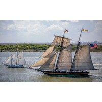
Managed a crew of scouts in the operation, maintenance, and navigation of a 77' gaff-rigged topsail schooner.
Quick answers generated from the profile data available on this page.
Max Squires works for ASET Partners.
Max Squires is listed as gis guy at ASET Partners.
AeroLeads has found 1 work email signal at @asetpartners.com for Max Squires at ASET Partners.
Max Squires is based in Bunker Hill, West Virginia, United States while working with ASET Partners.
Max Squires has worked for Aset Partners, Synergybis, Dmi (Digital Management, Llc), General Dynamics Information Technology, and Citizant.
You can use AeroLeads to view verified contact signals for Max Squires at ASET Partners, including work email, phone, and LinkedIn data when available.
Max Squires holds Masters; B.S, Business Administration from Shepherd University.
Max Squires is listed with skills including .Net, Gis, Arcgis, Esri, Arcgis Server, Spatial Analysis, Python, and Microsoft Sql Server.
Search by job title, company, industry, location, and seniority. Export verified B2B contact data when you need it.
Start free trial Search contacts