Marine Gis Consultant
Self-Employed
Please complete the CAPTCHA to continue
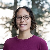
@usgs.gov
✓
LinkedIn matched
A concise factual answer block for searchers comparing this professional profile.
Monica Moritsch is listed as Marine GIS Consultant at Self-employed, based in Santa Cruz, California, United States. AeroLeads shows a work email signal at usgs.gov and a matched LinkedIn profile for Monica Moritsch.
Monica Moritsch previously worked as Senior Associate, Coastal Wetlands and Greenhouse Gas Inventories at Silvestrum Climate Associates and Geographic Information Systems Consultant at Self-Employed. Monica Moritsch holds Doctor Of Philosophy (Phd), Ecology And Evolutionary Biology from University Of California, Santa Cruz.
This section adds company-level context without repeating Monica Moritsch's masked contact details.
AeroLeads found 2 current-domain work email signals for Monica Moritsch. Compare company email patterns before reaching out.
Ecologist with strong interest in applying scientific information to support sustainability and conservation. Background in communicating details of scientific studies to interdisciplinary teams. Expert in GIS and environmental research, specializing in ecology of marine and coastal ecosystems.
Listed skills include Science, Marine Biology, Environmental Science, Gis, and 5 others.
Company context helps verify the profile and gives searchers a useful next step.

A career timeline built from the work history available for this profile.
Santa Cruz, Ca, Us
Sausalito, California, United States
- Conducts greenhouse gas inventories for coastal wetlands to support ecosystem restoration and climate policy- Analyzes land use/land cover data for coastal change- Improves function of blue carbon accounting tools to reduce time required for feasibility assessments- Updates scientific guidance for carbon offset calculations in wetlands
Santa Cruz, California, United States
- Maps changes in species distribution under sea level rise using ArcGIS and R- Models seagrass carbon sequestration using R for multiple restoration and loss scenarios- Analyzes accuracy of remote sensing data products for habitat mapping- Creates publication-quality maps and figures for reports- Conducts training sessions for the InVEST Coastal Vulnerability and Blue Carbon models- Advises clients on running ecosystem services models, obtaining data, and interpreting outputs

San Francisco Bay Area
Coordinated EDF Innovation Fund collaboration to build low-cost, portable methane and carbon dioxide sensors to lower financial and logistical barriers to emissions Monitoring, Reporting, and VerificationConducted drone flights of mangrove restoration sites and created multispectral orthomosaicsDeveloped custom spatial analysis tools and user manuals to evaluate aquaculture suitability for ArcGIS and RAnalyzed GHG emissions from bottom trawling by combining data from diverse online databases and adapting existing models to answer new questionsDesigned a multi-dose experiment to measure greenhouse gas emissions reduction from applying seaweed biostimulants to agricultural soils as substitute for conventional fertilizerLed writing of 2 scientific manuscripts for peer-reviewed journals, co-authored 1 published journal article, and co-authored 2 EDF reports on blue carbonCommunicated research findings through conference presentations, blog posts, and interviews

Mountain View, California, United States
Modeled changes to wetland ecosystem services due to climate and sea level rise impacts using GIS and soil process modelsMapped resilience of coral reefs in American Samoa and Guam by creating new metrics leveraging existing environmental dataLead field surveys in tidal ecosystemsPresented technical details of blue carbon research to state, federal, and tribal partnersLeads research on resilience of estuaries to sea level rise to support climate adaptation planning of a National Wildlife Refuge, modeling landscape-scale outcomes of management interventions using RCreated new approaches to measure coral reef resilience in Guam and American SamoaPresented technical details of blue carbon research to state, federal, and tribal partnersCreated ESRI Story Map with over 300 location-specific visualizations of future bird habitat across 5 climate and flooding scenariosWrote and reviewed 3 to 7 grant proposals and scientific manuscripts annually on topics of coastal adaptation, sea level rise impacts, ecosystem services, co-benefits, and climate resilience
Victoria, Australia
Created spatial models of coastal carbon sequestration scenarios and economic value to inform the Australian government’s carbon credit policyTrained researchers and non-profit partners how to use InVEST Blue Carbon and Coastal Vulnerability models by teaching 2 hands-on workshops with up to 25 people and writing 4 manualsProduced spatial data layers and metadata for The Nature Conservancy's Mapping Ocean Wealth platform
Stanford, Ca
Synthesized Ocean Tipping Points data on fishing pressure and environmental conditions in ArcGIS to inform spatial designs of coral bleaching recovery plans for Hawaiʻi Division of Aquatic ResourcesCommunicated scientific concepts to interdisciplinary team of environmental lawyers, marine scientists, policy experts, and software developersCreated 4 training manuals for interpreting spatial data in web maps, Google Earth, ArcMap, and ArcPro, tailoring content for multiple levels of experience and technology accessModeled co-benefits of coastal protection and “blue” carbon sequestration using InVEST and ArcGISPerformed risk assessment for marine polar species using the Habitat Risk Assessment frameworkPrepared public outreach materials, web maps, scientific reports, scientific publications, and presentations
Santa Cruz, California
Designed, found funding for, managed, and published 4 progressively complex research projectsLed 4 years of intertidal field surveys in California and Oregon to monitor Sea Star Wasting Disease, sea star losses, and related food web impactsSurveyed beach visitors on awareness of marine reserve locations, fishing restrictions, and visitor behavior inside reservesCommunicated research via fact sheets, California State Park meetings, Monterey Bay National Marine Sanctuary Advisory Council meetings, conferences, TV news interviews, and social mediaModeled disease risk in ArcGIS and R using data on environmental and anthropogenic conditions Trained undergraduates to conduct biological and social science surveys
Critiqued 3 to 9 undergraduate interns per year in writing skills by providing feedback on concept synthesis assignments and scientific writingMentored interns on data collection, analyses, and presentations for independent research projects
Stanford, Ca
Analyzed physical and biological data in ArcGIS to inform spatial design of Hawaiian coral reef recovery plans at 5 management-relevant scalesCoordinated spatial analysis tasks over in-person and remote meetings with small group of collaborators in Hawaiian government agencies and universities Standardized data and methods documentation for digital archive and online viewing platformsWrote and tested ArcGIS training modules to educate resource managers how to use data productsModeled carbon storage potential of coastal habitats using InVEST and ArcGIS. This work informed resource managers how coastal habitats can be conserved or restored to help achieve goals of California's evolving carbon sequestration policies.

Uc Santa Cruz
Planned professional development, networking, and skill-building events in teams of 2 to 6 individualsEvaluated success of event goals and integrated feedback into future eventsWrote 2 grants for new funding sources for Diversity, Equity, and Inclusion eventsFacilitated networking activities among UC Santa Cruz graduate students across 4 departmentsOrganized abstract selection, exposition tables, event promotion, citizen science discussion panel, and graphic design breakout session for approximately 80 attendees of the 2016 and 2017 Oceans ColloquiumLed Colloquium’s keynote speaker search for professional with career at the science-policy interface
Stanford, Ca
Quantified role of California coastal habitats in reducing sea level rise flooding and storing carbon using InVEST tool suite and ArcGIS modelingMapped California’s infrastructure and populations at risk of flooding for decision support toolsForged partnership with InVEST software developers to troubleshoot new GIS modeling toolsCommunicated results to coastal planners in 2 written reports and 2 meetings with Bay Area agenciesDesigned briefing fact sheets for potential research funders with Adobe InDesign
Graduation with Highest Honors, College of Natural Resources Dean's List, College of Natural Resources Junior Merit Scholar, Institute.
Quick answers generated from the profile data available on this page.
Monica Moritsch works for Self-employed.
Monica Moritsch is listed as Marine GIS Consultant at Self-employed.
AeroLeads has found 2 work email signals at @usgs.gov for Monica Moritsch at Self-employed.
Monica Moritsch is based in Santa Cruz, California, United States while working with Self-employed.
Monica Moritsch has worked for Self-Employed, Silvestrum Climate Associates, Environmental Defense Fund, U.S. Geological Survey (Usgs), and Deakin University And University Of California Santa Cruz.
You can use AeroLeads to view verified contact signals for Monica Moritsch at Self-employed, including work email, phone, and LinkedIn data when available.
Monica Moritsch holds Doctor Of Philosophy (Phd), Ecology And Evolutionary Biology from University Of California, Santa Cruz.
Monica Moritsch is listed with skills including Science, Marine Biology, Environmental Science, Gis, Scuba Diving, Experimental Design, Field Sampling, and Gis Applications.
Search by job title, company, industry, location, and seniority. Export verified B2B contact data when you need it.
Start free trial Search contacts