Nathan Nelson Email and Phone Number
Nathan Nelson work email
- Valid
Nathan Nelson personal email
- Valid
I am a geomorphologist currently specializing in road-related geomorphic impacts on watersheds and aquatic ecosystems, including modeling road-related risks for prioritization, treatment effectiveness, and projected treatment effects. I've completed GRAIP_Lite modeling efforts for the Northwest Forest Plan's AREMP reports and in support of the nation-wide Watershed Condition Classification work that is currently ongoing. I've studied the effectiveness of road decommissioning as part of monitoring efforts tied to the Legacy Roads and Trails Program. I have enjoyed seeing the science I have done being taken up to improve the stewardship of public lands.My Master's degree included research into geomorphic responses to wildfire and their relationships with climate, fire intensity, and vegetation changes over the last 8,000 years. I am familiar with radiocarbon and OSL (optically stimulated luminescence) dating methods, and methods used for reconstructing climate indices.Prior to studying at Boise State, I worked at a small environmental firm out of Grandville, Michigan, after obtaining my Bachelor's degree in Geology. The company specialized in leaking tanks at gas stations and truck stops across Michigan, Indiana, Illinois, and Ohio, including soil and groundwater remediation using SVE (Soil Vapor Extraction) and oxygen injection techniques, as well as pump and treat methods.
-
Geographic Information Systems TechnicianHighway District No. 4 Sep 2024 - PresentCaldwell, Idaho, United StatesChief mapmaker... More to come as I settle in, but will include storm water analysis
-
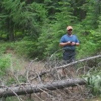
 GeologistRocky Mountain Research Station, Usfs Apr 2015 - Mar 2024Boise, Idaho AreaContinued development of GRAIP_Lite model in ArcGIS Desktop and ArcGIS ProTrained Forest Service personnel and other partners in the use of GRAIP_LiteServing as technical support for GRAIP_Lite users across the Forest Service and from other agencies or consulting firmsProviding GRAIP_Lite modeling and support for watershed condition assessments across the United States, including the WCATT National GRAIP_Lite runs for road and trail networksCompleted GRAIP_Lite modeling in support of AREMP and the Northwest Forest PlanRecreated the original Geomorphic Roads Analysis and Inventory Package (GRAIP) model using R to support continued demandTrained Forest Service personnel and other partners in collecting GRAIP inventory dataSupervised seasonal field crews collecting GRAIP inventory dataAssisting Forest Service personnel and other partners with data processingWorking on using GRAIP to assess post-fire changes in road-related geomorphic risksConstruction, sampling, maintenance, and decommissioning of road sediment plotsSetup and maintenance of rain gages and other meteorological equipmentConducted snow surveys to assess snow water equivalent at the research weather station at Bogus BasinStream monitoring using pressure transducers as stage gagesMeasured stream discharge using salt tracer dilution and other methodsExtensive data processing and analysis using ArcGIS Desktop, ArcGIS Pro, R, and other softwareGPS inventory data collection using Trimble TerraSync and ESRI FieldMapsWriting scientific reports and manualsDecommissioned sediment sampling sites at Priest River Experimental ForestCompleted other general or technical support for numerous other projectsComfortable with telework and all-weather field workAssisted with hiring of field crews and longer-term employees
 -
HydrologistRocky Mountain Research Station, Usfs Apr 2010 - Apr 2015Boise, Idaho AreaOrganized, trained, and supervised field crews working to collect GPS inventory data for Geomorphic Roads Analysis and Inventory Package (GRAIP)Used collected GRAIP inventory and modeling to assess the effectiveness of road decommissioning and storm-damage risk reduction (SDRR) treatments applied as part of the Legacy Roads and Trails programUsed repeated site visits and post-storm GRAIP inventories to monitor long-term effectiveness of treatments applied as part of the Legacy Roads and Trails programSynthesized data from Legacy Roads projects across Forest Service regions 1,4,5 and 6Authored reports, maps, and other figures for Legacy Roads projects and reportingAnalyzed GRAIP data collected by GRAIP watershed inventory crews and authored reports and maps for use by Forest Service personnel and partners from collaborative groups, including Collaborative Forest Landscape Restoration Program (CFLRP) projectsHelped run annual trainings on the GRAIP model and associated GPS inventory data collection for Forest Service personnel, tribal field crews, and other cooperators, non-profit watershed groups, and consultantsInitial model development for GRAIP_Lite using watershed-scale GRAIP inventories as training and calibration dataTraining Forest Service personnel in use of GRAIP_Lite for watershed-scale prioritization work and using GRAIP_Lite for Watershed Condition Framework assessmentsConstruction, sampling, and maintenance of road sediment plots
-
Hydrologic TechnicianRocky Mountain Research Station, Usfs May 2009 - Apr 2010Acted as field crew leader for a GRAIP watershed inventory project in Wall Creek, Oregon, after one week of training on the GRAIP inventory and modelTrained crew members on differences in local geology from training locationTracked project completion and scouted upcoming work areasCollected data when time and equipment allowedOrganized project data, including transfer of raw data files from Trimble GPS units to ArcGIS shapefilesAnalyzed collected data after the field seasonAuthored a report detailing findings for the Umatilla National ForestPrepared and gave a presentation on the study to BLM cooperators at their regional conferenceAwarded a Certificate of Merit from the USDA for "exceptional leadership in collecting and analyzing high quality data and completing a safe field season as field crew leader"
-
 Graduate Teaching AssistantBoise State University Jul 2006 - May 2009I have taught labs for Fundamentals of Geology and Environmental Geology. I have also assisted with Geomorphology (twice) and Field Geology. The Field Geology class involved coordinating multiple faculty members teaching sections throughout the geosciences; the TA is the primary point of contact for the students and ends up with much of the teaching load.
 -
 Physical Science TechnicianBureau Of Land Management Jun 2007 - May 2008I worked at the Idaho State Office on the Student Temporary Employment Program. I conducted field sampling for a juniper expansion project in the Owyhee Uplands. This involved coring and dating Western Juniper trees and measuring their height, diameter, and precise locations within nine different sample plots. I also measured heights and numbers of sapling, juvenile, and sub-dominant junipers within these plots. These data will provide ground-truthing for a LIDAR study of juniper expansion and woodland composition in the Owyhee Mountains.The other project I was involved with was a pilot project with the goal of capturing, preserving, and making readily available past data. This required the creation of protocols for scanning and cataloging this data in such a way that the data could be searchable, as well as establishing the initial catalog and beginning the data capture work.
 -
Field GeologistTimmermans Inc. Jan 2004 - Jun 2006This company specializes in environmental cleanup at gas stations and truck stops, primarily in regards to Leaking Underground Storage Tanks and resultant fuel spill, but also dealing with stormwater contamination issues at sites in Michigan and Indiana.I was responsible for groundwater and soil sampling, construction and maintanence of remediation systems (Soil Vapor Extraction, iSOC, Catalytic/Thermal Oxidizer, and pump-and-treat), and GeoProbe operations. In addition, I acted as a general handyman.
Nathan Nelson Skills
Nathan Nelson Education Details
-
Geology
-
 Geology
 -
 Ripon Christian High School
Frequently Asked Questions about Nathan Nelson
What company does Nathan Nelson work for?
Nathan Nelson works for Highway District No. 4
What is Nathan Nelson's role at the current company?
Nathan Nelson's current role is Geomorphologist - GIS Analyst - GRAIP/GRAIP_Lite Expert.
What is Nathan Nelson's email address?
Nathan Nelson's email address is ca****@****hoo.com
What schools did Nathan Nelson attend?
Nathan Nelson attended Boise State University, Calvin University, Ripon Christian High School.
What are some of Nathan Nelson's interests?
Nathan Nelson has interest in Leatherwork, See 2+see Less, Wildfire, Ecology, Backpacking, Smithing, Geomorphology, Hiking, Camping, Geology.
What skills is Nathan Nelson known for?
Nathan Nelson has skills like Geomorphology, Hydrology, Geology, Gis, Groundwater, Remote Sensing, Soil Sampling, Geochemistry, Groundwater Remediation, Earth Science, Gps, Structural Geology.
Not the Nathan Nelson you were looking for?
-

Nathan Nelson
Lamar, Co2syringanetworks.net, yahoo.com1 (512)-5XXXXXXX
-
NATHAN NELSON
Charleston-Huntington Area -

Nathan Nelson
Managing Partner | Organizational Transformation | Growth LeaderLos Angeles Metropolitan Area4yahoo.com, yahoo.com, adaptovate.com, pointb.com4 +177387XXXXX
-

Nathan Nelson
United States5gmail.com, albionminerals.com, hotmail.com, peakcapitalpartners.com, peakcapitalpartners.com2 +180134XXXXX
-

Nathan Nelson
Fenton, Mo5rolwesco.com, enterprisebank.com, eaglebankandtrust.com, relearnit.com, relearnit.com5 +163693XXXXX
Free Chrome Extension
Find emails, phones & company data instantly
Aero Online
Your AI prospecting assistant
Select data to include:
0 records × $0.02 per record
Download 750 million emails and 100 million phone numbers
Access emails and phone numbers of over 750 million business users. Instantly download verified profiles using 20+ filters, including location, job title, company, function, and industry.
Start your free trial