AeroLeads people directory · profile
Nirav Patel (Asct, B.Tech.) Email & Phone Number
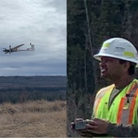
Civil 3D Drafter and Survey Tech and Pilot and Photogrammetry Lead
at
Underhill Geomatics Ltd.
1 work email found
@underhill.ca
LinkedIn matched
✓ Verified July 2026
4 data sources
Profile completeness 100%
Current company
Role
Civil 3D Drafter and Survey Tech and Pilot and Photogrammetry Lead
Location
Peace River, British Columbia, Canada
Company size
Who is Nirav Patel (Asct, B.Tech.)? Overview
A concise factual answer block for searchers comparing this professional profile.
Quick answer
Nirav Patel (Asct, B.Tech.) is listed as Civil 3D Drafter and Survey Tech and Pilot and Photogrammetry Lead at Underhill Geomatics Ltd., a with 88 employees, based in Peace River, British Columbia, Canada. AeroLeads shows a work email signal at underhill.ca and a matched LinkedIn profile for Nirav Patel (Asct, B.Tech.).
Nirav Patel (Asct, B.Tech.) previously worked as Civil 3D Drafter/Survey Tech/Pilot/Photogrammetry Lead at Underhill Geomatics Ltd. and Python Automation Developer - Agisoft Metashape Workflow (Hobbyist role) at Underhill Geomatics Ltd.. Nirav Patel (Asct, B.Tech.) holds Diploma, Geomatics Engineering Technology, 3.8/4.0 from Southern Alberta Institute Of Technology (Sait).
Company email context
Email format at Underhill Geomatics Ltd.
This section adds company-level context without repeating Nirav Patel (Asct, B.Tech.)'s masked contact details.
*@underhill.ca
71% confidence
AeroLeads found 1 current-domain work email signal for Nirav Patel (Asct, B.Tech.). Compare company email patterns before reaching out.
Profile bio
About Nirav Patel (Asct, B.Tech.)
Passionate about Drone surveys and almost everything about Geomatics 😊
Listed skills include Career Management, Leica Infinity, Virtual Teams, Autocad, and 30 others.
Current workplace
Nirav Patel (Asct, B.Tech.)'s current company
Company context helps verify the profile and gives searchers a useful next step.
Underhill Geomatics Ltd.
12 roles
Nirav Patel (Asct, B.Tech.) work experience
A career timeline built from the work history available for this profile.
Civil 3D Drafter/Survey Tech/Pilot/Photogrammetry Lead
Current-Utilize Civil 3D for precise and detailed drafting in the fields of geomatics, surveying, and construction.-Skilled in handling diverse projects involving bathymetric data, UAV flight data, and conducting volumetric calculations, surface comparisons, and material tracking.-Communicate and coordinate with team members to ensure the timely delivery of the deliverables (Recursive Deliverables happening at different interval monthly, bi-weekly, weekly and other special requests)-Experience in performing volume calculations, surface comparisons, and terrain analysis using advanced CAD tools and Veerum environment, providing valuable insights for earthwork estimation, slope analysis, etc. (Challenge is that the site is constantly changing day and night)-Skills involved - Profiles, Sections, Alignment, PointCloud, Orthos, etc.-Skilled in processing and integrating bathymetric data acquired through hydrographic surveys with topographic data coming from UAV-Collaborating closely with surveyors, engineers, and directly with project managers to ensure seamless integration of survey data and accurate representation in CAD drawings-Utilize industry standards and best practices to produce high-quality drawings that meet project specifications and requirements-Continue past duties as Photogrammetric Lead-Continue past duties as Survey Tech and Pilot occasionally
Mar 2023 - Present
Python Automation Developer - Agisoft Metashape Workflow (Hobbyist Role)
Current**I do this just out of my passion and ideas running in my brain, I'm putting it here as it requires extensive knowledge about the industry and photogrammetry and so considering here as an experience I gather along my career path.Please note I am NOT providing any services related to it.-Develop Python codes to automate standard workflow to process photogrammetric (from UAV) data using Agisoft Metashape, a leading photogrammetry software-Develop custom scripts to streamline data processing, 3D modeling, and image reconstruction workflows in Agisoft Metashape by enhancing/utilizing its capabilities and aim to increase productivity-Strong understanding of photogrammetry principles and techniques, leveraging Python to automate complex tasks, including image alignment, GCP inclusion, marker detection, point cloud generation, and mesh reconstruction, -Knowledgeable in utilizing Agisoft Metashape's API and SDK to extend its capabilities, creating tailored solutions for specific project requirement-Strong problem solving skills -Proactive in staying up to date with the latest advancements in photogrammetry, computer vision, and Python libraries, continuously seeking opportunities to enhance automation processes in Agisoft Metashape
Mar 2023 - Present
Rpas Pilot Advanced
Current
Feb 2022 - Present
Survey Tech - Photogrammetry Lead
CurrentGeneral:Lead the various kind of photogrammetric surveys on site C (Geological mapping, Underground mapping, different UAV flights)Determine the method of data collection according to required accuracy (and vice-versa)Equipment maintenance (regular cleaning, store safely, inspection for any defects, etc.)Update and maintain UAV targets all across the site (office perspective)Develop the UAV data collection and processing standards (doc with all the details of the periodic surveys to follow throughout the year)Plan and perform calibration flights to determine processing reference parametersQuality control of UAV data processing:Develop the appropriate UAV processing workflow to meet the standards established for clientHelp processors troubleshooting the errors in photogrammetric softwareInvestigating the factors affecting the accuracy and help team to apply the potential solutionUAV data management (tracking and maintaining the data structure and back up for 100s of flights)Geological mapping surveys in Dam Core areas: Method to collect data without using drones where drones are unsafe to usedevelop data collecting guidelines for the crew to perform surveys (drone-like but not drone)Maintain the data collection quality with terrain and other challengesModify and Monitor the processing data to achieve the same quality every time
Feb 2022 - Present
Personal Project - Station/Offset To Coordinates Conversion Tool From Dxf/Rxl Alignments
- providing solutions to repetitive coordinate derivation from stationing and offset values provided with the alignments in DXF or any such formats- developing 'Stationing/Offset To Coordinates' function from manual alignments- website development using different computer languages- AWS web hosting- Software development and designing the workflow- idea to practicality assessment and derive the cost estimation- planning, executing, commitment, analysis
Jan 2024 - Feb 2024
Survey Tech - Borehole Surveys - Lead
Lead the mapping surveys for the boreholes in right bank for the foundation enhancement which includes ensuring safety of crews and equipment. Consistent data capture in inconsistent conditions of the borehole, problem solving and decision making within given timeframe Post-processing and troubleshooting for the data collected (photogrammetric) Keep innovating the current system for obtaining underground data, by applying the solutions to the problems as they ariseKeep improving the established data processing workflow to deliver consistent productsWrite and continue to improve the data collection method (Field survey procedure)Write and continue to improve the data processing method (Office job procedure)
Oct 2021 - Jun 2023
Survey Tech - Field
Field Activities:- maintaining and updating UAV targets - perform stake out surveys in foundation area (congested) - Performed Hill slope monitoring survey with SX10- Stake out requested as-builts- Terrestrial scanning of bedrocks, excavated walls, etc. using SX10 for collecting 2cm sparse point cloud (faced challenges - uneven ground, varying extent and size of area, all with other obstacles) (near water, steep areas and busy)- Closed loop survey (Star*net)
May 2021 - Jun 2023
Survey Tech
BC Hydro Dam Project - Ft. Saint John, BC- Interpret field returns in order to create accurate survey drawings and legal plans, which will include downloading and editing field data, interpreting field notes and sketches, and processing data from various sources (conventional, GNSS, UAV, laser scanning, etc.)- Take instructions from the project manager for the performance of tasks- Refer UAV Flight Planning and Field Notes for tracking processed jobs, Files and document management using and maintaining both physical and digital field notes of various types- Have thorough understanding of planning and filling out various safety forms depending on the task- Create and update company procedure documents for TBC and Agisoft Processing- Assist to manage emails using Outlook and manage tasks using Calendar, Teams and MS excel spreadsheets in order to work out challenging projects and dynamic daily schedule- Keep track of 1000s of scan jobs and field notes and handle large amount of data to meet the specific deadlines- Classify scans based on its location on large site, elevation and material type of scanned surface in order to visualize the progress of Dam structure and extract useful information out of it which can further be used in order to fabricate the final deliverables for the client (Autodesk Navisworks, Autodesk Recap)- process UAV data in Agisoft - QC Check processed data from other offices
Nov 2020 - Jun 2023

Peer Tutor - Geomatics Engineering Technology
• Provide individualized skill-development tutoring to assigned students• Attend and complete online tutoring training and development session• Develop a good understanding and knowledge of college services, supports, and resources• Prepare for tutoring sessions by reviewing any notes, handouts, and/or bookwork• Be punctual, begin all sessions promptly, use time for academic tasks, and focus on the student’s needs• Help students set academic and personal goals, and monitor progress toward those goals
Sep 2020 - Nov 2020
Survey Assistant
Lark Associates, Morbi
Computed and interpreted plan to determine the position, shapes and elevation of the feature on the ground.Maintained and updated AutoCAD drawings, quantity estimation sheets and reports keeping senior engineer updated of daily site work.
Nov 2016 - Jan 2018
Intern
Backbone Enterprises Limited - India
Conducted the laboratory tests to pass acceptable materials supplied to the siteCollaborating with Project Manager to keep records of checked in and out materials Labor attendance reportChecking and updating Engineering DrawingsPrepared a final report and presentation for the company work during the period of internship
Jan 2016 - Apr 2016
Team & coworkers
Colleagues at Underhill Geomatics Ltd.
Other employees you can reach at underhill.ca. View company contacts for 88 employees →
JD
 Jason Dingelstad
Colleague at Underhill Geomatics Ltd.Burnaby, British Columbia, Canada
View →
JU
Jason Dingelstad
Colleague at Underhill Geomatics Ltd.Burnaby, British Columbia, Canada
View →
JU
 John Usselman
Colleague at Underhill Geomatics Ltd.Whitehorse, Yukon Territory, Canada
View →
DH
John Usselman
Colleague at Underhill Geomatics Ltd.Whitehorse, Yukon Territory, Canada
View →
DH
 Derek Hatch
Colleague at Underhill Geomatics Ltd.Kamloops, British Columbia, Canada
View →
MK
Derek Hatch
Colleague at Underhill Geomatics Ltd.Kamloops, British Columbia, Canada
View →
MK
 Mike Kojder
Colleague at Underhill Geomatics Ltd.Burnaby, British Columbia, Canada
View →
RL
Mike Kojder
Colleague at Underhill Geomatics Ltd.Burnaby, British Columbia, Canada
View →
RL
 Rob Leiper
Colleague at Underhill Geomatics Ltd.Langford, British Columbia, Canada
View →
FB
Rob Leiper
Colleague at Underhill Geomatics Ltd.Langford, British Columbia, Canada
View →
FB
 Francois Beaudet
Colleague at Underhill Geomatics Ltd.Burnaby, British Columbia, Canada
View →
EH
Francois Beaudet
Colleague at Underhill Geomatics Ltd.Burnaby, British Columbia, Canada
View →
EH
 Eric Ho
Colleague at Underhill Geomatics Ltd.Greater Calgary Metropolitan Area, Canada
View →
JM
Eric Ho
Colleague at Underhill Geomatics Ltd.Greater Calgary Metropolitan Area, Canada
View →
JM
 James Macleod
Colleague at Underhill Geomatics Ltd.Fort St John, British Columbia, Canada
View →
CH
James Macleod
Colleague at Underhill Geomatics Ltd.Fort St John, British Columbia, Canada
View →
CH
 Cameron Heath
Colleague at Underhill Geomatics Ltd.Kamloops, British Columbia, Canada
View →
DS
Cameron Heath
Colleague at Underhill Geomatics Ltd.Kamloops, British Columbia, Canada
View →
DS
 Daniella Szalkai
Colleague at Underhill Geomatics Ltd.Vancouver, British Columbia, Canada
View →
Daniella Szalkai
Colleague at Underhill Geomatics Ltd.Vancouver, British Columbia, Canada
View →
Jason Dingelstad
Colleague at Underhill Geomatics Ltd.Burnaby, British Columbia, Canada
View →
JU
John Usselman
Colleague at Underhill Geomatics Ltd.Whitehorse, Yukon Territory, Canada
View →
DH
Derek Hatch
Colleague at Underhill Geomatics Ltd.Kamloops, British Columbia, Canada
View →
MK
Mike Kojder
Colleague at Underhill Geomatics Ltd.Burnaby, British Columbia, Canada
View →
RL
Rob Leiper
Colleague at Underhill Geomatics Ltd.Langford, British Columbia, Canada
View →
FB
Francois Beaudet
Colleague at Underhill Geomatics Ltd.Burnaby, British Columbia, Canada
View →
EH
Eric Ho
Colleague at Underhill Geomatics Ltd.Greater Calgary Metropolitan Area, Canada
View →
JM
James Macleod
Colleague at Underhill Geomatics Ltd.Fort St John, British Columbia, Canada
View →
CH
Cameron Heath
Colleague at Underhill Geomatics Ltd.Kamloops, British Columbia, Canada
View →
DS
Daniella Szalkai
Colleague at Underhill Geomatics Ltd.Vancouver, British Columbia, Canada
View →
3 education records
Nirav Patel (Asct, B.Tech.) education
Diploma, Geomatics Engineering Technology, 3.8/4.0

Bachelor Of Technology - Btech, Civil Engineering
Metashape Professional Edition For Forensics Surveying, Photogrammetry, Pass
Accupixel
FAQ
Frequently asked questions about Nirav Patel (Asct, B.Tech.)
Quick answers generated from the profile data available on this page.
What company does Nirav Patel (Asct, B.Tech.) work for?
Nirav Patel (Asct, B.Tech.) works for Underhill Geomatics Ltd..
What is Nirav Patel (Asct, B.Tech.)'s role at Underhill Geomatics Ltd.?
Nirav Patel (Asct, B.Tech.) is listed as Civil 3D Drafter and Survey Tech and Pilot and Photogrammetry Lead at Underhill Geomatics Ltd..
What is Nirav Patel (Asct, B.Tech.)'s email address?
AeroLeads has found 1 work email signal at @underhill.ca for Nirav Patel (Asct, B.Tech.) at Underhill Geomatics Ltd..
Where is Nirav Patel (Asct, B.Tech.) based?
Nirav Patel (Asct, B.Tech.) is based in Peace River, British Columbia, Canada while working with Underhill Geomatics Ltd..
What companies has Nirav Patel (Asct, B.Tech.) worked for?
Nirav Patel (Asct, B.Tech.) has worked for Underhill Geomatics Ltd., Southern Alberta Institute Of Technology (Sait), Lark Associates, Morbi, and Backbone Enterprises Limited - India.
Who are Nirav Patel (Asct, B.Tech.)'s colleagues at Underhill Geomatics Ltd.?
Nirav Patel (Asct, B.Tech.)'s colleagues at Underhill Geomatics Ltd. include Jason Dingelstad, John Usselman, Derek Hatch, Mike Kojder, and Rob Leiper.
How can I contact Nirav Patel (Asct, B.Tech.)?
You can use AeroLeads to view verified contact signals for Nirav Patel (Asct, B.Tech.) at Underhill Geomatics Ltd., including work email, phone, and LinkedIn data when available.
What schools did Nirav Patel (Asct, B.Tech.) attend?
Nirav Patel (Asct, B.Tech.) holds Diploma, Geomatics Engineering Technology, 3.8/4.0 from Southern Alberta Institute Of Technology (Sait).
What skills is Nirav Patel (Asct, B.Tech.) known for?
Nirav Patel (Asct, B.Tech.) is listed with skills including Career Management, Leica Infinity, Virtual Teams, Autocad, Autodesk Infraworks, Arcgis Pro, Cartography, and Matlab.
Find 750M verified contacts
Search by job title, company, industry, location, and seniority. Export verified B2B contact data when you need it.
Start free trial