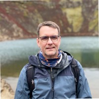
Peter Chirico, Phd
AeroLeads people directory · profile

Peter Chirico, Phd Email & Phone Number

Associate Center Director, USGS FBGC at USGS, Florence Bascom Geoscience Center
Location: Washington Dc-Baltimore Area, United States 9 work roles 3 schools
LinkedIn matched
✓ Verified August 2026 3 data sources Profile completeness 86%

Contact Signals

LinkedIn Profile matched
3 free lookups remaining · No credit card
Role
Associate Center Director, USGS FBGC
Location
Washington Dc-Baltimore Area, United States
Company size

Who is Peter Chirico, Phd? Overview

A concise factual answer block for searchers comparing this professional profile.

Quick answer

Peter Chirico, Phd is listed as Associate Center Director, USGS FBGC at USGS, Florence Bascom Geoscience Center, a with 10 employees, based in Washington Dc-Baltimore Area, United States. AeroLeads shows a matched LinkedIn profile for Peter Chirico, Phd.

Peter Chirico, Phd previously worked as Associate Science Center Director at Usgs, Florence Bascom Geoscience Center and Scientific and Technical Advisor on Conflict Minerals at U.S. Department Of State. Peter Chirico, Phd holds Doctor Of Philosophy (Phd), Geography And Environmental Systems from University Of Maryland Baltimore County.

Company email context

Email format at USGS, Florence Bascom Geoscience Center

This section adds company-level context without repeating Peter Chirico, Phd's masked contact details.

USGS, Florence Bascom Geoscience Center

Review company-level records connected to Peter Chirico, Phd before choosing the right outreach path.

Profile bio

About Peter Chirico, Phd

Pete Chirico is the Associate Center Director of the U.S. Geological Survey’s Bascom Geoscience Center in Reston, VA. In over 25 years at USGS, he has focused his research on the geography and geomorphology of illicit small-scale mining of diamonds and mineral deposits in conflict zones and during complex emergencies. He has worked extensively with the U.S. Department of State, U.S. Department of Defense, U.S. Agency for International Development, the United Nations, and the Kimberley Process to understand how diamonds and other natural resource exploitation contribute to funding conflicts. While his regional expertise is Sub-Saharan Africa, he has led or been a member of more than 30 field expeditions throughout Central America and the Caribbean, the Middle East, and Africa. He is author or co-author of over 50 peer reviewed scientific reports and journal articles in the fields of geography, geomorphology, remote sensing, and natural resources in conflict zones. Pete also serves as scientific and technical advisor to the Office of Threat Finance Countermeasures in the Department of State's Bureau of Economic and Business Affairs.

Current workplace

Peter Chirico, Phd's current company

Company context helps verify the profile and gives searchers a useful next step.

USGS, Florence Bascom Geoscience Center
Usgs, Florence Bascom Geoscience Center
Associate Center Director, USGS FBGC
reston, virginia, united states
Employees
10
AeroLeads page
9 roles

Peter Chirico, Phd work experience

A career timeline built from the work history available for this profile.

Associate Science Center Director

Current

Reston, Va

I serve as deputy to the Science Center Director and assist with scientific planning, supervision, and management of interdisciplinary team of over 100 geoscientists, technical specialists, laboratory staff, and support personnel. I focus on developing cooperative scientific agreements and strategic engagement with other Federal, State, and private sector/non-government partners. I also maintain my own research portfolio of scientific projects utilizing geomorphological mapping and remote sensing techniques for natural resource and critical/conflict mineral deposit modelling and monitoring.

Jan 2017 - Present
Scientific And Technical Advisor On Conflict Minerals

Washington Dc-Baltimore Area

I acted as the Scientific and Technical Advisor on Conflict Minerals to the Office of Threat Finance Countermeasures in the Department of State's Bureau of Economic and Business Affairs through an Interagency Memorandum of Understanding (MOU). I provided geologic, scientific, and technical support to the Department of State, USAID, and the Kimberly Process (KP) to stem the flow of conflict minerals and diamonds into the international market. This research employed field and advanced remote sensing analysis to map and monitor activity of small-scale artisanal mining activities in western and central Africa to achieve a comprehensive and detailed understanding of the geologic, social, and economic contexts of artisanal and small-scale mining.

Apr 2017 - Aug 2024

Embassy Science Fellow

Georgetown, Guyana

I directed a multi-agency team of specialists and experts from US government and the Government of Guyana in mapping and monitoring small-scale gold mining, deforestation, and associated environmental impacts using advanced remote sensing and geospatial data processing techniques.

Mar 2021 - Mar 2022

Research Geographer

Reston, Virginia, United States

I developed research and applications of digital terrain modeling techniques, GIS methods, and remote sensing data to study and map the geomorphology and geology of international areas of interest for the USGS, US Department of State, and USAID. The main focus of this research was mapping alluvial diamond and gold deposits and mine sites in Africa, Asia and South America. Participated in, and have led, field mapping expeditions to the Central African Republic, Mali, Ghana, Cote d'Ivoire, and Guinea to describe and verify artisanal mining activities. This work was in direct support to the Kimberley Process and the US Clean Diamond Trade Act. Additional research was focused on the geomorphology and geology of mining and land use features in Afghanistan to support reconstruction and mineral resource inventories. This included field assessments and terrain modelling of the Kajakai Dam and Reservoir in southwestern Afghanistan for hydropower and agricultural land use investigations.

Aug 2010 - Jan 2017

Geographer, Team Gis Coordinator

Reston, Virginia, United States

I served as coordinator of GIS staff and developed analytic capabilities within a complex multi-disciplinary team of research scientists engaged in geologic mapping, landslide hazards mapping, and paleo-climate science studies. I identified staffing needs, developed training plans, and developed innovative methods and procedures to support geospatial data processing needs for the Team.I also served as team member on several USGS international scientific projects supporting the U.S. Agency for International Development (USAID), the United Nations (UN), and the World Bank focused on geologic hazards, spatial data infrastructure, and remote sensing science applications. From 1998 to 2003, I led a team of USGS personnel developing digital ortho-photography, DEMs, and GPS ground control of over 70 municipalities in Honduras, Guatemala, El Salvador, and Nicaragua affected by widespread landslides and flooding as a result of the Hurricane Mitch disaster in 1998.

Jun 1998 - Aug 2010

Cartographic Technician

Reston, Virginia, United States

I developed GIS databases of geologic map and landslide hazard information for the National Cooperative Geologic Mapping Program (NCGMP) and regional mapping initiatives. Performed map database development using Arc/Info in UNIX based environment, developed and implemented Arc AML programming to automate the conversion and production of geologic map database information.

Aug 1996 - Jun 1998

Adjunct Instructor, Department Of Geography

Fredericksburg, Virginia, United States

In addition to full time research at the USGS, I was an adjunct faculty instructor at the University of Mary Washington's Geography Department in Fredericksburg, VA from 2006-2010 where I taught courses on Human Impact on the Environment, Aerial Photo Interpretation and Remote Sensing, as well as assisting in supervising student undergraduate research.Courses taught: GEOG 245 - Geography of the Human Environment (Environment and Society)GEOG 340B - Remote Sensing and Air Photo Interpretation, w/labGEOG URES197 - Undergraduate Research Experience

Aug 2006 - May 2010

Photo Interpreter/Gis Technician

Pacific Meridian Resources
Aug 1995 - Sep 1996
3 education records

Peter Chirico, Phd education

FAQ

Frequently asked questions about Peter Chirico, Phd

Quick answers generated from the profile data available on this page.

What company does Peter Chirico, Phd work for?

Peter Chirico, Phd works for USGS, Florence Bascom Geoscience Center.

What is Peter Chirico, Phd's role at USGS, Florence Bascom Geoscience Center?

Peter Chirico, Phd is listed as Associate Center Director, USGS FBGC at USGS, Florence Bascom Geoscience Center.

Where is Peter Chirico, Phd based?

Peter Chirico, Phd is based in Washington Dc-Baltimore Area, United States while working with USGS, Florence Bascom Geoscience Center.

What companies has Peter Chirico, Phd worked for?

Peter Chirico, Phd has worked for Usgs, Florence Bascom Geoscience Center, U.S. Department Of State, Usgs, U.S. Geological Survey (Usgs), and University Of Mary Washington.

How can I contact Peter Chirico, Phd?

You can use AeroLeads to view verified contact signals for Peter Chirico, Phd at USGS, Florence Bascom Geoscience Center, including work email, phone, and LinkedIn data when available.

What schools did Peter Chirico, Phd attend?

Peter Chirico, Phd holds Doctor Of Philosophy (Phd), Geography And Environmental Systems from University Of Maryland Baltimore County.

Find 750M verified contacts

Search by job title, company, industry, location, and seniority. Export verified B2B contact data when you need it.