Remote Sensing And Information Specialist
Current
Catie (Tropical Agricultural Research And Higher Education Center) / Servir Central America
Oct 2024 - Present
Please complete the CAPTCHA to continue
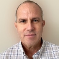
@winrock.org
✓
LinkedIn matched
A concise factual answer block for searchers comparing this professional profile.
Peter Schlesinger, Ph.D. is listed as Climate Change Consultant | Forest Carbon, ARR, REDD+, SOC, GIS at Reseed, based in New Hampton, New Hampshire, United States. AeroLeads shows a work email signal at winrock.org and a matched LinkedIn profile for Peter Schlesinger, Ph.D..
Peter Schlesinger, Ph.D. previously worked as Remote Sensing and Information Specialist at Catie (Tropical Agricultural Research And Higher Education Center) / Servir Central America and Climate Change Consultant at Reseed. Peter Schlesinger, Ph.D. holds Doctor Of Philosophy (Phd), Natural Resources from University Of Idaho.
This section adds company-level context without repeating Peter Schlesinger, Ph.D.'s masked contact details.
AeroLeads found 1 current-domain work email signal for Peter Schlesinger, Ph.D.. Compare company email patterns before reaching out.
As a Climate Change Consultant, I apply my Ph.D. in Natural Resources and over 20 years of experience in land cover and land-use change analysis to support climate mitigation programs in various regions of the world. I have a deep appreciation of the developing country context, having lived and worked more than 25% of my life in lesser developed nations, such as Costa Rica, Peru, Russia, and Mauritania. My core competencies include GIS and Remote Sensing technologies, forest carbon project design, REDD+ and ARR methodologies and standards, biomass modeling, and validation and verification. I have developed and advised on multiple forest carbon projects, trained and supported national and jurisdictional REDD+ teams, and explored forest transitions and rural agriculture using optical and radar sensors. I also serve as a Tech Panel member of the Global Conservation Standard, monitoring environmental services, including carbon, water, and biodiversity. My mission is to advance climate mitigation and adaptation solutions using spatial data and analysis, especially with rural smallholder farmers.
Listed skills include Photogrammetry, R, Forestry, Carbon Credits, and 53 others.
Company context helps verify the profile and gives searchers a useful next step.

A career timeline built from the work history available for this profile.

Supported scientific activities of a small team of unnamed government agencies and universities (NDA in place) discussing CONUS biomass modeling. Attended regular meetings, and submitted project status reports/next steps. Planned training efforts to be held at an undisclosed government facility. Cooperated with relevant agencies.
Developed and advised on forest carbon project design (for REDD+ and ARR). Reviewed and advised on feasibility studies, assisted in biomass surveys, sampling, and other fieldwork, advised on the potential for reforestation project development, prepared deployment materials for Africa, attended a seminar in Australia, and assessed potential sites for mitigation and reforestation in Latin America. Skills used included knowledge of AFOLU standards and methodologies, GIS, and remote sensing.
The Global Conservation Standard (GCS) is designed to make conservation pay for landowners and the local populations worldwide based on the stock volume of measurable ecosystem services benefits through the issuance and sale of Conservation Credit Units (CCUs). Through the sale, money is channeled to the legal-land use holder and the Stakeholder Foundation that has the mandate to invest in the empowerment of sustainable local livelihoods, thus creating a "core conservation area" and "commercial buffer zone". Reviewed project information notes (PIN) for Projects in Nicoya, Costa Rica, and Tierra del Fuego, Chile.

Little Rock, Arkansas, Us
Consultant to Program Officer for Architecture for REDD+ Transactions (ART) ARTREDD.ORG. Prepared content for guidance manual in remote sensing for carbon accounting of activity data.
Developed Agricultural Tool Prototype Based on Remote Sensing for International Development Client. NDA
Tools development using ESA constellation outputs.
New York, New York, Us
GIS consultancy to develop global guidance for assessing, monitoring and managing natural vegetation on Rainforest Alliance-certified farms and verification firms assessing certification compliance for coffee, cocoa, banana, and tea cropping.
Geneva, Ch
Developed content for European Space Agency Earth Observation for Sustainable Development (EO4SD) e-learning training on the use of remote sensing for Iraqi agriculture. Performed needs assessment with Iraqi officials and World Bank. Developed and delivered material for interactive and moderated awareness-raising technical workshop on Earth Observation, and agriculture for decision-makers using open-source international platforms (e.g. Quantum GIS and SNAP); collaborated with external partners, moderated online community of practice.

Leicester, Gb
Developed Differential Synthetic Aperture Radar (SAR) Interferometric (DInSAR) application for the investigation of earth displacement by subterranean mining activities in the Antioquia Region of Colombia (supported by UK Space / Catapult), detection of highly reflective machinery, as well as rural roads. Tools used included Python, HPC, SNAP, Linux Ubuntu.
Presented a three-day introductory RADAR remote sensing course for 30 Attendees in Spanish; with a concentration in SNAP v.6.
Verificacion REDD+ de VCS/CCB: Manejo Forestal para Reducir Deforestación y Degradación en las Comunidades Indígenas Shipibo Conibo y Cacataibo de la Región Ucayali.REDD+ VCS/CCB Verification: Forest Management To Reduce Deforestation and Degradation In Shipibo Conibo and Cacataibo Indigenous Communities of Ucayali Region. Spatial analysis and geoprocessing of project data were sampled to verify reported deforestation reductions. Skills included ArcGIS/ESRI products, Terrset and Quantum GIS,
Verified Carbon Standard (VCS) Community, Climate, and Biodiversity Standards (CCB) Reducing Emissions from Deforestation and Forest Degradation (REDD+) Project Validation. Climate change mitigation for Humid Forest Conservation in new a protected area of southern Madagascar. GIS, remote sensing, and other geoprocessing and spatial analysis tools were used to verify samples of reported project outcomes.

Alexandria, Virginia, Us
Assessed LCLUC in threatened micro watersheds via Performance and Impact Evaluations of the USAID “Governance, Ecosystems, Livelihoods and Water” (Gobernanza en Ecosistemas, Medios de Vida y Agua (GEMA)) activity in Western Honduras. Skills used included ArcGIS Products, Quantum GIS, and Terrset.

Moscow, Id, Us
Participated in NASA-supported science in the Trifinio Region of Central America (at the join of El Salvador, Guatemala, and Honduras). Examined traditional and nontraditional drivers of deforestation at medium and high resolution using satellite images across different tenure types. Investigated the use of NDVI as a proxy for forest cover changes. Measured accuracies when applying new sensors (Sentinel 1, Sentinel 2, and Landsat 8) with texture-driven strategies applied to machine-learning to discern hidden impacts of agriculture, shaded agroforestry, and forest conservation. Spatial analytical accomplishments were achieved by practicing (geospatial data science using Geographic Information Systems and using spatial analysis tools from remote sensing (ArcGIS Products, ENVI, IDRISI, Python, Quantum GIS, R, Zotero). Supervised & advised CATIE masters students.
Moscow, Id, Us
The growing unmanned aerial vehicle (UAV) market offered many opportunities for natural resources estimation activities. This technology opened up many possibilities for monitoring, inventory, and assessment in the forest, rangeland, and fire sciences. Students were taught a course in developing knowledge of key requirements, understanding, applications, and obstacles to be overcome by using various sizes and types of UAVs. The students were interested in vegetative, animal, habitat inventory and monitoring, as well as fire science applications; they produced a report developing key areas of learning and recommendations for new users.
Prepared national map of forested land cover and agroforestry land uses using RapidEye image mosaics for UNFCCC Reference Emissions Levels submission. Performed onsite field work to train team collecting training samples for remote sensing classifications and validation. Trained in field data collection protocols for applying Open Data Kit (ODK) technology for use with Android cellular phones.
REDD+ Project & 1st 5yr Validation &Verification.
Advisor to M & E Support for Collaborative Learning and Adapting (MESCLA) / Governance in Ecosystems, Livelihoods, and Water Activity (GEMA) Monitoring & Evaluation assessments for Coffee Grower Climate Change Adaptation project. My particiation was in consultative support of RFP preparation for GEMA Performance and Impact Evaluations.
Created and led a course for students and instructors in Sentinel 1 & 2-based Image Processing for climate-smart agriculture, territories, and LCLUC assessment.
Prepared and implemented a Spanish-language introductory course in synthetic aperture radar (SAR) image processing for 15 forest-oriented remote sensing specialists using European Space Agency (ESA) Sentinel Application Platform (SNAP) tutorial materials, SNAP and ENVI SARScape software, and Sentinel 1 datasets geared toward exploration of Peruvian and Latin American tropical forest conditions. Training covered radar basics and geometry, data acquisition, preprocessing, disturbance mapping, image classification, and land cover change using principles of polarimetry and interferometry.
Prepared and implemented a Spanish-language introductory course in synthetic aperture radar (SAR) image processing for 20 forest-oriented remote sensing specialists using European Space Agency (ESA) Sentinel Application Platform (SNAP) tutorial materials, SNAP software, and Sentinel 1 datasets geared toward exploration of Guatemala's tropical forest conditions. Training covered radar basics and geometry, data acquisition, preprocessing, disturbance mapping, and remotely-sensed image classification.
Image processing lead for Nicaragua Autonomous Region of the Northern Caribbean (RAAN), Reference Emission Levels (REL) Program. Trained technicians, prepared presentation materials, led meetings and presentations. Co-author of REL guidance document.
Prepared educational materials and technical inputs for 6-week course taught to Trimble-Peru technicians to use their drones to make useful normalized difference vegetation index-based images to provide precision agricultural products for Peruvian industrial agriculture farmers. Flights were made in Lima (at the National Agrarian University in fruit tree parcels) and Canete (in farm parcels of avacadoes and asparagas).
VCS REDD+ Methodological advising, REDD Reference Region Baseline Deforestation modeling, project design, methodological training. Verification and Validation Advising for Validated VCS ADPML- and RDMLT-Portel-Para REDD+ Projects (Para State, Brazil).

The Shade Coffee and Cacao Project is a grouped afforestation, reforestation, and revegetation (ARR) climate mitigation project based on improving agricultural farming techniques that include coffee and cacao grown under shade. Onsite visits with farmers (the fieldwork) in their existing agroforestry parcels allowed a discussion of their plans and strategies to include harvestable timbers and banana fruit trees as shade components among existing parcels of coffee and cacao. Skills included Program Management, Sustainable Development, Rural development. and Geography.
Arlington, Virginia, Us
Calculated a ranking of the top 50 countries with the most recent deforestation impacts and propensity for future deforestation from existing global satellite research and analyses (for a private client). Developed a manual of statistical information for key countries involved in agricultural development and deforestation, with contextual information on deforestation drivers. Skills included Spatial Analysis via ArcGIS Products (e.g. ArcMap), remote sensing tools, and statistics.

Washington, District Of Columbia, Us
NDA in place. Lead-authored Development Guide and Manual involving Participatory GIS-based Method for Assessing Impacts and Vulnerability to Coastal Climate Change for Developing Countries, Concentrating on Sea Level Rise, but method was applicable to all areas of Coastal Climate Change.
Consulting on Verified Carbon Standard (VCS) - based REDD+ projects and their deforestation models to support forest carbon sequestration activities (VCS REDD+, CCB, ARR, JNR) in Peru, Colombia (Putumayo REDD+), Guatemala (REDD+ in Mayan Biosphere Reserve), Senegal (mangroves reforestation), and Tanzania tropical forests (REDD+ project design). Independent evaluator of Deforestation Mapping for Guatemala and expert verifier in remote sensing for Guyana Measuring, Reporting & Verification (MRV) system (with Det Norske Veritas). Developer of REDD+ MRV response for Selva Central (Peru). Collaborator in VCS-validated Methodology for Unplanned Deforestation (July, 2011). Responsible for Technical Mapping and Modeling for Peru Forest Investment Program (FIP) (April-August 2012). Private Client, REDD+ Project Development (Paris, France). Pascal and Python.
Advising and consulting for Peruvian and international NGO technical working groups involved in historical deforestation mapping and modeling in the regions of Madre de Dios, Ucayali, Junin, Cerro de Pasco, Huanuco, San Martin, and Cuzco, Peru.

Arizona, Us
Taught Business English for conversation and presentation, concentrating in Informatics at the Pre-Intermediate and Intermediate Levels.
Outbound Telemarketing for USA clients
Munich, Bavaria, De
Consulted/Advised/Prepared English-Language Written Materials Designed to Generate new REDD-related (reducing emissions from deforestation and forest degradation in developing countries) business in Indonesia for German Natural Resources Consulting Firm. Attended REDD Workshop, Jena, Germany. Prepared Draft Chapter on Special Considerations for Carbon Emissions from Peat for submission to REDD Sourcebook. Drafted GCB Journal Submission on 25-Year LandUse Change activity in Riau Province, Indonesia.

St. Louis, Mo, Us
Door to door sales and cold call telemarketing of financial products as licensed and registered representative for financial firm. Securities Licenses held: Series 7 and Series 63.

Falmouth, Ma, Us
Applied scientific method using GIS and remote sensing technologies to develop environmental knowledge on impacts and rates of climate change over land surfaces, presenting to NGOs, national & international agencies, contributed significantly to grant proposal preparation, as well as many scientific articles.Forest & Vegetation Analysis. Mapping/Modeling/Programming for NASA and Private Foundations, Remote Sensing. GIS and Remote Sensing Trainer of Visiting and on Site Scholars/Field Work in South America, Amazon Basin, Central and Eastern Russia. Supervised GIS interns and volunteers. Co-authored many peer-reviewed publications. Pascal and Python programming. Data manager. Web-based GIS data distribution. GIS file translation. Experience with ArcGIS, ENVI, ERDAS, IDRISI, PCI, GDAL, OGR. Data formats: CSV, DXF, GeoTIFF, GIS, HDF, IMG, NetCDF, RST, SHP, VCT, VEC.
Us
Attended meetings, helped develop the company's strategic direction, hire organization director, budgeting, institutional promotion, week to week management.
Morristown, New Jersey, Us
Interim Evaluation of Famine Early Warning System (FEWS II), December 1991see: http://pdf.usaid.gov/pdf_docs/PDABE777.pdf
Researched development needs in Senegal River Basin before the construction of the Manantali Dam; trained anthropologists to use GIS techniques to facilitate socioeconomic research

Washington, District Of Columbia, Us
I lived in a mud hut on the edge of the Senegal River in southern Mauritania’s Dirol Plain and worked with Halpulaar women and children to stimulate and facilitate cooperative development in a zone of seven villages. I taught small scale and field vegetable cropping to improve health and diminish dependence on international food aid. I learned a lot about raw human existence, requirements for survival, life and death.
Quick answers generated from the profile data available on this page.
Peter Schlesinger, Ph.D. works for Reseed.
Peter Schlesinger, Ph.D. is listed as Climate Change Consultant | Forest Carbon, ARR, REDD+, SOC, GIS at Reseed.
AeroLeads has found 1 work email signal at @winrock.org for Peter Schlesinger, Ph.D. at Reseed.
Peter Schlesinger, Ph.D. is based in New Hampton, New Hampshire, United States while working with Reseed.
Peter Schlesinger, Ph.D. has worked for Catie (Tropical Agricultural Research And Higher Education Center) / Servir Central America, Reseed, Battelle Memorial Institute, At Columbus (Ohio Usa), Geneva, Eden Reforestation Projects, and Global Conservation Standard.
You can use AeroLeads to view verified contact signals for Peter Schlesinger, Ph.D. at Reseed, including work email, phone, and LinkedIn data when available.
Peter Schlesinger, Ph.D. holds Doctor Of Philosophy (Phd), Natural Resources from University Of Idaho.
Peter Schlesinger, Ph.D. is listed with skills including Photogrammetry, R, Forestry, Carbon Credits, Geomatics, Biodiversity, Erdas Imagine, and Environmental Issues.
Search by job title, company, industry, location, and seniority. Export verified B2B contact data when you need it.
Start free trial Search contacts