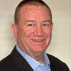
AeroLeads people directory · profile
Ray Mcpherson Email & Phone Number
Senior Research Associate
at
California Housing Partnership
1 work email found
@chpc.net
LinkedIn matched
✓ Verified Jul 2026
4 data sources
Profile completeness 100%
Current company
Role
Senior Research Associate
Location
United States
Who is Ray Mcpherson? Overview
A concise factual answer block for searchers comparing this professional profile.
Quick answer
Ray Mcpherson is listed as Senior Research Associate at California Housing Partnership, based in United States. AeroLeads shows a work email signal at chpc.net and a matched LinkedIn profile for Ray Mcpherson.
Ray Mcpherson previously worked as Geographic Information Systems Programmer Analyst at Renewable Resources Group Llc and Team Lead and GIS Data Analyst at Apex Onsite At Apple. Ray Mcpherson holds Graduate Certificate, Giscience from University Of Colorado Denver.
Company email context
Email format at California Housing Partnership
This section adds company-level context without repeating Ray Mcpherson's masked contact details.
{first_initial}{last}@chpc.net
86% confidence
AeroLeads found 1 current-domain work email signal for Ray Mcpherson. Compare company email patterns before reaching out.
Profile bio
About Ray Mcpherson
I am a Researcher, Geographic Information Scientist, and Programmer passionate about environmental and social justice and the ways they intersect. I believe that barriers to access are the biggest issue of my generation and affect every aspect of our lives from our health to the people we interact with to the air we breathe when we walk outside. These barriers are systemic and must be acknowledged and demolished in a way that benefits those that have been harmed the most. This is the work that drives me personally and in my career. It is my greatest ambition is to make the world healthier and more equitable with the knowledge and skills that I possess.I have experience in affordable housing, conservation, climate change, and water issues especially in California and am constantly learning more about these and other related topics. In an effort to stay informed, I often attend webinars and read articles and reports hosted by organizations such as CZI and PPIC. I also read books on a variety of topics and enjoy learning about other people’s passion projects. I am an interdisciplinary scientist striving to be one of the bridges. In my free time I roller skate, crochet, and work on my house and garden. It is my dream to be completely self-sufficient! In the future I would love to open a community center that is stocked with fresh produce from my garden and useful items that I have made or that have been donated by community members, and all of the items would be available for free for anyone to take. Free and open access to the things that people need to survive will ultimately result in my community being happier and healthier overall, which would be delightful to be a part of!
Listed skills include Archaeological Survey, Gps Navigation, Gps Devices, Trimble Gps, and 30 others.
Current workplace
Ray Mcpherson's current company
Company context helps verify the profile and gives searchers a useful next step.
California Housing Partnership
Website
AeroLeads page
15 roles
Ray Mcpherson work experience
A career timeline built from the work history available for this profile.

Senior Research Associate
Supporting the Partnership’s affordable housing data visualization and preservation projects through data analysis, spatial analysis, and automation. A key part of my role is to manage projects. I maintain and update a financing database yearly, I lead our recent Indigenous housing research initiative, and I co-manage our yearly Housing Needs Dashboard update and release. Data analysis can be a time-consuming process. I brought with me to the Partnership Python skills, which I have used to automate the analyses necessary for several of our yearly reports and to automate database updates. I enjoy teaching and have done a Python crash course with our Research Fellows every year. Additionally, the Partnership is releasing several Python training videos that I co-created with our Comms Director, which will be available on Youtube in September of 2024.

Geographic Information Systems Programmer Analyst
My primary role is to develop geoprocessing tools and models, primarily using Python. These tools range from the automation of repetitive tasks such as appending tabular data to a feature service in ArcGIS Online, to processing and analyzing large raster data for internal use, to creating interactive web app widgets in ArcGIS Portal that feed a user climatic information about a place anywhere in the world. Other programming accomplishments include setting up weekly reminder emails, learning VB Script to create forms in Excel, and learning to access and consume data stored in the cloud or on the web via various modules and/or REST endpoints. To achieve these successes, I collaborate closely with other members of the GIS Team as well as other groups within our organization and partnered organizations.In addition to developing, I am often called upon to troubleshoot technical issues and have a knack for solving problems. I research new data sources and organize demos, clean up and maintain data in our databases, and perform a myriad of data analyses. Occasionally, I create or update maps for stakeholders. I am a licensed drone pilot and am knowledgeable in the operation of commercial drones from flight planning to take-off. I have captured photos and videos for use in PR and orthomosaics, and have become familiar with Pix4D to create orthos, DEMs, and contour lines.
Nov 2018 - Jul 2022
Team Lead And Gis Data Analyst
Apex Onsite At Apple
After extensive training on propriety software and methodologies, I analyzed, validated, and enhanced data, and assembled new content for consumer applications. I developed and improved workflows, trained others on them, and performed QA and QC of colleagues’ work. As a team lead, I updated training and report materials, assisted with daily issues, and reported accomplishments.
Jan 2018 - Nov 2018

Graduate Student
Major in AnthropologyConcentrations in Archaeology and Biological AnthropologyGraduate GIScience Certificate ProgramCompleted all requirements Dec. 2017
Aug 2015 - May 2018
Facility For Advanced Spatial Technologies Lab Monitor
Ensuring the security of the lab by monitoring the doors and computer access, maintaining computers, maintaining computer and network cables, ensure supplies are stocked, posting jobs and announcements, assisting students with printing, troubleshooting basic computer problems, cleaning whiteboards and desks, ensuring classrooms and workrooms are reset and set-up, communicating with students and staff, and writing end of shift reports.
Nov 2017 - Jan 2018
Geology Assistant
University Of Colorado Denver
Performing field survey over rugged terrain in the Lone Mesa State Park, identifying geological formations and fossils in the field, collecting specimens, using a Garmin GPS unit to take data points, mapping data points and geological formations on a USGS 1:24,000 topography map, reading, interpreting, and navigating from topo maps, taking detailed field notes, interpreting aerial photography in 2D and stereoscope, using scientific work to identify specimens to the species or genus level, filling out site, fossil, and geology forms and databases, and assisting in making decisions on site sensitivity and mitigations.
Jun 2017 - Jan 2018
Teaching Assistant
Teaching lab sections of an Introduction to Biological Anthropology course. Improve and implement lesson plans, lab assignments, quizzes, and practicum. Grade assignments, identify key areas of difficulty for students, and work with students to improve their understanding of material.
Aug 2015 - May 2017

Archaeology Technician
Part time archaeology technician. Dug excavation units using shovels and hand tools. Dug shovel tests in a transect. Documented artifacts, took photographs, recorded features, screened excess sediments for artifacts. Hiked into and out of sites in all weather over rough terrain carrying necessary equipment.
May 2016 - Jul 2016
Field Archaeologist
Black Hills Forest Service
Performed pedestrian survey; discovered and identified prehistoric and historic artifacts and structures including lithics, trash dumps, saw mills, and mines; completed site and monitoring forms; monitored eligible sites; navigated using topographic maps, compasses, and Archer and Garmin GPS units; recorded data using an Archer GPS and ArcPad or a Garmin GPS unit; recorded and edited eligible sites for NRHP using an Oracle database, and transported people and equipment to and from areas of potential effect.
May 2015 - Aug 2015
Field Archaeologist
Commonwealth Cultural Resources Group, Inc. (Ccrg)
Cultural Resources Management phase I archaeology work, primarily in managing various Trimble units, working with the Trimble data dictionary, and taking GPS points using a Trimble. Other work included pedestrian survey, shovel testing, working with aerial maps, processing paperwork, and transporting people and materials to and from job sites in company owned or rental vehicles.
Sep 2014 - Nov 2014

Field Archaeologist
Did CRM phase II archaeological work, including survey, excavation of test units, regularly completed shovel and auger tests, recorded UTMs with a Trimble and total station, and collected and recorded artifacts and data as part of a team. Processed paperwork and records in the field and in the lab, and entered and corrected data. Participated in the writing of site reports and the completion of Wyoming SHPO reports. In charge of transporting people, materials, and tools to and from sites using government owned vehicles.
May 2013 - Sep 2014
Laboratory Assistant
Paleoindian Research Lab
Analyzed, organized, and processed artifacts, and sorted matrix. Organized data using Microsoft Office Access, found and corrected flawed data, ran statistical analyses of data with SPSS. Wrote site reports. Transcribed meeting minutes. Manned the PiRL booth at archaeology conferences. Mentored fellow students to develop necessary lab skills. Assisted students with completing projects.
Sep 2012 - Mar 2014
Museum Studies Intern
University Of Wyoming Anthropology Museum
Lead tours of the museum for visitors ranging from middle school students to curious adults. Created training manuals for future interns and future museum use. Managed artifact displays. Assisted in creating exhibits with a fellow student and the museum director. Learned and applied the minute details of creating and maintaining a small museum.
Jan 2013 - May 2013
Student
University Of Wyoming Field School
Participated in excavation at three sites, including a salvage excavation at a castle and excavation of two Paleolithic sites as part of different teams. Learned to use large and small excavation tools, cleaned and processed artifacts, and mapped and measured sites using techniques such as total station mapping, theodolite scoping, pacing, and a measuring tape.
Jun 2012 - Jul 2012
3 education records
Ray Mcpherson education
Graduate Certificate, Giscience
Master'S Degree, Anthropology, 2Nd Year
Bachelor Of Arts - Ba, Anthropology, 3.63
FAQ
Frequently asked questions about Ray Mcpherson
Quick answers generated from the profile data available on this page.
What company does Ray Mcpherson work for?
Ray Mcpherson works for California Housing Partnership.
What is Ray Mcpherson's role at California Housing Partnership?
Ray Mcpherson is listed as Senior Research Associate at California Housing Partnership.
What is Ray Mcpherson's email address?
AeroLeads has found 1 work email signal at @chpc.net for Ray Mcpherson at California Housing Partnership.
Where is Ray Mcpherson based?
Ray Mcpherson is based in United States while working with California Housing Partnership.
What companies has Ray Mcpherson worked for?
Ray Mcpherson has worked for California Housing Partnership, Renewable Resources Group Llc, Apex Onsite At Apple, University Of Colorado Denver, and Ero Resources Corporation.
How can I contact Ray Mcpherson?
You can use AeroLeads to view verified contact signals for Ray Mcpherson at California Housing Partnership, including work email, phone, and LinkedIn data when available.
What schools did Ray Mcpherson attend?
Ray Mcpherson holds Graduate Certificate, Giscience from University Of Colorado Denver.
What skills is Ray Mcpherson known for?
Ray Mcpherson is listed with skills including Archaeological Survey, Gps Navigation, Gps Devices, Trimble Gps, Arcgis, Archaeology, Archaeological Excavation, and Oracle Database.
Find 750M verified contacts
Search by job title, company, industry, location, and seniority. Export verified B2B contact data when you need it.
Start free trialPeople with similar names
Check these profiles if this is not the Ray Mcpherson you were looking for.
View similar profiles