Survey And Mapping Lead
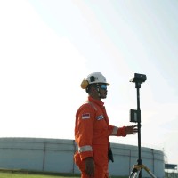
Current- Manage members of the survey and mapping team, which consists of drone pilots and GIS engineers.- At Halo Robotics as a drone pilot, GIS engineer, drone instructor, and data processing trainer
Please complete the CAPTCHA to continue
@halo-robotics.com
✓
LinkedIn matched
A concise factual answer block for searchers comparing this professional profile.
Reynal Bramasta is listed as Lead GIS Engineer at Halo Robotics at Halo Robotics, a with 25 employees, based in South Jakarta, Jakarta, Indonesia. AeroLeads shows a work email signal at halo-robotics.com and a matched LinkedIn profile for Reynal Bramasta.
Reynal Bramasta previously worked as Survey and Mapping Lead at Halo Robotics and GIS Engineer Lead at Halo Robotics. Reynal Bramasta holds Bachelor Of Engineering - Be, Geodesy Engineering, 3.16 from Institut Teknologi Nasional Malang (Itn Malang).
This section adds company-level context without repeating Reynal Bramasta's masked contact details.
AeroLeads found 1 current-domain work email signal for Reynal Bramasta. Compare company email patterns before reaching out.
Experienced Geographic Information Systems Analyst with a demonstrated history of working in the mining and infrastructure industry. Strong in Spatial Data Processing with a Bachelor of Engineering focused in Geodesy and Geoinformatics Engineering.
Company context helps verify the profile and gives searchers a useful next step.
A career timeline built from the work history available for this profile.
Jakarta, Indonesia
- Manage members of the survey and mapping team, which consists of drone pilots and GIS engineers.- At Halo Robotics as a drone pilot, GIS engineer, drone instructor, and data processing trainer
Morowali, Central Sulawesi, Indonesia
Supervised the survey team to take topography measurements properly and correctly in the nickel mining pit area. Responsible for all survey data from all pits. Making survey plans for mining production with GIS, Draw a map of the mine area topography, update the mine situation map, drone mapping with Phantom 4 RTK. Determine pit area boundaries for the production team and process data using Surpac and ArcGIS, reporting slope monitoring, calculate cut and fill for Over Burden, Ore, Quarry, Top Soil. Create weekly and monthly cut and fill calculation reports.
Sidoarjo Regency, East Java, Indonesia
Working on artificial toponymy in Sidoarjo using an application from Badan Informasi Geospatial (BIG) called Sakti. Collecting data by field surveys such as coordinates and building data, displays data into an artificial toponymy map.
Bulungan, North Kalimantan, Indonesia
Working on PTSL projects, data acquisition using GPS RTK, processing data in AutoCAD and drawing measurement results in AutoCAD.
Surabaya, East Java, Indonesia
Creating Geographic Information System for the boundaries of Surabaya using ArcGIS, creating database with Geodatabase, combine spatial and non-spatial data, present a digital map and displays information from the boundaries of Surabaya city.
Surabaya, East Java, Indonesia
Measurement and installation pillars for the boundaries of Surabaya, using GPS Geodetic for getting coordinates data, processing raw data, installing the pillars boundaries at coordinate points, Making reports GPS Geodetic Measurement.
Other employees you can reach at halo-robotics.com. View company contacts for 25 employees →
Ezria Adyas
Colleague at Halo RoboticsIndonesia
View →
IS
Ismail Syahidul Udzma
Colleague at Halo RoboticsSurakarta, Central Java, Indonesia
View →
EM
Eli Moselle
Colleague at Halo RoboticsIndonesia
View →
IP
Ilham Priyono
Colleague at Halo RoboticsGambir, Jakarta, Indonesia
View →
GS
Geo Scientia
Colleague at Halo RoboticsJakarta Metropolitan Area, Indonesia
View →
AR
Adhita R.
Colleague at Halo RoboticsJakarta, Indonesia
View →
PR
Penda Reflinda
Colleague at Halo RoboticsJakarta, Indonesia
View →
AA
Apriadi Agussalim
Colleague at Halo RoboticsKelurahan Pondok Pinang, Jakarta, Indonesia
View →
HA
Heldi Alfiadi
Colleague at Halo RoboticsBandung, West Java, Indonesia
View →
AK
Annemarie Kraan
Colleague at Halo RoboticsJakarta, Indonesia
View →
Quick answers generated from the profile data available on this page.
Reynal Bramasta works for Halo Robotics.
Reynal Bramasta is listed as Lead GIS Engineer at Halo Robotics at Halo Robotics.
AeroLeads has found 1 work email signal at @halo-robotics.com for Reynal Bramasta at Halo Robotics.
Reynal Bramasta is based in South Jakarta, Jakarta, Indonesia while working with Halo Robotics.
Reynal Bramasta has worked for Halo Robotics, Pt. Sentosa Abadi, Cv. Wira Buana Consultant, Badan Pertanahan Nasional, and Cv. Meridian Anugrah Pradipta.
Reynal Bramasta's colleagues at Halo Robotics include Ezria Adyas, Ismail Syahidul Udzma, Eli Moselle, Ilham Priyono, and Geo Scientia.
You can use AeroLeads to view verified contact signals for Reynal Bramasta at Halo Robotics, including work email, phone, and LinkedIn data when available.
Reynal Bramasta holds Bachelor Of Engineering - Be, Geodesy Engineering, 3.16 from Institut Teknologi Nasional Malang (Itn Malang).
Search by job title, company, industry, location, and seniority. Export verified B2B contact data when you need it.
Start free trial Search contacts