
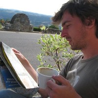
AeroLeads people directory · profile
Rob Marjot Email & Phone Number
Geo-Information Engineer and Software Developer
at
NEO BV Netherlands
1 work email found
@neo.nl
LinkedIn matched
✓ Verified Jun 2026
4 data sources
Profile completeness 100%
Current company
Role
Geo-Information Engineer and Software Developer
Location
Hilversum, North Holland, Netherlands
Company size
Who is Rob Marjot? Overview
A concise factual answer block for searchers comparing this professional profile.
Quick answer
Rob Marjot is listed as Geo-Information Engineer and Software Developer at NEO BV Netherlands, a company with 44 employees, based in Hilversum, North Holland, Netherlands. AeroLeads shows a work email signal at neo.nl and a matched LinkedIn profile for Rob Marjot.
Rob Marjot previously worked as Geo-Information Engineer / Software Developer at Neo Bv Netherlands and PROJECT: CAP OTSC & CbM results visualisation and dissemination systems development at Neo Bv Netherlands. Rob Marjot holds Msc, Geographical Information Science from Universiteit Utrecht.
Company email context
Email format at NEO BV Netherlands
This section adds company-level context without repeating Rob Marjot's masked contact details.
{first}.{last}@neo.nl
89% confidence
AeroLeads found 1 current-domain work email signal for Rob Marjot. Compare company email patterns before reaching out.
Profile bio
About Rob Marjot
Full-stack Geo-information Engineer (self-employed): GIS applications for (mobile) web and desktop, geo-information web-services and cloud solutions.Results-driven, agile. Architecture, abstractions and modelling are key success factors in software development. Advocate of open source and open standards; seen tons of code, written tons of code. Enjoy working in multi-disciplinary teams with experts from other domains like archaeology, earth observation, hydrography, agronomy.Platforms/technologies of choice:- (Geo-spatial, mobile friendly) Web front-end: JavaScript, OpenLayers, VueJS, D3JS, JQuery, BackboneJS, HTML, CSS- (Geo-spatial) Back-end: .NET/C# (ASP.NET, WebAPI), Python, PostgreSQL/PostGIS, PL/SQL, Oracle (Spatial), UMN MapServer, PHP; on Linux, on Windows, containerized (Docker)- Desktop: .NET/C#, Python, QGIS, MapInfo/MapBasic, ArcGIS, VBA, MS Access- Data management & ETL: GDAL/OGR, SQLite/SpatiaLite, FME, XML/XSLT, Fiona, Shapely, RasterioLiving in Hilversum area, married, 3 children. Enjoying Europe's diversity during holidays.
Listed skills include Gis, Spatial Databases, Arcgis, .Net, and 36 others.
Current workplace
Rob Marjot's current company
Company context helps verify the profile and gives searchers a useful next step.
Neo Bv Netherlands
12 roles
Rob Marjot work experience
A career timeline built from the work history available for this profile.
Geo-Information Engineer / Software Developer
CurrentFor NEO B.V., I am developing a geo-information infrastructure (back-end, front-end) to support computer aided image interpretation and change detection (on aerial / satellite imagery). The platform facilitates:1. Centralized workload preparation and prioritization2. Expert reviewing and complex data-entry, red-lining, etc.3. Procedures and reporting of.
Jan 2011 - Present
Project: Cap Otsc & Cbm Results Visualisation And Dissemination Systems Development
Current
Feb 2013 - Present
Project: Cropmonitor
CurrentAvailability of free (or affordable) medium-resolution satellite imagery (spectral and radar) is on the rise. CropMonitor is a platform for continuous monitoring of fields using time series satellite data of various sources/sensors, including Sentinel1/2, Landsat8, Modis and Aster. For the entire technology stack of web dissemination and service delivery.
Jan 2016 - Present
Project: National Satellite Data Portal (Netherlands Space Office)
The Netherlands Space Office (NSO) is a Dutch government agency promoting space technology, including the use of satellite imagery. Working with raw spaceborne imagery is not as easy as it may seem, therefore NEO B.V. has been contracted to download, process and georeference satellite image acquisitions. Subsequently, these images are made available.
Sep 2015 - Apr 2018
Project: Lianfoto
LIANFOTO is a smartphone App (Android) aiming to replace the costly land surveying equipment and personel involved in updating the mapping of sub-surface infrastructures like water, gas, electricity and data networks. Using LIANFOTO, pictures are taken and both the position (GPS: lat/lon) and external orientation parameters (pitch, roll, yaw) are stored.
Feb 2015 - Jun 2016

Senior Software Engineer For African Risk Capacity
CurrentThe African Risk Capacity (ARC) was established as a Specialized Agency of the African Union (AU) to help Member States improve their capacities to better plan, prepare and respond to extreme weather events and natural disasters, therefore protecting the food security of their vulnerable populations.ARC employs a suite of specialised software tools.
May 2017 - Present
Geo-Information Engineer / Software Developer (Freelance)
CurrentMe and ADC ArcheoProjecten have a long history together in developing and integrating spatially enabled software solutions in support of archeological fieldwork, synthesis and reporting. The core product I have been developing is ArcheoSuite: a platform for (geo)information processing in archaeological research. It has its use in the entire chain of.
Oct 2004 - Present
Project: Echarting (Selangor Land And Mines Office, Malaysia)
Selangor Ptgs
Being responsible for the timely and correct handling of land claims and permit requests, the Selangor (Malaysia) Land and Mines Office (Pejabat Tanah dan Galian Selangor, PTGS) wished to digitize the handling of these applications. Within this larger eCharting project, my job was to implement the integrated charting module in MapInfo, touching upon the.
Jan 2016 - Sep 2016

Geo-Information Engineer / Software Developer
Development of hydrographic processing toolkits (ArcGIS) and webbased Asset Management platform for Offshore Infrastructures. Development and bug fixing for SonarReg92 application in which the full record of sonar detected objects is being recorded and administrated by RWS.Development of Maritime Archaeology Database (MARIAD)Key technologies.
Dec 2013 - May 2015
Geo-Information Analyst
1. Data preparation, structuring, aligning data models2. Spatial Analysis using ArcGIS (ecological impact, impact on area accessibility / traffic)3. Dissemination of spatial information trough ArcView as well as more traditional cartographic outputs (paper, PDF)Task automation using ArcPy
Sep 2010 - Dec 2010

Systems Engineer (Internship)
Development and integration of a Point Of Sales system across a distributed computing environment. Key technologies: Borland C++Builder / Delphi, MS Access, MS SQL Server
Jan 2003 - May 2003
Team & coworkers
Colleagues at NEO BV Netherlands
Other employees you can reach at neo.nl. View company contacts for 44 employees →
FF
 Fang Fang
Colleague at Neo Bv NetherlandsUtrecht, Utrecht, Netherlands, Netherlands
View →
FG
Fang Fang
Colleague at Neo Bv NetherlandsUtrecht, Utrecht, Netherlands, Netherlands
View →
FG
 Fiona Gallagher
Colleague at Neo Bv NetherlandsAmsterdam, North Holland, Netherlands, Netherlands
View →
SB
Fiona Gallagher
Colleague at Neo Bv NetherlandsAmsterdam, North Holland, Netherlands, Netherlands
View →
SB
 Steven Braakman
Colleague at Neo Bv NetherlandsThe Randstad, Netherlands, Netherlands
View →
YC
Steven Braakman
Colleague at Neo Bv NetherlandsThe Randstad, Netherlands, Netherlands
View →
YC
 Yapkan Choi
Colleague at Neo Bv NetherlandsAmsterdam, North Holland, Netherlands, Netherlands
View →
FV
Yapkan Choi
Colleague at Neo Bv NetherlandsAmsterdam, North Holland, Netherlands, Netherlands
View →
FV
 Fenna Van Tillo
Colleague at Neo Bv NetherlandsDeventer, Overijssel, Netherlands, Netherlands
View →
FM
Fenna Van Tillo
Colleague at Neo Bv NetherlandsDeventer, Overijssel, Netherlands, Netherlands
View →
FM
 Fatemeh Mahmoudi
Colleague at Neo Bv NetherlandsVianen, Utrecht, Netherlands, Netherlands
View →
JE
Fatemeh Mahmoudi
Colleague at Neo Bv NetherlandsVianen, Utrecht, Netherlands, Netherlands
View →
JE
 Jan Erik Wien
Colleague at Neo Bv NetherlandsWageningen, Gelderland, Netherlands, Netherlands
View →
LV
Jan Erik Wien
Colleague at Neo Bv NetherlandsWageningen, Gelderland, Netherlands, Netherlands
View →
LV
 Lola Varga
Colleague at Neo Bv NetherlandsUtrecht, Utrecht, Netherlands, Netherlands
View →
MH
Lola Varga
Colleague at Neo Bv NetherlandsUtrecht, Utrecht, Netherlands, Netherlands
View →
MH
 Marcel Hazekamp
Colleague at Neo Bv NetherlandsArnhem, Gelderland, Netherlands, Netherlands
View →
BB
Marcel Hazekamp
Colleague at Neo Bv NetherlandsArnhem, Gelderland, Netherlands, Netherlands
View →
BB
 Barbara Bieńkowska
Colleague at Neo Bv NetherlandsLeusden, Utrecht, Netherlands, Netherlands
View →
Barbara Bieńkowska
Colleague at Neo Bv NetherlandsLeusden, Utrecht, Netherlands, Netherlands
View →
Fang Fang
Colleague at Neo Bv NetherlandsUtrecht, Utrecht, Netherlands, Netherlands
View →
FG
Fiona Gallagher
Colleague at Neo Bv NetherlandsAmsterdam, North Holland, Netherlands, Netherlands
View →
SB
Steven Braakman
Colleague at Neo Bv NetherlandsThe Randstad, Netherlands, Netherlands
View →
YC
Yapkan Choi
Colleague at Neo Bv NetherlandsAmsterdam, North Holland, Netherlands, Netherlands
View →
FV
Fenna Van Tillo
Colleague at Neo Bv NetherlandsDeventer, Overijssel, Netherlands, Netherlands
View →
FM
Fatemeh Mahmoudi
Colleague at Neo Bv NetherlandsVianen, Utrecht, Netherlands, Netherlands
View →
JE
Jan Erik Wien
Colleague at Neo Bv NetherlandsWageningen, Gelderland, Netherlands, Netherlands
View →
LV
Lola Varga
Colleague at Neo Bv NetherlandsUtrecht, Utrecht, Netherlands, Netherlands
View →
MH
Marcel Hazekamp
Colleague at Neo Bv NetherlandsArnhem, Gelderland, Netherlands, Netherlands
View →
BB
Barbara Bieńkowska
Colleague at Neo Bv NetherlandsLeusden, Utrecht, Netherlands, Netherlands
View →
3 education records
Rob Marjot education

Msc, Geographical Information Science
Bsc, Human Geography

Bsc, Electrical Engineering / Computer Science
FAQ
Frequently asked questions about Rob Marjot
Quick answers generated from the profile data available on this page.
What company does Rob Marjot work for?
Rob Marjot works for NEO BV Netherlands.
What is Rob Marjot's role at NEO BV Netherlands?
Rob Marjot is listed as Geo-Information Engineer and Software Developer at NEO BV Netherlands.
What is Rob Marjot's email address?
AeroLeads has found 1 work email signal at @neo.nl for Rob Marjot at NEO BV Netherlands.
Where is Rob Marjot based?
Rob Marjot is based in Hilversum, North Holland, Netherlands while working with NEO BV Netherlands.
What companies has Rob Marjot worked for?
Rob Marjot has worked for Neo Bv Netherlands, World Food Programme, Adc Archeoprojecten B.V., Selangor Ptgs, and Periplus Group.
Who are Rob Marjot's colleagues at NEO BV Netherlands?
Rob Marjot's colleagues at NEO BV Netherlands include Fang Fang, Fiona Gallagher, Steven Braakman, Yapkan Choi, and Fenna Van Tillo.
How can I contact Rob Marjot?
You can use AeroLeads to view verified contact signals for Rob Marjot at NEO BV Netherlands, including work email, phone, and LinkedIn data when available.
What schools did Rob Marjot attend?
Rob Marjot holds Msc, Geographical Information Science from Universiteit Utrecht.
What skills is Rob Marjot known for?
Rob Marjot is listed with skills including Gis, Spatial Databases, Arcgis, .Net, Postgresql, Spatial Analysis, Postgis, and Mapinfo Professional.
Find 750M verified contacts
Search by job title, company, industry, location, and seniority. Export verified B2B contact data when you need it.
Start free trialPeople with similar names
Check these profiles if this is not the Rob Marjot you were looking for.
View similar profiles