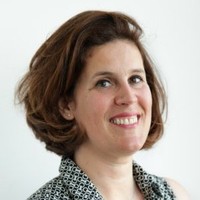
Sandrine Daniel
AeroLeads people directory · profile

Sandrine Daniel Email & Phone Number

Researcher Engineer in Remote sensing | Head of Scientific Office at Capgemini at CLS Group
Location: Toulouse, Occitanie, France 15 work roles 5 schools
LinkedIn matched
✓ Verified July 2026 3 data sources Profile completeness 86%

Contact Signals

LinkedIn Profile matched
3 free lookups remaining · No credit card
Current company
Role
Researcher Engineer in Remote sensing | Head of Scientific Office at Capgemini
Location
Toulouse, Occitanie, France
Company size

Who is Sandrine Daniel? Overview

A concise factual answer block for searchers comparing this professional profile.

Quick answer

Sandrine Daniel is listed as Researcher Engineer in Remote sensing | Head of Scientific Office at Capgemini at CLS Group, a with 435 employees, based in Toulouse, Occitanie, France. AeroLeads shows a matched LinkedIn profile for Sandrine Daniel.

Sandrine Daniel previously worked as Responsable de la cellule Observation Radar Off-Nadir chez CLS at Cls Group and Data & AI CoE leader for France at Capgemini. Sandrine Daniel holds Doctorat, Traitement Du Signal from Université De Rennes I.

Company email context

Email format at CLS Group

This section adds company-level context without repeating Sandrine Daniel's masked contact details.

CLS Group

Review company-level records connected to Sandrine Daniel before choosing the right outreach path.

Profile bio

About Sandrine Daniel

The Scientific Office of Capgemini, Toulouse, includes Earth observation physicists, mathematicians and scientific developers.Among its missions, the Scientific Office prepares future satellite missions, helps with the industrialisation of scientific algorithms from labs, and proposes space applications

Current workplace

Sandrine Daniel's current company

Company context helps verify the profile and gives searchers a useful next step.

CLS Group
Cls Group
Researcher Engineer in Remote sensing | Head of Scientific Office at Capgemini
france
Website
Employees
435
AeroLeads page
15 roles · 22 years

Sandrine Daniel work experience

A career timeline built from the work history available for this profile.

Responsable De La Cellule Observation Radar Off-Nadir Chez Cls

Current

Ramonville-Saint-Agne, Occitanie, France

Responsable des activités relatives aux missions d'observation non-conventionnelles comme SWOT/S3NG (Altimètre à fauchée), CFOSAT (Altimètre diffusiomètre), Harmony, Odysea.- Coordonner les activités d'études, de simulation et d'analyse des missions d'Observation- Montage d'appels d'offre

May 2024 - Present

Data & Ai Coe Leader For France

Toulouse, Occitanie, France

Data & AI Business development in differents sectors

Feb 2023 - Apr 2024

Scientific Consultant

Projects:* GEORICE (DUE Innovators III funding), using Sentinel-1 SAR data for rice monitoring, with the Mekong river delta as demonstration site. This project intends to contribute to the Asia rice crop estimation and monitoring, a major component of the GEOGLAM initiative, which aims to enhance rice production estimates across Asia through the use of Earth Observation.Task: Prototyping and industrialization of scientific algorithm from CESBIO French Lab for an operational application of rice field monitoring with Sentinel-1 data (ESA)Skill: SAR remote sensing, Python, Pydoop* FAAPS (Fully Automated Aqua Processing Service), in the ESA IAP (Integrated Applications Promotion) programme frame, SW elements to automatically process the ENVISAT and Sentinel radar images to assess the flooding area, using the technologies such as hadoop, cloud and mobile technologies (on smartphone and tablet) to share information. Project in collaboration with Capgemini Austria. (https://artes-apps.esa.int/projects/faaps)Task: Participating to the industrialization of a software prototype for an operational application of flood alert and detection areas from SAR data (ESA). Scientific algorithm have been developed by TU-Vienna.Skill: SAR remote sensing, ENVI/IDL

2012 - Apr 2024

Head Of Scientific Office

Toulouse Area, France

The Scientific Office of Capgemini, Toulouse, includes Earth observation physicists, mathematicians and scientific developers.Among its missions, the Scientific Office prepares future satellite missions, helps with the industrialisation of scientific algorithms from labs, and proposes space applications

May 2018 - Jan 2023

Scientific Engineer At Capgemini Scientific Office (Toulouse, Fr)

Région De Toulouse, France

* SWOT mission:There are two primary science rationales for the development of SWOT (1) make high-resolution (HR), wide-swath altimetric measurement of the ocean surface topography to make fundamental advances in the understanding of the oceanic mesoscale and submesoscale processes, and (2) measure the elevation of water on land to make fundamental advances in the understanding of the spatial and temporal distribution of the storage and discharge of water on land.* SWOT-HR projects : - SWOT-HR scientific simulator design and implementation (CNES). From the feasibility study and to industrialized prototypes- Analyzing airborne measurement campaigns in the SWOT-HR context (DRIVE-BUSARD data from ONERA) (CNES)Publication: "KaRIn on SWOT: Characteristics of near-nadir Ka-band interferometric SAR imagery", Fjortoft R., Gaudin J.M., Pourthie N., Lalaurie J.C., Mallet A., Nouvel J.F., Martinot-Lagarde J., Oriot H., Borderies P., Ruiz C., Daniel S., IEEE Transactions on Geoscience and Remote Sensing 04/2014; 52(4):2172-2185.* AltiKa Mission: SARAL/AltiKa is the world’s first satellite equipped with a Ka-band (35.75 GHz) altimeter for the measurement of ocean levels.(https://altika-saral.cnes.fr/en/SARAL/index.htm)* AltiKa project:- Sensitivity study of Electromagnetic responses of a model describing snow of Antarctica in the context of AltiKa(CNES)

Nov 2011 - Dec 2020

Project Manager

Project:GEORICE provides services (using Sentinel-1 data) to the rice monitoring stakeholders. This tool, web-accessible, proposes to generate and display paddy maps, season rice maps or season phenology maps. The services include rice crop grown area at a given time of the year, rice crop area estimates per season and per year, early warning of yield shortage and indicators of rice production. Project in collaboration with CESBIO French lab.Video: https://www.youtube.com/watch?v=JdvH2y6g8uc

Jun 2016 - Dec 2017

Post-Doctorate At The Electromagnetic And Radar Department Of Onera

Onera-Cnes

* BIOMASS mission:The primary scientific objectives of the Biomass mission are (1) to determine the distribution of aboveground biomass in the tropical forests and (2) to measure annual changes in this stock over the period of the mission (~5 years).Project:Characterization of tropical forest using PolInSAR techniques in the frame of the BIOMASS missionPublications:"The TropiSAR airborne campaign in French Guiana: Objectives, description and observed temporal behavior of the backscatter signal", Dubois-Fernandez P., Le Toan T., Daniel S., Oriot H., Chave J., Blanc L., Villard L., Davidson M. et Petit M., IEEE Geoscience and Remote sensing, vol.56, no 8, pp 3228-3241, August 2012."TropiSAR, a SAR data acquisition campaign in French Guiana", Dubois-Fernandez P., Oriot H., Coulombeix C., Cantalloube H., Ruault du Plessis O., Le Toan T., Daniel S., Chave J., Blanc L., Davidson M., Proc EUSAR, 2010.

Nov 2010 - May 2011

Researcher Engineer In Remote Sensing

At Onera, Salon De Provence

* TropiSAR mission in BIOMASS context:The TropiSAR campaign was conducted in French Guiana in the summer 2009 in the framework of the Phase A studies pertaining to the BIOMASS mission, one of the three for Earth Explorer candidates. Its main objectives were the evaluation of P-Band radar imaging over tropical forests for biomass and forest height estimation. Project:- Analysis of Polarimetric and Interferometric SAR data in frame of the TROPISAR project for the remote sensing of tropical forest (in BIOMASS mission context)- Image quality assessment, PolInSAR data processing, physical parameter retrieval, participation to ground measurementsPublication:"P-Band SAR study of Tropcial forest in French Guiana", Daniel S., Dubois-Fernandez P., Le Toan T., Chave J., Blanc L., Davidson M., SPIE 2010.

2009 - 2010 ~1 yr

Teaching Associate And Research Associate

Teaching topics- Analog and digital electronics- Multidisciplinary projects- Analog Modulation- Digital communications- SAR remote sensing

2008 - 2009 ~1 yr

Phd In Remote Sensing

Airborne polarimetric SAR images analysis for the retrieval of agricultural fields physical parameters- Modelling radar interaction with periodic bare surface - Classification of agricultural fields based on the support vector machine technique and on the analysis of the behaviour of radar polarimetric parameters- Retrieval of soil moisture- Time-frequency analysis- Multi-temporal analysisThis work deals with the soil moisture estimation over different kind of agricultural fields from polarimetric SAR data acquired in L band by the airborne radar of Germany Aerospace center, E-SAR. Different electromagnetic models are studied in order to simulate the backscattering behavior of bare and vegetated soils and to determine the influence of soil moisture on their radar response. Furthermore, plowed agricultural fields are modeled using periodic structure within the surface geometry in order to understand their particular electromagnetic behavior. Classical inversion methods are shown to be unadapted for periodic soils. Thus, a new inversion method based on the polarimetric parameter a1 is developed and applied to the SAR response of periodic bare soils, whose location in the SAR image is detected using a coherent Time-Frequency analysis. Vegetated agricultural fields are studied using multi-temporal SAR images. An identification of different kinds of vegetation is led using a classification based on the support vector machine technique and on the analysis of the behavior of polarimetric parameter. The obtained vegetation maps allow to follow temporal evolution of plants.My thesis manuscrit is available at: http://tel.archives-ouvertes.fr/tel-00523413/fr/

2005 - 2009 ~4 yrs

Phd Publications

Ietr

Publications:"Agricultural vegetation classification with SVM and polarimetric SAR data", Daniel S., Angelliaume S., Allain S., Dubois-Fernandez P., Pottier E., SPIE 2010. Soil moisture retrieval over periodic rough surface using POLSAR data, Daniel S., Allain S., Ferro-Famil L., Pottier E., Proc. PolInSAR, Frascatti, Italy, January 2009."Surface parameter estimation over periodic surface using Time-Frequency approach", Daniel S., Allain S., Ferro-Famil L., Pottier E., IGARSS, Boston, US, July 2008."Agricultural Mapping using Polarimetric SAR Data", Daniel S., Allain S., Pottier E., International Symposium on Retrieval of Bio- and Geophysical Parameters fro SAR data, Bari, Italy, September 2007."Short Vegetation Influence on Surface Parameter Estimations", Daniel S., Allain S., Pottier E., IGARSS, Barcelona, Spain, July 2007."Ground-Agricultural Separation by Means of PolInSAR", Neumann M., Daniel S., Ferro-Famil L., Reigber A., Pottier E., Proc. PolInSAR, Frascati, Italy, January 2007."Characterization of SAR polarimetric of periodic surface", Daniel S., Allain S., Pottier E., Proc Majestic, Lorient, France, October 2006.
2005 - 2009 ~4 yrs

Research Student At Microwaves And Radar Institute (Hr)

Dlr

Quantitative Soil Parameter Estimation using the X-Bragg a Rough Surface Scattering Model

Feb 2005 - Aug 2005

Internship

Participation a l'élaboration d'analyses fonctionnelles d'un projet de rénovation d'un process agro-alimentaire (animal), au développement et test de module contrôle conforme au standard ISA S88.

Jun 2004 - Aug 2004

Internship

Serpe-Iesm

Projet technique au sein de l'équipe hydrologie de la SERPE-IESM. Le travail consiste à modifier une carte électronique d'un band d'étalonnage de sonde hauteur d'eau.

Mar 2002 - Jun 2002
Team & coworkers

Colleagues at CLS Group

Other employees you can reach at cls.fr. View company contacts for 435 employees →

5 education records

Sandrine Daniel education

FAQ

Frequently asked questions about Sandrine Daniel

Quick answers generated from the profile data available on this page.

What company does Sandrine Daniel work for?

Sandrine Daniel works for CLS Group.

What is Sandrine Daniel's role at CLS Group?

Sandrine Daniel is listed as Researcher Engineer in Remote sensing | Head of Scientific Office at Capgemini at CLS Group.

Where is Sandrine Daniel based?

Sandrine Daniel is based in Toulouse, Occitanie, France while working with CLS Group.

What companies has Sandrine Daniel worked for?

Sandrine Daniel has worked for Cls Group, Capgemini, Onera-Cnes, Cesbio, and Université De Rennes 1.

Who are Sandrine Daniel's colleagues at CLS Group?

Sandrine Daniel's colleagues at CLS Group include Leye C., Carlos De Wasseige, Grégoire Zara, Nicolas Graillot, and Aude Soulié.

How can I contact Sandrine Daniel?

You can use AeroLeads to view verified contact signals for Sandrine Daniel at CLS Group, including work email, phone, and LinkedIn data when available.

What schools did Sandrine Daniel attend?

Sandrine Daniel holds Doctorat, Traitement Du Signal from Université De Rennes I.

Find 750M verified contacts

Search by job title, company, industry, location, and seniority. Export verified B2B contact data when you need it.

People with similar names

Check these profiles if this is not the Sandrine Daniel you were looking for.

View similar profiles