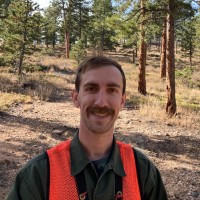
I am a Conservation Forester, Remote Sensing Scientist, and Forest Program Manager for a nonprofit covering 330,000 acres. I wear many hats, from GIS and remote sensing, to landowner communication and outreach, to project management and budgeting of landscape-scale forest restoration projects, to interagency strategic planning and collaboration. As a remote sensing scientist, I have experience in all of the widely-used systems such as multispectral and hyperspectral imagery, synthetic aperture radar (SAR), and lidar. I have published my work in the journal Forests, and have used remote sensing to bolster on-the-ground action for forest restoration on all of my projects.As a Conservation Forester I do everything from initial landowner outreach, to developing and conducting inventory, to writing forest management plans and prescriptions, to strategic project development alongside partner organizations, to grant-seeking and budgeting, to hiring contractors, to finalizing and certifying projects, to coordinating post-project monitoring. Although I specialize in private landowner project development, my partners have included county, state, and federal entities as well. My experience in working within a patchwork landscape continues to result in strong partnerships and a cohesive landscape strategy.I also have 5 years additional experience in my other ecological roles, including stingray hybridization research, spotted owl surveying, and invasive plant mitigation. I am a hobbyist native plant propagator in my free time, and an absolute geek about history, technology, ecology, and the interconnections between them all.