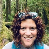
Aaron Vaughn
AeroLeads people directory · profile

Aaron Vaughn Email & Phone Number

GIS Coordinator at City of Great Falls at CITY OF GREAT FALLS
Location: Great Falls, Montana, United States 6 work roles 3 schools
1 work email found @greatfallsmt.net LinkedIn matched
✓ Verified August 2026 4 data sources Profile completeness 100%

Contact Signals · 1 work email

Work email a****@greatfallsmt.net
LinkedIn Profile matched
3 free lookups remaining · No credit card
Current company
Role
GIS Coordinator at City of Great Falls
Location
Great Falls, Montana, United States
Company size

Who is Aaron Vaughn? Overview

A concise factual answer block for searchers comparing this professional profile.

Quick answer

Aaron Vaughn is listed as GIS Coordinator at City of Great Falls at CITY OF GREAT FALLS, a with 13 employees, based in Great Falls, Montana, United States. AeroLeads shows a work email signal at greatfallsmt.net and a matched LinkedIn profile for Aaron Vaughn.

Aaron Vaughn previously worked as GIS Coordinator at City Of Great Falls and Land Management and Addressing Specialist at City Of Great Falls. Aaron Vaughn holds Bachelor Of Arts (B.A.), Mass Communication/Media Studies from University Of Utah.

Company email context

Email format at CITY OF GREAT FALLS

This section adds company-level context without repeating Aaron Vaughn's masked contact details.

{first_initial}{last}@greatfallsmt.net
89% confidence

AeroLeads found 1 current-domain work email signal for Aaron Vaughn. Compare company email patterns before reaching out.

Profile bio

About Aaron Vaughn

GIS professional with experience in both raster and vector spatial analysis. Heavily involved in municipal GIS and asset management through an Esri-based enterprise system. Manage and train users in GIS within a city government. I enjoy staying on the cutting edge of the geospatial industry, while also exploring and learning about the foundations of cartography.

Listed skills include Geographic Information Systems, Geospatial Modeling, Geospatial Data, Quantum Gis, and 28 others.

Current workplace

Aaron Vaughn's current company

Company context helps verify the profile and gives searchers a useful next step.

CITY OF GREAT FALLS
City Of Great Falls
GIS Coordinator at City of Great Falls
great falls, montana, united states
Employees
13
AeroLeads page
6 roles

Aaron Vaughn work experience

A career timeline built from the work history available for this profile.

Gis Coordinator

Current

Great Falls, Montana

• Sustain a enterprise level GIS infrastructure to do outreach and mapping services for city departments and external customers as well as empower those to use spatial data for their work.• Manage the GIS Specialist position to ensure the direction and quality changes of the city's land data and addressing.• Maintain a multi-user GIS shared with nearly 100 users.• Conduct outreach as part of IT and GIS technical working group to better communicate efforts in the city.

Dec 2019 - Present

Land Management And Addressing Specialist

City Of Great Falls

Great Falls, Mt

Dec 2017 - Dec 2019

Temporary Gis Analyst For City Of Bozeman

Bozeman, Montana

Worked with the Bozeman City GIS group during a 4-month period assisting the Public Works department, Community Development and Planning, and Engineering:• Conducted pothole analysis and created charts using ArcGIS map layer data to determine problem city street areas that typically need annual repairs. Results used to show effectiveness of gathering pothole data and subsequent repairs as well as being integrated into a city transportation storymap.• Assisted planning and community… Show more Worked with the Bozeman City GIS group during a 4-month period assisting the Public Works department, Community Development and Planning, and Engineering:• Conducted pothole analysis and created charts using ArcGIS map layer data to determine problem city street areas that typically need annual repairs. Results used to show effectiveness of gathering pothole data and subsequent repairs as well as being integrated into a city transportation storymap.• Assisted planning and community development with projects including mapping special improvement districts and annexations, as well as areas called 'Paybacks' where data was made available through an interactive online map software.• Beta tested new GIS data visualization software to show rates of change and unique data arrangements to assist the city Stormwater department.• Collected field data using Trimble GPS tripod collectors and laser vertical measuring equipment to determine storm drain laterals. Show less

Jun 2017 - Oct 2017

Reporter

The River Press

Fort Benton, Montana

• Interviewed local officials and public figures, including the mayor, council members, commissioners, historians, and state reps.• Wrote 3-5 news stories a week while photographing those same story events for print.• Routinely received praise for stories and coverage.• Researched under deadline, covered everything from Montana's oldest Episcopalian church restoration to the city revamping legacy utility lines and having to raise sewer/water rates.• Helped design the annual… Show more • Interviewed local officials and public figures, including the mayor, council members, commissioners, historians, and state reps.• Wrote 3-5 news stories a week while photographing those same story events for print.• Routinely received praise for stories and coverage.• Researched under deadline, covered everything from Montana's oldest Episcopalian church restoration to the city revamping legacy utility lines and having to raise sewer/water rates.• Helped design the annual Visitor's Guide and wrote several informational articles for its release.• Initiated new editorial workflow utilizing Google cloud tools. Show less

Mar 2017 - Jun 2017

Water Information System Gis Editor Intern

Helena, Mt

• Edited the USGS National Hydrography Dataset (NHD) for the Lower Musselshell watershed basin.• Digitized over 1,200 square miles of area that included stream flowlines, water bodies, dams, and canals.• Referenced satellite imagery using both RGB and near infrared image spectrum to more accurately edit surface water flowlines, and water body polygons.• Demonstrated during a meeting the integration of a Google Earth Python script to aid reference and editing projects through… Show more • Edited the USGS National Hydrography Dataset (NHD) for the Lower Musselshell watershed basin.• Digitized over 1,200 square miles of area that included stream flowlines, water bodies, dams, and canals.• Referenced satellite imagery using both RGB and near infrared image spectrum to more accurately edit surface water flowlines, and water body polygons.• Demonstrated during a meeting the integration of a Google Earth Python script to aid reference and editing projects through capturing the extents from ArcMap and launching GE to that image area.•Used the USDA Land Cover dataset water body feature class to overlay against NHD waterbody data to find matches and missing polygons as a QC method.•Ran topology to check for gaps, overlaps, and intersects with streamlines and water body polygons to see that they were properly snapped. Show less

Jul 2016 - Dec 2016

Gis Certificate Student

Helena, Mt

Projects pertaining to GIS work:Carroll College GIS 110 – 'Water Pipeline location, replacement, and cost estimate for Harris Landand Cattle Ranch', Aug – Dec 2015• Took GPS coordinate recordings (Trimble) of water trough locations to identify an unknown pipeline location (circa 1974) -- a failing pipeline where only two of the four pour points are active.• Uploaded recordings through a GPS, Trimble Terrasync software, into ArcCatalog.• Digitized lines between… Show more Projects pertaining to GIS work:Carroll College GIS 110 – 'Water Pipeline location, replacement, and cost estimate for Harris Landand Cattle Ranch', Aug – Dec 2015• Took GPS coordinate recordings (Trimble) of water trough locations to identify an unknown pipeline location (circa 1974) -- a failing pipeline where only two of the four pour points are active.• Uploaded recordings through a GPS, Trimble Terrasync software, into ArcCatalog.• Digitized lines between troughs to indicate ‘straight shot’ pipeline locations for future replacement.• Created a report and in-class demonstration of procedure showing estimated scope and cost of the project.Carroll College GIS 220 Databases – USGS Soils Map Georeferencing/Digitizing, Aug – Aug - Dec 2015• Created ArcGIS file geodatabase and nested dataset file structure.• Georeferenced a black and white USGS 7.5 minute topo map first using listed coordinates and hatch marks to determine proper projection location.• Created and used the hatch marks as reference points to rectify map and project map to Montana State Plane.• Digitized box from each four-corner point, created a soils polygon feature class, and cut separate polygons from that box into individuals with their associated soil type codes.• Created a cartographically pleasing map with citations, color-coded legend, title, background basemap.• Added metadata FGDC template style.Carroll College GIS 435 Project– "BLM Grazing Leases and Percent Land Cover Jan" — Jan - May 2016•Downloaded datasets from BLM district office and Montana State Library referencing USGS GAP Analysis.•Discovered through different analysis techniques (joins, intersects, dissolves, and field calculations) percentage of grassland for leases in the Chouteau County area.•Presented findings on the research with a question and answer session among peers.•Included a 10-page report detailing the process and print-out of the map. Show less

Jan 2016 - Dec 2016
Team & coworkers

Colleagues at CITY OF GREAT FALLS

Other employees you can reach at greatfallsmt.net. View company contacts for 13 employees →

3 education records

Aaron Vaughn education

Gis Certification, Geographic Information Science And Cartography

Attended the two-year course that spanned from beginning GIS familiarity covering basic spatial analysis and feature data manipulation.

Mooc, Geography And Cartography, Certification Pass

Udemy
FAQ

Frequently asked questions about Aaron Vaughn

Quick answers generated from the profile data available on this page.

What company does Aaron Vaughn work for?

Aaron Vaughn works for CITY OF GREAT FALLS.

What is Aaron Vaughn's role at CITY OF GREAT FALLS?

Aaron Vaughn is listed as GIS Coordinator at City of Great Falls at CITY OF GREAT FALLS.

What is Aaron Vaughn's email address?

AeroLeads has found 1 work email signal at @greatfallsmt.net for Aaron Vaughn at CITY OF GREAT FALLS.

Where is Aaron Vaughn based?

Aaron Vaughn is based in Great Falls, Montana, United States while working with CITY OF GREAT FALLS.

What companies has Aaron Vaughn worked for?

Aaron Vaughn has worked for City Of Great Falls, City Of Bozeman, The River Press, Montana State Library, and Carroll College.

Who are Aaron Vaughn's colleagues at CITY OF GREAT FALLS?

Aaron Vaughn's colleagues at CITY OF GREAT FALLS include Melissa Robbins, Veronica Van Treeck, Liz Lee, Sawyer Bishop, and Nate Besich.

How can I contact Aaron Vaughn?

You can use AeroLeads to view verified contact signals for Aaron Vaughn at CITY OF GREAT FALLS, including work email, phone, and LinkedIn data when available.

What schools did Aaron Vaughn attend?

Aaron Vaughn holds Bachelor Of Arts (B.A.), Mass Communication/Media Studies from University Of Utah.

What skills is Aaron Vaughn known for?

Aaron Vaughn is listed with skills including Geographic Information Systems, Geospatial Modeling, Geospatial Data, Quantum Gis, Remote Sensing, Editing, Proofreading, and Photoshop.

Find 750M verified contacts

Search by job title, company, industry, location, and seniority. Export verified B2B contact data when you need it.

People with similar names

Check these profiles if this is not the Aaron Vaughn you were looking for.

View similar profiles