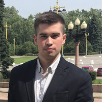

Alexander Lukin
AeroLeads people directory · profile

Alexander Lukin Email & Phone Number

Survey Operations Specialist at Teledyne Optech
Location: Toronto, Ontario, Canada 4 work roles 3 schools
1 phone found area 647 LinkedIn matched
✓ Verified August 2026 4 data sources Profile completeness 100%

Contact Signals · 1 phone

Direct phone (647) ***-****
LinkedIn Profile matched
3 free lookups remaining · No credit card
Current company
Role
Survey Operations Specialist
Location
Toronto, Ontario, Canada
Company size

Who is Alexander Lukin? Overview

A concise factual answer block for searchers comparing this professional profile.

Quick answer

Alexander Lukin is listed as Survey Operations Specialist at Teledyne Optech, a with 190 employees, based in Toronto, Ontario, Canada. AeroLeads shows phone signal with area code 647 and a matched LinkedIn profile for Alexander Lukin.

Alexander Lukin previously worked as GIS Specialist / Aerial Camera Operator at First Base Solutions Inc. and Land Surveyor at J.D. Barnes Limited. Alexander Lukin holds Post Graduate Certificate Program, Project Management, 3.2 from Centennial College.

Company email context

Email format at Teledyne Optech

This section adds company-level context without repeating Alexander Lukin's masked contact details.

Teledyne Optech

Review company-level records connected to Alexander Lukin before choosing the right outreach path.

Profile bio

About Alexander Lukin

Enthusiastic, highly motivated, and result-oriented Environmental GIS Specialist with a background in Project Management. My educational background comes from a Master of Arts Degree with a Major in Environmental Management and a Post Graduate program in Project Management. I have gained experience both in the field and in the office gaining hands-on experience in all realms involving GIS techniques and practices. I am continuously looking for challenges to expand my knowledge to understand and gain the expertise that will take my GIS skills to the next level. I am familiar with a wide range of geomatics and graphical software including ArcGIS, MicroStation, POSPac, UltraMap, SimActive and others. I have proficiency in remote sensing technologies, mapping, photogrammetry, LiDAR, database analysis, 3D modelling.

Listed skills include Microsoft Office, Обслуживание Клиентов, Microsoft Excel, Научно Исследовательская Деятельность, and 8 others.

Current workplace

Alexander Lukin's current company

Company context helps verify the profile and gives searchers a useful next step.

Teledyne Optech
Teledyne Optech
Survey Operations Specialist
vaughan, ontario, canada
Employees
190
AeroLeads page
4 roles

Alexander Lukin work experience

A career timeline built from the work history available for this profile.

Survey Operations Specialist

Current

Toronto, Ontario, Canada

- Conduct system operational testing and troubleshooting for airborne and mobile LiDAR and camera products- Conduct full workflow training from airborne LiDAR data acquisition to analysis at various international locations- Prepare client visits with necessary documentation and ensure all deliverable goals are met to the client’s satisfaction- Provide survey operations and planning services to production, engineering, and service departments as well as to the company’s worldwide clientele- Participate in software, hardware and firmware testing by developing and executing survey operations activities - Complete data processing, analysis, calibrating, validating, interpreting, and troubleshooting of LiDAR, GNSS/IMU, & imagery sensor data for both airborne and mobile LiDAR systems- Install and configure hardware, firmware and software as required according to standard operating procedures- Use professional judgement to identify, define and develop an understanding of any technical product issues, and drive complex problem resolution- Create effective and efficient flight plans for airborne sensors which maximize the capabilities of the technology- Generate reports of system performance and validation with Jira/Flir software- Deliver software and webinar demonstrations as part of support or pre-sales activities and assist in sessions customized to the specific technical needs of the customers and their planned use of the product.


Dec 2022 - Present

Gis Specialist / Aerial Camera Operator

Markham, Ontario, Canada

- Operate large formats of airborne Vexcel digital cameras (Eagle 80/210 and UCXp), lasers, radar sensors- Maintain the cameras: lens swap, post-flight calibration procedures, installation/removal cameras from aircraft, hard drive replacement in data units - Prepare flight plans, create ATC maps, build DEM for future missions in the TrackAir (snapPlot/Plan/Base/Shot)- Conduct ground control surveys using RTK and Static equipment, and use this data for calibration purposes- Transfer image data from data units using docking stations/plates and MSUD tools; conduct post-mission QCs; create flight diagrams- Work with raw data; perform colour balancing and radiometry processing in UltraMap (Lvl00-Lvl02)- Generate DEM applying LiDAR data and online tools; create tile diagrams in ArcGIS; generate orthorectified images, seamlines and mosaicking in PCI and GeoMedia; produce MrSID and individual SID files- GNSS/IMU Post Processing in Applanix POS MMS 8.6 software: extract various EO files, write processing summaries, conduct Real-Time Checks, apply Rover (GPS) data- Involved in DAT\EM 3D Stereo compilation procedures- Perform aerial triangulations, control adjustments, process boresight flights- Operate computer graphics equipment to provide three-dimensional optical models of terrain, topographic maps and aerial-photograph mosaics- Monitor and predict weather conditions using various online tools

Oct 2020 - Dec 2022

Land Surveyor

Toronto, Canada Area

- Conducted field surveys and operated survey instruments and computer equipment to measure distance, angles, elevations and contours- Recorded measurements and other information obtained during field survey activities- Determined precise locations using electronic distance measuring equipment and global positioning systems (GPS)- Analyzed, managed and displayed data using geographic information systems (GIS)- Certified and assumed liability for surveys made to establish real property boundaries- Analyzed latitude, longitude and angles and computed trigonometric and other calculations to plot features, contours and areas to a specific scale- Assisted survey engineers to develop methods and procedures for conducting field surveys- Prepared detailed drawings, charts and plans and survey notes and reports- Kept records, measurements and other survey information in systematic order- Developed survey plans, methods and procedures for conducting legal surveys- Planed surveys to establish and mark legal boundaries of properties, parcels of lands, provincial and Canada Lands, Aboriginal land claims, wellsites, mining claims, utility rights-of-way, roadways and highways- Surveyed and layout subdivisions for rural and urban development- Provided consultation and testify as an expert witness on matters related to legal surveys- Assisted in the calculation, analysis and computation of measurements obtained during field surveys- Assisted in the preparation of detailed drawings, charts and plans.

Sep 2019 - Oct 2020

Research Engineer

Isr "Aerocosmos"

Moscow, Russian Federation

- Analyzed and selected satellite images for further processing, interpreted and created sets of thematic maps- Thematically processed multispectral and hyperspectral space images for solving problems of regional environmental management- Chose optimal methods for processing heterogeneous earth GIS data to solve a wide range of tasks in the field of space monitoring of the natural environment and man-made objects- Trained in specialists of methods and technologies for remote sensing data processing in aerospace environmental monitoring- Co-authored scientific articles on the theme of space monitoring through remote sensing technologies

Feb 2014 - Dec 2017
Team & coworkers

Colleagues at Teledyne Optech

Other employees you can reach at teledyneoptech.com. View company contacts for 190 employees →

3 education records

Alexander Lukin education

FAQ

Frequently asked questions about Alexander Lukin

Quick answers generated from the profile data available on this page.

What company does Alexander Lukin work for?

Alexander Lukin works for Teledyne Optech.

What is Alexander Lukin's role at Teledyne Optech?

Alexander Lukin is listed as Survey Operations Specialist at Teledyne Optech.

What is Alexander Lukin's phone number?

AeroLeads has found 1 phone signal(s) with area code 647 for Alexander Lukin at Teledyne Optech.

Where is Alexander Lukin based?

Alexander Lukin is based in Toronto, Ontario, Canada while working with Teledyne Optech.

What companies has Alexander Lukin worked for?

Alexander Lukin has worked for Teledyne Optech, First Base Solutions Inc., J.D. Barnes Limited, and Isr "Aerocosmos".

Who are Alexander Lukin's colleagues at Teledyne Optech?

Alexander Lukin's colleagues at Teledyne Optech include Serguei Souslov, Walid Tahiri, Julia Zu, Donald Cowl, and Lei Zhu.

How can I contact Alexander Lukin?

You can use AeroLeads to view verified contact signals for Alexander Lukin at Teledyne Optech, including work email, phone, and LinkedIn data when available.

What schools did Alexander Lukin attend?

Alexander Lukin holds Post Graduate Certificate Program, Project Management, 3.2 from Centennial College.

What skills is Alexander Lukin known for?

Alexander Lukin is listed with skills including Microsoft Office, Обслуживание Клиентов, Microsoft Excel, Научно Исследовательская Деятельность, Высшее Руководство, Искусство Публичного Выступления, Powerpoint, and Управление Проектами.

Find 750M verified contacts

Search by job title, company, industry, location, and seniority. Export verified B2B contact data when you need it.

People with similar names

Check these profiles if this is not the Alexander Lukin you were looking for.

View similar profiles