Usmc Geofidelis Imagery Analyst
Current
Mar 2020 - Present
Please complete the CAPTCHA to continue
@geocgi.com
✓
2 phones found area 816
✓
LinkedIn matched
A concise factual answer block for searchers comparing this professional profile.
Corey Brunk is listed as USMC GEOFidelis Imagery Analyst at Geospatial Consulting Group International, LLC (geocgi), a with 37 employees, based in Overland Park, Kansas, United States. AeroLeads shows a work email signal at geocgi.com, phone signal with area code 816, and a matched LinkedIn profile for Corey Brunk.
Corey Brunk previously worked as GIS Specialist/Lead at Mts and GIS Technician II at Transystems. Corey Brunk holds Masters Of Geospatial Sciences, Geographic Information Science And Cartography, 3.7 Gpa from Missouri State University.
This section adds company-level context without repeating Corey Brunk's masked contact details.
AeroLeads found 1 current-domain work email signal for Corey Brunk. Compare company email patterns before reaching out.
Highly motivated, versatile, and creative geospatial professional with over 10 years of GIS experience in a wide-range of industries. All work experience has been aided by a robust and comprehensive academic foundation in Geospatial Sciences. Proficient in the technical GIS domains of data acquisition, data modeling, QA/QC geodatabase design, cartographic design, spatial analysis, network analysis, surface analysis, linear referencing, and programming. Additional experience serving and administering GIS data to clients, working in CADD environments, and processing LiDAR data. A talent for finding innovative solutions for geospatial problems, developing procedures, and establishing workflows for standardizing/streamlining GIS processes. Proven success of interpersonal communication and collaboration with professionals of different backgrounds and skill sets. Accomplished in demanding environments while remaining pragmatic and focused.
Listed skills include Arcgis, Esri, Gis, Cartography, and 9 others.
Company context helps verify the profile and gives searchers a useful next step.
A career timeline built from the work history available for this profile.
Kansas City, Missouri, United States

Overland Park, Ks
As the lead GIS technical specialist, I was responsible for a diversity of challenges that demanded the ability to understand problems, think critically, and develop creative solutions. Common technical GIS task involved using ESRI ArcGIS software to build alignment sheets for linear utility features, creating detailed exhibits for project sites, performing travel cost estimates for accessing jobsites by using ArcGIS Network Analyst, automating GIS task using ArcGIS Modelbuilder and Python… Show more As the lead GIS technical specialist, I was responsible for a diversity of challenges that demanded the ability to understand problems, think critically, and develop creative solutions. Common technical GIS task involved using ESRI ArcGIS software to build alignment sheets for linear utility features, creating detailed exhibits for project sites, performing travel cost estimates for accessing jobsites by using ArcGIS Network Analyst, automating GIS task using ArcGIS Modelbuilder and Python ArcPy scripts, and designing geodatabases to ensure attribute and spatial integrity through the use of attribute domains, subtypes, and spatial topology. Furthermore, I was the leader in our company’s initiative make GIS data accessible to our clients. I was involved with every step of this process – from setting up the repository geodatabases, to publishing vector and raster data, to administering data security protocols such as client user-rights to view or edit the published data. Using GeoServer to publish and administer databases, I successfully set up infrastructure for serving vector and raster data in compliance of formats established by the Open Geospatial Consortium (OGC), including: Web Map Services (WMS), Web Tile Feature Services (WTMS), and Web Feature Services (WFS). Finally, my previous experience working with Bentley Microstation (CADD) and Leica Cyclone (LiDAR) software, I was relied upon as the technical expert. Achievements: Enacted highly effective QA/QC geodatabase protocols to ensure that spatial and attribute accuracy and consistency. Assisted project managers with cost estimates by using ArcGIS Network Analyst to calculate the time/distance for crews to access jobsites. Automated GIS task by writing Python scripts that incorporated ArcPy’s GIS functionality. Successfully developed the necessary infrastructure and workflow for publishing GIS services to clients. Advised and coached colleagues in using GIS, CADD, and LiDAR software. Show less

Kansas City, Missouri Area
Worked as a GIS team to create spatial and attribute data within an enterprise geodatabase environment – ESRI ArcSDE – for BNSF, Kansas City Southern, and Union Pacific railroad clients. Common responsibilities included creating vector data, populating attribute tables, reconciling GIS edits between different users, and calibrating routes to enforce station equations. Moreover, geodatabase QA/QC protocol of topology was employed to ensure spatial connectivity between linear track and point… Show more Worked as a GIS team to create spatial and attribute data within an enterprise geodatabase environment – ESRI ArcSDE – for BNSF, Kansas City Southern, and Union Pacific railroad clients. Common responsibilities included creating vector data, populating attribute tables, reconciling GIS edits between different users, and calibrating routes to enforce station equations. Moreover, geodatabase QA/QC protocol of topology was employed to ensure spatial connectivity between linear track and point features along tracks such as switches and milepost markers. In 2013, I took the initiative to expand my professional expertise by transferring to the civil survey department. While my primary responsibility was processing survey field data using CADD software Bentley Microstation, I also spent considerable time as a field surveyor. My time in the field provided hands on experience collecting ground data using survey grade GPS, total station, and terrestrial LiDAR scanner equipment for civil-site, department of transportation, and railroad clients. My time in the office gave me the opportunity to process the survey field data using Bentley Microstation and build detailed exhibits such as plan, profile, cross-section, contour maps. Key Achievements: Developed multi-disciplinary skills working with both the GIS and survey teams. Extensive experience of in-field data collection as well as processing field data in the office. Worked collectively as a GIS team to effectively work together within an enterprise geodatabase environment. Gained proficiency in acquiring and integrating raster and vector data with an understanding of the technical, legal, and ethical issues related to data acquisition. Registered, manipulated, and extracted survey grade topographic data from terrestrial LiDAR point cloud data. Processed field data using Microstation CADD software and outputted exhibits and TIN/DTM models in Microstation Show less

Washington D.C. Metro Area
Employed with the USDA International Production Assessment Division (IPAD), a co-op focused on global agricultural production assessment by using a convergence of evidence methodology including geospatial analysis, production statistics, and digital satellite imagery. Headed the program of archiving satellite imagery, geospatial data, and agricultural statistical data into a relational database management system – PostgreSQL. Additionally, I was involved with remote sensing analysis of… Show more Employed with the USDA International Production Assessment Division (IPAD), a co-op focused on global agricultural production assessment by using a convergence of evidence methodology including geospatial analysis, production statistics, and digital satellite imagery. Headed the program of archiving satellite imagery, geospatial data, and agricultural statistical data into a relational database management system – PostgreSQL. Additionally, I was involved with remote sensing analysis of multi-spectral satellite imagery to monitor agriculture production in the Middle East. Created rasterized land cover data outputs and designed cartographic exhibits for monthly reports to the USDA.Key Achievements: Successfully functioned in a complex environment of geospatial domains including database management, remote sensing, and statistical analysis Effectively worked in a high pressure situation when IPAD provided imagery analysis support during the 2010 Haiti earthquake disaster Used multi-spectral satellite imagery of AWIFS, Landsat 5&7, QuickBird, IKONOS, MODIS, and SPOT Collaborated as a team to meet USDA deadlines for monthly agricultural production reports Show less
Springfield, Missouri
As the subject of my Master’s thesis, I collaborated with Ozark Greenways Inc. in an effort to promote the “Bike to Work” program in Springfield, Missouri. This project gave me the opportunity to cultivate a relationships with local residents where I gained valuable input on the shortcomings of the current greenway system. I also researched and implemented a methodology to quantify the effectiveness of the existing greenway system using GIS technology. Through the processes of geocoding… Show more As the subject of my Master’s thesis, I collaborated with Ozark Greenways Inc. in an effort to promote the “Bike to Work” program in Springfield, Missouri. This project gave me the opportunity to cultivate a relationships with local residents where I gained valuable input on the shortcomings of the current greenway system. I also researched and implemented a methodology to quantify the effectiveness of the existing greenway system using GIS technology. Through the processes of geocoding residential addresses and using ArcGIS Network Analyst to calculate the distance from resident to greenway, I was able to quantify and visualize a resident’s accessibility to a greenway. This GIS analysis and visualization led to discoveries of residential areas with poor accessibility to greenways. All analysis was detailed in a comprehensive report that contained numerous cartographic exhibits that aided in the future development of the greenway system. Key Achievements: Envisioned and developed a geospatial methodology using ESRI Network Analyst to comprehensively assess the Springfield’s greenway system as a viable commuter corridor for residents. Developed a personal relationship with the local community and worked diligently to gain invaluable insight on the public’s perception of alternative commuting in Springfield. Created a comprehensive report containing detailed maps, statistical data, and evidence-based plans future greenway expansion. Show less
Other employees you can reach at geocgi.com. View company contacts for 37 employees →
 Aaron Dawson
Colleague at Geospatial Consulting Group International, Llc (Geocgi)Fredericksburg, Virginia, United States
View →
AM
Aaron Dawson
Colleague at Geospatial Consulting Group International, Llc (Geocgi)Fredericksburg, Virginia, United States
View →
AM
 Ajmal M.
Colleague at Geospatial Consulting Group International, Llc (Geocgi)Woodbridge, Virginia, United States
View →
CM
Ajmal M.
Colleague at Geospatial Consulting Group International, Llc (Geocgi)Woodbridge, Virginia, United States
View →
CM
 Clara Maxwell
Colleague at Geospatial Consulting Group International, Llc (Geocgi)Carbondale, Colorado, United States
View →
AT
Clara Maxwell
Colleague at Geospatial Consulting Group International, Llc (Geocgi)Carbondale, Colorado, United States
View →
AT
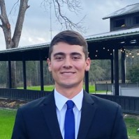 Alejandro Torres
Colleague at Geospatial Consulting Group International, Llc (Geocgi)Lake Charles, Louisiana, United States
View →
NG
Alejandro Torres
Colleague at Geospatial Consulting Group International, Llc (Geocgi)Lake Charles, Louisiana, United States
View →
NG
 Nick Guzi
Colleague at Geospatial Consulting Group International, Llc (Geocgi)Philadelphia, Pennsylvania, United States
View →
SL
Nick Guzi
Colleague at Geospatial Consulting Group International, Llc (Geocgi)Philadelphia, Pennsylvania, United States
View →
SL
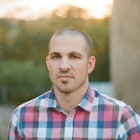 Sean Lacey
Colleague at Geospatial Consulting Group International, Llc (Geocgi)El Paso, Texas, United States
View →
JC
Sean Lacey
Colleague at Geospatial Consulting Group International, Llc (Geocgi)El Paso, Texas, United States
View →
JC
 John Chladon
Colleague at Geospatial Consulting Group International, Llc (Geocgi)Sterling, Virginia, United States
View →
KA
John Chladon
Colleague at Geospatial Consulting Group International, Llc (Geocgi)Sterling, Virginia, United States
View →
KA
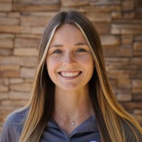 Kyler Arbeiter
Colleague at Geospatial Consulting Group International, Llc (Geocgi)Franklin, Tennessee, United States
View →
JH
Kyler Arbeiter
Colleague at Geospatial Consulting Group International, Llc (Geocgi)Franklin, Tennessee, United States
View →
JH
 Jed Hargett
Colleague at Geospatial Consulting Group International, Llc (Geocgi)Warrensburg, Missouri, United States
View →
RD
Jed Hargett
Colleague at Geospatial Consulting Group International, Llc (Geocgi)Warrensburg, Missouri, United States
View →
RD
 Raul De La Peña
Colleague at Geospatial Consulting Group International, Llc (Geocgi)Ginowan, Okinawa, Japan
View →
Raul De La Peña
Colleague at Geospatial Consulting Group International, Llc (Geocgi)Ginowan, Okinawa, Japan
View →


Quick answers generated from the profile data available on this page.
Corey Brunk works for Geospatial Consulting Group International, LLC (geocgi).
Corey Brunk is listed as USMC GEOFidelis Imagery Analyst at Geospatial Consulting Group International, LLC (geocgi).
AeroLeads has found 1 work email signal at @geocgi.com for Corey Brunk at Geospatial Consulting Group International, LLC (geocgi).
AeroLeads has found 2 phone signal(s) with area code 816 for Corey Brunk at Geospatial Consulting Group International, LLC (geocgi).
Corey Brunk is based in Overland Park, Kansas, United States while working with Geospatial Consulting Group International, LLC (geocgi).
Corey Brunk has worked for Geospatial Consulting Group International, Llc (Geocgi), Mts, Transystems, Asrc, and Ozark Greenways Inc..
Corey Brunk's colleagues at Geospatial Consulting Group International, LLC (geocgi) include Aaron Dawson, Ajmal M., Clara Maxwell, Alejandro Torres, and Nick Guzi.
You can use AeroLeads to view verified contact signals for Corey Brunk at Geospatial Consulting Group International, LLC (geocgi), including work email, phone, and LinkedIn data when available.
Corey Brunk holds Masters Of Geospatial Sciences, Geographic Information Science And Cartography, 3.7 Gpa from Missouri State University.
Corey Brunk is listed with skills including Arcgis, Esri, Gis, Cartography, Gps, Arcmap, Spatial Analysis, and Access.
Search by job title, company, industry, location, and seniority. Export verified B2B contact data when you need it.
Start free trial Search contactsCheck these profiles if this is not the Corey Brunk you were looking for.