

AeroLeads people directory · profile
Derek M. Strout Email & Phone Number
Geographic Information Systems Specialist
at
Rails to Trails Conservancy
1 work email found
@railstotrails.org
3 phones found area 207 and 212
LinkedIn matched
✓ Verified Jul 2026
4 data sources
Profile completeness 100%
Current company
Role
Geographic Information Systems Specialist
Location
Portland, Maine, United States
Company size
Who is Derek M. Strout? Overview
A concise factual answer block for searchers comparing this professional profile.
Quick answer
Derek M. Strout is listed as Geographic Information Systems Specialist at Rails to Trails Conservancy, a with 64 employees, based in Portland, Maine, United States. AeroLeads shows a work email signal at railstotrails.org, phone signal with area code 207, 212, and a matched LinkedIn profile for Derek M. Strout.
Derek M. Strout previously worked as Geographic Information System Specialist at Rails-To-Trails Conservancy and Geospatial Analyst & Imagery Scientist at Riverside Research. Derek M. Strout holds Bachelor Of Arts (B.A.), Geography from University Of Vermont.
Company email context
Email format at Rails to Trails Conservancy
This section adds company-level context without repeating Derek M. Strout's masked contact details.
*@railstotrails.org
71% confidence
AeroLeads found 1 current-domain work email signal for Derek M. Strout. Compare company email patterns before reaching out.
Profile bio
About Derek M. Strout
Experienced Geographic Information Systems specialist with a passion for all things geospatial, from research and data collection to analytics and cartography of all sorts. Currently proud to be working with an amazing team to develop and advocate for multi-use trails connecting happy, healthy communities around the country.
Listed skills include Gis, Spatial Databases, Cartography, Esri, and 40 others.
Current workplace
Derek M. Strout's current company
Company context helps verify the profile and gives searchers a useful next step.
Rails To Trails Conservancy
6 roles
Derek M. Strout work experience
A career timeline built from the work history available for this profile.
Geographic Information System Specialist
Responsible for managing and coordinating the use of GIS across the organization, including the trails database powering TrailLink.com. Collaborating with RTC researchers and analysts to find and create new datasets, design useful internal GIS maps and apps and ensure effective use of mapping content for a variety of communication platforms.

Geospatial Analyst & Imagery Scientist
• Supported the Office of Naval Intelligence as part of the Maritime Advanced Geospatial Intelligence Cell in GEOINT analysis and imagery science capacities.• Provided open-source intelligence support to the National Air and Space Intelligence Center (NASIC). Built unique databases and reports of foreign industry sectors and utilized data mining and mapping software for analysis and visualization.• Assessed and developed multi-sensor data analysis approaches to provide U.S. Navy and… Show more • Supported the Office of Naval Intelligence as part of the Maritime Advanced Geospatial Intelligence Cell in GEOINT analysis and imagery science capacities.• Provided open-source intelligence support to the National Air and Space Intelligence Center (NASIC). Built unique databases and reports of foreign industry sectors and utilized data mining and mapping software for analysis and visualization.• Assessed and developed multi-sensor data analysis approaches to provide U.S. Navy and Intelligence Community (IC) members with custom maritime domain solutions and coastal GIS data. Published geospatial layers currently employed in various software packages and ship detection algorithms.• Responded to ad-hoc, quick turnaround GIS analysis requests, often concerning large datasets involving vector and raster sources.• Synthesized industry standards with respect to maritime data production, feature characteristics and geospatial accuracy. Familiar with National Geospatial-Intelligence Agency (NGA) products to include Digital Nautical Charts (DNC), List of Lights, Notice to Mariners and Sailing Directions Enroute publications as well as data formats from NASA, NOAA, USGS and EPA.• Independently charted and published over 200,000 km of precisely georeferenced, high resolution (1:10,000-scale) vector coastline across 25 countries of interest, data layers which are being employed by numerous members of the IC.• Authored and maintained comprehensive documentation on various projects in the form of technical extraction guides, advanced opportunity proposals and visualizations.• Responsible for liaising with other members of the community to remain informed on the latest advances in algorithm development to address geospatial intelligence gaps. Show less
Oct 2012 - May 2016
Senior Gis & Map Technician
Delorme
• Served as Project Lead on critical road infrastructure portion of multi-year NGA contract, developing strategic plan and full documentation. • Successfully trained and guided 24 temporary associates and monitored daily progress of entire project staff over 18 month project timeline.• Produced newly updated DeLorme Baxter State Park and Katahdin sheet map from raw vector data. Performed full review and horizontal correction of geographic features within FGDBs, shapefile creation and… Show more • Served as Project Lead on critical road infrastructure portion of multi-year NGA contract, developing strategic plan and full documentation. • Successfully trained and guided 24 temporary associates and monitored daily progress of entire project staff over 18 month project timeline.• Produced newly updated DeLorme Baxter State Park and Katahdin sheet map from raw vector data. Performed full review and horizontal correction of geographic features within FGDBs, shapefile creation and terrain modeling with GlobalMapper, symbology and design with Adobe Illustrator. Data accuracy and narrative POI information compiled and finalized in coordination with Baxter SP staff members.• Interpreted a multitude of satellite imagery and aerial photography sources in researching map and database content. Leveraged power of crowd-sourced datasets in combination with geophysical and transportation project research to confirm spatial and temporal accuracy, identify trends and plan future areas of interest.• Digitized an array of feature types within XMap to enhance vector layers, always ensuring accuracy in both location and full attribution.• Investigated cross-layer topology approach and worked with colleagues and software developers to see dataset integration proposals implemented.• Performed data QA and staff evaluations, reporting successful and on-schedule completion of all work, continually modifying and strengthening action plan against periodic budget and staffing changes.• Worked with DeLorme software engineers to design and improve XMap UI and tools for data production. Show less
Sep 2009 - Aug 2012
Gis & Map Technician
Delorme
• Served as Project Lead on major U.S. National Forest roads and trails study, creating strategic plan and full documentation. Trained temporary map technicians on XMap software and tools, interpretation of USGS topographic quadrangles and USNF maps as well as DeLorme and industry standards for digitization and attribution of vector data. Closely monitored daily progress over six month project schedule, providing daily feedback and direction. Performed database QA and evaluations, reporting… Show more • Served as Project Lead on major U.S. National Forest roads and trails study, creating strategic plan and full documentation. Trained temporary map technicians on XMap software and tools, interpretation of USGS topographic quadrangles and USNF maps as well as DeLorme and industry standards for digitization and attribution of vector data. Closely monitored daily progress over six month project schedule, providing daily feedback and direction. Performed database QA and evaluations, reporting successful, on-time completion for use in software, hardware and paper products.• Continued meticulous page creation and design work in Adobe Illustrator and InDesign on over 240 map pages across 18 newly updated state atlas titles, helping to generate over $3,000,000 in annual revenue.• Selected to oversee critical publishing stage of multiple atlas titles at prominent Canadian printing press, inspecting each cover, map page and index to ensure impeccable quality and consistency.• Chosen to become member of DeLorme's critical World Data Production team, providing feature extraction and attribution for numerous government, private and public data contracts through analysis of Landsat 5, 7 and GLS2005 as well as high-resolution images of priority AOIs.• Provided critical QA on various aspects of federal GIS contract production work, including vector data accuracy, attribution, product metadata and plot design with all work completed for on-time delivery. Show less
Jul 2007 - Sep 2009
Temporary Map Technician
Delorme
• Quickly mastered DeLorme's proprietary GIS software program XMap, digitizing U.S. road and utility networks for use in popular commercial products StreetAtlas and TopoUSA and for base map data on DeLorme’s PN line of hanheld GPS units.• Solved discrepancies in temporal resolution and quality of NAIP imagery mosaics by conducting further imagery, DOT literature and anecdotal studies for validation of construction progress.• Selected as first Temporary Map Technician to begin work on… Show more • Quickly mastered DeLorme's proprietary GIS software program XMap, digitizing U.S. road and utility networks for use in popular commercial products StreetAtlas and TopoUSA and for base map data on DeLorme’s PN line of hanheld GPS units.• Solved discrepancies in temporal resolution and quality of NAIP imagery mosaics by conducting further imagery, DOT literature and anecdotal studies for validation of construction progress.• Selected as first Temporary Map Technician to begin work on DeLorme's new digitally-produced atlas and gazetteer series.• Performed precise and efficient text placement and QA on over 50 map pages using Adobe Illustrator, in coordination with other atlas production team members.• Provided design critique and recommendations on new feature styles. Show less
May 2007 - Jul 2007
Team & coworkers
Colleagues at Rails to Trails Conservancy
Other employees you can reach at railstotrails.org. View company contacts for 64 employees →
RB
 Rhonda Border-Boose
Colleague at Rails To Trails ConservancyCanal Winchester, Ohio, United States
View →
IS
Rhonda Border-Boose
Colleague at Rails To Trails ConservancyCanal Winchester, Ohio, United States
View →
IS
 Iman Sylvain, Phd
Colleague at Rails To Trails ConservancySan Francisco Bay Area, United States
View →
WK
Iman Sylvain, Phd
Colleague at Rails To Trails ConservancySan Francisco Bay Area, United States
View →
WK
 Willie Karidis
Colleague at Rails To Trails ConservancyGreater Milwaukee, United States
View →
JL
Willie Karidis
Colleague at Rails To Trails ConservancyGreater Milwaukee, United States
View →
JL
 Joe Lacroix
Colleague at Rails To Trails ConservancyGreater Richmond Region, United States
View →
LS
Joe Lacroix
Colleague at Rails To Trails ConservancyGreater Richmond Region, United States
View →
LS
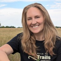 Laura Stark
Colleague at Rails To Trails ConservancyBroomfield, Colorado, United States
View →
CD
Laura Stark
Colleague at Rails To Trails ConservancyBroomfield, Colorado, United States
View →
CD
 Cindy Dickerson
Colleague at Rails To Trails ConservancyArlington, Virginia, United States
View →
ES
Cindy Dickerson
Colleague at Rails To Trails ConservancyArlington, Virginia, United States
View →
ES
 Elle Segal, Mpa
Colleague at Rails To Trails ConservancyWashington, District Of Columbia, United States
View →
QJ
Elle Segal, Mpa
Colleague at Rails To Trails ConservancyWashington, District Of Columbia, United States
View →
QJ
 Quinton Javon Batts
Colleague at Rails To Trails ConservancyBaltimore, Maryland, United States
View →
EO
Quinton Javon Batts
Colleague at Rails To Trails ConservancyBaltimore, Maryland, United States
View →
EO
 Eric Oberg
Colleague at Rails To Trails ConservancyYellow Springs, Ohio, United States
View →
LB
Eric Oberg
Colleague at Rails To Trails ConservancyYellow Springs, Ohio, United States
View →
LB
 Leslie Bethke
Colleague at Rails To Trails ConservancyBethesda, Maryland, United States
View →
Leslie Bethke
Colleague at Rails To Trails ConservancyBethesda, Maryland, United States
View →
Rhonda Border-Boose
Colleague at Rails To Trails ConservancyCanal Winchester, Ohio, United States
View →
IS
Iman Sylvain, Phd
Colleague at Rails To Trails ConservancySan Francisco Bay Area, United States
View →
WK
Willie Karidis
Colleague at Rails To Trails ConservancyGreater Milwaukee, United States
View →
JL
Joe Lacroix
Colleague at Rails To Trails ConservancyGreater Richmond Region, United States
View →
LS
Laura Stark
Colleague at Rails To Trails ConservancyBroomfield, Colorado, United States
View →
CD
Cindy Dickerson
Colleague at Rails To Trails ConservancyArlington, Virginia, United States
View →
ES
Elle Segal, Mpa
Colleague at Rails To Trails ConservancyWashington, District Of Columbia, United States
View →
QJ
Quinton Javon Batts
Colleague at Rails To Trails ConservancyBaltimore, Maryland, United States
View →
EO
Eric Oberg
Colleague at Rails To Trails ConservancyYellow Springs, Ohio, United States
View →
LB
Leslie Bethke
Colleague at Rails To Trails ConservancyBethesda, Maryland, United States
View →
2 education records
Derek M. Strout education

Bachelor Of Arts (B.A.), Geography

Environmental Science, Biophysical Environments (Southern Hemisphere)
FAQ
Frequently asked questions about Derek M. Strout
Quick answers generated from the profile data available on this page.
What company does Derek M. Strout work for?
Derek M. Strout works for Rails to Trails Conservancy.
What is Derek M. Strout's role at Rails to Trails Conservancy?
Derek M. Strout is listed as Geographic Information Systems Specialist at Rails to Trails Conservancy.
What is Derek M. Strout's email address?
AeroLeads has found 1 work email signal at @railstotrails.org for Derek M. Strout at Rails to Trails Conservancy.
What is Derek M. Strout's phone number?
AeroLeads has found 3 phone signal(s) with area code 207, 212 for Derek M. Strout at Rails to Trails Conservancy.
Where is Derek M. Strout based?
Derek M. Strout is based in Portland, Maine, United States while working with Rails to Trails Conservancy.
What companies has Derek M. Strout worked for?
Derek M. Strout has worked for Rails To Trails Conservancy, Rails-To-Trails Conservancy, Riverside Research, and Delorme.
Who are Derek M. Strout's colleagues at Rails to Trails Conservancy?
Derek M. Strout's colleagues at Rails to Trails Conservancy include Rhonda Border-Boose, Iman Sylvain, Phd, Willie Karidis, Joe Lacroix, and Laura Stark.
How can I contact Derek M. Strout?
You can use AeroLeads to view verified contact signals for Derek M. Strout at Rails to Trails Conservancy, including work email, phone, and LinkedIn data when available.
What schools did Derek M. Strout attend?
Derek M. Strout holds Bachelor Of Arts (B.A.), Geography from University Of Vermont.
What skills is Derek M. Strout known for?
Derek M. Strout is listed with skills including Gis, Spatial Databases, Cartography, Esri, Arcgis, Geomatics, Remote Sensing, and Geography.
Find 750M verified contacts
Search by job title, company, industry, location, and seniority. Export verified B2B contact data when you need it.
Start free trial