
3D Measurement Specialist
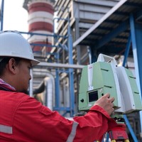
Current• Operates 3D scanning equipment • Responsible for inspection and visits field project site to familiarize with boundaries, terrain, topography etc.• Prepares and compute survey data, lot area, traverse station solar observation, consolidation of lots and subdivision• Lease squares adjustment of traverse, level lines and GPS data; terrain modeling and contour generation with TIN or DEM method; feature coding and 3D mapping terrain modeling and 3D visualization• Able to perform and handle image files and digital files conversions. Handling manipulating and executing GIS data.• Responsible for survey Registration
Apr 2012 - Present