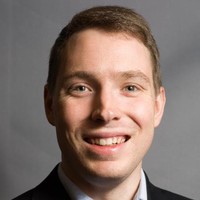
Senior City Planner - Urban Design
CurrentCommunity Planning and Development - Regulatory Team- Zoning Code and Design Guidelines Text Amendments and Map Revisions- Urban Design Review- Strategic Planning Initiatives
Dec 2022 - Present
Please complete the CAPTCHA to continue

@kimley-horn.com
✓
LinkedIn matched
A concise factual answer block for searchers comparing this professional profile.
Matthew Bossler is listed as Urban Designer, Landscape Architect, Coalition Builder, Educator at City and County of Denver, a with 4618 employees, based in Denver, Colorado, United States. AeroLeads shows a work email signal at kimley-horn.com and a matched LinkedIn profile for Matthew Bossler.
Matthew Bossler previously worked as Senior City Planner - Urban Design at City And County Of Denver and Owner at Shift Planning And Design Llc. Matthew Bossler holds Master Of Urban Design (M.U.D.), Urban Design from University Of Colorado Denver.
This section adds company-level context without repeating Matthew Bossler's masked contact details.
AeroLeads found 1 current-domain work email signal for Matthew Bossler. Compare company email patterns before reaching out.
Matthew synthesizes 16 years of experience in urban design, planning, landscape architecture, ecological design, and public policy for the public good at the City and County of Denver. Matthew is committed to forming planning and design solutions that encourage the evolution of our regions, cities, small areas, and properties within them, in order to better meet both immediate and future needs. At the city scale, Matthew advises city-builders and community groups to form urban planning solutions that set the stage for quality urbanism and sustainability. Through vigorous community engagement and constructive dialogue, Matthew organizes public processes that allow stakeholders to envision transit corridors, neighborhoods, urban campuses, parks, streetscapes and courtyards, and actualizes these visions through 3D modeling, design standards formulation, and planning documentation. At the site scale, Matthew performs rapid urban design and development scenario modeling, conceptual site plans and yield studies, as well as complete construction documentation of landscapes ranging from urban plazas to hospital grounds to naturalized riverfronts.___________________________________________________________________________I envision and coordinate interdisciplinary design, planning, and policy-making to realize sustainable urban communities. I believe that livable communities arise where: -socioeconomic and environmental objectives are balanced for today and tomorrow, -districts and neighborhoods are built around multi-modal transportation networks,-tax, zoning, and other municipal policy supports community-serving businesses, and -development is guided by flexible, form-based codes and context-sensitive design standards that focus on the pedestrian experience.Successful contemporary site developments are built around low-impact site infrastructure that creates enjoyable, interactive experiences at the human scale, in the shared public realm and in places of private refuge. I have dedicated my career equally to both envisioning AND implementing great places. As a site designer, my technical expertise lies in circulatory planning, grading and drainage, water-conserving planting design, urban site furnishings, irrigation, and ecological infrastructure. I am also experienced in regional environmental planning; zoning and development review; and landscape construction/installation.
Listed skills include Landscape Architecture, Environmental Planning, Landscape Design, Urban Design, and 45 others.
Company context helps verify the profile and gives searchers a useful next step.
A career timeline built from the work history available for this profile.
Denver, Colorado, United States
Community Planning and Development - Regulatory Team- Zoning Code and Design Guidelines Text Amendments and Map Revisions- Urban Design Review- Strategic Planning Initiatives
Denver, Co
-Zoning and urban design research for rapidly-evolving Tennyson Street district (38th to 46th St.) Development of revised Main Street and Mixed Use zone district design standards. -Urban Planning Research and development of Zoning Overlay for established single-unit residential neighborhood (Harkness Heights, Denver, CO). Field measurements and photography, GIS research and mapping, and drafting of recommended zoning overlay text and diagrams. Neighborhood outreach and coordination with city council, planning board, and planning staff. Zoning rules which I helped develop included setback, height, and bulk plane dimensions; defining allowable encroachments into this bulk plane, determining a floor area square footage cap, restricting rooftop decks, requiring porches and defining their dimensions, requiring trees be planted in tree lawns, and defining permitted dimensions of unobtrusive retaining walls and fences. -Zoning and development code review and recommendations for change to promote adaptive reuse projects in downtown Chandler, AZ-AutoCAD and InDesign support for streetscape projects in Council Bluffs, IA-Residential landscape/garden design and installation projects in Congress Park, Park Hill, West Colfax, and Highlands (Denver), Standley Lake (Westminster), Boulder, and Broomfield neighborhoods (work includes preparation of scopes of work, estimates, preparation of conceptual design drawings and construction/planting/grading/irrigation plans, billing, and client communications)-Analysis, Planning, Design, and Construction consultation for ecological restoration projects, including present Golden Open Space Master Plan

Denver, Colorado
QUIMBY Eastside is a GRASSROOTS effort to spark a well-informed community discussion of the East Colfax Neighborhood Planning Initiative. Supported by numerous community groups and Denver-area non-profits, QUIMBY Eastside is committed to improving the East Central Area Plan and East Area Plan so that it promotes more inclusive, sustainable, and close-knit communities for existing and future neighbors.

Denver, Colorado
-Modeled transit-oriented development and transportation infrastructure scenarios, zoning recommendations, and real property yield studies for the Newhall Rail Station (San Jose/ Santa Clara, CA)-Conceptually designed a complete street corridor along Coffman Street in downtown Longmont, CO. Design included center-running BRT w/ platforms, protected bike lanes, on-street parking, determination of vehicular turning radii, landscape design, and commercial/residential property access. -Designed (DD) landscape of Arapahoe Community College - Castle Rock. Design included a variety of flexible outdoor gathering places, context-enhancing hardscape forms, and a diversity of low-water use plantings. -Designed streetscape alternatives associated with a road diet of W Colorado Ave, Old Colorado City, Colorado Springs, CO-Analyzed history and existing conditions of land use and transportation infrastructure in downtown Parker, CO-Developed landscape and irrigation plans for commercial, industrial, and industrial properties from urban to rural contexts in CO, UT, and NV. -Established client relations with Discovery Midstream Partners via initiating, project managing, and representing the company on four visual mitigation and landscape design projects associated with natural gas infrastructure through use by special review process in Weld County, CO.
Greater Denver Area
Analyzed the impact of recent residential growth trends on the quality of Denver’s urbanism, architecture, landscape, environmental quality, economy, and culture, with particular emphasis on the West Colfax and Sloan's Lake neighborhoods of Denver.
Fort Collins, Colorado
- Illustrated, technically edited, and co-wrote "Living Streambanks: A Manual of Bioengineering Treatments for Colorado Streams"- Developed site analyses, scopes of work, estimates, and site plans for ecological restoration and erosion stabilization of lands (private and public) impacted by Front Range flooding of 2013. - Technically oversaw landscape restoration crews and contractors performing revegetation and erosion control projects- Led ecological research field crews and managed data for a restoration treatment efficacy study in the High Park Fire burn area (botanical transects)- Delineated wetlands (field and office) for Army Corps / Section 404 permitting- Collected data (field and desktop), analyzed, and created maps of project work using GIS. Managed company GIS database. - Developed construction documents (plans, sections, profiles, and typical details) with AutoCAD and/or hand drafting. Managed company CAD database and file transfers with project partners. - Developed illustrative graphics (concepts, environmental processes, photorealistic simulations, and rendered CDs) for ecological restoration projects- Technically reviewed survey, site layout, grading, and drainage plans developed by design collaborators (civil engineers, landscape architects, surveyors).- Collected live plant material (seeds and whips) from Front Range drainages and coordinated delivery to CO state forest service for propagation.

Denver, Colorado
Master of Landscape Architecture (MLA) program

Boulder, Co
- Supported designs for residential landscape design projects. Duties included base plan development, construction detailing, hand and digital graphics- Developed design programs, site designs, scopes of work and estimates for residential landscape design projects- Interpreted landscape construction plans and estimates and translated into construction direction- Organized construction site logistics (material estimates and deliveries, equipment purchases, construction scheduling, site organization, work crew coordination, worker safety, change orders, post-construction evaluation, etc.)- Supervised installation of hardscapes, irrigation, drainage, erosion control measures, and plantings at residential properties in Boulder and foothills communities

Denver, Co
- Planted and maintained Rock/Alpine Garden and South African Plaza - Designed annual planting beds in outdoor wedding places- Educated visitors on garden plants and growing conditions- Propagated plant materials
Boulder, Co
-3D Modeled (Sketchup) and provided researched and writing support (InDesign) for urban design guidelines in various U.S. communities-Developed site programs, conceptual designs, Sketchup models, and renderings of Civic Plaza for Georgetown, TX

Phoenix, Arizona Area
-3D-modeled and rendered photorealistic simulations of regional and interstate transmission line proposals (Google Earth, ArcGIS, AutoCAD Civil 3D, 3dsMAX, Photoshop, InDesign)-Analyzed visual resource impacts for regional and interstate transmission line proposals; drafted assessments for an EIS and multiple EAs-Presented findings of a planning study and solicited community comments in a public workshop setting-Analyzed Land Use and Recreation impacts for regional and interstate transmission line proposals; drafted assessments for multiple EAs-Tracked the progress of mitigation and conservation requirements associated with a major copper mine proposal (Excel) -Analyzed biological, hydrological, and soil characteristics of a proposed pipeline; Prepared restoration plan for proposed pipeline (including ArcGIS project setup)-Field-surveyed erosion control BMP function, final stabilization (revegetation),and invasive weeds along the Williams Natural Gas Overland Pass Pipeline (1-80 corridor)-Researched cultural landscape impacts of a transmission line project; drafted impact assessments for an EIS-Researched impacts to the Continental Divide Scenic Trail and Arizona Scenic Trail of a transmission line project; interviewed recreation non-profits regarding trail development efforts; helped develop novel impact assessment technique; drafted impact assessment for an EIS-Drafted landscape site designs of public parks (AutoCAD)
Boulder, Co
-Organized sales floor and warehouse via: -inventory accounting, -special-ordering of bicycle components for customers, and -staff supervision, -Contributed to five straight quarters of company-leading sales numbers and inventory variance minimization

Tucson, Arizona Area
-Used GIS to analyze socioeconomic geospatial information and identify affordable housing planning opportunities in Sierra Vista, AZ (State of Arizona Housing Department)-Researched and wrote a Cultural Landscape Inventory of Tumacacori National Historic Park (NPS). Work included stakeholder workshopping, primary source interviews, archival research, digitization of field observations, and utilization of ArcGIS, Illustrator, Photoshop, and MS Word-Wrote and Illustrated Design Guidelines for riparian restoration, recreation, and aesthetic use of detention basins (Pima County Regional Flood Control District/Granite Construction)-Conceptually designed a multi-phase 17-acre riparian restoration area and open space park within a degraded municipal detention basin. Phase 1 constructed in 2012 (Pima County Regional Flood Control District/Granite Construction)-Welded (TIG & MIG), assembled and installed desks and cubicles of design studios (College of Architecture and Landscape Architecture materials laboratory)
Tucson, Arizona Area
-Drafted landscape site plans (planting, grading, hardscape), details, and specifications for residential, commercial, and streetscape designs-Conceptually designed residential multi-use streetside detention basins for local developer
Mesa, Az
-Analyzed land use and visual resource impacts of regional and urban transmission line proposals-Designed a community image impact analysis technique for company (nodes, gathering areas, borders, landmarks, etc.)-Illustrated maps of archeological surveys and transmission line proposals

Arizona And New Mexico
-Assessed, mapped (ArcGIS), and restored endangered species habitat (Sonoran Pronghorn)-Field-assessed Arizona native fish population and habitat -Field-assessed Proper Functioning Condition (PFC) of perennial and intermittent streams in Central Arizona-Led biological field crew and contributed to statistical study of the effects of elk herbivory on post-wildfire forest regeneration (Ponderosa Pine & Spruce/Fir forests of Bandelier National Monument, NM) -Identified hazardous fuels within the Wildland-Urban Interface (WUI) of the BLM-Colorado River District; drafted NEPA documentation for fuels reduction methods and projects (herbicidal and mechanical); oversaw field crews performing fuels reduction/invasive species removal projects-Delineated invasive species stands and ecological site types (wetland and riparian) within Lower Colorado River floodplain-Surveyed earthen water impoundments and analyzed water quality of wells and wildlife drinkers
Other employees you can reach at denvergov.org. View company contacts for 4618 employees →
 Austen Welker
Colleague at City And County Of DenverLouisville, Colorado, United States
View →
AO
Austen Welker
Colleague at City And County Of DenverLouisville, Colorado, United States
View →
AO
 Andrew Olthuis
Colleague at City And County Of DenverDenver, Colorado, United States
View →
MC
Andrew Olthuis
Colleague at City And County Of DenverDenver, Colorado, United States
View →
MC
 Maria Cruz
Colleague at City And County Of DenverDenver, Colorado, United States
View →
PN
Maria Cruz
Colleague at City And County Of DenverDenver, Colorado, United States
View →
PN
 Patrice Nixon
Colleague at City And County Of DenverUnited States
View →
EM
Patrice Nixon
Colleague at City And County Of DenverUnited States
View →
EM
 Emily Mazzeo
Colleague at City And County Of DenverDenver, Colorado, United States
View →
AR
Emily Mazzeo
Colleague at City And County Of DenverDenver, Colorado, United States
View →
AR
 Angela Rowland
Colleague at City And County Of DenverUnited States
View →
JR
Angela Rowland
Colleague at City And County Of DenverUnited States
View →
JR
 Judy Rigg
Colleague at City And County Of DenverIndian Hills, Colorado, United States
View →
BH
Judy Rigg
Colleague at City And County Of DenverIndian Hills, Colorado, United States
View →
BH
 Brandon Herman, Aicp, Pla
Colleague at City And County Of DenverDenver, Colorado, United States
View →
KS
Brandon Herman, Aicp, Pla
Colleague at City And County Of DenverDenver, Colorado, United States
View →
KS
 Ken Seeley
Colleague at City And County Of DenverDenver, Colorado, United States
View →
JA
Ken Seeley
Colleague at City And County Of DenverDenver, Colorado, United States
View →
JA
 Jason Anderson
Colleague at City And County Of DenverAurora, Colorado, United States
View →
Jason Anderson
Colleague at City And County Of DenverAurora, Colorado, United States
View →
Activities and Societies: Students for Classical Architecture; ULI - Hines Student Competition
Activities and Societies: ASLA Arizona chapter, Student Representative, 2009-2010Awards: • U of A Landscape Architecture Faculty Award.

Activities and Societies: Outing Club, Beta Theta Pi, Project Wild, Wilderness Outdoor Opportunities for Durham Students-Coursework.

Coursework in: -3ds Max -AutoCAD 3D -AutoCAD Civil 3D -Sketchup -Revit -Solidworks


Activities and Societies: Soil, Water, and Environmental Science (SWES) Club; ASLA-AZ Student Chapter (President, 2009)Coursework.

Quick answers generated from the profile data available on this page.
Matthew Bossler works for City and County of Denver.
Matthew Bossler is listed as Urban Designer, Landscape Architect, Coalition Builder, Educator at City and County of Denver.
AeroLeads has found 1 work email signal at @kimley-horn.com for Matthew Bossler at City and County of Denver.
Matthew Bossler is based in Denver, Colorado, United States while working with City and County of Denver.
Matthew Bossler has worked for City And County Of Denver, Shift Planning And Design Llc, Smithgroup, Quality Urbanism In My Back Yard (Quimby) - Eastside, and Kimley-Horn.
Matthew Bossler's colleagues at City and County of Denver include Austen Welker, Andrew Olthuis, Maria Cruz, Patrice Nixon, and Emily Mazzeo.
You can use AeroLeads to view verified contact signals for Matthew Bossler at City and County of Denver, including work email, phone, and LinkedIn data when available.
Matthew Bossler holds Master Of Urban Design (M.U.D.), Urban Design from University Of Colorado Denver.
Matthew Bossler is listed with skills including Landscape Architecture, Environmental Planning, Landscape Design, Urban Design, Land Use Planning, Gis, Site Plans, and Nepa.
Search by job title, company, industry, location, and seniority. Export verified B2B contact data when you need it.
Start free trial Search contactsCheck these profiles if this is not the Matthew Bossler you were looking for.