Data Ambassador
Current
Dec 2023 - Present
Please complete the CAPTCHA to continue
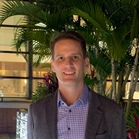
@fema.gov
✓
LinkedIn matched
A concise factual answer block for searchers comparing this professional profile.
Michael Commons is listed as Data Ambassador at FEMA, a with 14062 employees, based in Oakland, California, United States. AeroLeads shows a work email signal at fema.gov and a matched LinkedIn profile for Michael Commons.
Michael Commons previously worked as Geographer at Fema and Geographer at U.S. Census Bureau. Michael Commons holds Doctor Of Philosophy Candidate, Geography, Geography from Syracuse University - Maxwell School.
This section adds company-level context without repeating Michael Commons's masked contact details.
AeroLeads found 1 current-domain work email signal for Michael Commons. Compare company email patterns before reaching out.
I am a dynamic and data-savvy geographer with 20+ years of experience with ArcGIS Pro and open-source Geographic Information Systems (GIS), spatial database design, SQL, geospatial modeling, and data visualization. My background includes supporting government programs, ecological field studies, conservation, and teaching. I have specialized expertise in geospatial analysis, sampling design, and problem-solving including developing and implementing geospatial models to describe and predict spatial phenomena. As a geographer, I have a thorough understanding of cartographic principles and techniques. Additionally, I am a subject matter expert in urban-rural classifications and modeling, wildland fire systems, natural resources management, and community planning.I am passionate about training and building highly effective teams. I work closely with them to provide coaching and mentoring both individually and as a group to help every member achieve success and contribute to the overall goals. ACCOMPLISHMENTSSome of my key accomplishments include the following:• Developing the 2020 Urban Areas delineation model for the U.S. Census Bureau, which will be used in the agency for the next ten years as well as by other federal, state, and local governments, and researchers.• Managing complex data processing and reporting for the Triggers program in support of the In-Office Address Canvassing operations as part of the 2020 Decennial Census.• Designing, organizing, and managing spatial and non-spatial databases.• Conducting deterministic and geostatistical analyses of 100+ years of fire occurrences across California.• Instructing and training others in cartographic principles, techniques, and technologies.• Designing and implementing geospatial models to describe and predict spatial phenomena.If you would like to connect or know more about my professional story, please send me an InMail message or email me at michael.geo.commons@gmail.com.
Listed skills include Gis, Statistics, Arcgis, Geography, and 32 others.
Company context helps verify the profile and gives searchers a useful next step.
A career timeline built from the work history available for this profile.
Washington, District Of Columbia
Provide broad geographic research, analysis, standardization, and support for US Census bureau operations using ArcGIS Pro, QGIS, Oracle Spatial, SQL, Python, and other technologies.• Analyze, identify, and resolve data issues for In-Office Address Canvassing Operations using SQL and Python code to extract, process, and review spatial and non-spatial data in Oracle databases.• Conduct spatial and non-spatial statistical analyses on built and populated landscapes using complex demographic, structural, political, and land cover variables across a range of spatio-temporal scales.• Plan, design, conduct, and document geospatial analyses and methodology supporting the 2020 Urban Areas delineation criteria including managing complex geospatial workflows to automate urban delineation process.• Co-author multiple Federal Register notices describing the criteria for the Urban Areas for the 2020 Census. • Conduct geostatistical analyses comparing European Commission “Degrees of Urbanisation” model to US Census Urban Area model for presentation to United Nations for global standard definitions of urban types.• Develop and test gridded data products for Open Geospatial Consortium Sprint application. • Assess the impacts of complex geographic data transformations on spatial products.• Develop IFAC viewer, TEA viewer, and Urban Areas Demonstration viewer data products for web publishing.• Prepare daily, weekly, and monthly geographic operations reports integrating maps, graphs, and narrative summaries to communicate complex operations and data to a wide audience.• Present complex geographic concepts to government partners, data researchers, Census State Data Centers, and academic and professional conferences.• Plan and conduct workshops and webinars with stakeholders and Congressional committees to facilitate open dialog around sensitive topics and data products.

Taught four geography courses per semester including Introduction to Geographic Information Systems, Applied Geographic Information Systems, World Regional Geography, Physical Geography, and Environmental Geography.• Designed curriculum, lectures, readings, assignments, exams, quizzes, study guides, and digital media.• Managed GIS research laboratory technologies and hardware.• Hired and supervised course assistants and student tutors.• Supported faculty and student research, including data analysis and development of cartographic products for publication in scientific journals.

Collected, organized, processed, and analyzed geospatial data for fire ecology and vegetation dynamics research projects.• Digitized analog datasets into Geodatabases and developed tools for automating geospatial analyses.• Conducted deterministic and geostatistical analyses of 100+ years of fire occurrences across California.• Analyzed remotely sensed fire severity data to assess accuracy of fire boundaries.• Planned and conducted vegetation and geomorphological field data collections and analyses.Taught four semesters of The Natural Environment and one semester of Global Environmental Change.• Designed curriculum, lectures, readings, assignments, exams, quizzes, study guides, and digital media.


Coordinated and managed projects for community groups. Applied GIS, CAD, remote sensing, and GPS technologies to acquire, process, analyze, and communicate data. Maintained all metadata standards. Supervised student GIS interns.Set up, calibrated, and maintained weather station facilities and data collection operations. Led four Physical Geography Lab sections and assisted with teaching Introduction to ArcGIS, Advanced Cartography, and Field Techniques.Managed GIS and Cartography lab facilities, including basic maintenance of computers, printers, plotter, and scanner. Provided technical assistance and tutoring to GIS and Cartography students.
Conducted field work, data collection, and program management for Natural Resources Management Division.• Developed and maintained GIS databases for the invasive plant management program• Conducted extensive field mapping of vegetation using GPS and post-processing.• Planned, implemented, and documented invasive plant removal projects that followed a response-based regime of mechanical and chemical treatments.• Conducted wildland fire management operations, including suppression, prescribed fire, and mechanical fuels reduction.

Other employees you can reach at fema.gov. View company contacts for 14062 employees →
 Annabelle Riojas
Colleague at FemaGreater Houston, United States
View →
SB
Annabelle Riojas
Colleague at FemaGreater Houston, United States
View →
SB
 Steve Bryson
Colleague at FemaOakland, California, United States
View →
CT
Steve Bryson
Colleague at FemaOakland, California, United States
View →
CT
 Christory Teah
Colleague at FemaHalethorpe, Maryland, United States
View →
RD
Christory Teah
Colleague at FemaHalethorpe, Maryland, United States
View →
RD
 Rochelle Davis Lewis
Colleague at FemaGulfport, Mississippi, United States
View →
JP
Rochelle Davis Lewis
Colleague at FemaGulfport, Mississippi, United States
View →
JP
 James Parker
Colleague at FemaFort Myers, Florida, United States
View →
GH
James Parker
Colleague at FemaFort Myers, Florida, United States
View →
GH
 Greyson Harris
Colleague at FemaGreater Sacramento, United States
View →
DS
Greyson Harris
Colleague at FemaGreater Sacramento, United States
View →
DS
 David Solomon Mph, Arm
Colleague at FemaSalem, Oregon, United States
View →
SS
David Solomon Mph, Arm
Colleague at FemaSalem, Oregon, United States
View →
SS
 Starlynn Sims
Colleague at FemaDallas-Fort Worth Metroplex, United States
View →
BE
Starlynn Sims
Colleague at FemaDallas-Fort Worth Metroplex, United States
View →
BE
 Benji Edwards
Colleague at FemaWashington, District Of Columbia, United States
View →
TF
Benji Edwards
Colleague at FemaWashington, District Of Columbia, United States
View →
TF
 Tony Faison
Colleague at FemaWaldorf, Maryland, United States
View →
Tony Faison
Colleague at FemaWaldorf, Maryland, United States
View →


Activities and Societies: Graduated, 2000
Quick answers generated from the profile data available on this page.
Michael Commons works for FEMA.
Michael Commons is listed as Data Ambassador at FEMA.
AeroLeads has found 1 work email signal at @fema.gov for Michael Commons at FEMA.
Michael Commons is based in Oakland, California, United States while working with FEMA.
Michael Commons has worked for Fema, U.S. Census Bureau, Ohio Northern University, Syracuse University, and California State University, Long Beach.
Michael Commons's colleagues at FEMA include Annabelle Riojas, Steve Bryson, Christory Teah, Rochelle Davis Lewis, and James Parker.
You can use AeroLeads to view verified contact signals for Michael Commons at FEMA, including work email, phone, and LinkedIn data when available.
Michael Commons holds Doctor Of Philosophy Candidate, Geography, Geography from Syracuse University - Maxwell School.
Michael Commons is listed with skills including Gis, Statistics, Arcgis, Geography, Remote Sensing, Research, Geostatistics, and Cartography.
Search by job title, company, industry, location, and seniority. Export verified B2B contact data when you need it.
Start free trial Search contactsCheck these profiles if this is not the Michael Commons you were looking for.