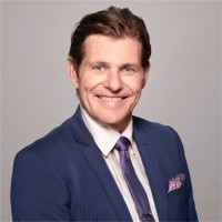
Geospatial Consultant
Current
Aug 2024 - Present
Please complete the CAPTCHA to continue
@we-do-it.com
✓
LinkedIn matched
A concise factual answer block for searchers comparing this professional profile.
Rob Gray is listed as Geospatial Consultant at Remote, a with 10 employees, based in Canberra, Australian Capital Territory, Australia. AeroLeads shows a work email signal at we-do-it.com and a matched LinkedIn profile for Rob Gray.
Rob Gray previously worked as Senior Geospatial Engineer at Nova Systems and Geospatial Consultant at Self. Rob Gray holds Post Graduate Diploma - Geospatial Information, Post Grad Diploma - Geoinformation from Curtin University.
This section adds company-level context without repeating Rob Gray's masked contact details.
AeroLeads found 1 current-domain work email signal for Rob Gray. Compare company email patterns before reaching out.
Proactive and dedicated geospatial manager with an extensive professional career including commercial, international, Government, military and multi-cultural environments in Australia, South Pacific, USA and Africa. Excellent teambuilding, human resources and training abilities Highly skilled in Geospatial Information Management (Surveying, GPS, GIS, Cartography, Remote Sensing, Aerial Photography, Technology Integration, Visualisation) Strong background in geospatial needs analysis and solutions Very experienced in workplace, national and international standards development Proven problem solver, utilising lateral thinking to deliver practical solutions
Listed skills include Spatial Analysis, Cartography, Gis, Remote Sensing, and 46 others.
Company context helps verify the profile and gives searchers a useful next step.
A career timeline built from the work history available for this profile.
Canberra, Australia
Looking for the next challenge in my career.

Canberra, Australia
Assisting existing clients maximise the efficiency and effectiveness of their geospatial data, systems and people to attain the best answers to a myriad of problems

Australia
Geospatial data audit of Australian Defence Force to determine any occurrences of duplication, improve data flow processes and identify areas requiring standardisation.

Addis Ababa, Ethiopia
• Coordination of United Nations Global Geospatial Information Management (UN-GGIM) for Africa to achieve standardised geospatial inputs from local to global levels and promote the use of geoinformation to achieve the Sustainable Development Goals• Comprehensive study & analysis of national and international geospatial needs and applications with practical expectations and details of African required initiatives • Involved in logistics, support & documentation of establishing the African Geodetic Reference Frame• National liaison, documentation & QC for African Second Administrative Level Boundaries• Promoted national participation in Gazetteer programme• Cooperation of geospatial initiatives with national and international bodies including: International Standards Organisation (ISO), Open Geospatial Consortium (OGC), Center for International Earth Science Information Network (CIESIN), Google Earth, UK Ordnance Survey, China National Mapping, UN-GGIM, ANZLIC, UN Geospatial Information Working Group, Center for Spatial Law & Policy.
Somalia, Nairobi
• Analyse customers business to determine & tailor geospatial solutions (logistics, asset management, communications, security, health, engineering, political, social, aviation)• International & national personnel recruitment (15), management, training & development to build cohesive & focussed team servicing client needs• Project management including budget planning ($2.5 million p.a.), justification& oversight• Geospatial project proposal development with European Union, African Union & US State Dept.• Somalia GIS Working Group coordinating UN, foreign governments and NGOs to affect savings of almost $1 million• Project management for Somalia topographic line map series (100k and 50k) through Multinational Geospatial Co-production Program (MGCP) and Italian Military mapping• Prioritisation of geospatial product& application development for five (5) United Nations missions within Horn of Africa• Leader of Somalia Interagency Mapping and Coordination (SIMac) for interoperability of geospatial efforts by UN and foreign governments
New York, Usa
• Coordination of UN GIS efforts across 15 peacekeeping missions around the world to achieve standardised work practices improving quality, consistency and output levels.• Standards development and monitoring• Budgeting across all missions to a value of $20 million• Personnel rotation management to satisfy mission and individual needs• Personnel interviews and selection to obtain the right staff for a wide variety of positions & locations• Oversight of global contracts (imagery, software & hardware) to affect savings of over $2 million and improve timeliness of delivery• Liaison with international partners (US State Dept, European Union, African Union, North Atlantic Treaty Organisation, ISO, OGC, ESRI, etc.) to support peacekeeping missions around the globe.
Midland, Wa
Shared Land Information Platform - Contractorhttps://www2.landgate.wa.gov.au/web/guest• Business analysis to identify where & how geospatial applications can assist customers• GIS audit of external company to determine functional new structure and procedures• Consultant manager to State Government initiative integrating and sharing geospatial data between departments and public platform
Perth, Australia
• Business analysis to identify where & how geospatial applications can assist customers• Senior GIS Analyst for Chevron Australia pipeline design, alignment, including environmental considerations• Develop and implement standards and methodologies (technical and procedural)
South West Western Australia
Coordinator of mapping and GIS for Natural Resource Management – 6 staff spread across south west WA and numerous volunteers. • Web applications developed to encourage public input of environmental hazards, explain situatons and visualise solutions• Develop and implement standards and methodologies (technical and procedural)
Khartoum, Sudan
• Establishment of GIS and Mapping Unit:• GIS and mapping needs analysis for peacekeeping, humanitarian and security• Personnel recruitment – 32 National and International staff• Sourcing equipment, hardware, software, data and consumables• Budget forecast and management ($2.7 million)• Development and implementation of Unit procedures• Manager – Mapping Guidelines and Standards: United Nations Geospatial Information Working Group (UNGIWG): Developing standards to be applied across all UN entities.• Collaborative development of UN mapping community• Co-founder &Coordinator – Sudan Interagency Mapping:• Establish protocols for data collection, manipulation and product development of geospatial information and mapping within Sudan by all UN agencies, organisations, NGO’s and Sudan Government authorities to minimise duplication and ensure interoperability
Asmara, Eritrea
• Management of GIS and mapping in support of United Nations operations:• Task prioritisation• Personnel management• Quality control, quality assurance• Financial budgeting• Training requirements, development and implementation• Data collection, manipulation and product output• Liaison with other organisations for development• Manager – UNGIWG Mapping Guidelines and Standards
Bendigo, Adelaide, Sydney, Darwin, Png, Solomon Islands, Eritrea
Training, Aerial Photography, Carto, Field check, Policy, Survey, GIS
Other employees you can reach at remote.com.au. View company contacts for 10 employees →
 Andrew Campbell, Mba, Gaicd
Colleague at RemoteBrisbane, Queensland, Australia
View →
LB
Andrew Campbell, Mba, Gaicd
Colleague at RemoteBrisbane, Queensland, Australia
View →
LB
 Lee Bath
Colleague at RemoteQueanbeyan, New South Wales, Australia
View →
JB
Lee Bath
Colleague at RemoteQueanbeyan, New South Wales, Australia
View →
JB
 John Bath
Colleague at RemoteCanberra, Australian Capital Territory, Australia
View →
CG
John Bath
Colleague at RemoteCanberra, Australian Capital Territory, Australia
View →
CG
 Cheryl Goldsmith-Jakimoff
Colleague at RemoteRussell, Australian Capital Territory, Australia
View →
CM
Cheryl Goldsmith-Jakimoff
Colleague at RemoteRussell, Australian Capital Territory, Australia
View →
CM
 Coen Murphy
Colleague at RemoteBraddon, Australian Capital Territory, Australia
View →
SZ
Coen Murphy
Colleague at RemoteBraddon, Australian Capital Territory, Australia
View →
SZ
 Sheree Zuniga
Colleague at RemoteCanberra, Australian Capital Territory, Australia
View →
CH
Sheree Zuniga
Colleague at RemoteCanberra, Australian Capital Territory, Australia
View →
CH
 Casey Happonen
Colleague at RemoteCanberra, Australian Capital Territory, Australia
View →
WM
Casey Happonen
Colleague at RemoteCanberra, Australian Capital Territory, Australia
View →
WM
 William Mayfield
Colleague at RemoteGoogong, New South Wales, Australia
View →
DF
William Mayfield
Colleague at RemoteGoogong, New South Wales, Australia
View →
DF
 Daniel Flynn
Colleague at RemoteCanberra, Australian Capital Territory, Australia
View →
OT
Daniel Flynn
Colleague at RemoteCanberra, Australian Capital Territory, Australia
View →
OT
 Oscar Tindale
Colleague at RemoteBruce, Australian Capital Territory, Australia
View →
Oscar Tindale
Colleague at RemoteBruce, Australian Capital Territory, Australia
View →

Quick answers generated from the profile data available on this page.
Rob Gray works for Remote.
Rob Gray is listed as Geospatial Consultant at Remote.
AeroLeads has found 1 work email signal at @we-do-it.com for Rob Gray at Remote.
Rob Gray is based in Canberra, Australian Capital Territory, Australia while working with Remote.
Rob Gray has worked for Remote, Nova Systems, Self, Esri Australia, and We-Do-It Group Of Companies.
Rob Gray's colleagues at Remote include Andrew Campbell, Mba, Gaicd, Lee Bath, John Bath, Cheryl Goldsmith-Jakimoff, and Coen Murphy.
You can use AeroLeads to view verified contact signals for Rob Gray at Remote, including work email, phone, and LinkedIn data when available.
Rob Gray holds Post Graduate Diploma - Geospatial Information, Post Grad Diploma - Geoinformation from Curtin University.
Rob Gray is listed with skills including Spatial Analysis, Cartography, Gis, Remote Sensing, Arcgis, Gps, Spatial Databases, and Geomatics.
Search by job title, company, industry, location, and seniority. Export verified B2B contact data when you need it.
Start free trial Search contactsCheck these profiles if this is not the Rob Gray you were looking for.
View similar profiles